 Roadside Attraction
MK Tunnels
Roadside Attraction
MK Tunnels
Northern Swell
Overview
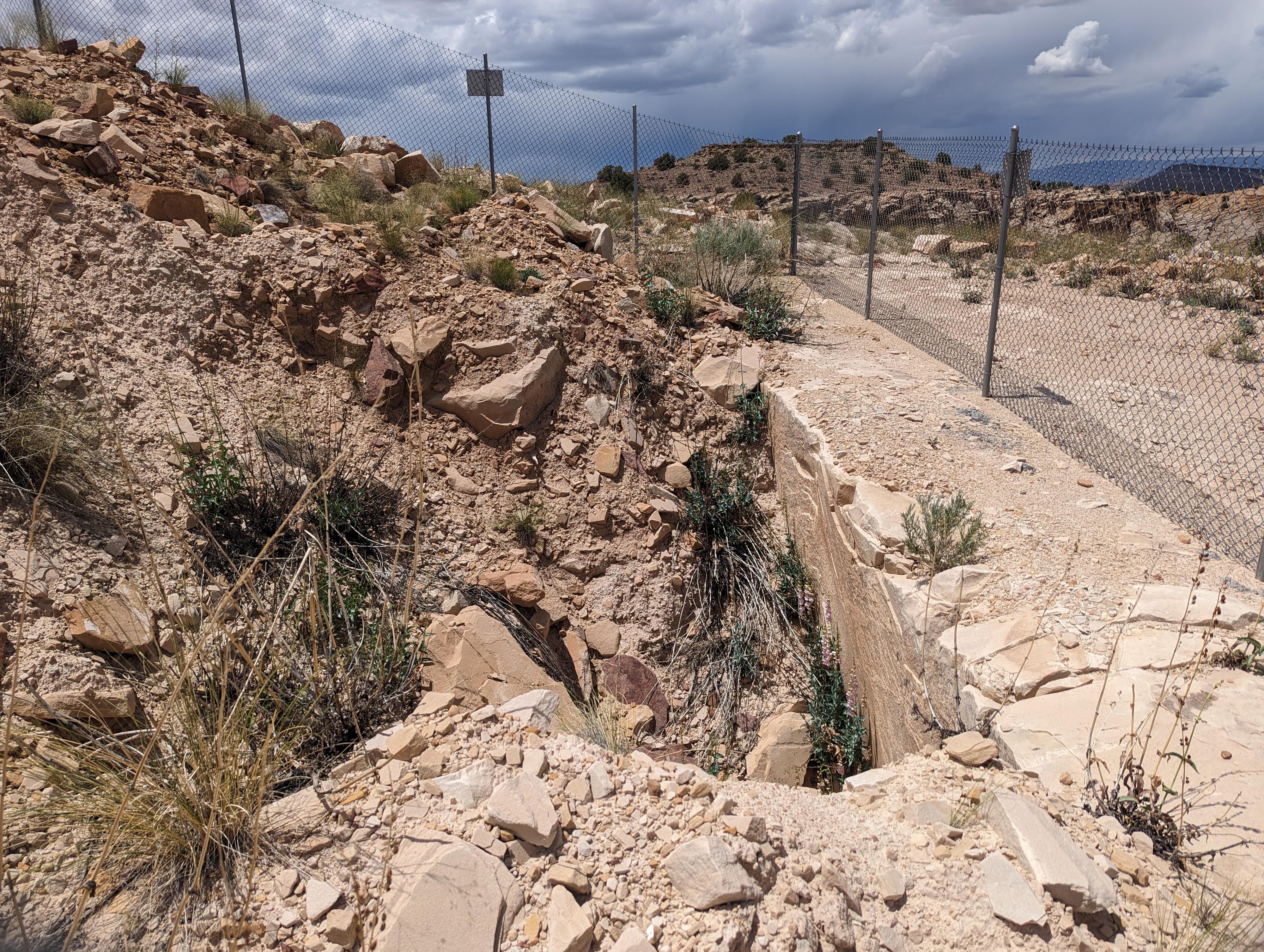
The San Rafael Swell has such an incredibly interesting and diverse history. From dinosaur tracks, native peoples, early ranchers and homesteaders, miners, and even the Department of Defense! Above Buckhorn Wash, in the last 1940s, the Department of Defense quietly did classified testing in the sandstone here, known as the Morrison-Knudsen (MK) site. The site, currently, has several large fenced off collapsed tunnels from this testing. It is an interesting place to visit and ponder the history.
From the informational sign:
MORRISON KNUDSEN TUNNELSThe MK Tunnels project began with a Department of Defense (DOD) contract to create, by drilling and shooting, a series of horizontal tunnels in the soft sandstone of the Navajo Formation. Morrison- Knudsen (MK) Corporation won the contract and created the tunnels over a four-year period from 1948 until 1952. When the tunnels were completed, a number of experiments were conducted using varying amounts of trinitrotoluene (TNT) or C-2 explosives.
The interior of the tunnels were painted white, and state-of-the- art (for the time) instruments were placed within the shafts to document the effects of the explosions. Remnants of the wiring to the instruments may still be visible in some of the tunnels.
For many years, the purpose of the project was unknown. DOD records were classified and unavailable. Those interested in the visible remains of the project suggested the following theories: the tunnels were built to store ammunition with plans of a support area of government employees; it was a candidate site for construction of the North American Aerospace Defense Command (NORAD); other defense related infrastructure well hidden in a remote desert area.
Declassification by DOD brought limited answers. According to available records, the project site "was designed to study the generation and propagation of disturbances, resulting from the detonation of buried explosive charges" and to "determine the effects of disturbances on underground structures, to establish military requirement, and design criteria for construction of underground installations."
LARGEST TUNNEL
From this point, you are looking at the surface above the largest of the tunnels created by the project. The shaft itself is nearly 1,000 feet long. The surface disturbance you see on the ground and in the aerial view represents the effect of controlled explosions. The blasting created craters and collapsed the top of this tunnel.
Some of the largest explosions were "advertised" and witnessed by many people from the nearby communities who drove near to the area to experience the event. The photographs on this panel were taken by individuals present on that day.
AERIAL VIEW
Above, all blast sites are visible. The two holes seen closer to the top are the sites of the dynamite explosions; the third, smaller hole seen below the other two was caused by seismic activity of the explosive charges.
The blasting on top of the tunnels was witnessed by many people who drove to the San Rafael Swell to watch. The photographs below were taken by bystanders.
These test sites are approximately 600 to 1,000 feet northeast of the end of this tunnel where 2-inch drill holes were filled with 320 pounds of TNT and detonated.
More information can be found in the Emery County Archives located in Castle Dale on the second floor of the old County Court House. Project by Emery County Historic Preservation Commission, Emery County Road Department, Bureau of Land Management, Utah Department of Oil, Gas and Mining Abandoned Mines Program.
Getting There
Acess to Buckhorn Wash starts near Castle Dale.
Route Description
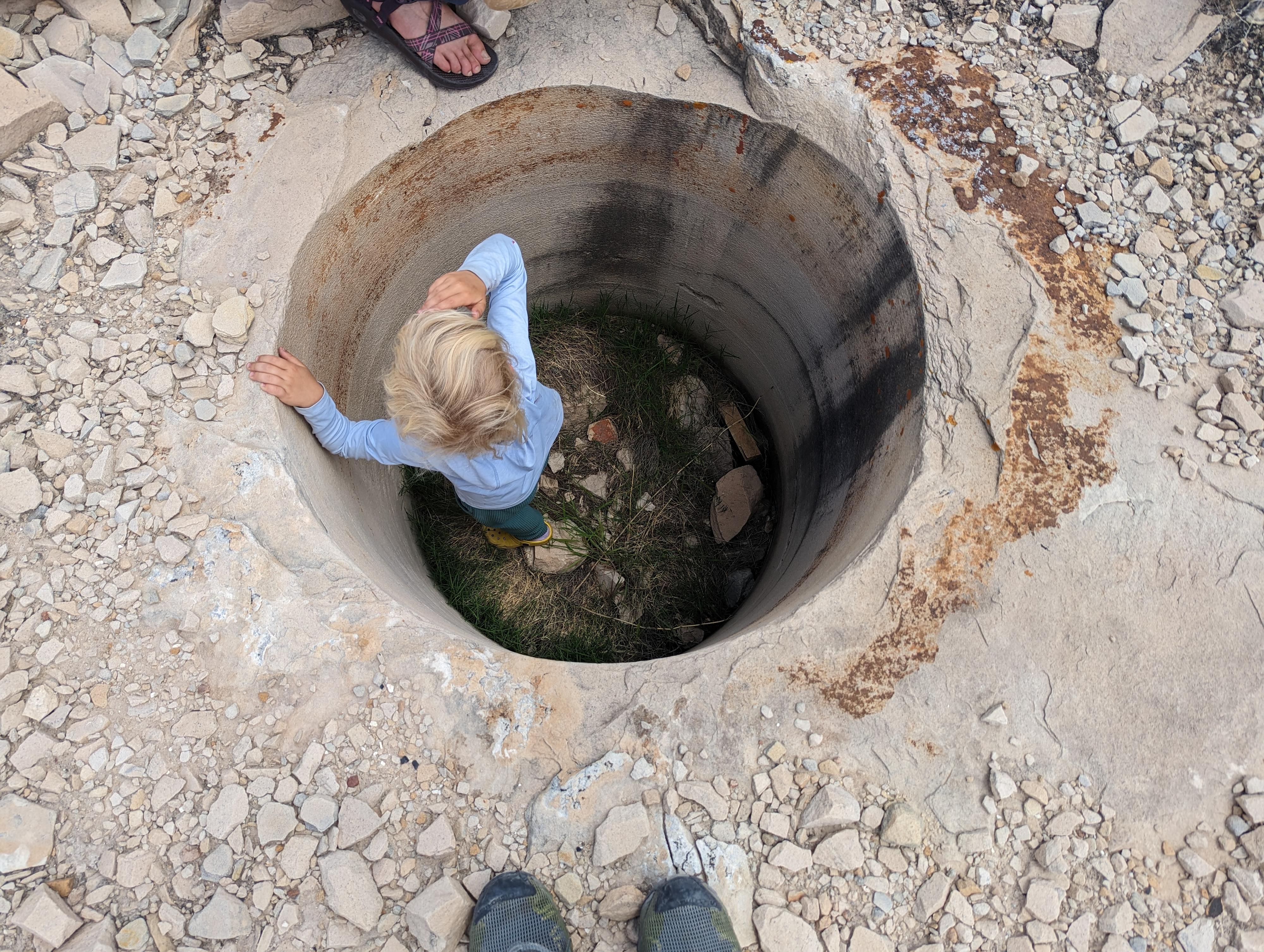
From the sign, find a place to park. It is, to me, a neat place to walk around. The mines are fences off but work walking over to and peering in. There are also a number of holes 2-3' in diameter and 3-4' deep drilled along the rim of the canyon. I assume these were core samples to test rock structure, or perhaps just what more miners do on their time off!
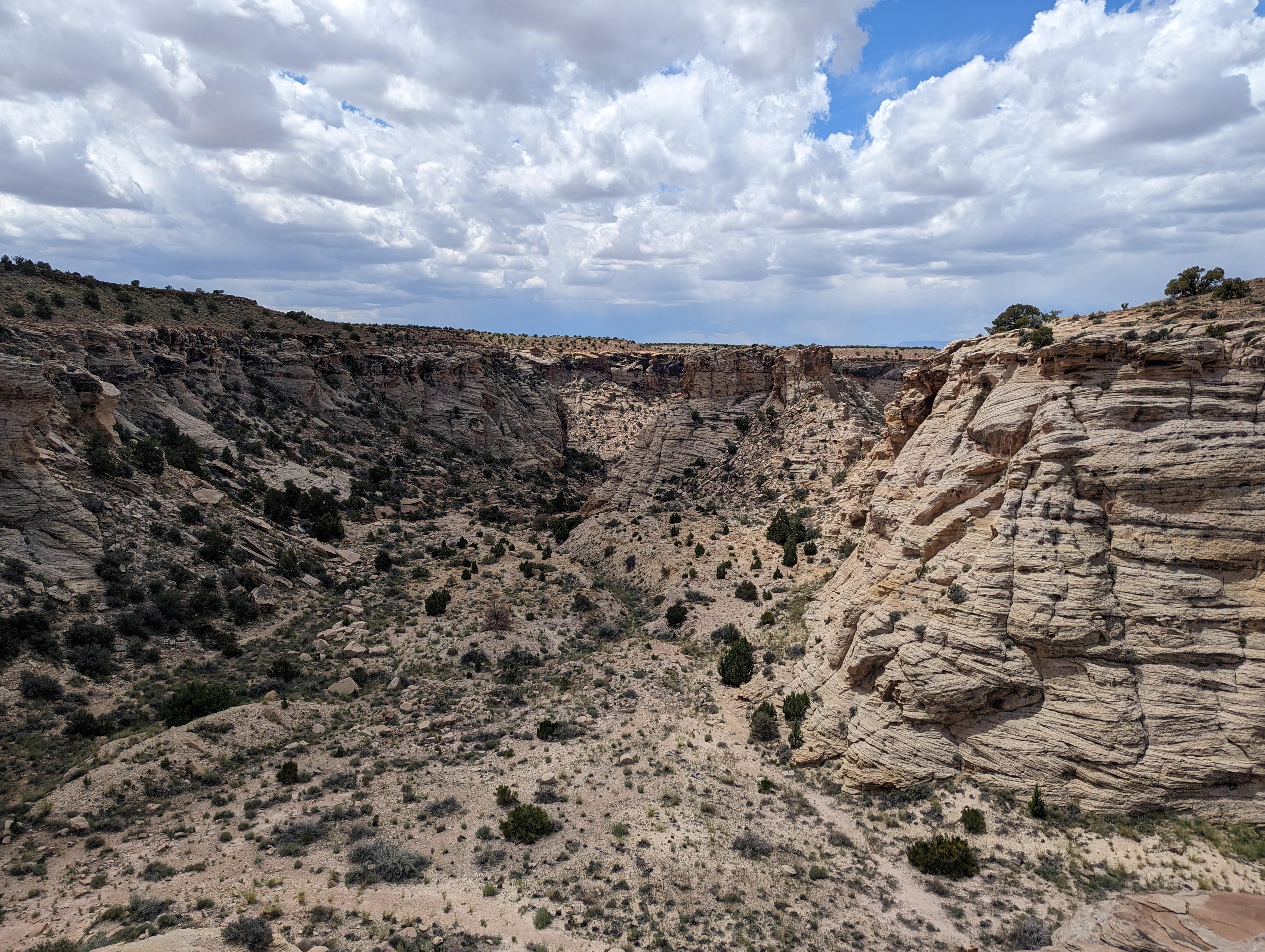
For a short hike, find the old and now mostly eroded road that heads west and down the steep hill to the lower area below. Follow this road down to the flat area below. In the south-east corner of the flat area is an enormous tunnel. The tunnel, unfortunately, is closed off, so you can't access the tunnel behind, but it looks incredibly fascinating. The area around the tunnel was clearly where they dumped the material removed to make the tunnel. A few old mining relics litter the flats, but there isn't much left these days.
A social trail heads west from the flat to an overlook of Buckhorn Wash. Definitely worth the short side trip if you have time.
Photos
Maps

12S 524486E 4334428N
39°09'31"N 110°42'60"W
12S 524540E 4334420N
39°09'31"N 110°42'57"W
12S 524487E 4334391N
39°09'30"N 110°42'60"W
12S 524431E 4334357N
39°09'29"N 110°43'02"W
12S 524354E 4334321N
39°09'28"N 110°43'05"W