Willis Creek |

Bryce Area

Hiking Willis Creek - Bryce Area Hiking Willis Creek

Bryce Area

Overview

RATING: 2A
MAPS: Bull Valley Gorge, UT

Fri

Mostly sunny, with a high near 58. Southwest wind 9 to 23 mph, with gusts as high as 38 mph.

58 | 34

Sat

A slight chance of snow showers before noon, then a chance of rain showers. Mostly cloudy, with a high near 55. South southwest wind 20 to 28 mph, with gusts as high as 41 mph. Chance of precipitation is 40%.

55 | 35

Sun

Snow showers likely before 3pm, then rain showers likely. Mostly cloudy, with a high near 46. Chance of precipitation is 60%. Little or no snow accumulation expected.

46 | 32

Mon

A chance of rain showers after noon. Mostly sunny, with a high near 50.

50 | 25

Tue

Sunny, with a high near 58.

58 | 30

View Full Weather Details
SEASON: Spring, Summer, Fall
GEAR: Wading shoes.
WATER: Willis Creek has a small flowing stream all year. Some wading to ankle deep likely.Mild flash-flood danger, there are many places to get out if need be, and the narrow sections are short.

Fri

Mostly sunny, with a high near 58. Southwest wind 9 to 23 mph, with gusts as high as 38 mph.

58 | 34

Sat

A slight chance of snow showers before noon, then a chance of rain showers. Mostly cloudy, with a high near 55. South southwest wind 20 to 28 mph, with gusts as high as 41 mph. Chance of precipitation is 40%.

55 | 35

Sun

Snow showers likely before 3pm, then rain showers likely. Mostly cloudy, with a high near 46. Chance of precipitation is 60%. Little or no snow accumulation expected.

46 | 32

Mon

A chance of rain showers after noon. Mostly sunny, with a high near 50.

50 | 25

Tue

Sunny, with a high near 58.

58 | 30

View Full Weather Details
Willis Creek

Willis Creek

Willis Creek Winter

Willis Creek Winter

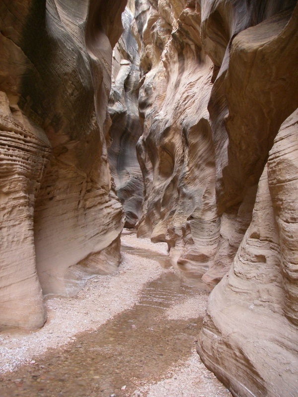
Willis Creek is a great family hike near Bryce. No real difficulties are encountered, the hike is as long or short as you want, and there are some very beautiful sections. This is a great addition to visiting Bull Valley Gorge just down the road.

Willis Creek

Willis Creek

Willis Creek 2

Willis Creek 2

Getting There

Head south out of Cannonville toward Kodachrome basin on the Kodachrome Basin road for 2.7 miles to the Skutumpah Road.

  • This road Skutumpah Road is signed to Bull Valley gorge. Turn onto it and reset your odometer. ( 12S 407246mE 4154284mN / N37° 31' 51" W112° 02' 59" )
  • At 5.5 miles, stay left. (on road 500) ( 12S 403121mE 4149745mN / N37° 29' 22" W112° 05' 45" )
  • At 6.2 miles is the trailhead. This is a wide area just before crossing the shallow and small flowing Willis Creek ( 12S 402963mE 4149124mN / N37° 29' 02" W112° 05' 51" )

Route

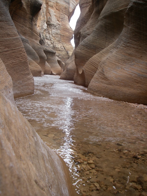
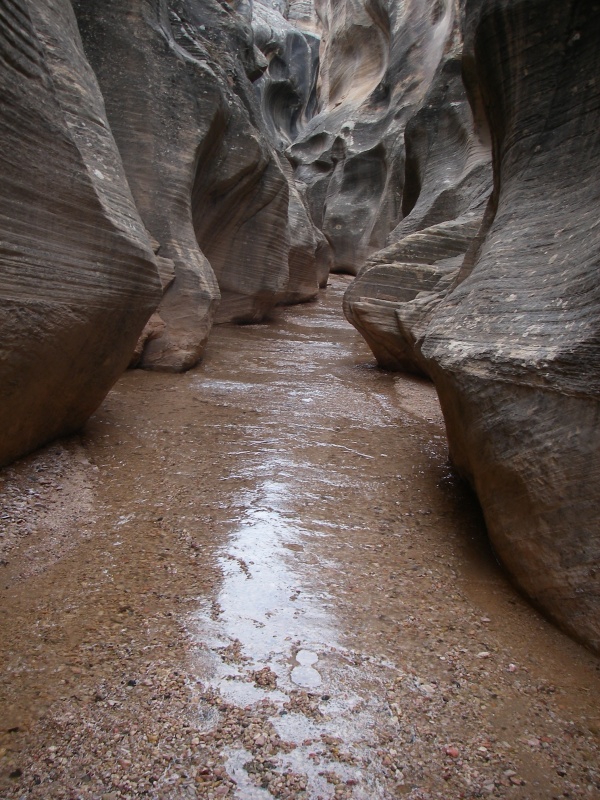
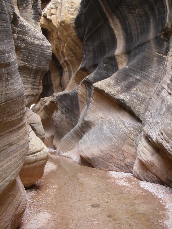
From the trailhead, follow the marked trail down Willis Creek. The trail follows along the rim for a short distance, then drops in. 10 minutes from the car, you will encounter a short waterfall that can be downclimbed, or bypassed on either side. Below the waterfall are the most scenic sections. The canyon is narrow, but never a slot. Enjoy the yellow and black colors on the wall.

About 30 or 40 minutes from the car a side canyon comes in on the left. This makes a great turn around spot or continue down as far as you like. Return the way you came.

Optional Exit: The side canyon can be up-climbed. The first chockstone 2 minutes up the canyon is tricky, but not very exposed. The next one, 5 minutes above the first, is not as tricky, but very exposed. Climbers only. Above this second up-climb, the canyon opens dramatically and is not particularly interesting. Follow it until you come to the main road, and then hike left down the road back to your car. All in all, you are likely better off going back up Willis, but for those who prefer loop hikes, this is an option.

Photos

Videos

Willis Creek canyon richardpattison

Maps

Full Route / 4.65 miles / Elevation Range 5,722 - 5,988 ft.
Printable Maps:
Trailhead

12S 402963mE 4149124mN

N37° 29' 02" W112° 05' 51"

Comments

Want to make a comment? Login and let yourself be heard.