Bingo Canyon |

Dirty Devil

Canyoneering Bingo Canyon - Dirty Devil Canyoneering Bingo Canyon

Dirty Devil

Overview

RATING: 3/4A
MAPS: Angel Cove, UT

Fri

A chance of rain showers before noon, then showers and thunderstorms likely. Mostly cloudy, with a high near 66. South wind 5 to 16 mph. Chance of precipitation is 70%.

66 | 48

Sat

Rain showers likely before noon, then a chance of showers and thunderstorms. Mostly cloudy, with a high near 62. Chance of precipitation is 60%.

62 | 43

Sun

Sunny, with a high near 68.

68 | 41

Mon

Sunny, with a high near 75.

75 | 43

Tue

Sunny, with a high near 81.

81 | 48

View Full Weather Details
SEASON: Any, hot in summer
RAPPELS: 2+ to 22 m ( 73 ft. )
WATER: Little or none.
FLASHFLOOD: Moderate, but you can see the whole drainage and skies on the approach.
NOTES: The final rappel may require a sandtrap or other advanced anchor techniques. Bringing a 60m rope and fiddlestick type device may allow for using an anchor farther up canyon.

Fri

A chance of rain showers before noon, then showers and thunderstorms likely. Mostly cloudy, with a high near 66. South wind 5 to 16 mph. Chance of precipitation is 70%.

66 | 48

Sat

Rain showers likely before noon, then a chance of showers and thunderstorms. Mostly cloudy, with a high near 62. Chance of precipitation is 60%.

62 | 43

Sun

Sunny, with a high near 68.

68 | 41

Mon

Sunny, with a high near 75.

75 | 43

Tue

Sunny, with a high near 81.

81 | 48

View Full Weather Details
Diane negotiating a minor obstacle in the upper section.

Diane negotiating a minor obstacle in the upper section.

Roadtrip heading into the narrows

Roadtrip heading into the narrows

Bingo is one of the mini slots Dave found and documented in 2009. I had done Sawtooth (which starts at the same trailhead), but had never gotten back to check out the others in the area. Bingo turned out to be a pleasant surprise. The goods are very short, but also very good. A relatively short approach leads to a deeply cut and narrow slot that is long enough and provides enough difficulty to be fun, but not overwhelming. The skilled can downclimb many of the drops, while the timid and less experienced may do a handful of rappels. All will do at least 1-2 rappels.

Warning: This is a very narrow canyon. At 6'2" / 185lbs, I fit, but would not have wanted to be much bigger. Many of the anchors are hard to reach or setup if you are a bigger canyoneer. A petite canyoneer is recommended in the group to help with anchors. Be careful! Even petite canyoneers can get suckered into staying in the narrows too long. My petite partner Diane had her first "stuck in a slot" experience when she mis-judged the width of a downclimb and ended up slightly wedged for a few minutes until some flaying and using my shoulders/head provided enough of a step up to un-stick .
Diane determined to stay dry in the upper section.

Diane determined to stay dry in the upper section.

Heading down to Bingo in the morning light

Heading down to Bingo in the morning light

Getting There

From Hanksville, travel south on Highway 95. 10.1 miles south of Hanksville, at mile post 10.1, turn east (left) off the highway on the signed Angel Point Trail Road #0100.

  • Reset your odometer as you turn off Highway 95 ( 12S 530839mE 4232060mN / N38° 14' 10" W110° 38' 51" )
  • 1.7 miles, stay left ( 12S 533177mE 4232026mN / N38° 14' 08" W110° 37' 15" )
  • 2.5 miles, turn right on road #0101 and reset your odometer. ( 12S 534117mE 4232786mN / N38° 14' 33" W110° 36' 36" )
  • 0.8 miles, cattle guard ( 12S 535083mE 4231908mN / N38° 14' 04" W110° 35' 57" )
  • 3.4 miles, turn left onto road #0103 and reset your odometer ( 12S 538064mE 4230240mN / N38° 13' 10" W110° 33' 55" )
  • 1.1 miles, cross slickrock. This is a rough section that will stop low clearance vehicles. ( 12S 539104mE 4231673mN / N38° 13' 56" W110° 33' 12" )
  • 2.9 miles, Benign Trailhead. Nondescript parking spot after the road has made a turn. There are likely tire tracks here at a small parking area. ( 12S 540225mE 4234082mN / N38° 15' 14" W110° 32' 25" )
  • 3.7 Bloodhound Canyon Trailhead. Road #4477 goes off on the right. ( 12S 540857mE 4235256mN / N38° 15' 52" W110° 31' 59" )
  • 3.9 miles, Y-Junction, stay right ( 12S 540946mE 4235486mN / N38° 15' 59" W110° 31' 55" )
  • 4.4 miles - Faint track on the left, take it. Note: If you stay right here, the roads ends in a short distance at an excellent primitive camping spot above the Dirty Devil. ( 12S 541550mE 4235998mN / N38° 16' 16" W110° 31' 30" )
  • 5.2 miles - End of the road, and trailhead for Bingo and Sawtooth Canyon ( 12S 541007mE 4237120mN / N38° 16' 52" W110° 31' 52" )
Bottom of one of the rappels or downclimbs. Don't get stuck!

Bottom of one of the rappels or downclimbs. Don't get stuck!

Second to last rap. (Hard downclimb)

Second to last rap. (Hard downclimb)

Route

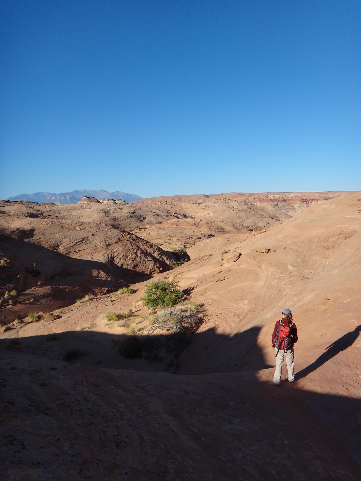
Approach (45-60 minutes)
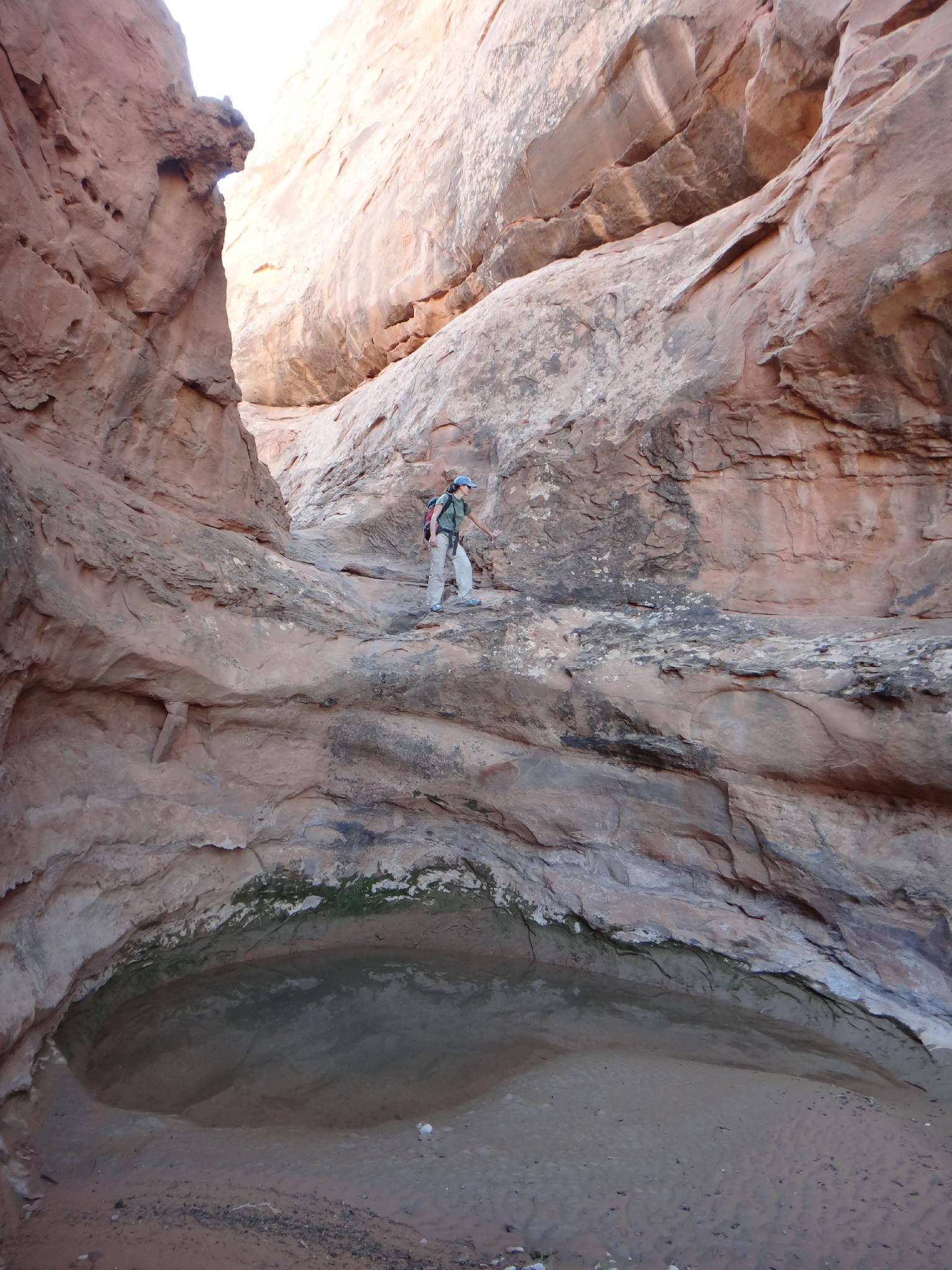
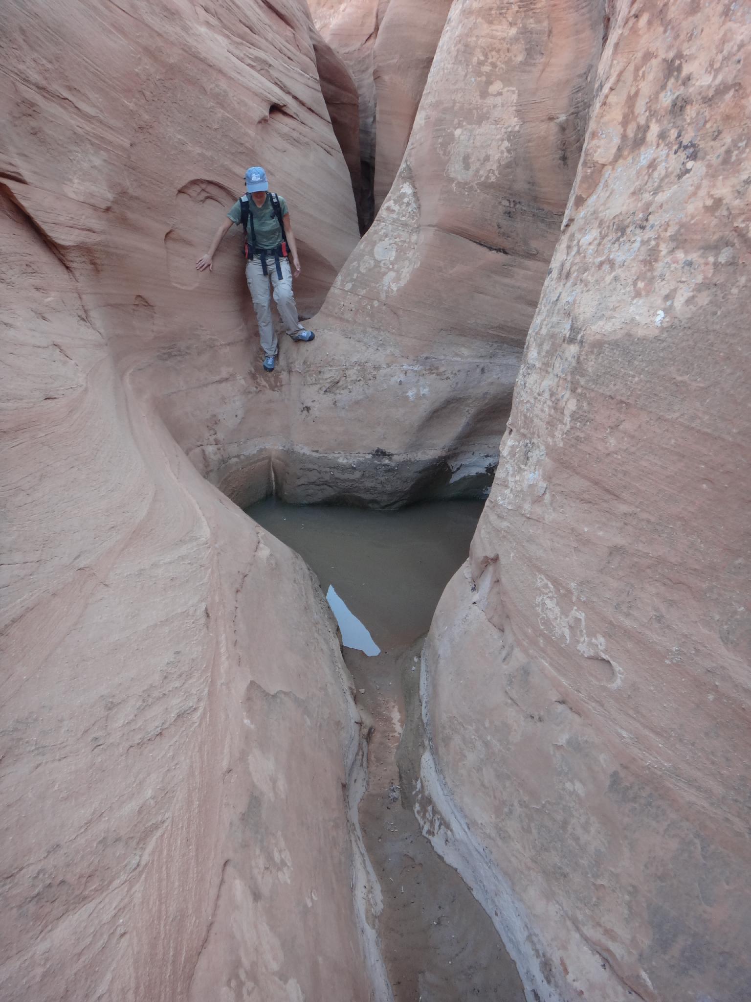
From the trailhead go west down into the wide open drainage. After you reach the bottom, just below the confluence with a side fork on the left, is a small dryfall that is easily passed on the left. Continuing down, another small dryfall is passed before the canyon slots up a bit and has a few minor obstacles that are easily defeated. The canyon opens one final to time before the main event.

Just when you are wondering if the canyon was going to be any good, it begins slotting up and dropping. This is the final, exquisite section.

Canyon
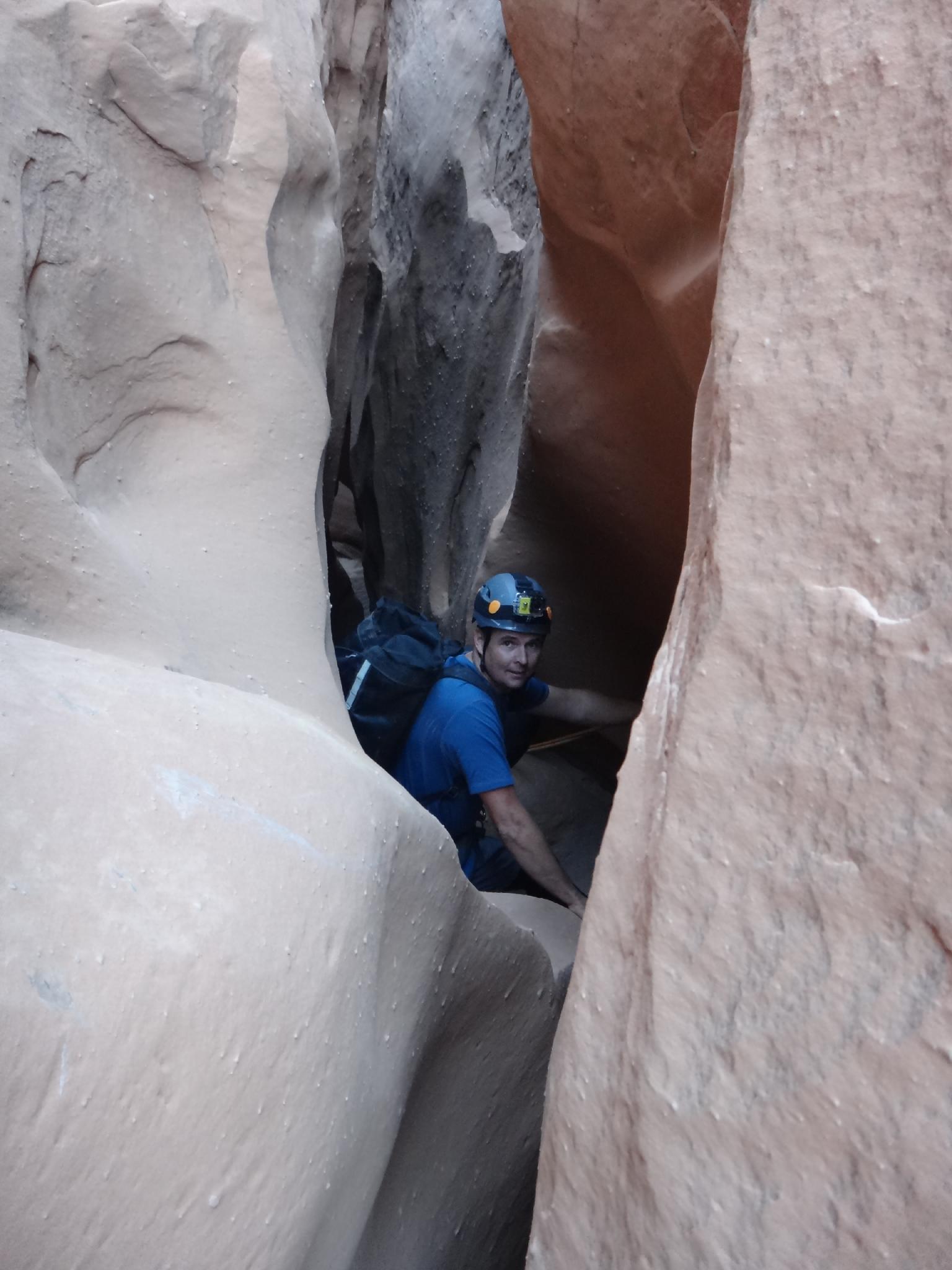
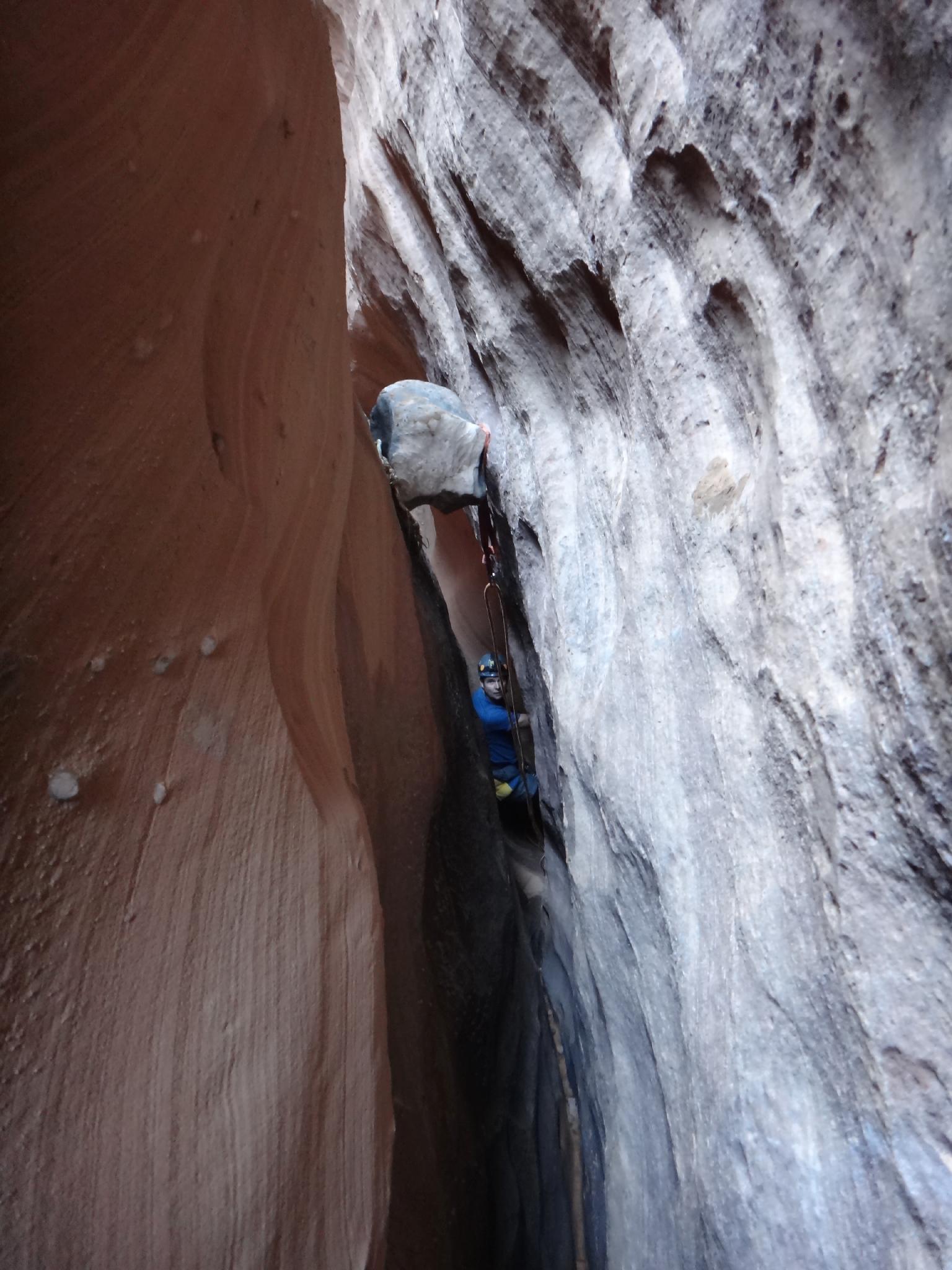
Heading down, a steep, narrow drop is easier to downclimb than it appears. Some may want a rope. This is quickly followed by a 7 m ( 23 ft. ) downclimb or rappel, which is quickly followed by another 7 m ( 23 ft. ) drop. This one is very narrow to get to, and to get on rappel at. It can be down climbed or rappelled, but either way, be careful not to get stuck!

Phew! One more narrow section leads to another 9 m ( 30 ft. ) drop with a difficult to reach anchor for bigger canyoneers. This could also be downclimbed, but is harder than the others.

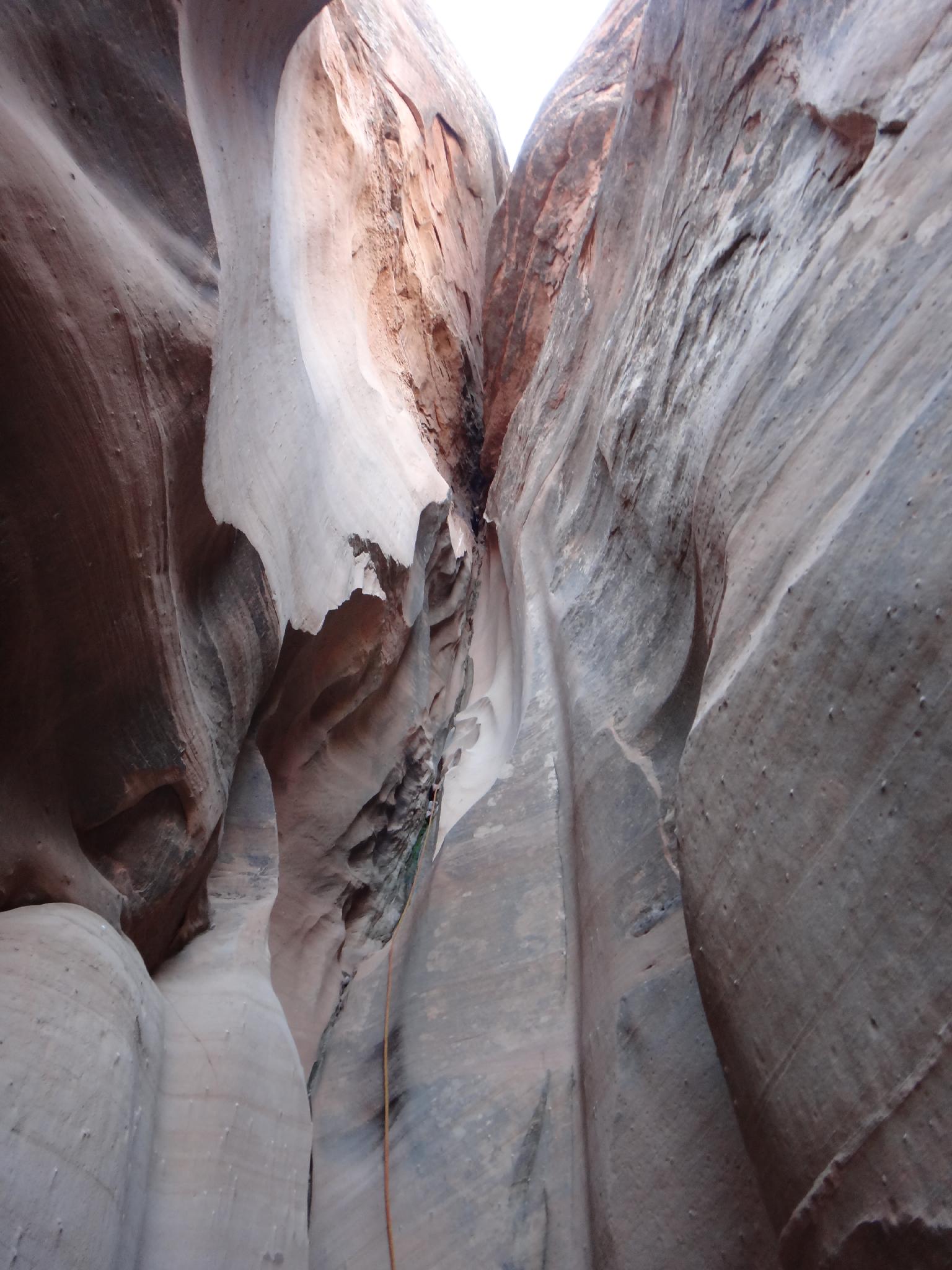
The final rappel is about 22 m ( 73 ft. ) with a bit of an awkward start. Check the anchor well. It was a small chockstone that seems to be getting worn with age. A sandtrap or trying to use an anchor farther up canyon may be a better approach.

A lot of action for such a short section of canyon!

Exit (60-75 minutes)
Once down the last rappel, continue down canyon a couple of minutes until it is easy to escape up the sandy left bank. Work up slickrock and circle back up to the start of the final slot, cross the canyon, and rim walk back to the trailhead.


Videos

Benign, Sawtooth, and Bingo Canyon. Flapbag

Maps

Printable Maps:
Trailhead

12S 541007mE 4237120mN

N38° 16' 52" W110° 31' 52"

Final Slot

12S 539934mE 4237142mN

N38° 16' 53" W110° 32' 36"

Narrows

12S 540263mE 4237056mN

N38° 16' 50" W110° 32' 23"

Comments

Want to make a comment? Login and let yourself be heard.