 Canyoneering
Sandthrax Canyon
Canyoneering
Sandthrax Canyon
North Wash
Overview
Ah, Sandthrax! What do you write as an introduction to a canyon that needs no introduction?
Well, first off, a little about the history of the canyon. Steve Allen descended it back in the day, calling it Dog Gone. Then, in 2001, an ill-fated group (Shane Burrows, Hank Moon, and Chris Raver) tried to descend the canyon. They were stopped by the climbing crux, spent the night engineering a route out the side using bolts and free climbing, and reached the rim just about the time Search and Rescue were going to reach them. They re-named the canyon Sandthrax Canyon, and the name has stuck. Being the internet age, the Sandthrax tale garnered much attention in the canyoneering community. Some people gave kudos, and some were critics. From my understanding, Chris went back shortly after and finished the lower section.
Sometime about 2004 or so, Nat Smale mentioned he wanted to go check it out. I didn't know Nat back then, but we e-mailed a bit, and I too got the bug. Sandthrax is the only canyon that I have actively trained for. When I decided I wanted to give it a try, I spent a year trad climbing (chimneys and off widths in particular) and did about 80 canyons. Many of those 80 were R and X rated canyons to be sure I had solid high stemming and climbing skills. During that time, I did some canyons with Nat and Jeff Webb as well in preparation.
Which brings me to my second important point for Sandthrax success, I picked partners that I knew could absolutely crush the climbing cruxes. Normally I don’t like to be the weakest link in a team, but for Sandthrax, I was happy to have excellent climbers along. Both Nat and Jeff could out climb me if I were on my best day, and they on their worst!
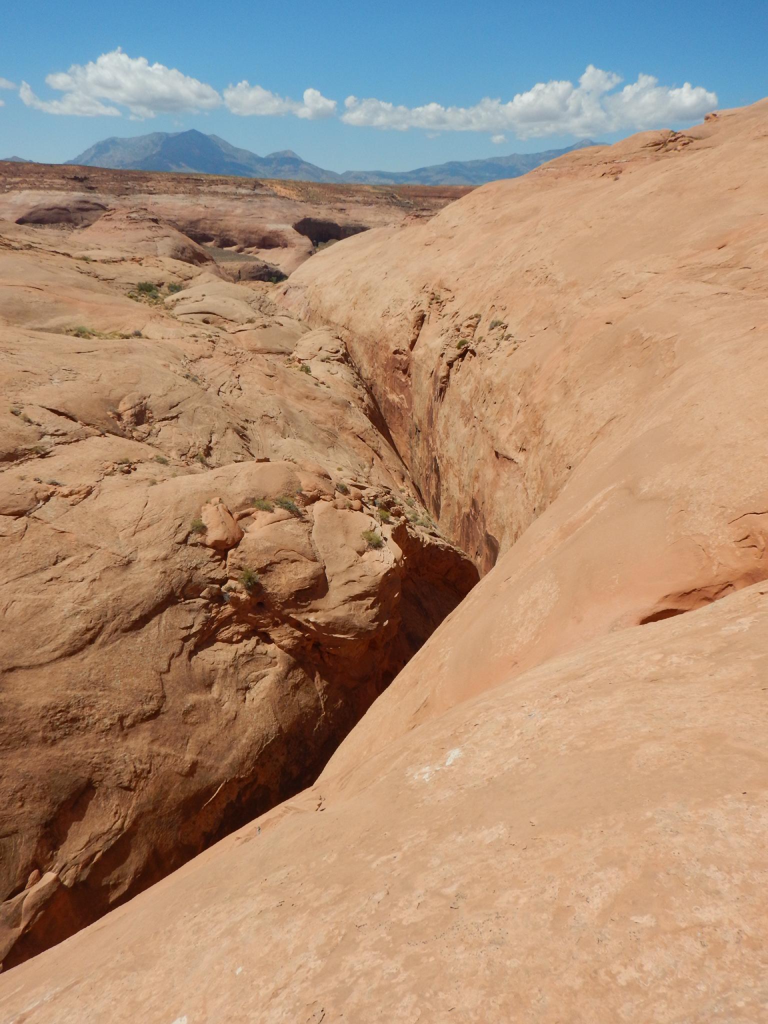
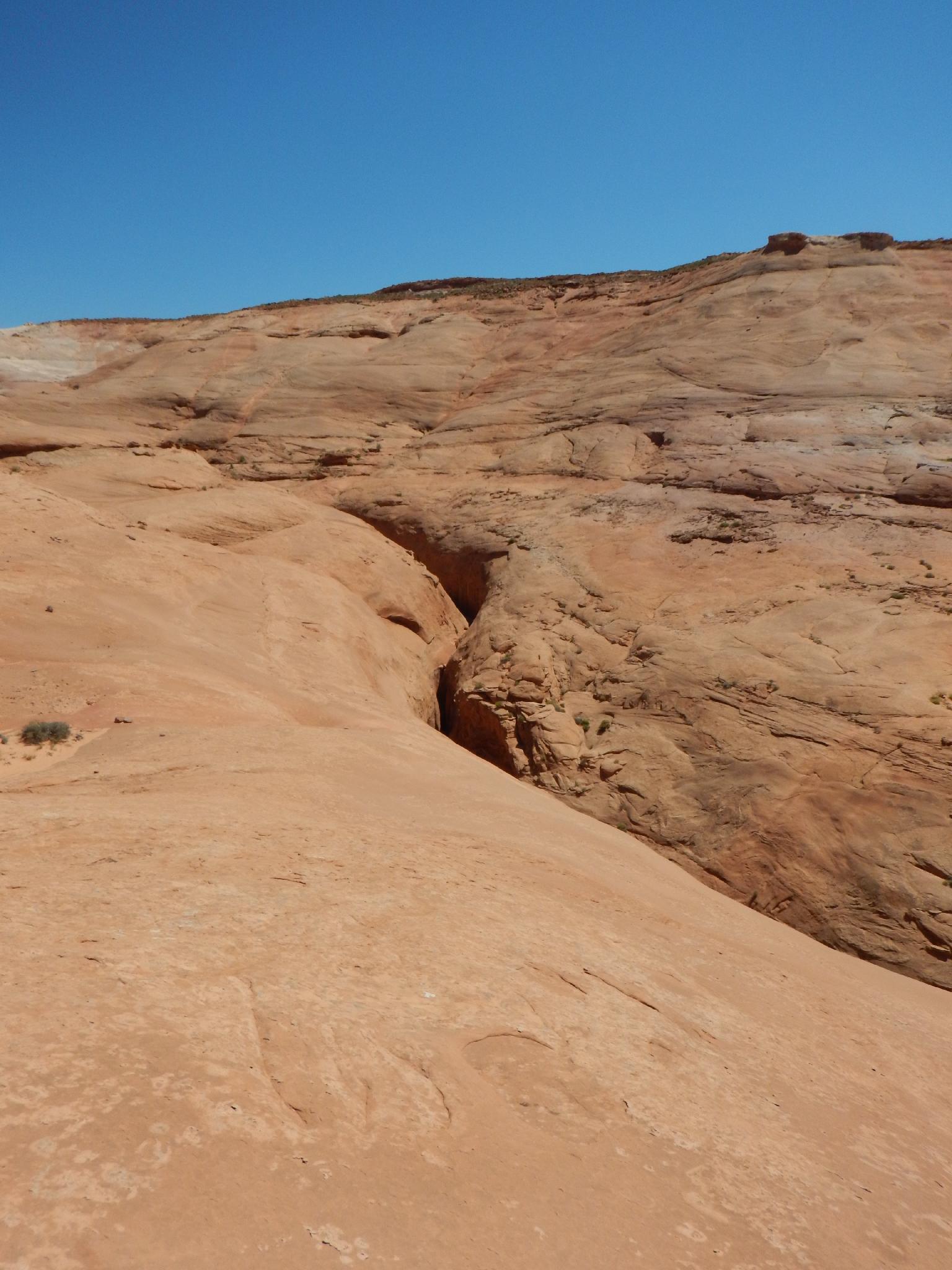
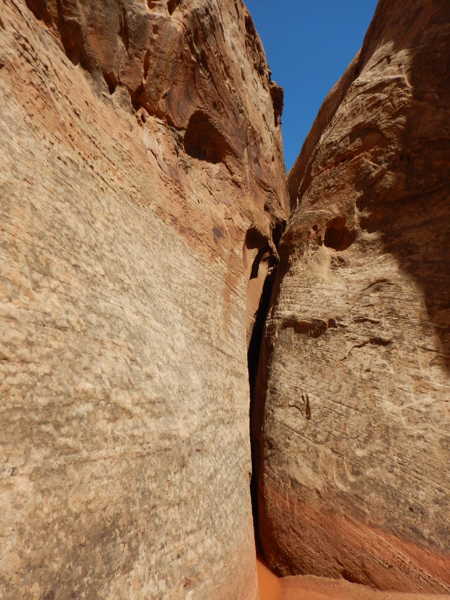
I have refrained from posting my thoughts and beta on the canyon, not feeling it was an appropriate canyon for most canyoneers. It is being done more and more these days, and beta is popping up, so I feel I should share my information to help those planning a trip. Sadly I used an old school disposable camera on our trip and did not get any good pictures. Pictures are from recent hikes around the area to show the canyon from the approach.
Getting There
From Hanksville, head south on Highway 95 towards Hite. About milepost 28.2, a side road goess off on the left to a large camping area and information board. This is the Sandthrax Camping area and trailhead.
Route Description
Did you read the warning above? Can you climb hard off-width and stem large silos with cool confidence? Below are my notes from when we descended the canyon. Keep in mind I had put in a lot of mileage on other hard canyons before doing this one.
Rack we used: Old (PreC4) BD #4.5, #5, Big Bros #3, #4. (we didn't bring, but I would recommend aiders for most). The crux is short (7 m ( 23 ft. )), but a 30 m ( 99 ft. ) rope may be useful for possible belays elsewhere in the canyon.
Our time was a bit under 4 hours, but many groups will take substantially longer.
Approach (30 minutes)
From the Sandthrax campsite, follow the dirt road south to the more isolated campsites, and then head up the wash. As soon as convenient, climb out on the left (looking up canyon) and climb the slickrock as you continue work up the rim of the canyon. Sandthrax is clearly visible below. Contour up the canyon until it is easy to walk down to the bottom of Sandthrax.
Canyon
Are you sure you're ready? The beta is one short rappel, much high stemming, big silos to cross, a crux off-width, even more high stemming and silos, and then you are done.
Head down canyon, immediately coming to an easy down climb. The canyon opens for a second before the first rappel is encountered. I was dismayed to find a bolt and fixed rope here recently. Leaving a rope here in case you need to retreat may be prudent, but pick it up when you are done with the canyon. A bolt and rope are an invitation for a beginner to plunge into the canyon without knowing what they are getting into.
The canyon, in my head, was divided into three sections. The first section is fairly easy, with occasional wide spots and much high stemming, but nothing too tricky. The silos you cross, however, are getting bigger and the climbing a bit tougher. Some awkward stem across and up moves seemed tricky, but overall nothing too bad. Once stemming off the ground from the start, you will likely not touch down again until at the crux. One big pothole before the crux may have a pin that can be used to help protect its crossing.
The second section is the crux off-width. You will not miss it. Fortunately, only a few body lengths tall, the short off-width is overhung and imposing. Ratings vary from 5.10 to 5.11. If free climbing it (which I could not), I would put it at about desert 5.10 off width based on my struggles following it and experience following other off widths in the desert. It can be aided at awkward 5.8 C1, though emphasis on AWKWARD, not on 5.8 or C1. If you have not aided off widths before, this is not a great place to learn. Know how to aid before you get here. There is also not a great anchor to belay those below you up. Wedging into the crack and holding the weight with your body seems the best approach, though very uncomfortable.
The third section is the rest. The canyon has more and higher stemming and more and bigger silos to cross. On our visit there was an anchor to help protect a very big silo near the end. Of particular note is near the end it is easy to stay stemming high, and find yourself 15 m ( 50 ft. ) up a perfect elevator slot. This was the most fun I had in the canyon, down climbing such a huge and impressive slot.
The canyon eventually eases as you reach the floor again and the right wall is getting lower and lower. Keep going though, there are a few more difficulties before a final down climb returns you to the open desert. Follow the wash down to the campsite.
Maps

12S 541183E 4207687N
38°00'57"N 110°31'51"W
12S 542073E 4208364N
38°01'19"N 110°31'14"W
12S 541594E 4207960N
38°01'06"N 110°31'34"W