
 Hiking
East Fork of Blacks Fork River
Hiking
East Fork of Blacks Fork River
North Slope Uinta Mountains
Overview
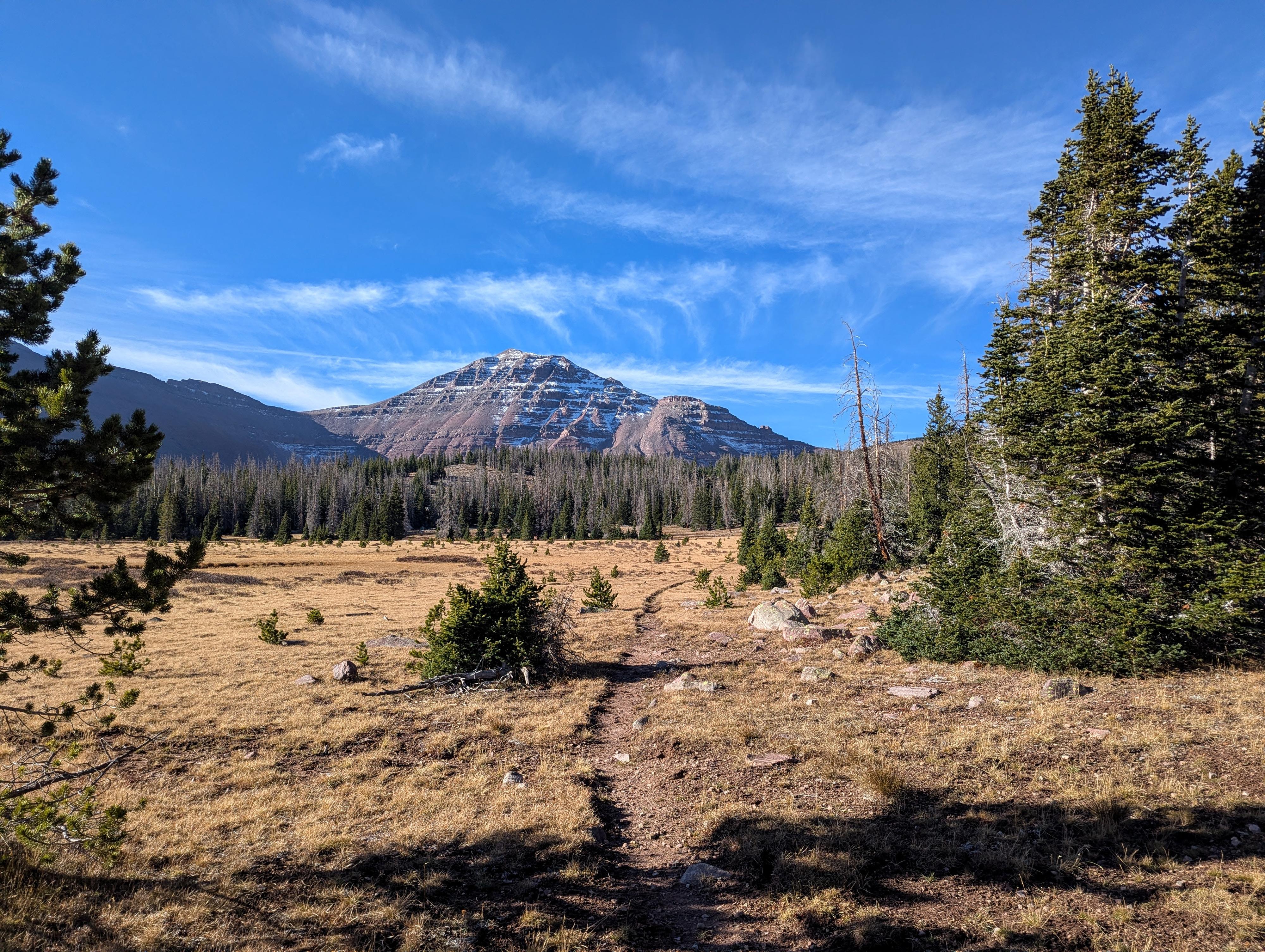
The East Fork of the Blacks Fork drainage goes about 12 miles from the trailhead to the top of the ridge near Red Knob Pass. The drainage doesn't have lakes, so it doesn't see the amount of use of other drainages with "lake destinations." It is a pretty ramble. The trail stays fairly close to the river, passing through a few large open meadows and past a couple of old log cabins before reaching treeline and heading up to the ridge.
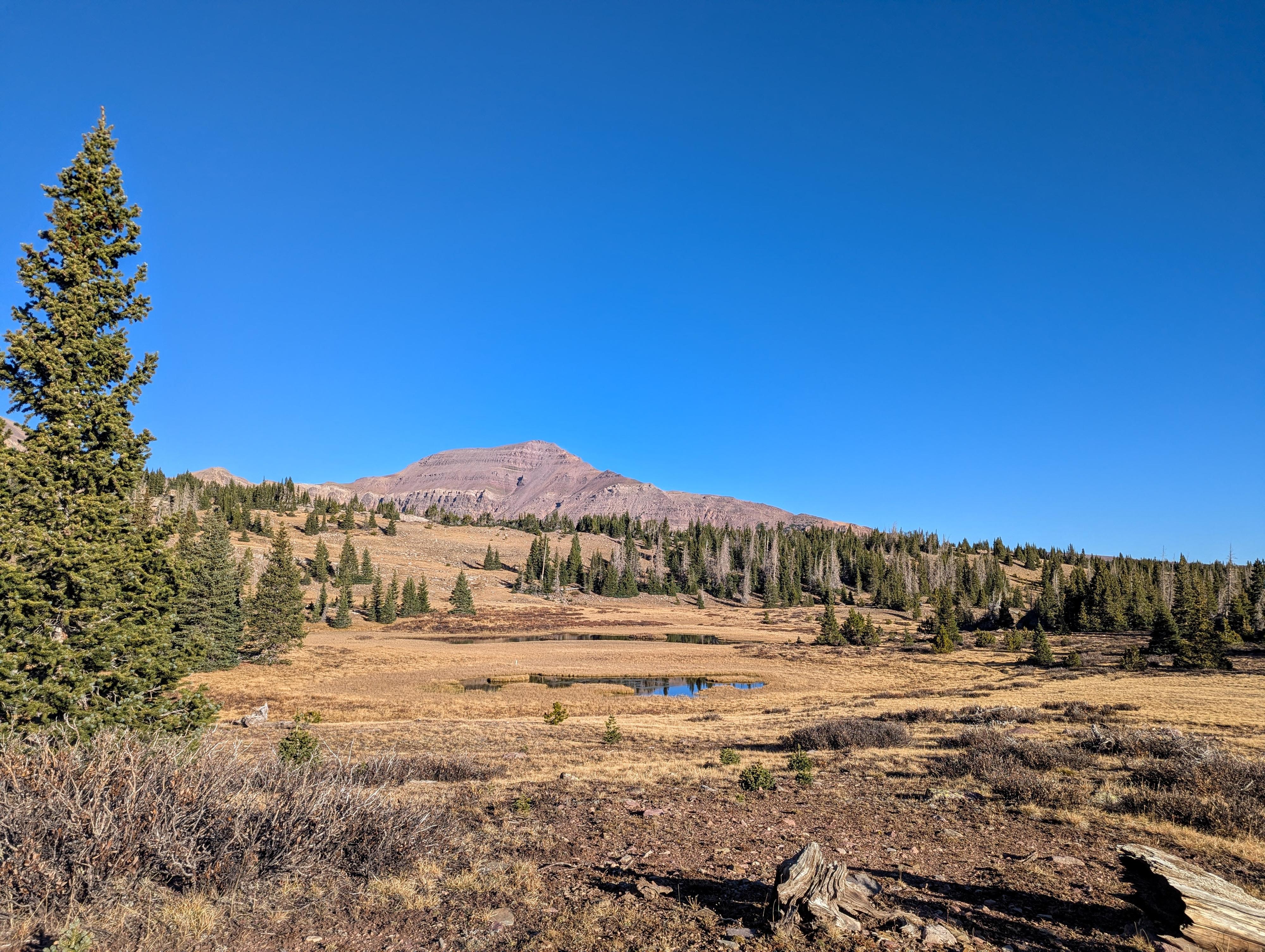
The lower part of the drainage is pretty but also heavily forested, so you only see glimpses of the peaks and ridges. At about 9 or so miles, as the trail approaches 10,800 feet, the trees open up, and big expansive views of Mt. Lovenia and the ridges surrounding the drainage are visible. This is the part that I thought was gorgeous. If you continue up to Red Knob Pass, about 12-ish miles from the trailhead, the views are some of the best I have seen in the High Uintas. It is a drainage that I think is best visited with an overnight backpack, though day hiking as far as motivation allows is good as well. Going to Red Knob Pass and back in the day would be a very long, strenuous day for most.
There are a few stream crossings and quite a few marshy areas to cross. You will likely get your feet wet. I had not brought a pair of shoes to wade in and wish I had.
Finally, the upper drainage is north-facing and can hold snow well into summer. If trying to get all the way to Red Knob Pass, I would recommend mid-to-late July on a normal snow year, or later if it has been a heavy snow year. If just going up to treeline, early July in a normal snow year could be doable, though the river crossings can be difficult if runoff is high.
Getting There
You reach the trailhead via the Elizabeth Mountain Road road that leaves Mirror Lake Highway at milepost 48.6 on UT-150. This is about 48.6 miles from Kamas, or about 29 miles south of Evanston Wyoming if coming from the north.
Turn east onto the Elizabeth Mountain Road. There is a large parking area here used for winter snowmobile staging. The road is dirt and rough from the start. Follow it for 18.4 miles. There are quite a few side roads, but stay on the main road that heads generally east. It passes over Elizabeth Mountain and past Lyman Lake. At about 18.4 miles is the junction with the East Fork of Blacks Fork Road.
Go right and follow the East Fork of Blacks Fork for 5.4 miles to where it enters the campground. The trailhead is on the left just after entering the campground, with a larger parking area a short distance past the trail start. This is near the Hewinta Guard Station. This last 5.4 miles of road is generally quite a bit smoother than the Elizabeth Mountain Road.
Route Description
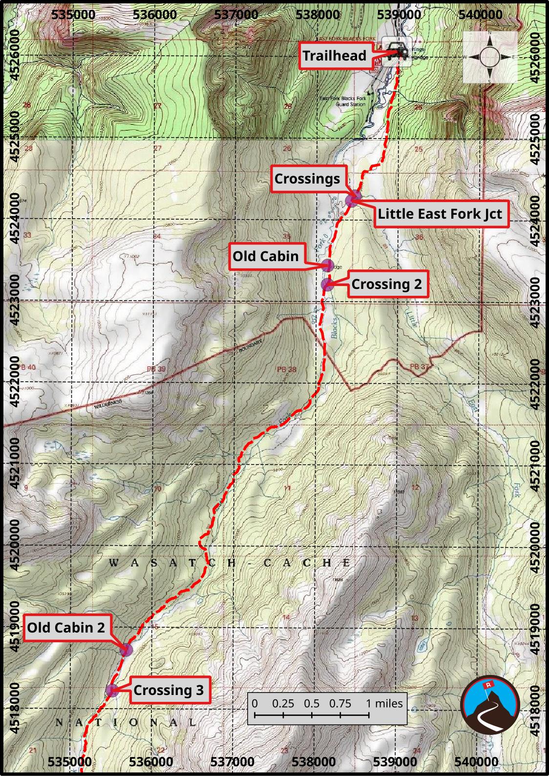
From the trailhead, follow the trail as it quickly crosses the East Fork of Blacks Fork River via a wide bridge, then turns south. After this first crossing, none of the other stream crossings have bridges. The trail stays away from the river on drier ground in the trees for about 1.3 miles as it heads south to the first river crossing. There is a large campsite right before this crossing.
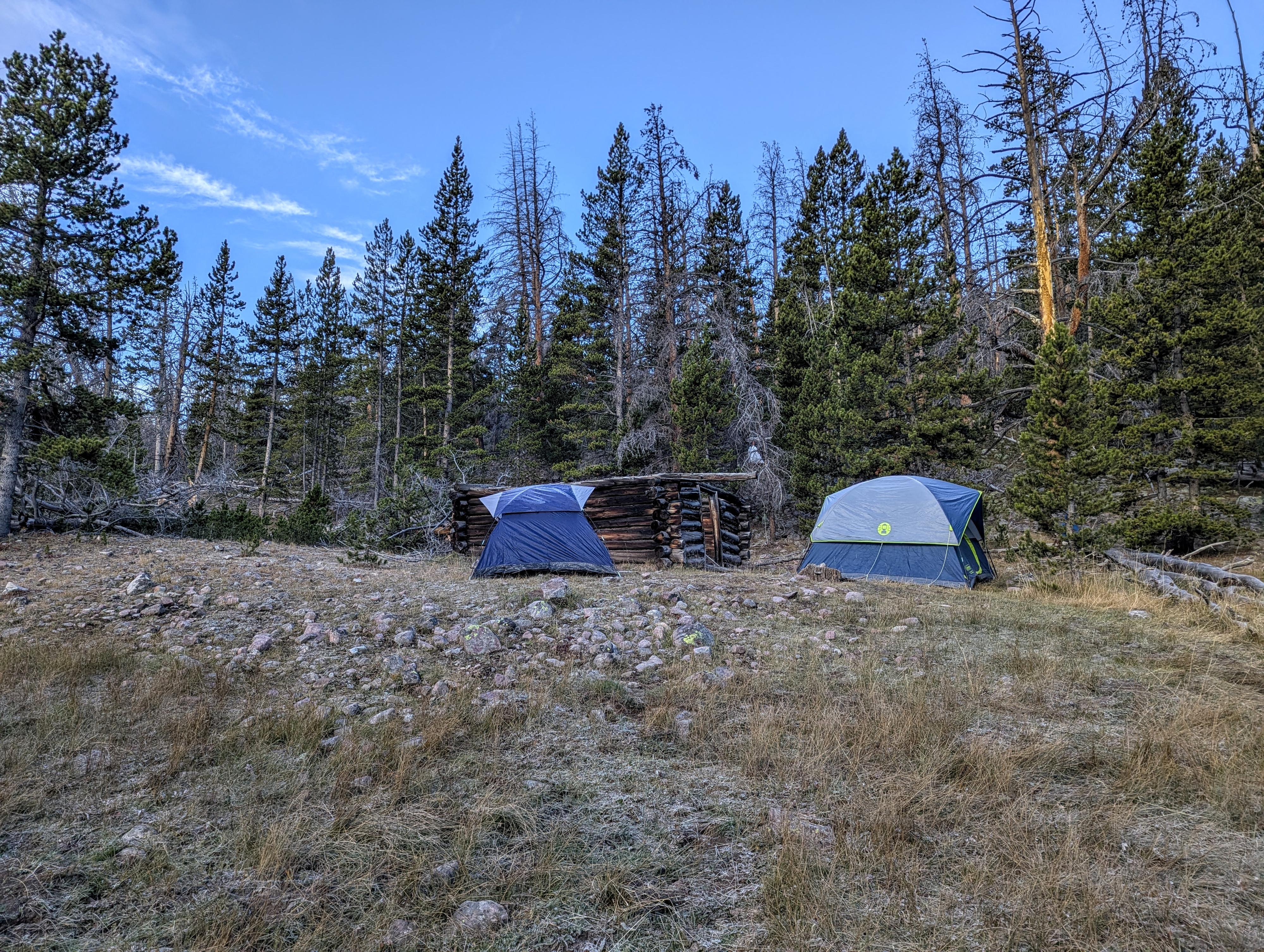
Once across the river is a trail junction. Left goes up the Little East Fork of the Blacks Fork; go right instead to go up the East Fork of Blacks Fork. About 2 miles from the trailhead, an old logger's cabin is on the right side of the trail. Just a few minutes past the cabin is another river crossing. This second river crossing has a lovely and often quiet muddy meadow just past it. After this second bridgeless crossing and the often muddy meadow, the trail stays on drier terrain and the west side of the river for about 4 miles.
There is a second old logger's cabin next to the trail a little under 6 miles from the trailhead, with another bridgeless crossing back to the east bank of the river about 6.2 miles from the trailhead.
About 7.5 miles from the trailhead, the trail crosses back to the west bank and changes character. Instead of following the river up the valley, the trail now begins to climb up and out of the basin. Initially in the trees, on my visit, there were quite a few fallen trees in this section. Most of them have social trails around them; just pay attention to these side paths so you end up back on the main trail. As the trail gets higher, the views get better and better. From the last crossing, it is about 2.5 miles to the upper basin and headwall. There are good camping opportunities in this area with several small meadows and quite a few springs.
In the upper basin, the trail can be a bit difficult to find as it crosses the basin to the base of the ridge. Look for large cairns or the trail going up the ridge in the distance and just head for that. The trail climbs up to the ridge via a series of switchbacks. The last switchback near the top has some of the best views I have seen in the Uintas as it looks west toward Red Knob and the jagged ridgeline west of Deadhorse Lake. The trail then goes to the south side of the range and traverses west to Red Knob Pass proper, which also has amazing views both north and south into the Lake Fork River drainage.
Photos
Maps
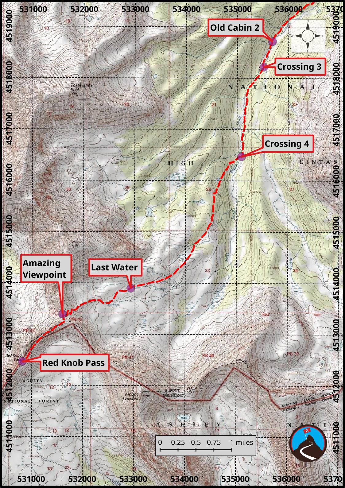
12T 538977E 4526065N
40°53'05"N 110°32'14"W
12T 538471E 4524291N
40°52'08"N 110°32'36"W
12T 538432E 4524234N
40°52'06"N 110°32'38"W
12T 538139E 4523440N
40°51'40"N 110°32'51"W
12T 538140E 4523206N
40°51'32"N 110°32'51"W
12T 535688E 4518718N
40°49'07"N 110°34'37"W
12T 535520E 4518218N
40°48'51"N 110°34'44"W
12T 535089E 4516469N
40°47'55"N 110°35'03"W
12T 532935E 4513896N
40°46'31"N 110°36'35"W
12T 531600E 4513390N
40°46'15"N 110°37'32"W
12T 530814E 4512461N
40°45'45"N 110°38'06"W