 Hiking
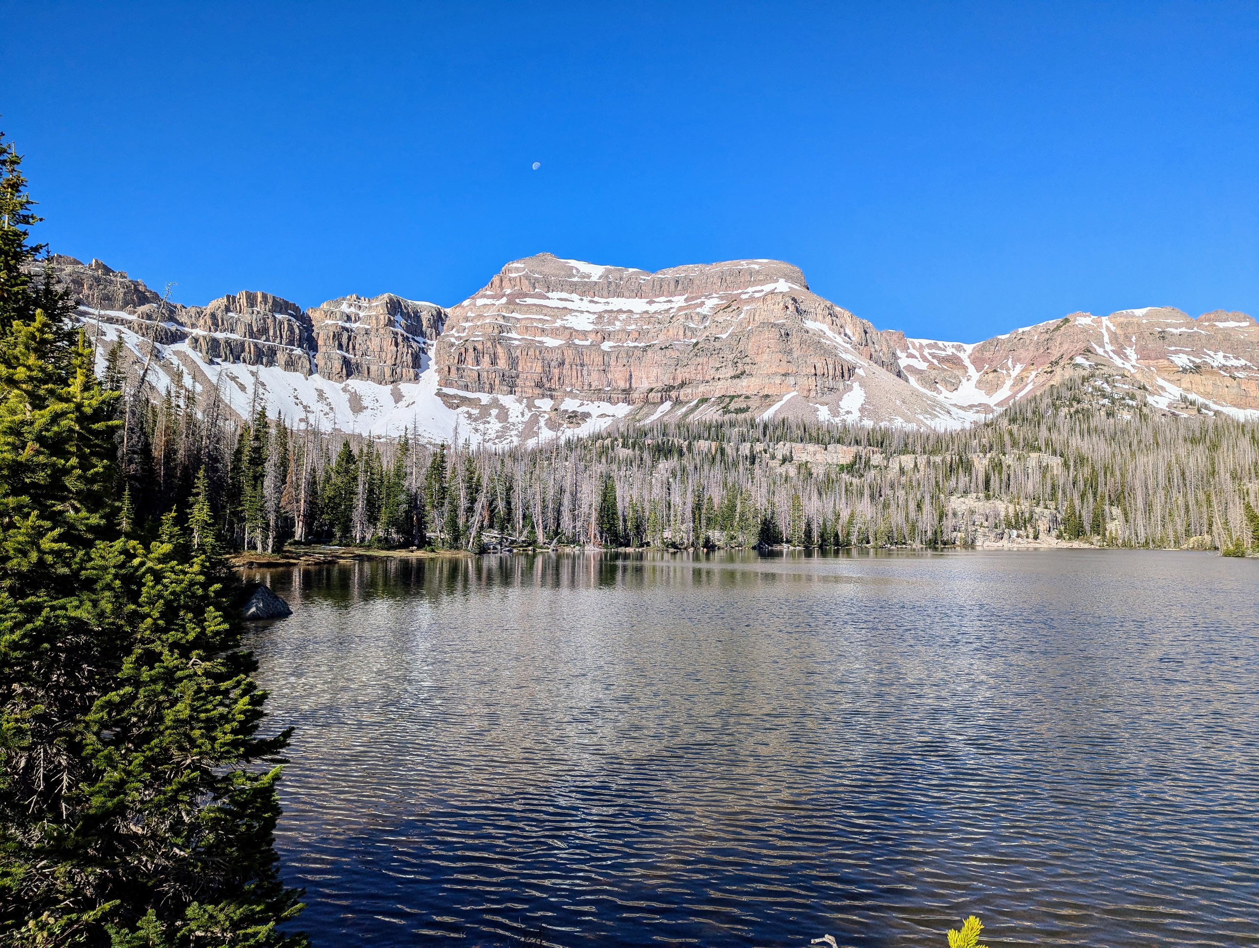
Kermsuh Lake
Hiking
Kermsuh Lake
Western Uintas
Overview
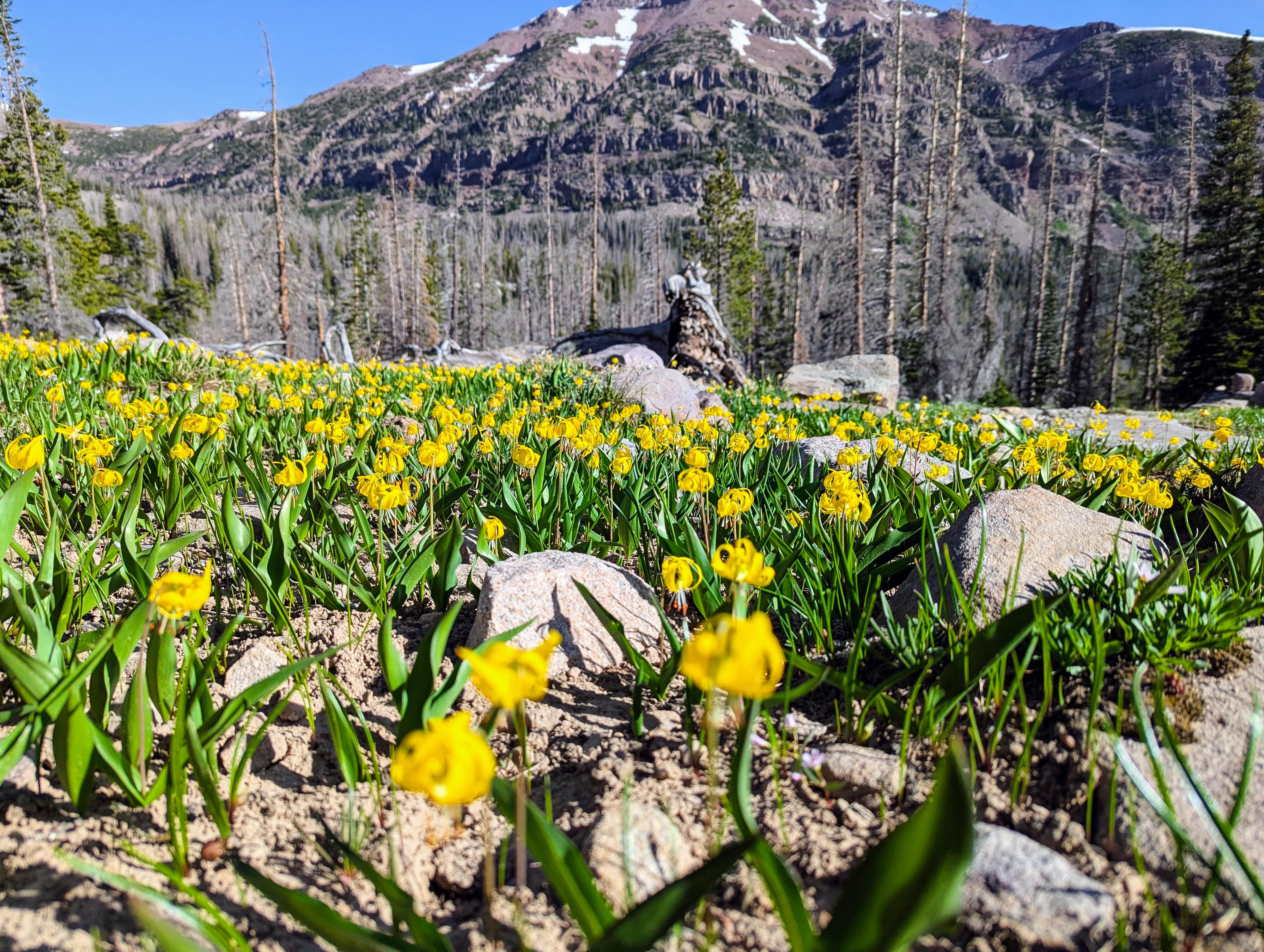
Kermsuh Lake is in the Middle Basin, a side fork of Stillwater Fork. The area is much less used than its far more popular neighbor, Amethyst Basin. If you are looking for more solitude in the area, Kermsuh Lake can be a good choice. I find Kermsuh not quite as scenic as Amethyst Basin or Middle Basin, where McPheters and Ryder lakes reside. It is still a beautiful basin, though, surrounded by lofty peaks that tower over 12,000'. (A1, Kleeting, and Hayden/East Hayden peaks)
I've visited both on a backpack trip and on a long day hike. The lake itself has pretty rocky shores, and I couldn't find great campsites at the lake proper. We ended up camping about 1/2 mile away from the lake on the edge of a lovely meadow. As a day hike, it is about 15 miles, which is fairly long for many groups. I, personally, preferred doing the trip as a day hike because it made for a lighter pack and easier going.
Getting There
The trail starts at the Christmas Meadows trailhead in the Uintas. Travel south out of Evanston Wyoming on highway 150. Follow this for about 30 miles, crossing into Utah after about 20 miles.
Turn left at the signed Christmas Meadows road. This is milepost 45.9, not far past the Ranger Station.
Follow the Christmas Meadows road, staying on the main road, about 3 miles to the Christmas Meadows campground. The trailhead parking is signed just after the campground and has a pit toilet.
Route Description
To Amethyst Basin Junction (2.5 miles)
From Christmas Meadows Trailhead, navigation is quite straightforward. Head south on the Christmas Meadows Trail. It is well side, and easy to follow. The first bit has some open meadow sections, allowing for some views.
It is about 2.5 miles to where the Amethyst Basin trail leaves on the left and is an obvious junction with a large pile of rocks denoting it. This is the trail to Amethyst and Ostler Lakes. Stay straight here.
Amethyst Basin Junction to Kermsuh Lake Junction (2.3 miles)
The trail continues to amble up the valley from Amethyst Basin Junction. It is about 2.3 miles from the Amethyst Basin junction to where the trail to Kermsuh Lake and West Bain leaves on the right. Like Amethyst, it is denoted by a large pile of rocks and likely small wooden sign. Stray straight here to continue heading to Ryder and McPheters Lakes.
Kermsuh Lake Junction To Kermsuh Lake (2.5 miles)
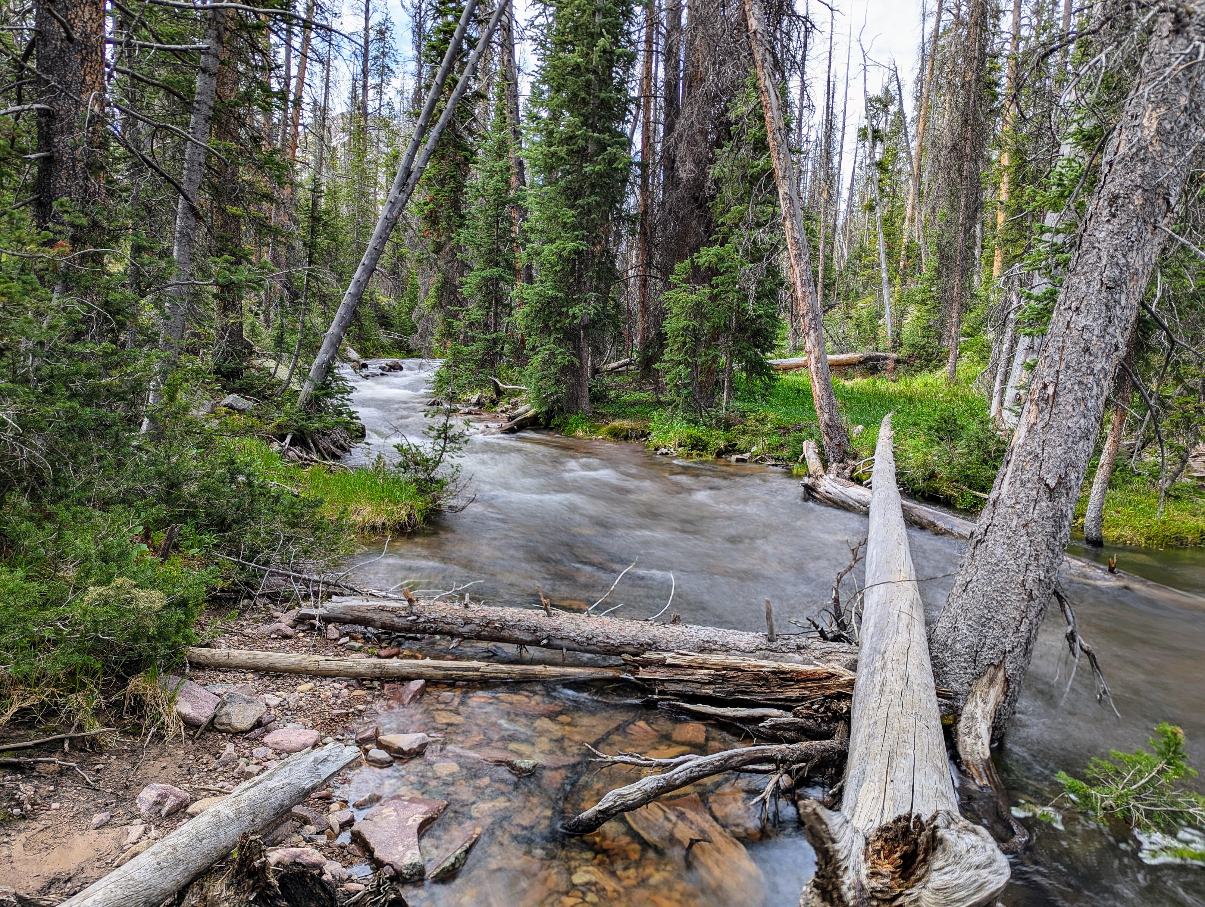
From the junction, go right. In just a minute or two, you reach the Stillwater Fork crossing. If it is high, a log provides precarious passage. Be careful; a fall could be treacherous if the creek is flowing high.
Once across the creek, the trail begins its relatively steep ascent into the West Basin. The trail has been changed since the USGS maps were drawn. It is now steeper, without switchbacks. Once up into the basin, the trail levels out and the ridge and peaks surrounding the basin begin to come into view.
A large meadow is soon reached (about 1.4 miles from the Stillwater Fork crossing). If looking for a campsite away from the lake, the edge of this meadow has some excellent spots, though it is still about a mile from Kermsuh Lake.
Continue from the meadow a little over a mile to Kermsuh Lake.
Return the same way.
Photos
Maps

12T 516766E 4519054N
40°49'20"N 110°48'04"W
12T 517307E 4515513N
40°47'26"N 110°47'41"W
12T 517008E 4512386N
40°45'44"N 110°47'55"W
12T 514523E 4510888N
40°44'56"N 110°49'41"W