Monte Cristo Peak |

Monte Cristo Range

Hiking Monte Cristo Peak - Monte Cristo Range Hiking Monte Cristo Peak

Monte Cristo Range

Overview

RATING: Easy Hiking
MAPS: MONTE CRISTO PEAK, UT;

Fri

Snow showers likely before 9am, then snow showers and a chance of thunderstorms. Cloudy. High near 39, with temperatures falling to around 37 in the afternoon. Northwest wind 6 to 10 mph. Chance of precipitation is 90%. New snow accumulation of less than half an inch possible.

39 | 32

Sat

Snow showers before noon, then snow showers and a slight chance of thunderstorms. Cloudy, with a high near 35. South southwest wind 7 to 13 mph. Chance of precipitation is 90%. New snow accumulation of around one inch possible.

35 | 32

Sun

A chance of snow showers before noon, then a chance of snow showers and a slight chance of thunderstorms. Partly sunny, with a high near 38. Chance of precipitation is 40%.

38 | 28

Mon

A slight chance of snow showers before noon, then a chance of snow showers and a slight chance of thunderstorms. Partly sunny, with a high near 43.

43 | 30

Tue

A slight chance of snow showers after noon. Mostly sunny, with a high near 46.

46 | 29

View Full Weather Details
SEASON: Summer, Fall
GEAR: Standard Hiking Gear
WATER: None

Fri

Snow showers likely before 9am, then snow showers and a chance of thunderstorms. Cloudy. High near 39, with temperatures falling to around 37 in the afternoon. Northwest wind 6 to 10 mph. Chance of precipitation is 90%. New snow accumulation of less than half an inch possible.

39 | 32

Sat

Snow showers before noon, then snow showers and a slight chance of thunderstorms. Cloudy, with a high near 35. South southwest wind 7 to 13 mph. Chance of precipitation is 90%. New snow accumulation of around one inch possible.

35 | 32

Sun

A chance of snow showers before noon, then a chance of snow showers and a slight chance of thunderstorms. Partly sunny, with a high near 38. Chance of precipitation is 40%.

38 | 28

Mon

A slight chance of snow showers before noon, then a chance of snow showers and a slight chance of thunderstorms. Partly sunny, with a high near 43.

43 | 30

Tue

A slight chance of snow showers after noon. Mostly sunny, with a high near 46.

46 | 29

View Full Weather Details
Just getting started on a June day

Just getting started on a June day

Separating the Wasatch Range from to the west from Woodruff, Randolf, and Wyoming to the east, the Monte Cristo Range runs north-south for about 30 miles. State Highway 39 crosses the range and offers exquisite views and a winding road often frequented by motorcyclists.

Monte Cristo Peak, the tallest point in the range at 9,148, sits a very short distance off the highway and makes a great family friendly leg stretch when passing through the area.

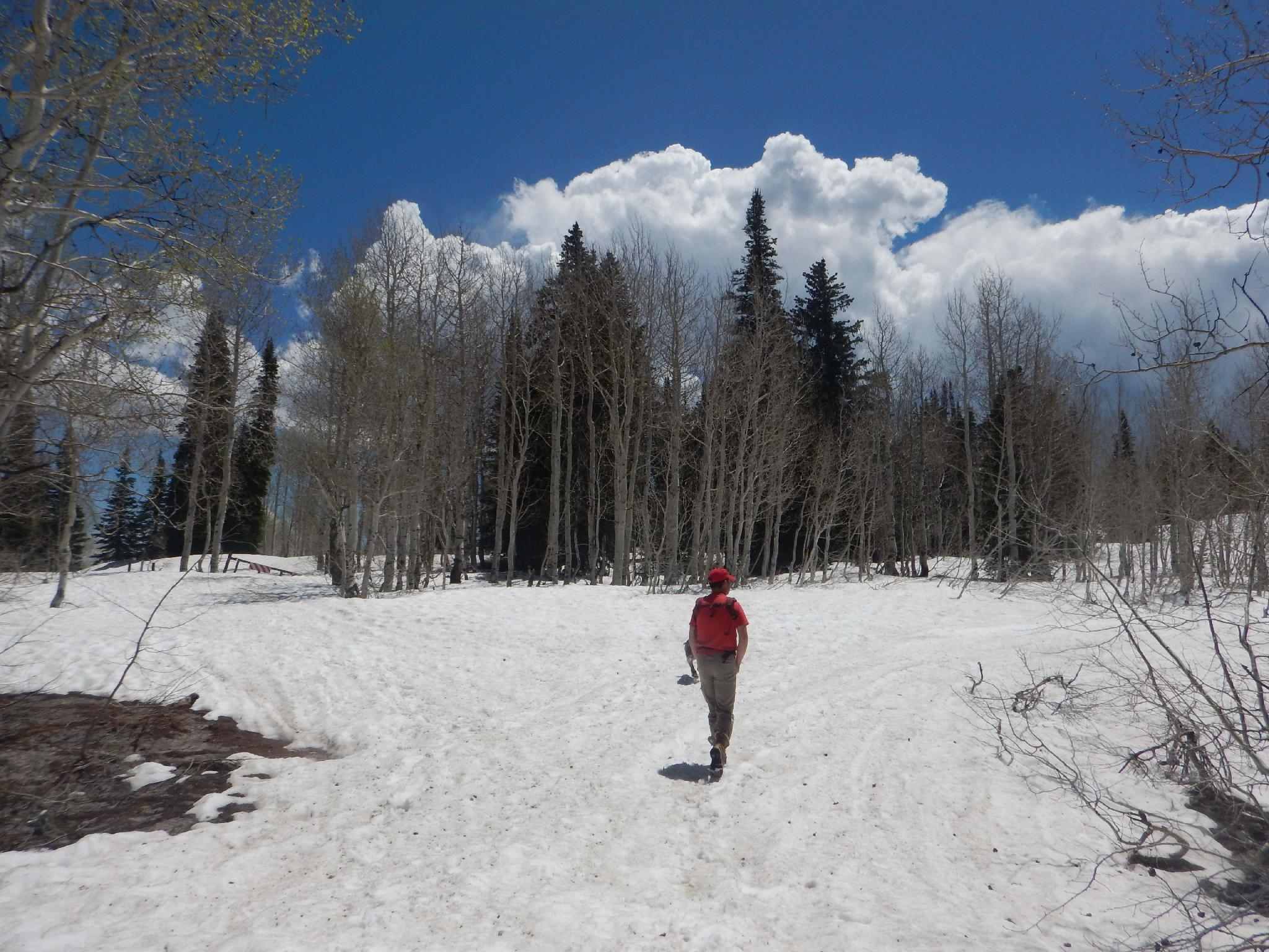
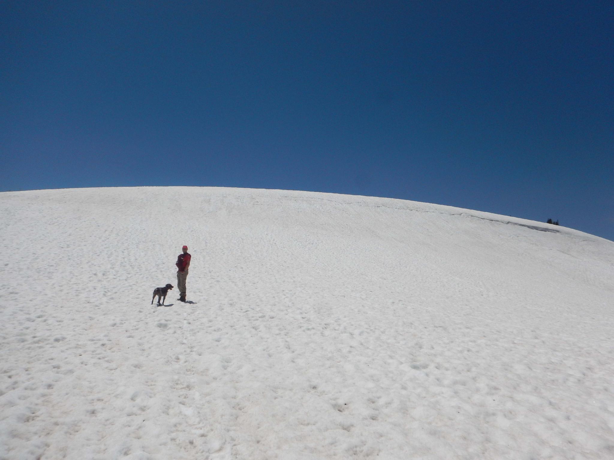
A note on timing. UT-39 is closed in the winter, roughly from November to Memorial Day, though can stay closed later into the summer during very heavy snow years. Check UDOT’s website for road condition information ( https://www.udot.utah.gov/ ). Visiting the peak in early summer, right after the road has been opened, is likely to bring snow covered slopes and potential sledding fun. Visiting in mid-summer is more likely to be wildflower season. Finally, visiting in the fall brings dramatic foliage, a leaf peepers dream. Bottom line, anytime in the summer and fall is a good time to visit!

The open slope before the top. Would be a great sledding day.

The open slope before the top. Would be a great sledding day.

Getting There

The traihead is at mile post 44.6 on UT-39. To reach the trailhead from Ogden, go east on UT-39 through Ogden Canyon. The state road passes along the south side of Pineview Reservoir, then bends north and reaches Hunstville. In Hunstville, be sure to take a right to continue on UT-39 at mile post 19.3. This is well signed. Follow UT-39 as it climbs up the Monte Cristo Mountains.

About 24 miles from Hunstville the trailhead is a spur road on the right that is closed. The destination, Monte Cristo Peak, is the peak you just passed, clearly visible from the trailhead a short distance to the south.

Benchmark at the top.

Benchmark at the top.

Route

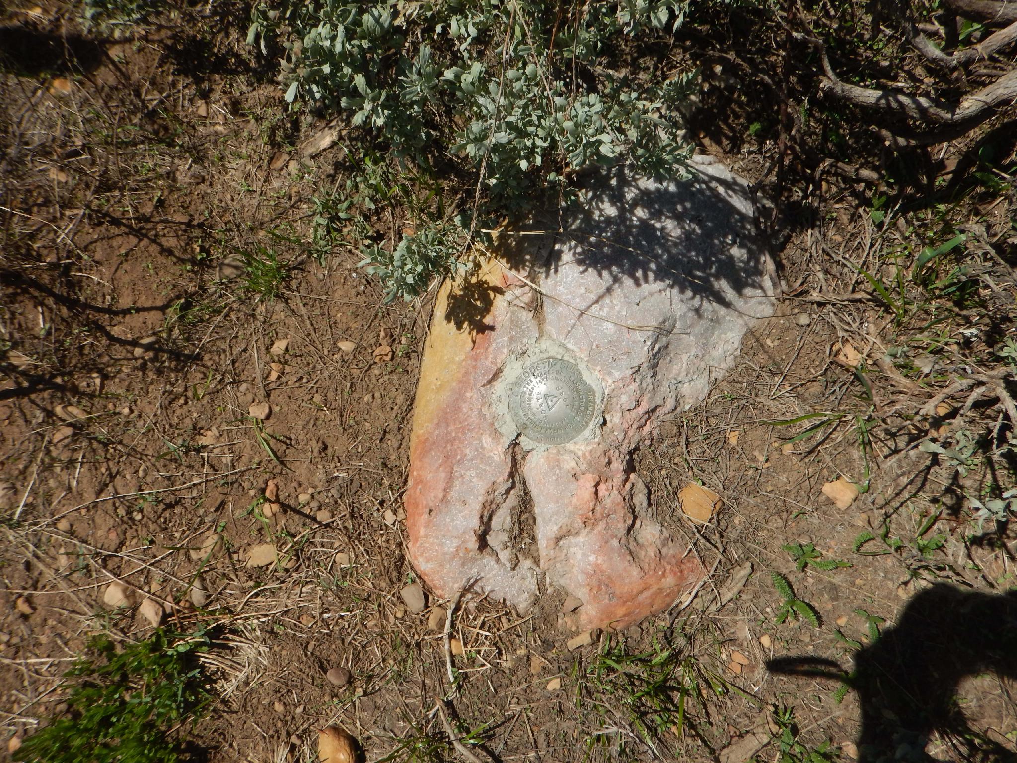
From the parking area, follow a closed road. It passes a small communications station, then spirals up to the summit. A survey marker stake and benchmarker mark the top. The views to the west are of the Bear River Range and Wasatch Back. To the southeast, the prominent Uinta Mountains are visible and often snow-capped until at least mid-summer.


Maps

Route / 1.36 miles / Elevation Range 8,960 - 9,148 ft.
Printable Maps:
Trailhead

12T 457279mE 4586148mN

N41° 25' 33" W111° 30' 41"

Marker

12T 456751mE 4585718mN

N41° 25' 19" W111° 31' 03"

Comments

Want to make a comment? Login and let yourself be heard.