 Hiking
Wind Cave
Hiking
Wind Cave
Logan Canyon
Overview
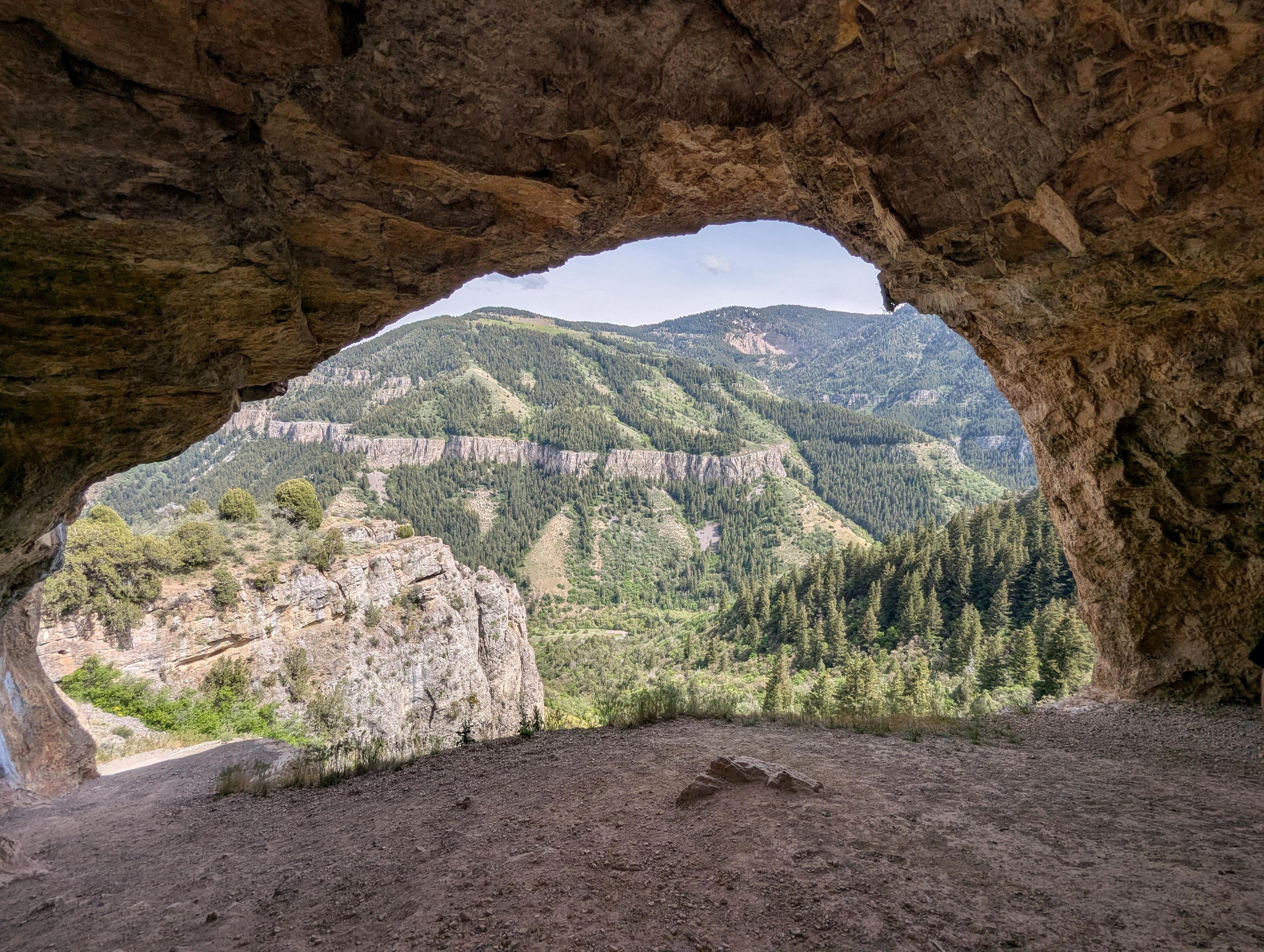
Wind Cave, just across the canyon from the Crimson Trail, is one of the iconic, must-do Logan Canyon hikes. The hike is about 2 miles and 1,100 feet of elevation gain to reach the cave, then another 2 miles and 1,100 feet of descent on the return. Though most consider it a pretty strenuous hike, it is still immensely popular. I've visited numerous times over the years, and the parking lot has always been full or nearly full! It is iconic for a reason - a really stunning place to visit.
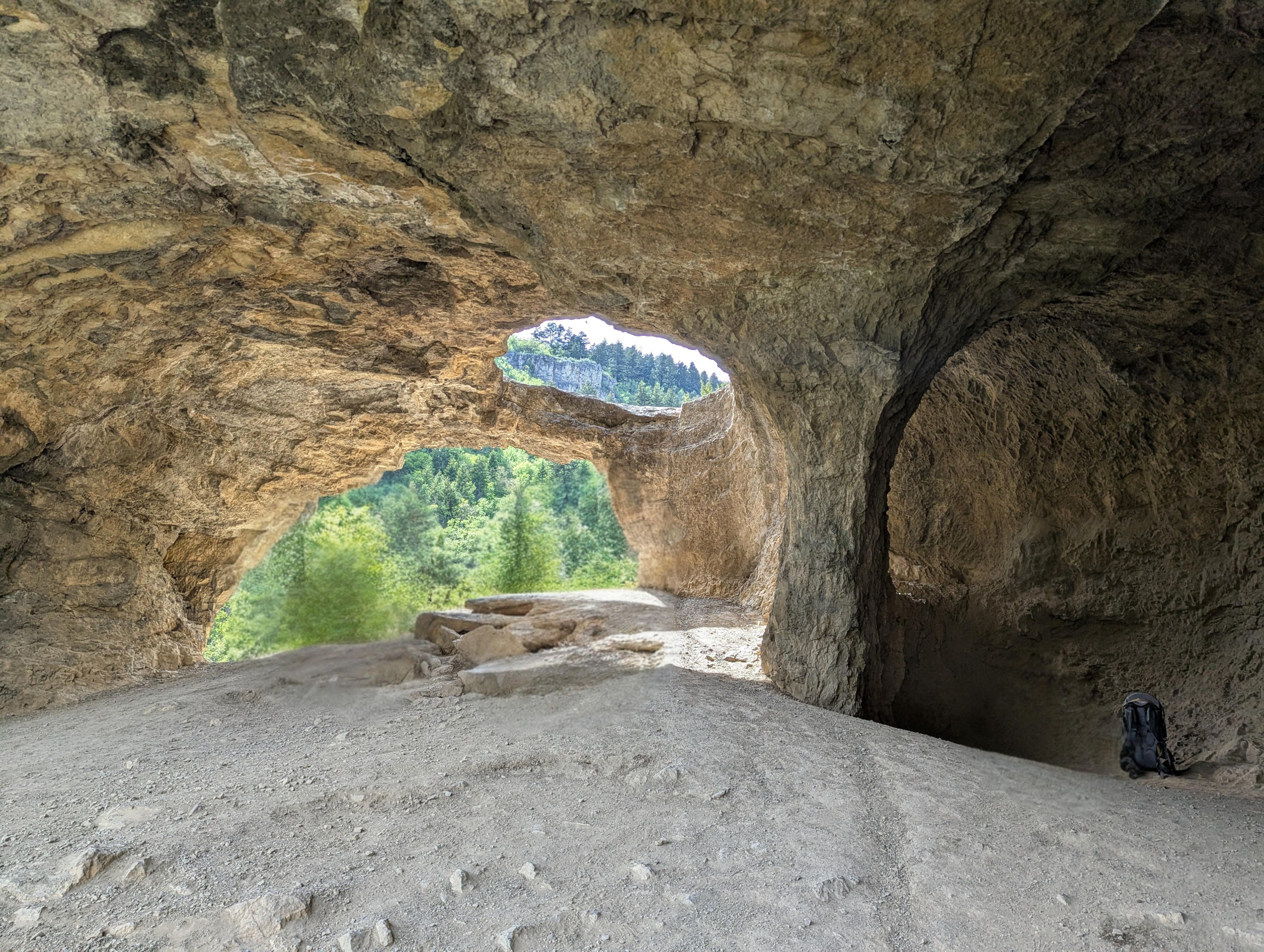
The actual sculpting of the caves began when tectonic forces pushed this ancient seabed skyward, fracturing the rock and allowing acidic groundwater to seep into the cracks. This water slowly dissolved the limestone from the inside out, hollowing out hidden subterranean chambers. Millions of years later, as the Logan River cut its way down to create the canyon, it drained the caverns and sliced open the cliffside.
Getting There
The trailhead is up Logan Canyon between Spring Hollow and Guinavah/Malibu Campgrounds. From the mouth of Logan Canyon, take 89 east about 5 miles. The trailhead is on the left side at about mile post 465.8.It is signed and has a fairly large parking area.
Route Description
From the trailhead, follow the trail as it heads west (down canyon), initially without too much elevation gain, then begins climbing. After 1.25 miles, a junction is reached. Right goes to Beirdneau Peak and Green Canyon, and left goes to Wind Cave. Go left!
About 1/3 of a mile above this junction, a switchback goes right with a limestone cliff band on the left side of the trail and a social trail going to and along the cliff base. Stay right on the main trail. It climbs to one more switchback, then starts heading west to the top of Wind Cave, about 2 miles from the trailhead.
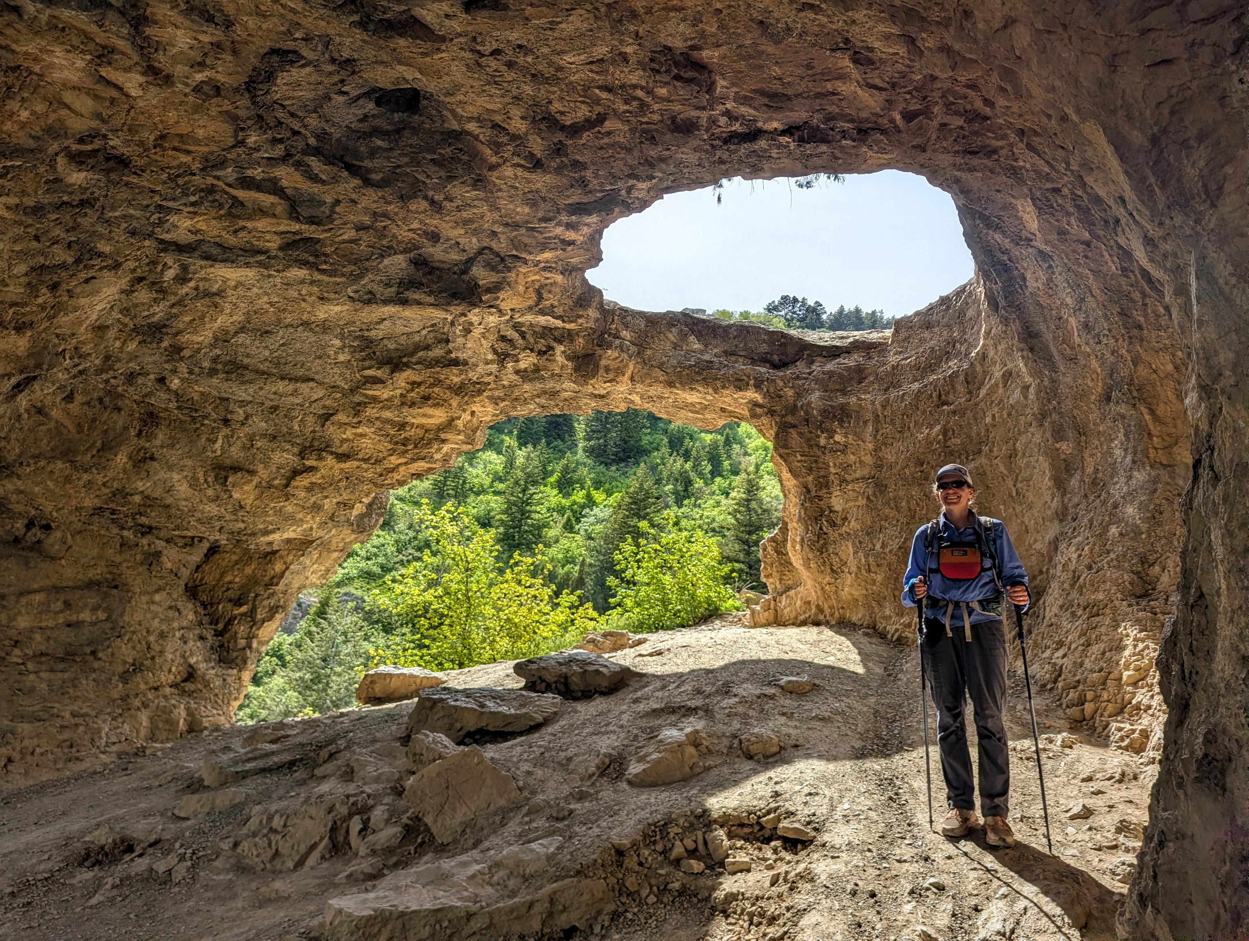
Use caution around the cave as there are some steep drops and loose sections. It is an amazing and photogenic feature.
Photos
Maps

12T 441505E 4623626N
41°45'44"N 111°42'13"W
12T 440881E 4623702N
41°45'47"N 111°42'40"W
12T 440597E 4623889N
41°45'53"N 111°42'53"W
12T 440358E 4623682N
41°45'46"N 111°43'03"W