Cane Wash | Northern Swell

Hiking Cane Wash - Northern Swell Hiking Cane Wash

Northern Swell

Overview

RATING: Moderate Hike
MAPS: Bottleneck Peak, UT;

Sat

Sunny, with a high near 91. Northwest wind around 8 mph.

91 | 61

Sun

Sunny, with a high near 93. North northwest wind around 7 mph.

93 | 63

Mon

Sunny, with a high near 93.

93 | 65

Tue

Sunny, with a high near 93.

93 | 65

Wed

A slight chance of showers and thunderstorms after noon. Sunny, with a high near 90.

90 | 65

View Full Weather Details
SEASON: Fall, Winter, Spring
GEAR: Standard Hiking Gear
WATER: A few seeps, bring all you need to drink.
FLASHFLOOD: Low
NOTES: Car shuttle required. Generally both trailhead are accessible to most cars.

Sat

Sunny, with a high near 91. Northwest wind around 8 mph.

91 | 61

Sun

Sunny, with a high near 93. North northwest wind around 7 mph.

93 | 63

Mon

Sunny, with a high near 93.

93 | 65

Tue

Sunny, with a high near 93.

93 | 65

Wed

A slight chance of showers and thunderstorms after noon. Sunny, with a high near 90.

90 | 65

View Full Weather Details
The colorful Cane Wash.

The colorful Cane Wash.

Though a good hike, this is a tough hike to recommend given all of the other amazing hikes in the nearby area. This is a hike I would NOT recommend without a car shuttle. Though the shuttle could be mountain biked, I would not recommend it.

Ok, enough of a disclaimer. With a car shuttle, this is a pleasant stroll down the deep and colorful Cane Wash. Just before the river, a rock art side is visited, then the trail meanders down along the San Rafael River to the exit trailhead.

There is decent primitive camping at the trailhead, or even better, at the San Rafael Campground where the bridge crosses the San Rafael River.

Note: Bugs can be absolutely miserable during spring/summer. I would recommend visiting in late fall, winter, or spring when temps are mellow and the bugs shouldn't be a problem.
Rock Art in Cane Wash

Rock Art in Cane Wash

Getting There

The trailhead starts near the San Rafael Campground To get to the San Rafael Campground, depends on where you are coming from.

  • From the North
  • Just before the town of Castle Dale, at milepost 39.4, go east on the signed San Rafael Swell Access road. Reset your odometer as you turn off the highway onto the dirt road. ( 12S 500218E 4341289N / 39°13'15"N 110°59'51"W )
  • Continue on this road, passing a cattle guard after 12 miles, and reaching a 4 way junction at 12.7 miles. ( 12S 518059E 4336281N / 39°10'32"N 110°47'27"W )
  • Continue east at this 4 way junction for 2.4 miles to the signed Buckhorn Wash road. Go right, down the Buckhorn Wash road about 9.5 miles to the cattle guard and San Rafael Campground. ( 12S 521483E 4335782N / 39°10'16"N 110°45'05"W )
  • From the South
  • Take the exit, turning right. This road goes east, paralleling the freeway for a couple of miles before turning north. ( 12S 529541E 4303709N / 38°52'54"N 110°39'34"W )
  • Follow this road 19 miles to where the San Rafael campground is, and the bridge over the river. ( 12S 529065E 4326048N / 39°04'59"N 110°39'50"W )
  • From The San Rafael Bridge/Campground
  • San Rafael Bridge - Reset odometer and head south. ( 12S 528862E 4325810N / 39°04'51"N 110°39'59"W )
  • 0.4 miles - Exit trailhead on the right. Follow the road to its end in 0.75 miles and leave the exit vehicle there. ( 12S 528350E 4325418N / 39°04'39"N 110°40'20"W )
  • 3.8 miles from the San Rafael Bridge, turn Right on a less used dirt road and reset your odometer. ( 12S 526755E 4320489N / 39°01'59"N 110°41'27"W )
  • 0.12 miles - stay left. ( 12S 526615E 4320635N / 39°02'04"N 110°41'33"W )
  • 0.65 - Road Crosses a wash. ( 12S 525987E 4320296N / 39°01'53"N 110°41'59"W )
  • 0.8 miles - Road enters and stays in wash bottom. ( 12S 525772E 4320183N / 39°01'49"N 110°42'08"W )
  • 1.9 miles - Junction. Stay left. (Right goes up to an old mining area) ( 12S 524258E 4319643N / 39°01'32"N 110°43'11"W )
  • 2.8 miles - Road enters wash again. This is Cane Wash. You can start from here, or continue driving down Cane Wash a short distance. ( 12S 523538E 4320633N / 39°02'04"N 110°43'41"W )
Walking along the San Rafael River trail

Walking along the San Rafael River trail

Route

Rock Art and Historic Site Etiquette
Rock art and historic sites are fragile, non-renewable cultural resources that, once damaged, can never be replaced. To ensure they are protected, please:
  • Avoid Touching the Petroglyphs: Look and observe, BUT DO NOT TOUCH!
  • Stay on the Trails: Stay on the most used trails when visiting sites, and don't create new trails or trample vegetation.
  • Photography and Sketching is Allowed: Do not introduce any foreign substance to enhance the carved and pecked images for photographic or drawing purposes. Altering, defacing, or damaging the petroglyphs is against the law -- even if the damage is unintentional.
  • Pets: Keep pets on a leash and clean up after them.
  • Artifacts: If you happen to come across sherds (broken pottery) or lithics (flakes of stone tools), leave them where you see them. Once they are moved or removed, a piece of the past is forever lost.

To The San Rafael River (6.5 miles / 3 hours)
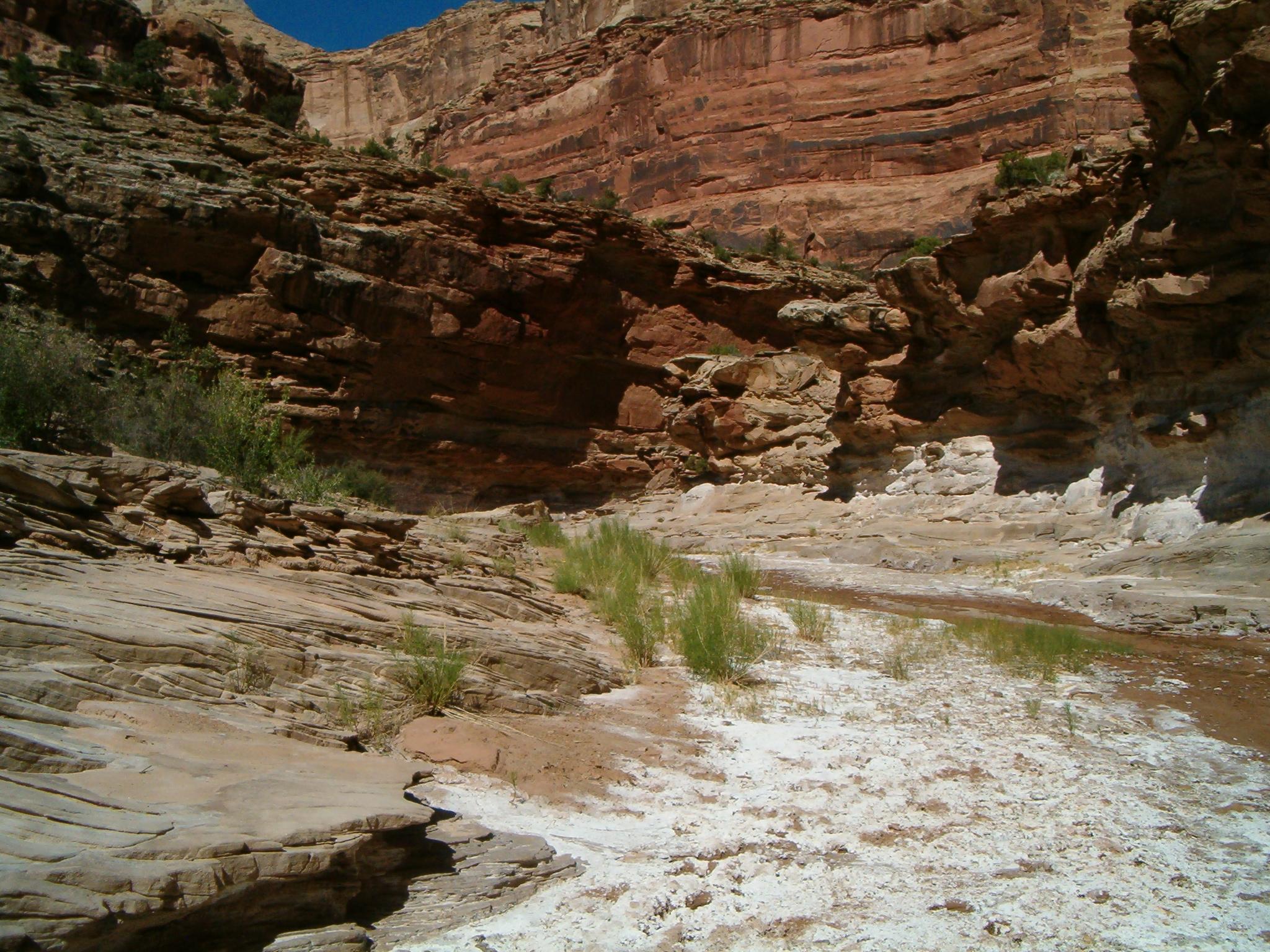
From the trailhead, simply head down Cane Wash. It is wide and sandy, but soon begins to narrow and a seep generally keeps the canyon floor damp. In wetter times, this can actually have a very small flow.

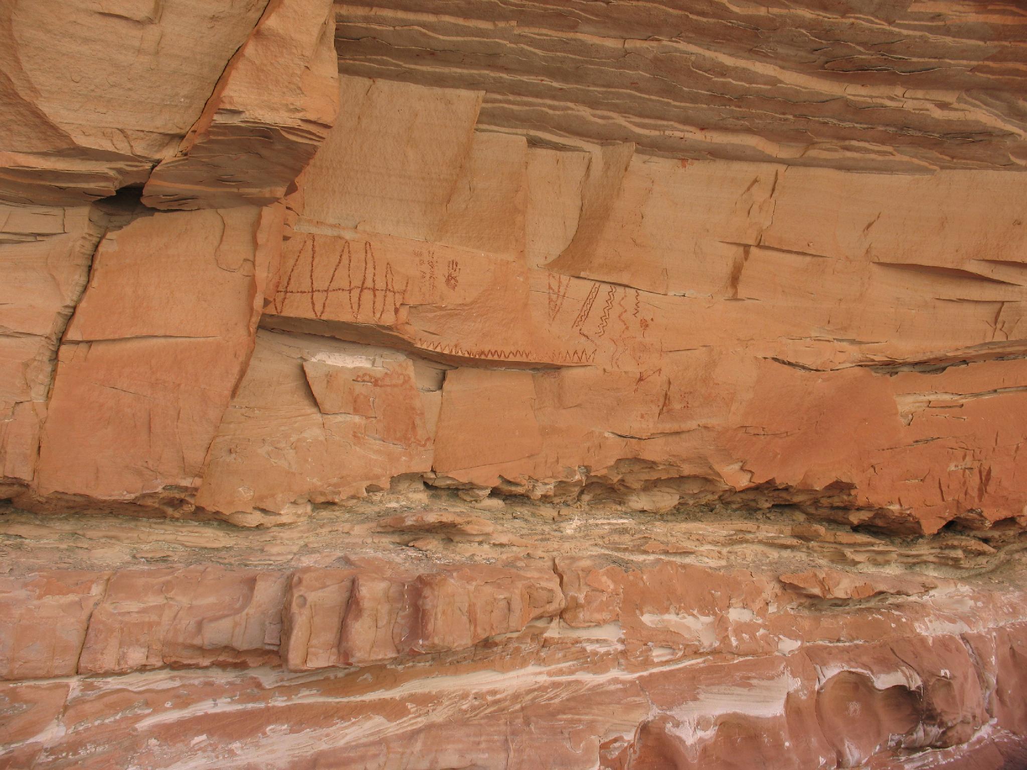
The canyon winds and deepens. It is about 6.5 miles to the San Rafael River with no obstacles along the way. As the San Rafael River comes into view, keep an eye out on the right for an excellent rock art panel. In addition, keep an eye out on the left for a small window (arch) in the cliff up high.

To The Exit Trailhead (3.4 miles / 1-2 hours)
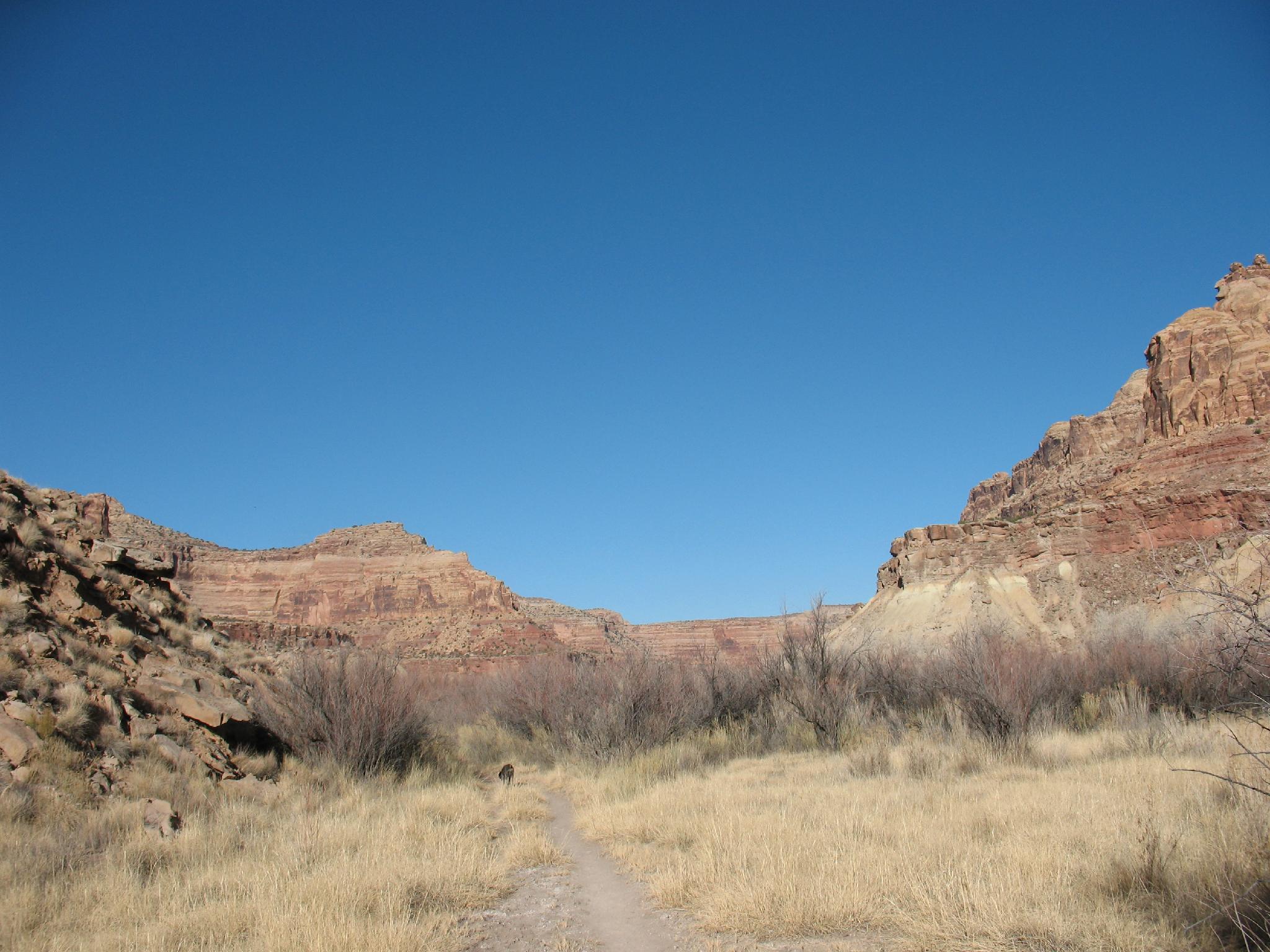
Follow the well worn San Rafael River trail right (downstream) to the exit trailhead in about 3.4 miles.


Maps

Route / 9.91 miles / Elevation Range 5,115 - 5,518 ft.
Printable Maps:

Trailhead

12S 523530E 4320655N

39°02'05"N 110°43'41"W

Old Mining Road

12S 523137E 4321635N

39°02'37"N 110°43'57"W

San Rafael Trail

12S 523292E 4327081N

39°05'33"N 110°43'50"W

Exit Trailhead

12S 527222E 4325439N

39°04'40"N 110°41'07"W

Comments

Want to make a comment? Login and let yourself be heard.