 Hiking
Cottonwood Wash Ruins
Hiking
Cottonwood Wash Ruins
Eastern Reef
Overview
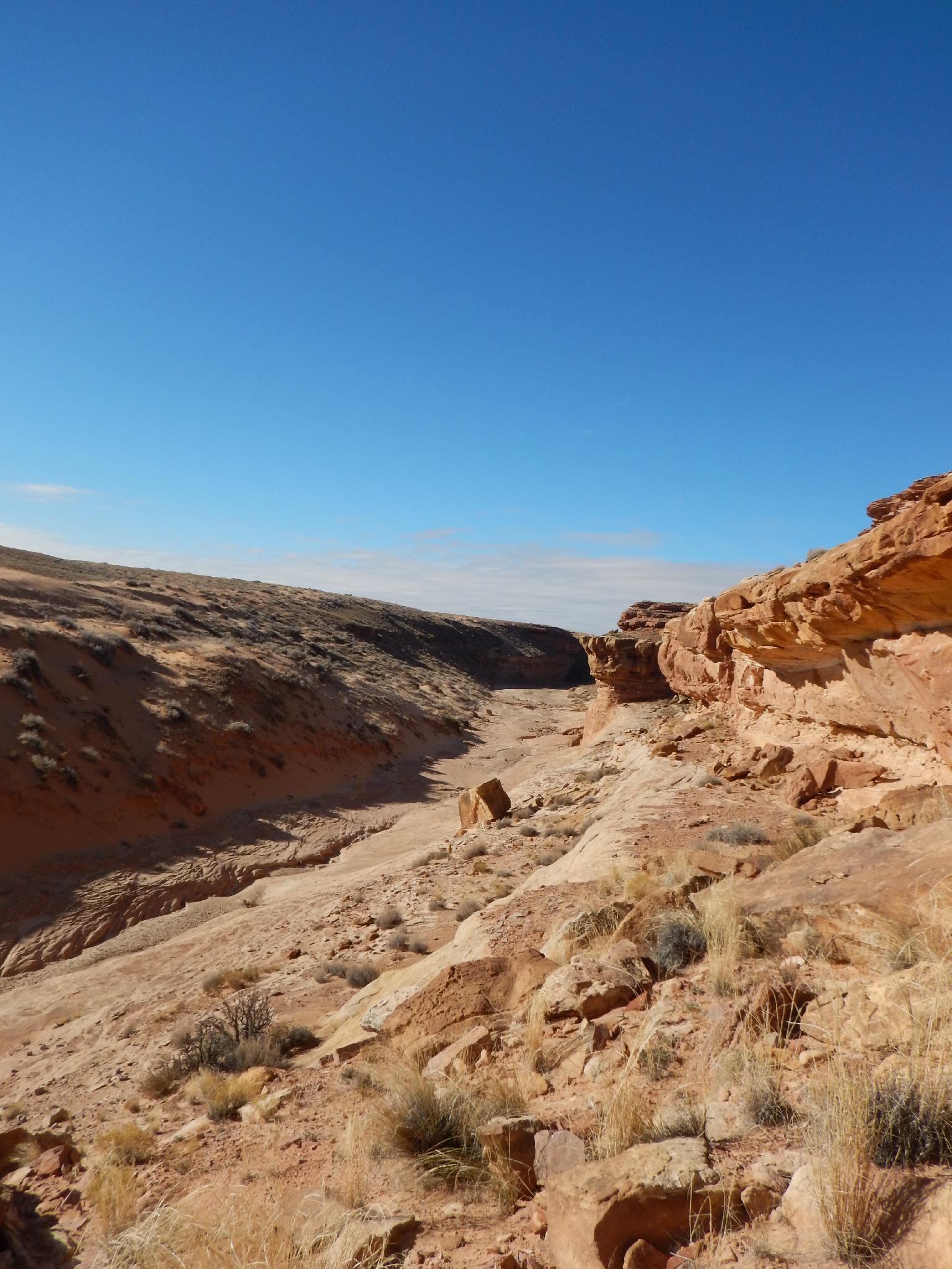
How many Cottonwood Washes are there in Utah? I can think of many, and at least two in the San Rafael area. This one is just east of UT-24 on the way to Hanksville. From the highway, the area appears to be rolling sage brush plain and not particularly interesting. Up close, however, the area contains several canyons, slickrock cliffs, and relics of when the ancient people passed through and lived in the area. This hike meanders down Cottonwood Wash, visiting a ruin and panel en route before circling back to the car.
Though interesting, this is not a hike I would highly recommend. The ruins are small and mostly destroyed. There are certainly better panels to visit in the Swell. This hike does offer solitude, in a very seldom visited area just off the highway.
Getting There
Reaching the trailhead starts by getting to mile post 140.5 on UT-24. If coming from I-70, this is about 20 miles south after taking exit 149 from I-70. If coming from Hanksville, this is about 25 miles north of Hanksville.
Route Description
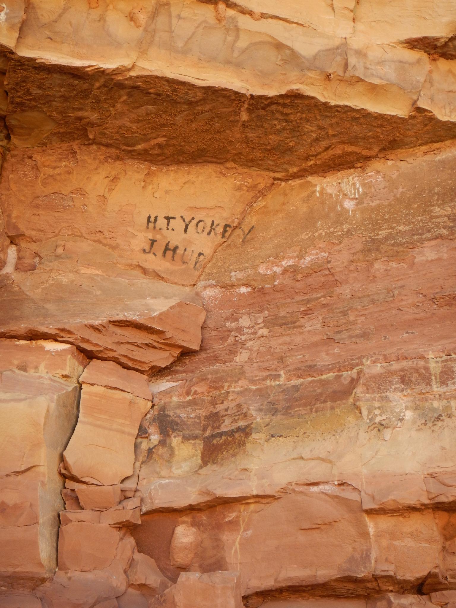
From the trailhead, head due south finding any easy path to the bottom of Cottonwood Wash. Once in the bottom, go down canyon. Shortly, an old signature is under an overhang on the left. H.T.Yokey and J.Hub. It would be fascinating to know the age and story behind them!
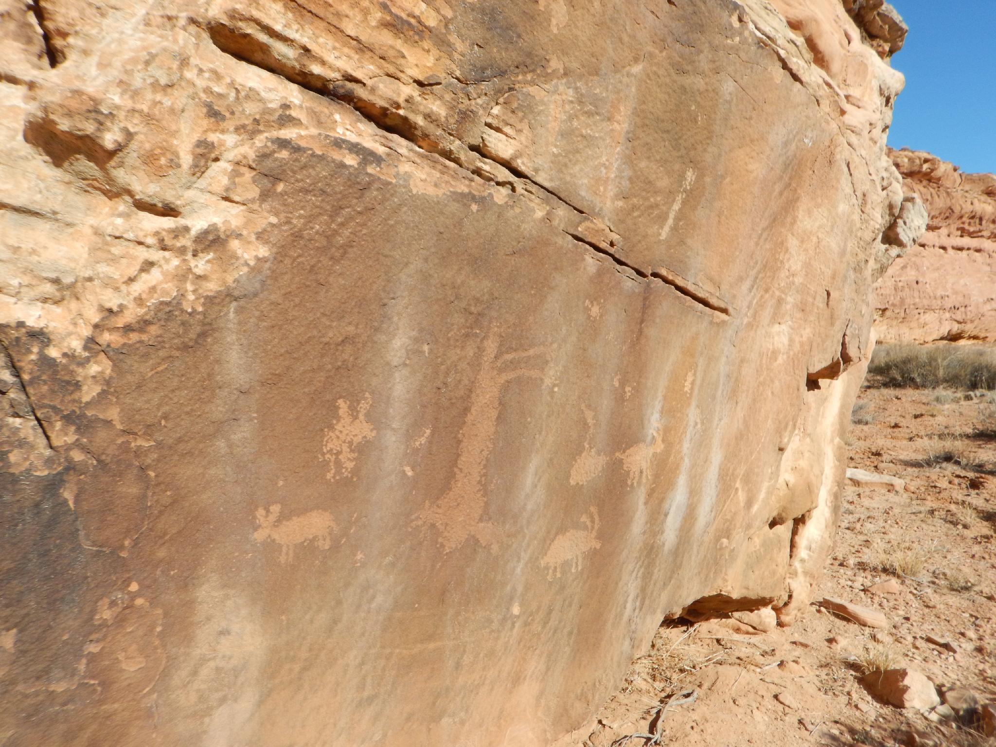
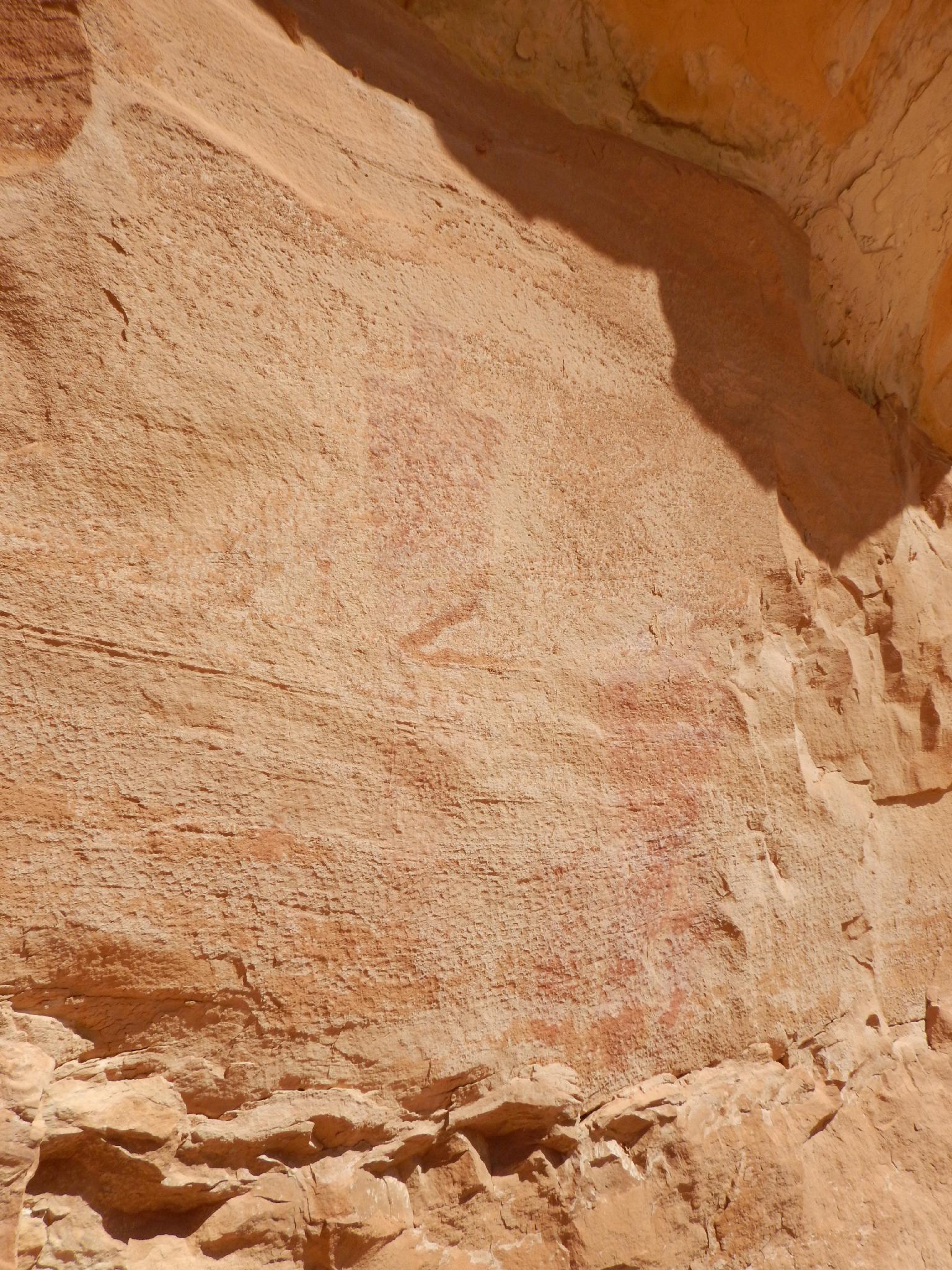
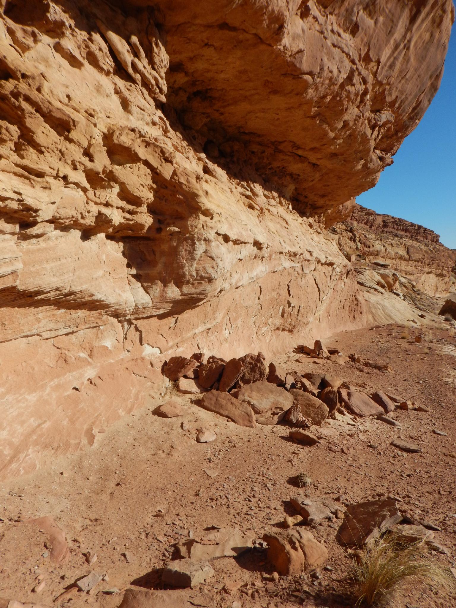
Just below the signatures is a very small narrow section. The open, wide walled canyon is easy going. Shortly a fence and second small narrows is passed. Begin watching on the left below the second small narrows. A small side drainage that ends in an overhang appears to have very well worn ruins. Just down from this less than a minute on the left is the main attraction, a panel and signs of old habitation.
Continuing down, there is another dot petroglyph on the left just around a small bend.
Next up is a petroglyph on a large boulder next to the wash bottom. It is hard to miss. Just past it a side drainage comes in that provides easy exit. This is the exit.
Exit: The drainage provides easy access to the rim of the canyon. At the rim, head due north, reaching a road within 10 minutes. Follow the road west back to the trailhead, passing through a gate just before the trailhead.
Maps

12S 543816E 4280712N
38°40'26"N 110°29'47"W
12S 544420E 4280736N
38°40'27"N 110°29'22"W
12S 544152E 4280280N
38°40'12"N 110°29'33"W
12S 544125E 4280233N
38°40'11"N 110°29'34"W
12S 544754E 4280450N
38°40'17"N 110°29'08"W
12S 544852E 4280542N
38°40'20"N 110°29'04"W
12S 545428E 4280420N
38°40'16"N 110°28'40"W
12S 545487E 4280436N
38°40'17"N 110°28'38"W
12S 545859E 4280293N
38°40'12"N 110°28'22"W
12S 546472E 4280308N
38°40'13"N 110°27'57"W
12S 546773E 4280480N
38°40'18"N 110°27'44"W
12S 546781E 4280265N
38°40'11"N 110°27'44"W
12S 546817E 4280271N
38°40'11"N 110°27'43"W