Mexican Mountain | Northern San Rafael Swell

Climbing Mexican Mountain - Northern San Rafael SwellHiking Mexican Mountain - Northern San Rafael Swell Mexican Mountain

Northern San Rafael Swell

Overview

RATING: Low-5th Class Climbing
CFS RANGE: 0 - 100
CURRENT CFS: Getting current CFS.... Full Details
MAPS: MEXICAN MOUNTAIN, UT

Wed

Sunny, with a high near 76. South southwest wind 6 to 9 mph.

76 | 43

Thu

Sunny, with a high near 82. Southeast wind around 8 mph.

82 | 46

Fri

Sunny, with a high near 83.

83 | 49

Sat

Sunny, with a high near 85.

85 | 51

Sun

Mostly sunny, with a high near 79.

79 | 53

View Full Weather Details
SEASON: Spring, Fall, Winter (if no snow on the ground)
GEAR: Standard Hiking Gear, 15 m ( 50 ft. ) rope (or 30 m ( 99 ft. ) if planning on rappelling the crux down climb) If rappelling, bring webbing, harnesses, devices, and carabiners.
WATER: None, bring all you need
FLASHFLOOD: Low

Wed

Sunny, with a high near 76. South southwest wind 6 to 9 mph.

76 | 43

Thu

Sunny, with a high near 82. Southeast wind around 8 mph.

82 | 46

Fri

Sunny, with a high near 83.

83 | 49

Sat

Sunny, with a high near 85.

85 | 51

Sun

Mostly sunny, with a high near 79.

79 | 53

View Full Weather Details
Mexican Mountain from near the trailhead at sunset.

Mexican Mountain from near the trailhead at sunset.

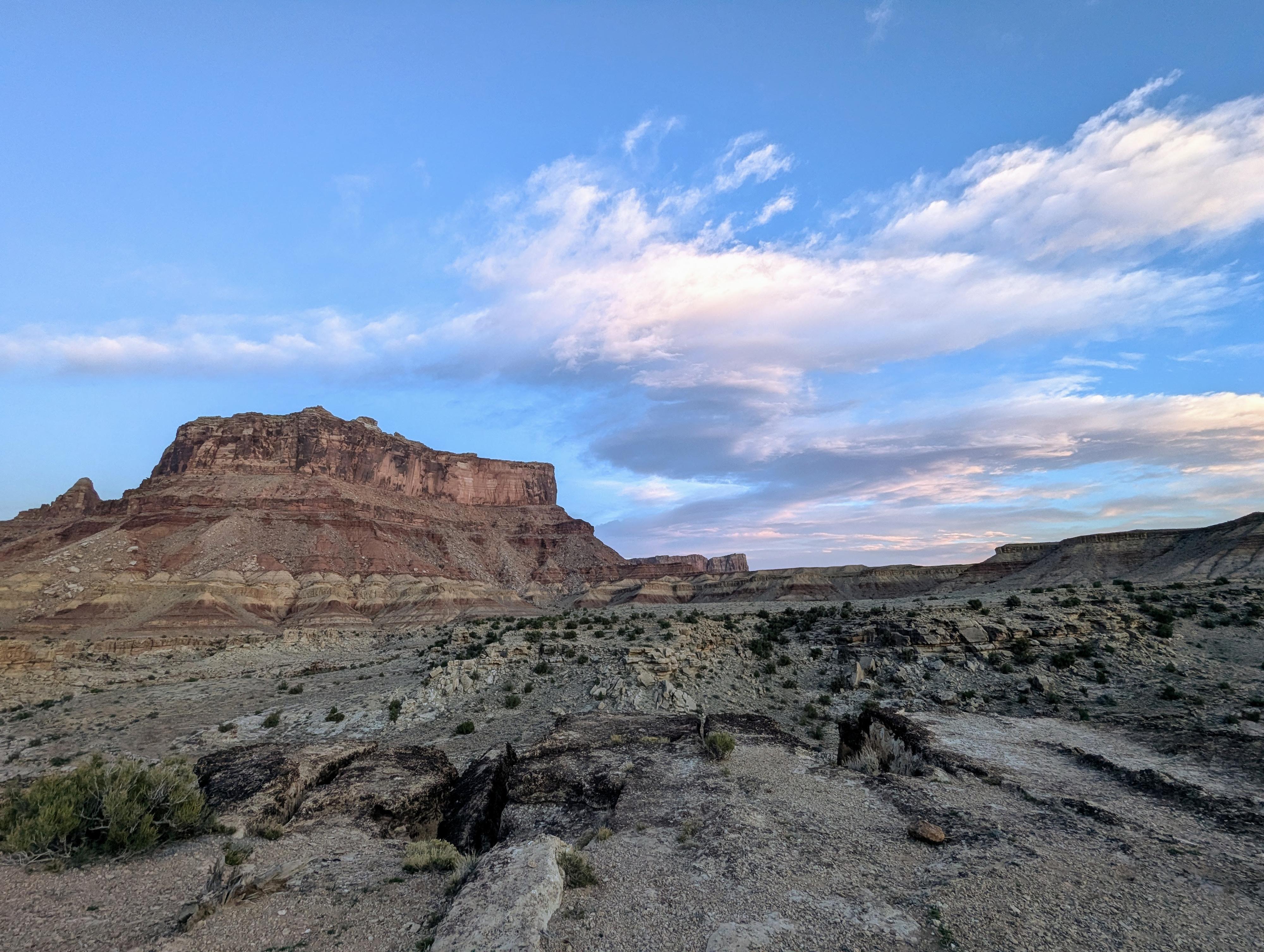
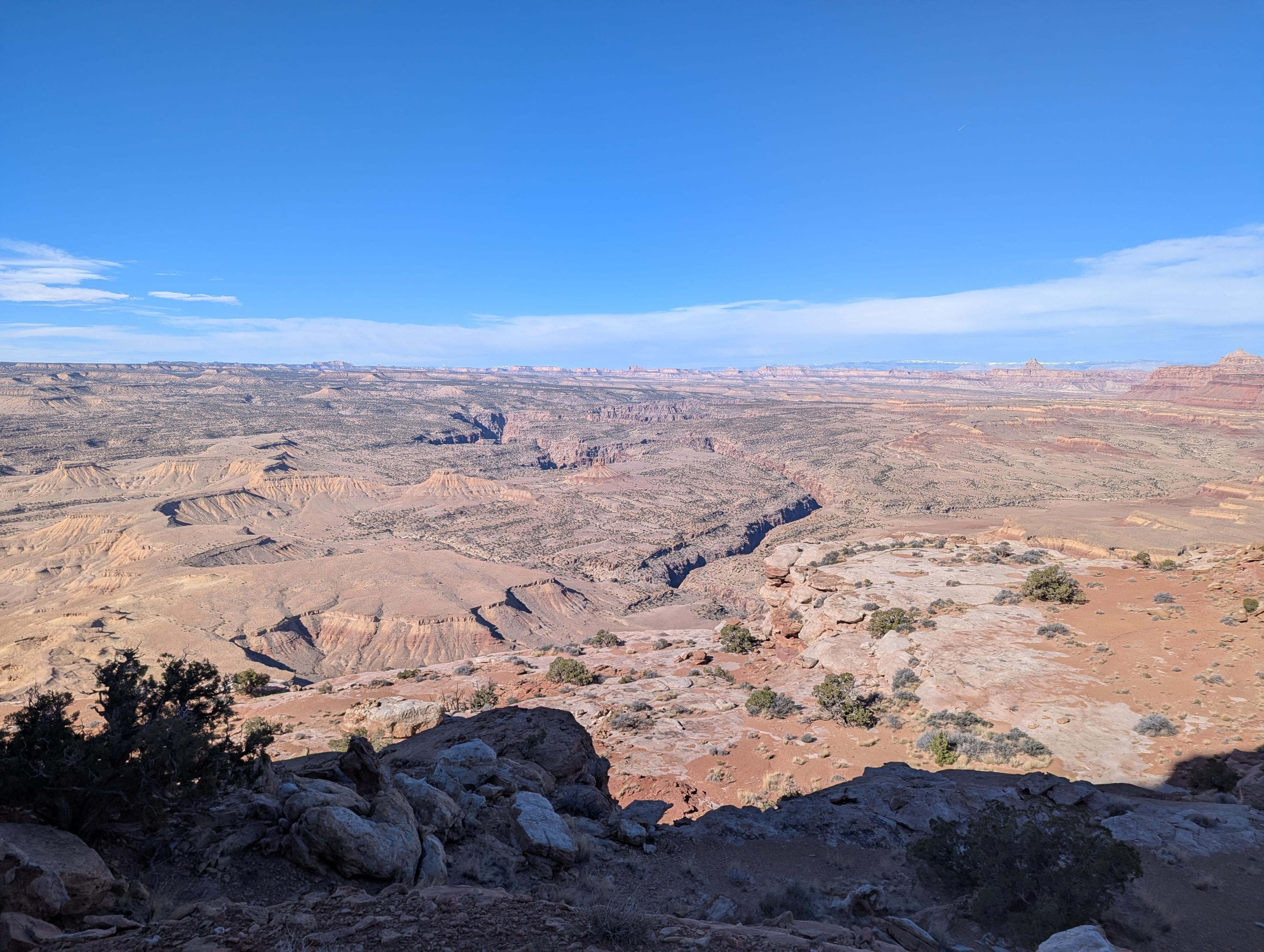
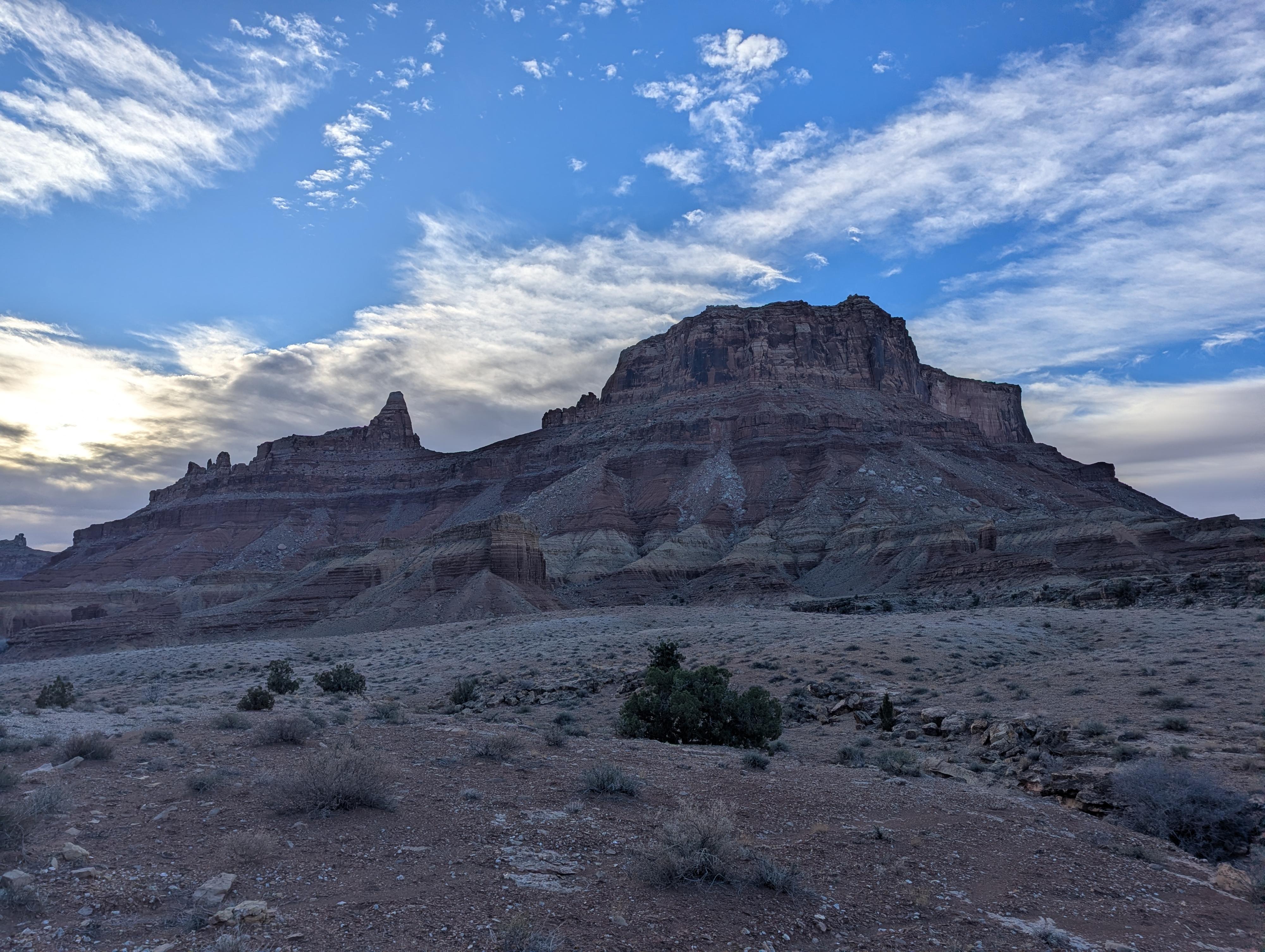
Mexican Mountain is one of the most dramatic viewpoints in the northern San Rafael Swell. It towers over the Upper and Lower Black Boxes and has wide views of the Eastern Reef, Windowblind Peak, and the cliffs that form the San Rafael River corridor. This is, to me, one of the more dramatic and fun summits in the Swell.

The elegant and improbable route finds weaknesses in the various layers that make up the peak. It is one of those routes that makes me feel like I am part of the view instead of just taking in the view. The route is hard enough to require care and skill but also approachable by those with some desert scrambling and climbing experience. I've done the route twice over the years and found it exquisite both times. Highly recommended for those with the skills and experience.

Difficulty Note: The crux of the route is about 10 m ( 33 ft. ) of climbing in the low 5th class range early in the route. Above this, there is still an exposed traverse and a few other shorter sections of what I would consider low 5th class climbing. Beginners will likely want a rope and harness on the first climb and may want a belay on some upper sections. A competent leader is a must!
River Levels: The hike requires crossing the San Rafael River. Usually it is very shallow and not a problem, but it can be high during spring runoff or after major storms. I would consider anything less than 50 CFS to be easy, though you could probably go up to 100 CFS if needed. The crossing shown on the map is typically quite shallow. There are some deep spots along this section of the river, however, so be careful where you cross.
View from near the summit. The Upper Black Box is the canyon visible in the center of the photo.

View from near the summit. The Upper Black Box is the canyon visible in the center of the photo.

Getting There

The trailhead starts at the end of the Mexican Mountain road. To get to the Mexican Mountain road, which is near the San Rafael Campground, depends on where you are coming from. Once at the campground, the Mexican Mountain road is on the north side of the river, and well signed just before the cattleguard. (This is also part of the campground.)

  • From the North
  • Just before the town of Castle Dale, at milepost 39.4, go east on the signed San Rafael Swell Access road. Reset your odometer as you turn off the highway onto the dirt road. ( 12S 500218E 4341289N / 39°13'15"N 110°59'51"W )
  • Continue on this road, passing a cattle guard after 12 miles, and reaching a 4 way junction at 12.7 miles. ( 12S 518059E 4336281N / 39°10'32"N 110°47'27"W )
  • Continue east at this 4 way junction for 2.4 miles to the signed Buckhorn Wash road. ( 12S 521483E 4335782N / 39°10'16"N 110°45'05"W )
  • Go right, down the Buckhorn Wash road about 9.5 miles to the cattle guard and San Rafael Campground. ( 12S 529065E 4326048N / 39°04'59"N 110°39'50"W )
  • From The South
  • Take I-70 west from Green River about 30 miles, to exit 131. Take exit 131, turning right. This road goes east, paralleling the freeway for a couple of miles before turning north. ( 12S 529541E 4303709N / 38°52'54"N 110°39'34"W )
  • Follow this road 19 miles to where the San Rafael campground is, and the bridge over the river. The cattle guard marks the lower end of Buckhorn Wash. ( 12S 529065E 4326048N / 39°04'59"N 110°39'50"W )
  • To the trailhead from the San Rafael Campground
  • Head down the Mexican Mountain road. It is 13.7 miles to the end of the road, and several pullouts for parking. The road is generally passable by high clearance vehicles, or very carefully driven cars. ( 12S 544144E 4318528N / 39°00'53"N 110°29'24"W )
View from the approach. You climb the talus pile almost dead center in the photo.

View from the approach. You climb the talus pile almost dead center in the photo.

Route

To the River Crossing
From the trailhead, follow the old road/trail for about a mile to where it comes close to the river for the first time. Across the river is a large talus pile coming down the slope. This is the only large talus pile that looks reasonable that goes up to near the top of the cliff band. Cross the river and find a way to the base of the talus pile. The crossing and route shown on the map are the route I took, but there are others. Just be sure once across the river you have a good route to get up the hill and small cliff band down low en route to the large talus pile.

To The Crux
Head up the large talus pile with occasional cairns and signs of a social trail. This is the Moenkopi layer of sandstone. At the top of the talus pile, the ridge narrows, and a more worn social trail goes to the base of the Chinle layer and the crux 10 m ( 33 ft. ) climb.

To The Summit Base
Once up the climb, follow a social trail that heads east and angles up to the base of the towering Wingate cliffs above. Follow the Wingate cliff to the point, then follow it around the corner, now heading back west. Stay fairly close to the base of the cliff, as a bit of a social trail goes over to a small drainage, crosses it, and then begins climbing a steep dirt and rock slope to stripped slickrock.

The stripped slickrock usually has a few cairns. Traverse across this exposed section until a large cairn is encountered. From the large cairn, continue a very short distance to the end of the ledge and some large boulders. This is a great viewpoint that overlooks the start of the Lower Black Box below.

From the large cairn, work up steep slickrock to the cliff band. Look for a solution pocketed crack that allows passage up the first bit, then traverse north (climbers right), then back south and up to the large flats below the summit block. There are a few short climbing sections here. Look for cairns and the most reasonable spots to climb.

To The Summit
Once on the flats below the summit block, take note of where you are so you can find the route down on the return. I didn't find tracks of cairns past this spot on either of my trips, but the goal is to head west and circle the summit block to get to the north side of it.

On the north side of the summit block is a crack with a couple of bushes that allow you to climb, then traverse a little west, and finally back east to the dramatic summit. Big views all around from the top!

Return the same way.


Maps

Route / 7.82 miles / Elevation Range 4,487 - 6,395 ft.
Printable Maps:

Trailhead

12S 544147E 4318476N

39°00'51"N 110°29'24"W

River Crossing

12S 545306E 4318980N

39°01'07"N 110°28'36"W

Cairn First Small Cliff

12S 545483E 4318666N

39°00'57"N 110°28'29"W

Crux Climb

12S 545880E 4318076N

39°00'38"N 110°28'12"W

Traverse

12S 546082E 4317709N

39°00'26"N 110°28'04"W

Large Cairn

12S 546263E 4317428N

39°00'17"N 110°27'57"W

Final Climb

12S 545848E 4317619N

39°00'23"N 110°28'14"W

Comments

Want to make a comment? Login and let yourself be heard.