 Hiking
Wikiup
Hiking
Wikiup
Central Swell
Overview
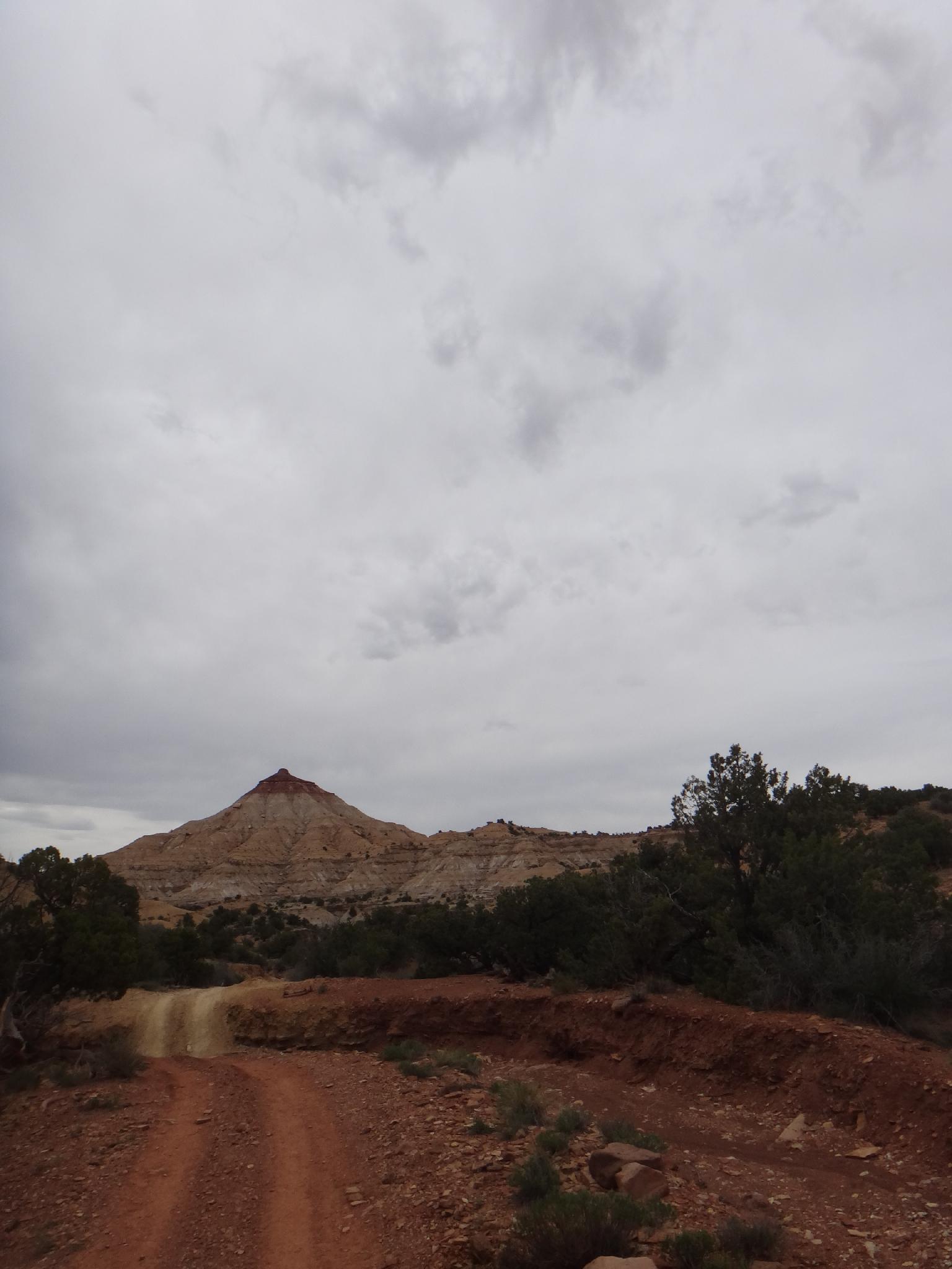
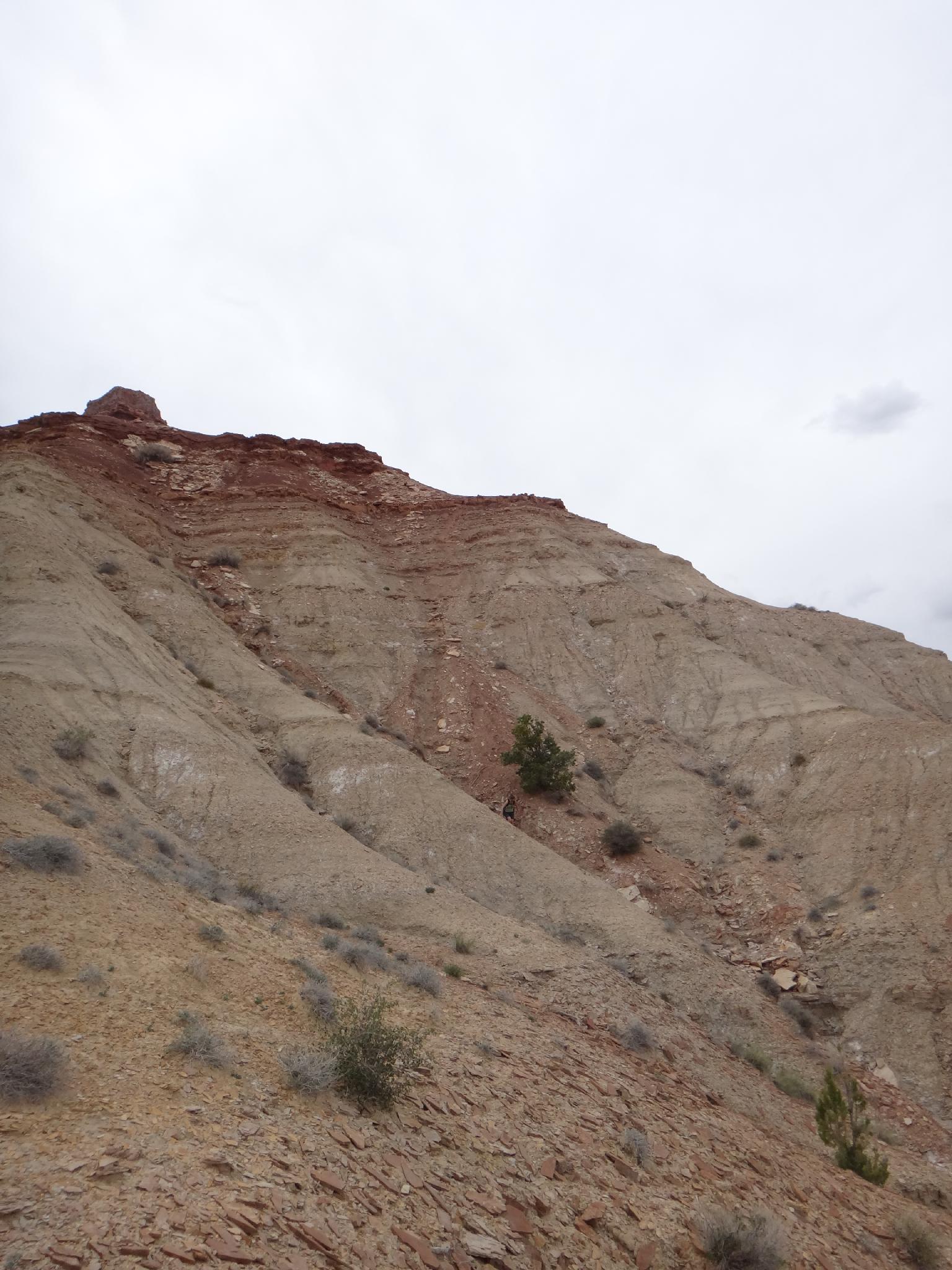
Ah, a steep, loose, exposed dirt ridge to a gravel coated summit cap, sounds like a nice hike?!?! The Wikiup, just north of I-70 in the central Swell is a very inviting looking hike. From a distance, the pyramid peak looks like a casual wander to a summit with likely unparalleled views. The views are good, and this is an inviting summit, though the ridge line to the summit is steep, loose dirt, and the summit capped by very crumbly rock. Though not terrible, this is also not a hike I would recommended for beginners.
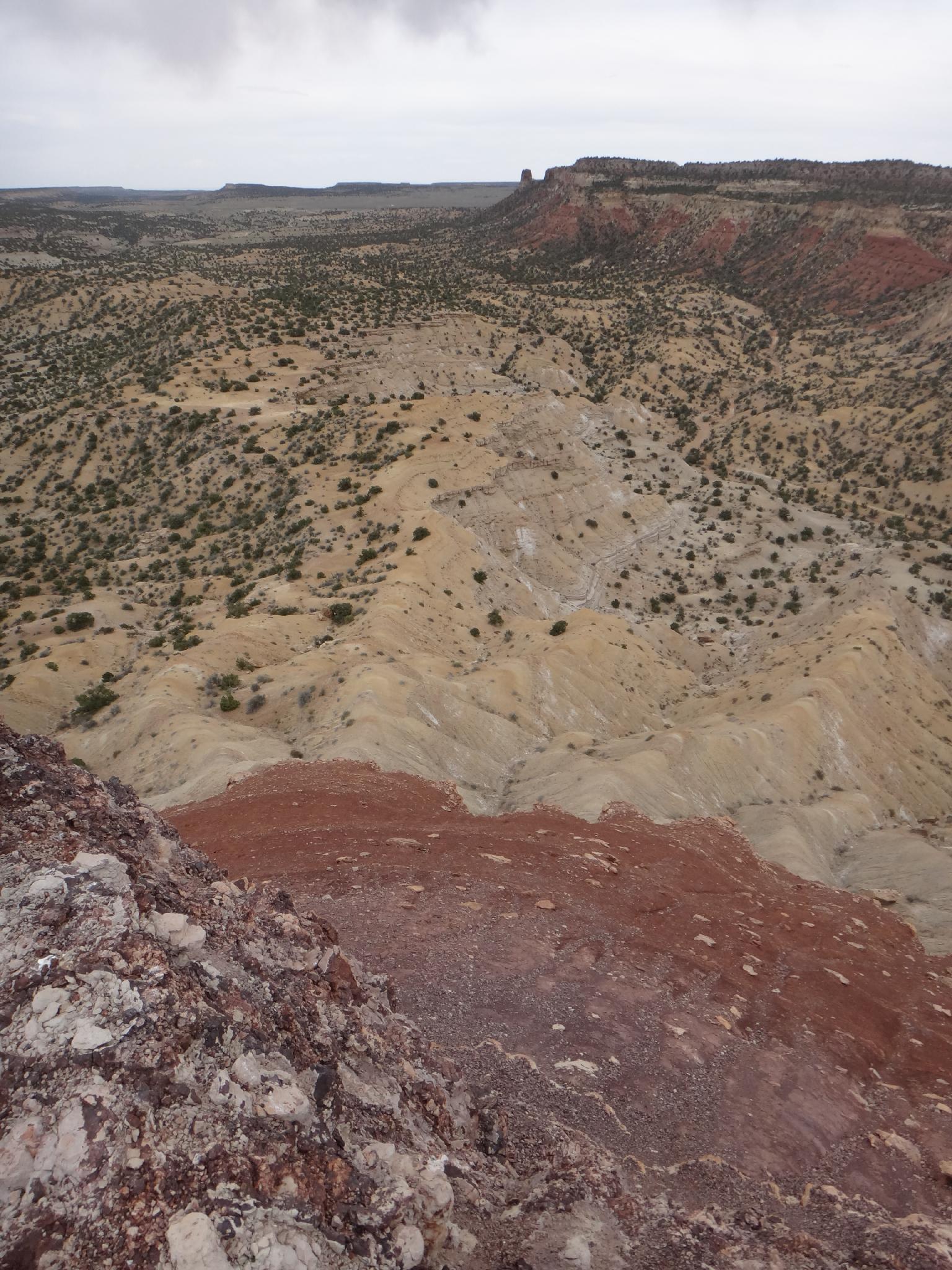
The views are good, however, and the few sets of prints up the ridge indicate this is likely done more than one would expect.
Getting There
Go west on I-70 out of Green River to exit 131. As you get off the highway, reset your odometer.
- Go right (north) from the exit on the frontage road that parallels the highway going east for 0.1 miles to side road (trail) 642. Reset your odometer as you turn on to the trail.
- 0.6 miles - Gate
- 1.0 miles - Stay straight
- 1.8 miles - Stay left, you can park anywhere in here if needed. The road deteriorates a bit.
- 2.1 miles - Small pull-out into a wash on the left part way down a hill, this is a good stopping point. The road gets quite a bit worse at the bottom of the hill.
Route Description
From the trailhead, follow the jeep road down the wash to the bottom of the valley, then work your way up the first layer. An easy path is up below the obvious small tower. Once up the first layer, go left, directly below the Wikiup, and follow the path of least resistance up the next level, likely following one of the washes up.
If the first 1/2 of the hike seemed loose and not particularly alluring, turn back now. For the intrepid, continue up whichever ridge looks most inviting. They are all steep, and loose. Once up to the final dark red layer, traverse right (east) and around to the easiest path up the summit block. Be careful, it is loose and crumbly!
Return the same way.
Maps

12S 527313E 4305542N
38°53'54"N 110°41'06"W
12S 526993E 4306504N
38°54'25"N 110°41'19"W