 Hiking
Deuel Creek
Hiking
Deuel Creek
Centerville
Overview
When people think of hiking in the Wasatch, the big, dramatic canyons around Salt Lake City like Big Cottonwood or Little Cottonwood often come to mind or the lofty peaks like Mount Olympus that surround the Salt Lake Valley.
Deuel Creek, 20 minutes north of Salt Lake City, is not as dramatic as many of the nearby hikes, but is beautiful, with easy access, excellent scenery, and less visitation than many of the hikes closer to Salt Lake. This, in my opinion, is one of the best "little known" hikes around. It is a charming amble.
The hike is easy enough for families as it meanders up Deuel Creek, but offers enough length to feel like a real hike if you make the loop all the way to the falls. Highly recommended.
Getting There
The trailhead is on the east side of Centerville. To reach it, take exit 319/Parrish Lane off of I-15 and head east. This exit is about 10 miles north of Salt Lake City.
Once off the exit, travel east on 400 N to 400 E. Turn right on 400 E and go south to 100 south. Turn left on 100 S. As 100 south approachs the foothills, it twists and turns before reaching a T.
If doing the loop hike, I recommend parking anwhere just before the T.
For the North Trailhead, go left at the T up a dirt road a short distance to the signed trailhead and limited parking.
For the South Trailhead, go right at the T, staying on the most used dirt road about 0.5 miles to a large pullout and the signed trailhead. This section of road is a bit rough. Those in low clearance cars may wish to walk the 0.5 miles of dirt.
If doing the loop, you will be walking down the dirt road to this T junction, then back up to the North Trailhead.
Route Description
From the North Trailhead
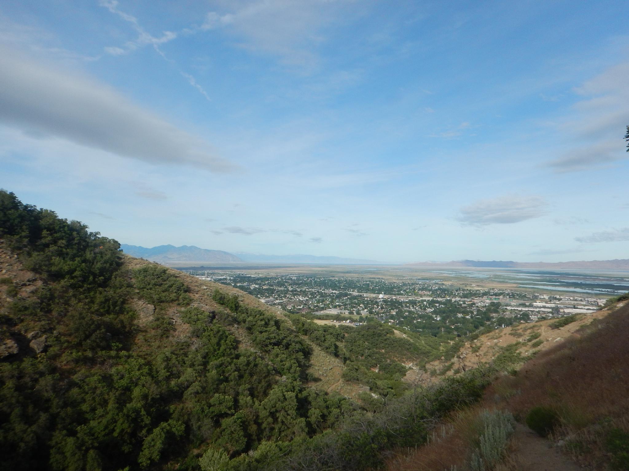
From the parking along the road, follow the paved road up to a split, then go left. The North Trailhead is a few minutes up the dirt road. Follow the North Trailhead trail. The trail is well traveled and easy to follow as it works up the foothills with excellent views of the Great Salt Lake and surrounding areas.
After 0.9 miles, the trail descends to Deuel Creek proper and joins up with the more well-traveled trail.
From the South Trailhead
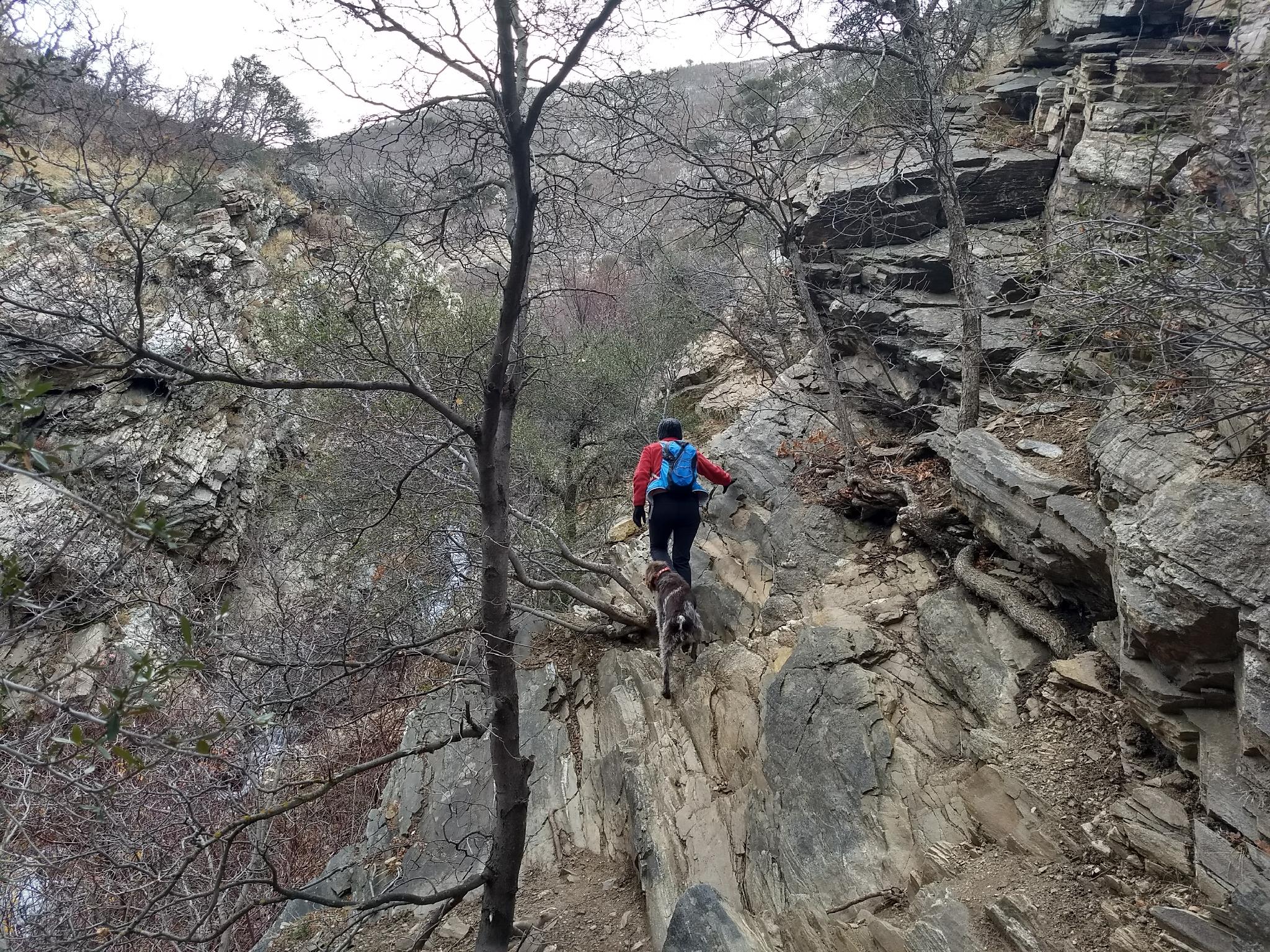
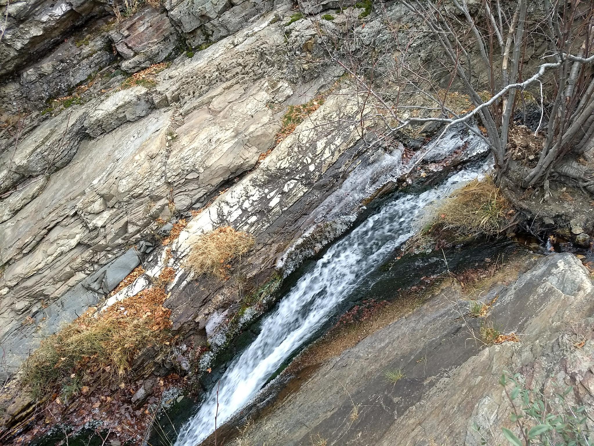
From the trailhead, the trail passes a steep loose section. Watch your step! A few minutes from the trailhead, a lovely cascade is passed on the right, then the trail follows Deuel Creek more closely.
At 0.6 miles, the north trail comes in on the left. This isn't very obvious and can be easily missed.
From the South/North Junction (1.5 miles to the falls)
The trail continues up, following Deuel Creek closely, and crossing it many times on wooden log bridges. 10-15 minutes above the junction, a large area with an adult-sized rope swing is reached. This is a destination for many families and makes a great turn around spot.
Still have some energy left? Continuing up from the rope swing, it is about 30 or so minutes to a small waterfall. This is a good destination, though a lesser used trail continues beyond.
Photos
Maps

12T 427464E 4529758N
40°54'57"N 111°51'41"W
12T 427258E 4529943N
40°55'03"N 111°51'50"W
12T 428064E 4529803N
40°54'58"N 111°51'15"W
12T 428260E 4529764N
40°54'57"N 111°51'07"W
12T 428914E 4529919N
40°55'02"N 111°50'39"W
12T 430132E 4530350N
40°55'17"N 111°49'47"W