Grizzly Gulch | Little Cottonwood Canyon

Hiking Grizzly Gulch - Little Cottonwood Canyon Hiking Grizzly Gulch

Little Cottonwood Canyon

Overview

Sat A chance of snow showers between noon and 3pm, then a chance of snow showers and a slight chance of thunderstorms. Mostly sunny, with a high near 43. West southwest wind 6 to 10 mph. Chance of precipitation is 30%.
43° | 24°
Sun Snow showers before noon, then snow showers and a slight chance of thunderstorms. Cloudy, with a high near 32. Chance of precipitation is 100%. New snow accumulation of 6 to 10 inches possible.
32° | 30°
Mon Snow showers before noon, then snow showers and a chance of thunderstorms. Cloudy, with a high near 34. New snow accumulation of 3 to 5 inches possible.
34° | 26°
Tue Snow showers likely before noon, then snow showers likely and a slight chance of thunderstorms. Mostly cloudy, with a high near 41. New snow accumulation of less than half an inch possible.
41° | 26°
Wed A chance of snow showers before noon, then snow showers likely and a slight chance of thunderstorms. Partly sunny, with a high near 44. New snow accumulation of less than half an inch possible.
44° | 30°
RATING: Moderate Hike
MAPS: BRIGHTON, UT; DROMEDARY PEAK, UT
SEASON: Late spring, summer, fall
GEAR: Standard Hiking Gear
WATER: Bring All You Need
Sat A chance of snow showers between noon and 3pm, then a chance of snow showers and a slight chance of thunderstorms. Mostly sunny, with a high near 43. West southwest wind 6 to 10 mph. Chance of precipitation is 30%.
43° | 24°
Sun Snow showers before noon, then snow showers and a slight chance of thunderstorms. Cloudy, with a high near 32. Chance of precipitation is 100%. New snow accumulation of 6 to 10 inches possible.
32° | 30°
Mon Snow showers before noon, then snow showers and a chance of thunderstorms. Cloudy, with a high near 34. New snow accumulation of 3 to 5 inches possible.
34° | 26°
Tue Snow showers likely before noon, then snow showers likely and a slight chance of thunderstorms. Mostly cloudy, with a high near 41. New snow accumulation of less than half an inch possible.
41° | 26°
Wed A chance of snow showers before noon, then snow showers likely and a slight chance of thunderstorms. Partly sunny, with a high near 44. New snow accumulation of less than half an inch possible.
44° | 30°
The ski resort from Grizzly Gulch

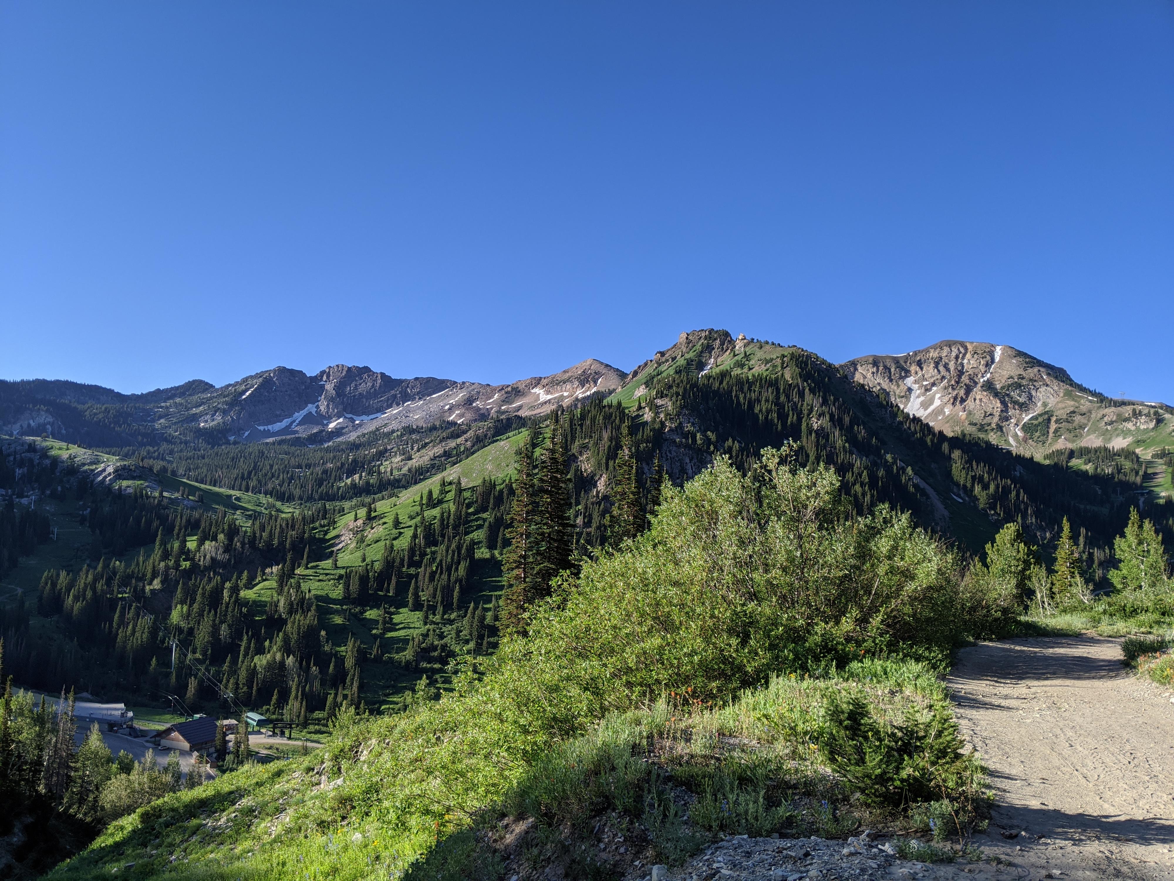
Though Albion Basin is the go-to for many people during wildflower season, if you are willing to hike a bit, I found the flowers and views from Grizzly Gulch to be stunning without the crowds. The hike, mostly on an old mining road, is moderate with a few very rocky sections and a bit of elevation gain. The views along the way are excellent, and the mining history fascinating. Bring a lunch and make an afternoon of it.

The hike, as an out and back, can be as long or as short as your motivated to do. For my time, however, making the Prince of Wales Mine the destination is the best choice. If going to the mine, the trail crosses over to Big Cottonwood Canyon with nice views of Silver Fork below.

History: The Prince of Wales mine was developed in 1872 after discovering the site in 1870. Due to the geology, Little Cottonwood Canyon mines were higher producing mines than the mines just over the ridge in Big Cottonwood. Prince of Wales, being in the Big Cottonwood geology, wasn’t particularly successful, and ceased operation after a few short years. The site of the mine is impressive, at nearly 10,000’ feet overlooking Silver Fork. The shafts have long since had grates put over them, but a large boiler and few other artifacts remain. I found this a fascinating place to visit and ponder how much work went into carving roads and bringing equipment up to the site.
Michigan Utah Mine
Michigan Utah Mine

Getting There

Little Cottonwood Canyon is on the east side of the Salt Lake City Valley. Get there by following I-215 to the east, taking exit 6 off the interstate and heading east toward the mountains.

Follow 6200 South which becomes Wasatch Blvd for 1.8 miles to the stop light and signs for Big Cottonwood Canyon. Continue south (straight) through the light an additional 2.3 miles to a junction and light. Stay left here, reaching the mouth of Little Cottonwood Canyon in an additional 1.6 miles.

From the mouth of Little Cottonwood, travel up the canyon 8.3 miles to a parking area on the left (north). The Alta-Brighton trail leaves from here. This is just after the Snowpine Lodge, and across from a side road down to the large parking area of the ski school.

Prince of Wales Mine

Route Description

From the parking area, a single track signed (Alta-Brighton) trail leaves on the north side and climbs a bit before quickly reaching a dirt road. Go right, following this well used road. It comes to a junction with a gate just beyond. Go straight here, around the gate, and continuing along the now lesser used road.

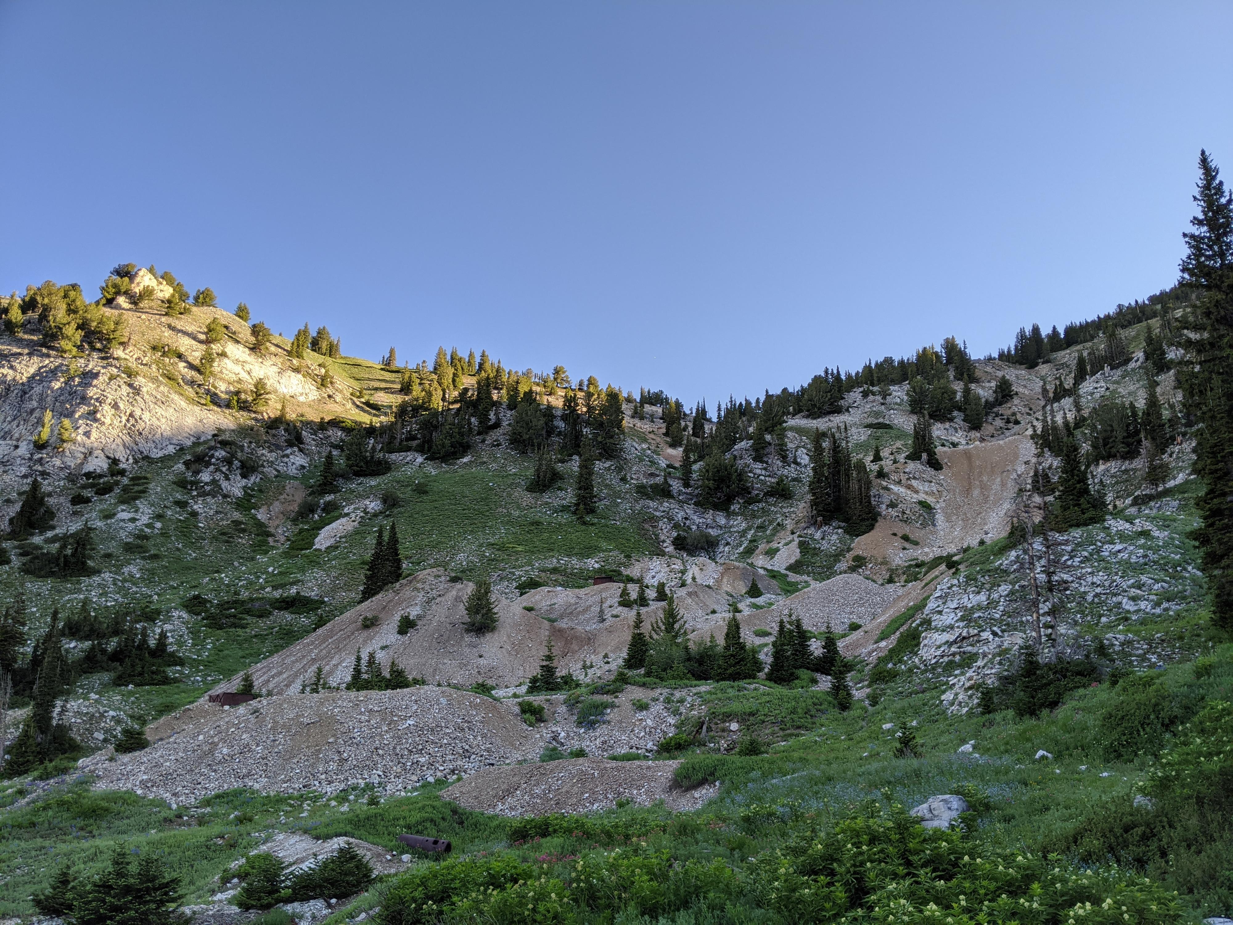
The road begins to climb a bit and comes to the remnants of the large Michigan Utah Mine. Continue right here (left goes to the mine). The trail becomes rougher as it climbs steeply along the stream. When the road turns north away from the stream, side trails on the right go up to Twin Lakes pass, stay on the old road heading north up the hill.

As the road climbs the slope, wildflowers and views abound in the summer. After passing an old tailing pile, the road becomes a single track and continues winding up the hill to the ridge. At the top of the ridge, a side trail goes off on the left into Silver Fork and west along the ridge. Stay right on the old road.

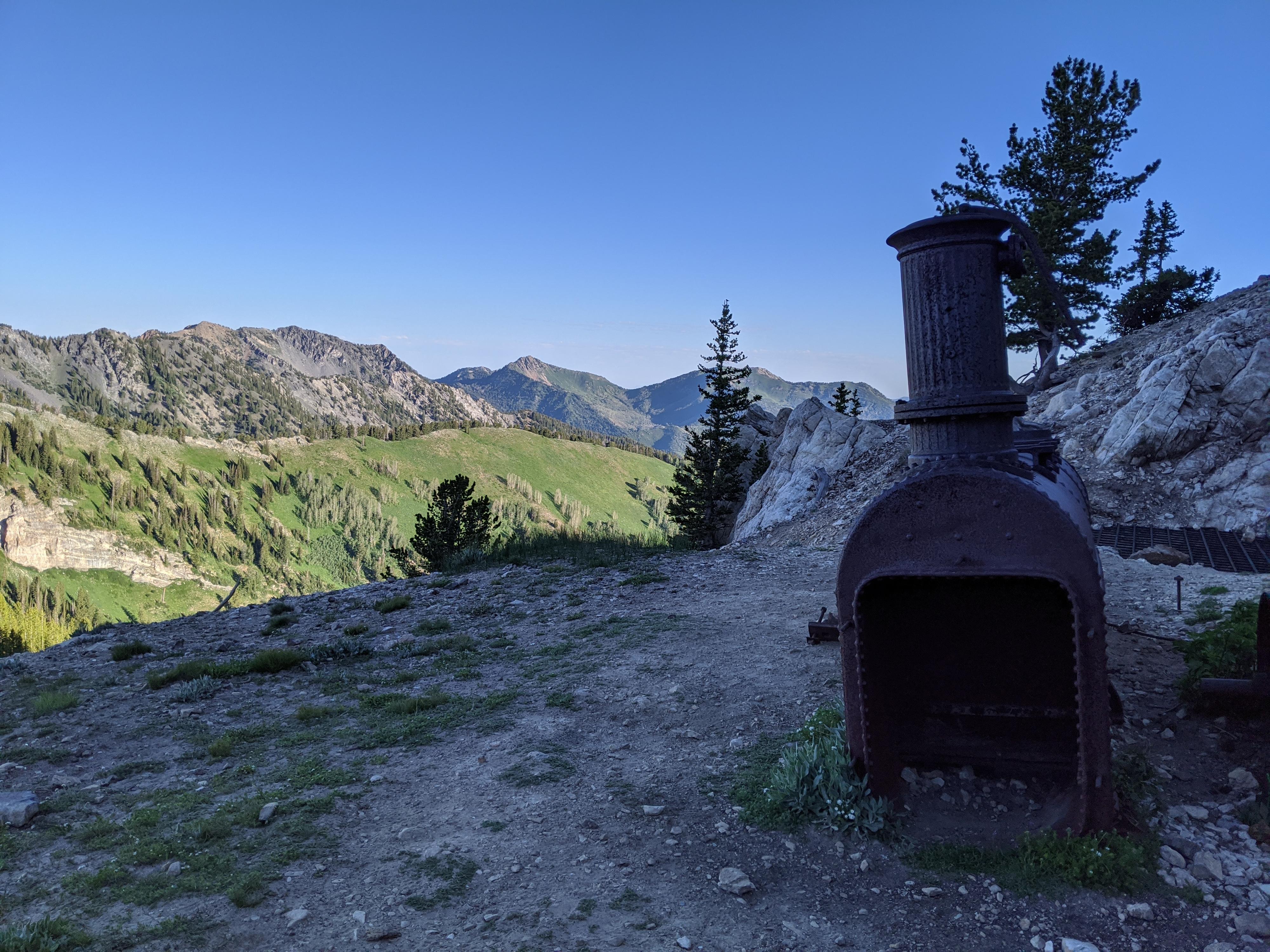
The old road crosses over into Big Cottonwood Canyon and reaches a split. Either left of right will get you to the Prine of Wales mine. If going left here, take the next right you reach a few minutes down the trail to climb up to the mine. The gated entrances reveal what appears to be an impressive tunnel system.

Return the same way.


Photos

Maps

Route / 4.59 miles / Elevation Range 8,713 - 10,087 ft.
Printable Maps:

Trailhead
12T 446535E 4493647N 40°35'31"N 111°37'55"W
Jct - Single Track / Dirt Road
12T 446431E 4493804N 40°35'36"N 111°37'59"W
Jct - Straight
12T 446850E 4493876N 40°35'38"N 111°37'41"W
Gate
12T 446880E 4493887N 40°35'39"N 111°37'40"W
Mine Jct
12T 447597E 4494130N 40°35'47"N 111°37'10"W
Jct - Prince of Wales / Grizzly Gulch
12T 447786E 4494516N 40°35'59"N 111°37'02"W
Loop Junction
12T 447792E 4494673N 40°36'04"N 111°37'01"W
Jct - Right to Prince of Wales
12T 447854E 4494892N 40°36'12"N 111°36'59"W
Prince of Wales Mine
12T 447884E 4495049N 40°36'17"N 111°36'58"W

Comments