
 Smith Creek Lakes
Farmington
Overview
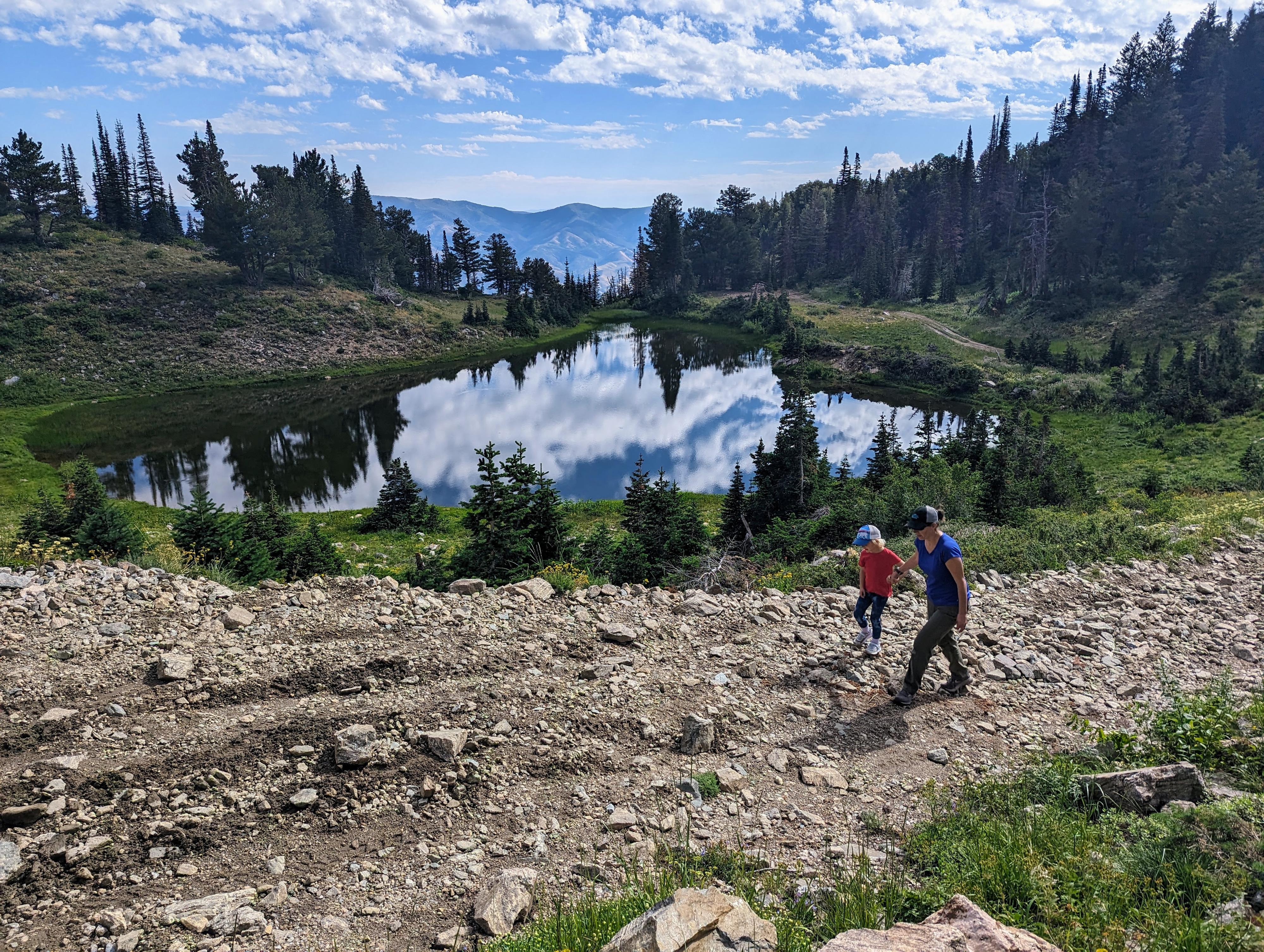
I think Smith Creek Lakes are some of the prettiest lakes in the northern Wasatch. The three lakes, nestled below the ridgeline between Francis and Thurston peaks, seem to cling to the side of the mountain, with craggy slopes and a dramatic skyline above. It is a lovely place, particularly in wild flower season when the hills are awash with color. There are even a few small primitive campsites near the lakes, but they can fill up on busy fall weekends.
What is the catch to visiting this lovely area? Well, it either involves a moderate hike, or moderate rocky 4-wheel drive road. If hiking, expect about a 6-7 mile hike with a bit of elevation. If driving, you will need a true high clearance 4-wheel drive vehicle. We drove a stock Ford Ranger to the lakes, and save a couple of 4-Runners and an F-150 at the lakes as well. The are is popular with ATVs, which were definitely the preferred mode of transportation on the day we visited.
Getting There
The peak is above Farmington. To reach the trailhead from I-15 heading north:
- Take exit 322 for UT-227/Lagoon Dr toward Farmington
- Go 0.3, Keep right at the fork, follow signs for UT-225 and merge onto UT-227/S 200 W
- 1.0, Turn right onto State St
- 1.2, Take the 2nd left onto N Main St
- 1.9, Turn right onto E 600 N
- 2.0, Turn left onto N 100 E/Farmington Canyon Rd/N Skyline Dr. Continue to follow N Skyline Dr, resetting your odometer here. The road turns to dirt shortly and begins its steep switchback climb. Be very cautious of other vehicles and ATV traffic, especially on the weekends.
- 7.9, junction, go left.
- 8.8, junction, left.
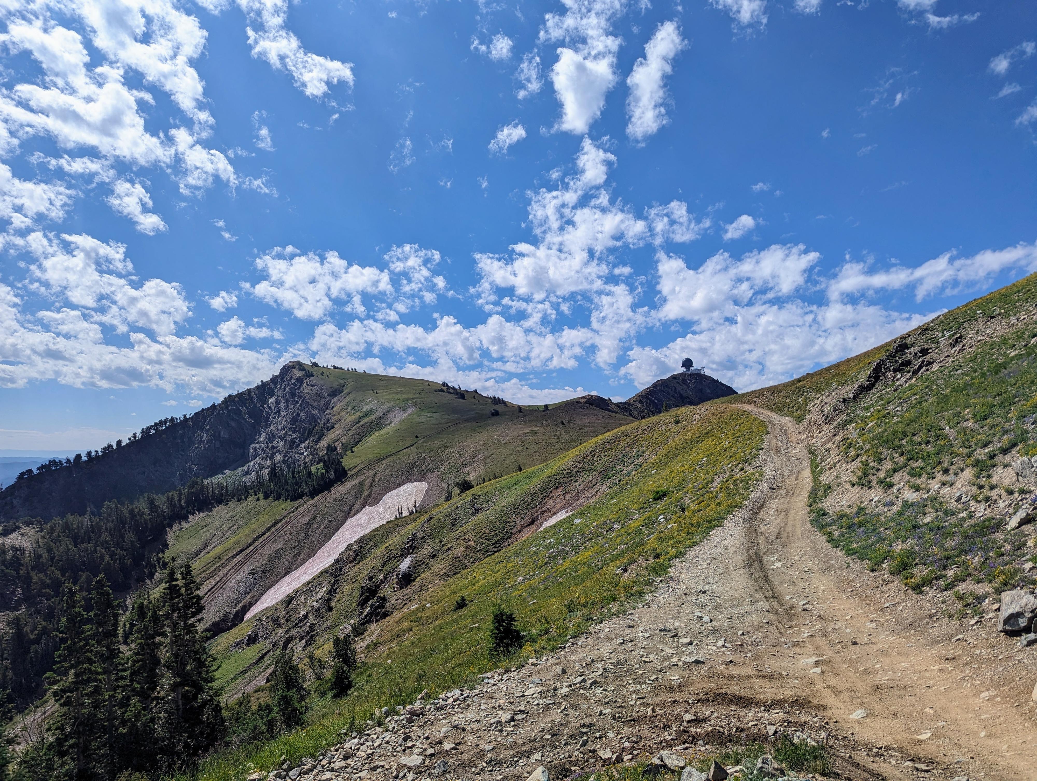
- 12.3, Junction with a side road going off to the right and becoming rougher. This is the recommended trailhead. The left fork goes to the radio tower.
Route Description
To The Pass (About 1.4 miles)
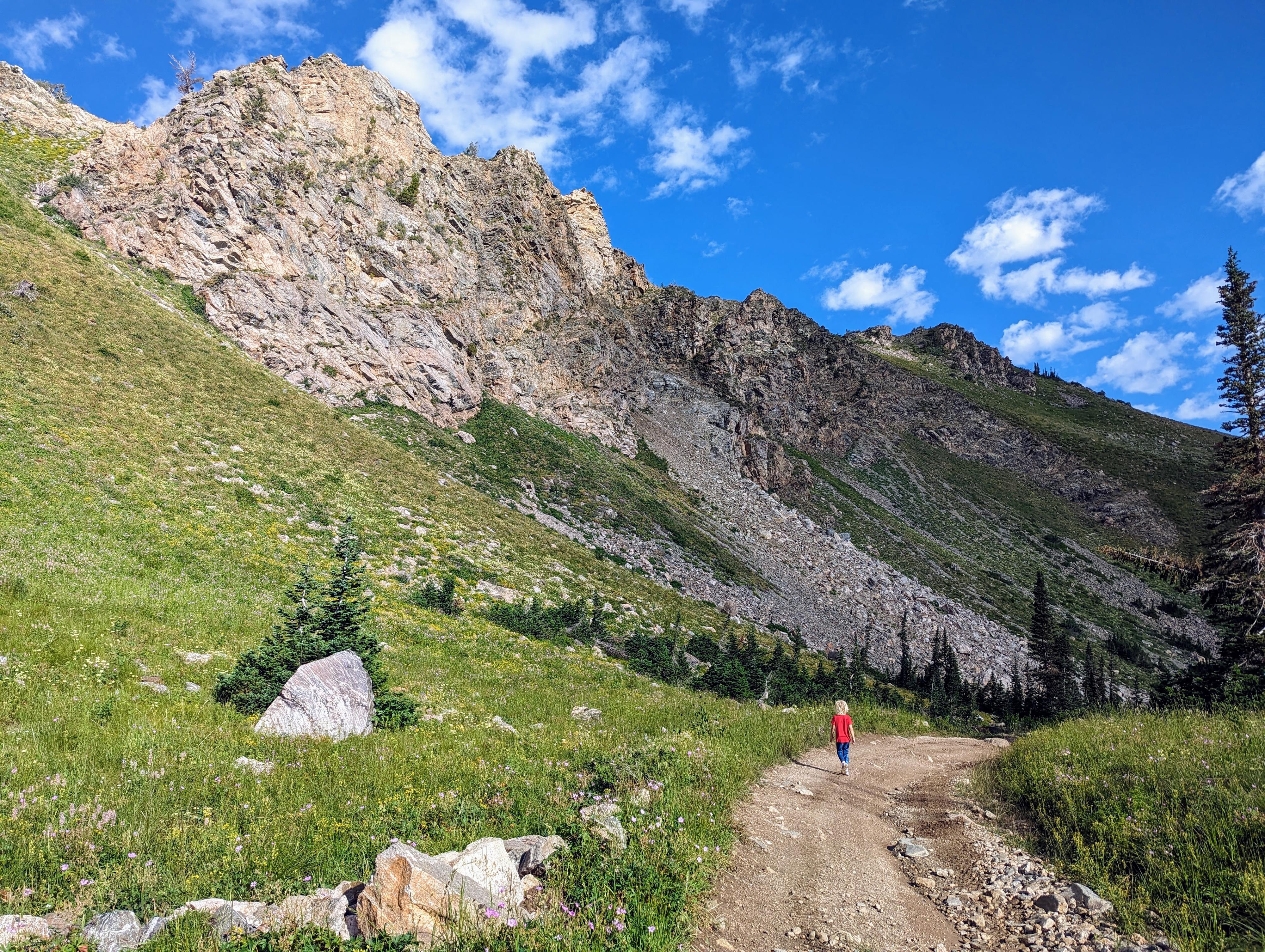
From the trailhead, follow the rocky jeep road as it traverses the hillside north below the large communication tower that sits atop Francis Peak. If driving, this section is one you hope you don't meet someone coming from the other direction!
After about 0.65 miles, a 4-way junction is reached. Continue straight at this junction. As you continue north, a small two-track leaves on the right about a mile from the trailhead, ignore it. About 1.1 miles from the low clearance trailhead, a road leaves on the right, signed road 259. Go right at this junction.
The road heads downhill and quickly reaches another junction. Go left at this junction, as the road climbs to a pass.
To The Lakes (about 2.3 miles from the trailhead to the southern lake)
From the pass, the lakes are north, down the hill. The route down is a bit of a maze of roads. Hikers will likely want to head straight down the steeper road that ATVs use. Vehicles, at least if you are me, will want to follow the easier road that makes switchbacks down. It is crossed by the steeper road often, so pay attention. The longer switchback route was a fairly easy drive on our visit, though the steeper road looked substantially more difficult.
The road makes a few switchbacks before making a broad traverse along the base of the mountain to the southernmost Smith Creek Lake.
The southern lake, on our visit, was the most silty and smallest. All the lakes, including this one, have side roads going to them with a spot or two for primitive camping near the lake.
From the southern lake, continue on the 4x4 road north. It is a little less than a half-mile to the middle lake. This one, on our visit, was shallow and crystal clear with a great overlook of the Morgan Valley to the east.
To reach the northern lake, continue on the road about another 0.3 of a mile. The northern lake is the largest and most picturesque. Absolutely lovely!
For an alternate return route, I would recommend climbing to the ridge from the middle lake and following the ridgeline south. You will intersect a road that leads back to the approach road. The ridge has great views. You may even want to take a side trip to Thurston Peak to the north while in the area.
Photos
Maps

12T 429547E 4542133N
41°01'39"N 111°50'17"W
12T 429532E 4543705N
41°02'30"N 111°50'18"W
12T 429600E 4543932N
41°02'37"N 111°50'15"W
12T 429273E 4544997N
41°03'11"N 111°50'30"W
12T 429267E 4545333N
41°03'22"N 111°50'30"W
12T 429357E 4544607N
41°02'59"N 111°50'26"W