Smugglers Gap |

City Creek Canyon

Hiking Smugglers Gap - City Creek Canyon Hiking Smugglers Gap

City Creek Canyon

Overview

RATING: Moderate Hike

Fri

A chance of snow showers before 3pm, then a chance of rain showers. Mostly cloudy, with a high near 46. East southeast wind around 6 mph. Chance of precipitation is 50%.

46 | 29

Sat

Snow showers before noon, then rain showers. Cloudy, with a high near 45. Chance of precipitation is 90%. Little or no snow accumulation expected.

45 | 36

Sun

Snow showers before noon, then rain showers. Cloudy, with a high near 46. New snow accumulation of less than half an inch possible.

46 | 35

Mon

A chance of snow showers before noon, then a chance of rain showers. Mostly cloudy, with a high near 46. New snow accumulation of less than half an inch possible.

46 | 33

Tue

Sunny, with a high near 52.

52 | 31

View Full Weather Details
SEASON: Late Spring through Fall.
GEAR: Standard Hiking Gear
WATER: None, bring all you need.

Fri

A chance of snow showers before 3pm, then a chance of rain showers. Mostly cloudy, with a high near 46. East southeast wind around 6 mph. Chance of precipitation is 50%.

46 | 29

Sat

Snow showers before noon, then rain showers. Cloudy, with a high near 45. Chance of precipitation is 90%. Little or no snow accumulation expected.

45 | 36

Sun

Snow showers before noon, then rain showers. Cloudy, with a high near 46. New snow accumulation of less than half an inch possible.

46 | 35

Mon

A chance of snow showers before noon, then a chance of rain showers. Mostly cloudy, with a high near 46. New snow accumulation of less than half an inch possible.

46 | 33

Tue

Sunny, with a high near 52.

52 | 31

View Full Weather Details
The Salt Lake Valley from Little Black Mountain

The Salt Lake Valley from Little Black Mountain

City Creek is rich in history. The canyon is currently home to one of the Salt Lake valley’s water treatment plants and has long had a history of providing water to the valley. The upper reaches of the canyon held the site of several mines, none of which were very successful. Then came prohibition, and moonshine was added to the story of City Creek Canyon. The trail described here, Smugglers Gap, was used by moonshiners to smuggle moonshine from City Creek to the military base at Fort Douglas.

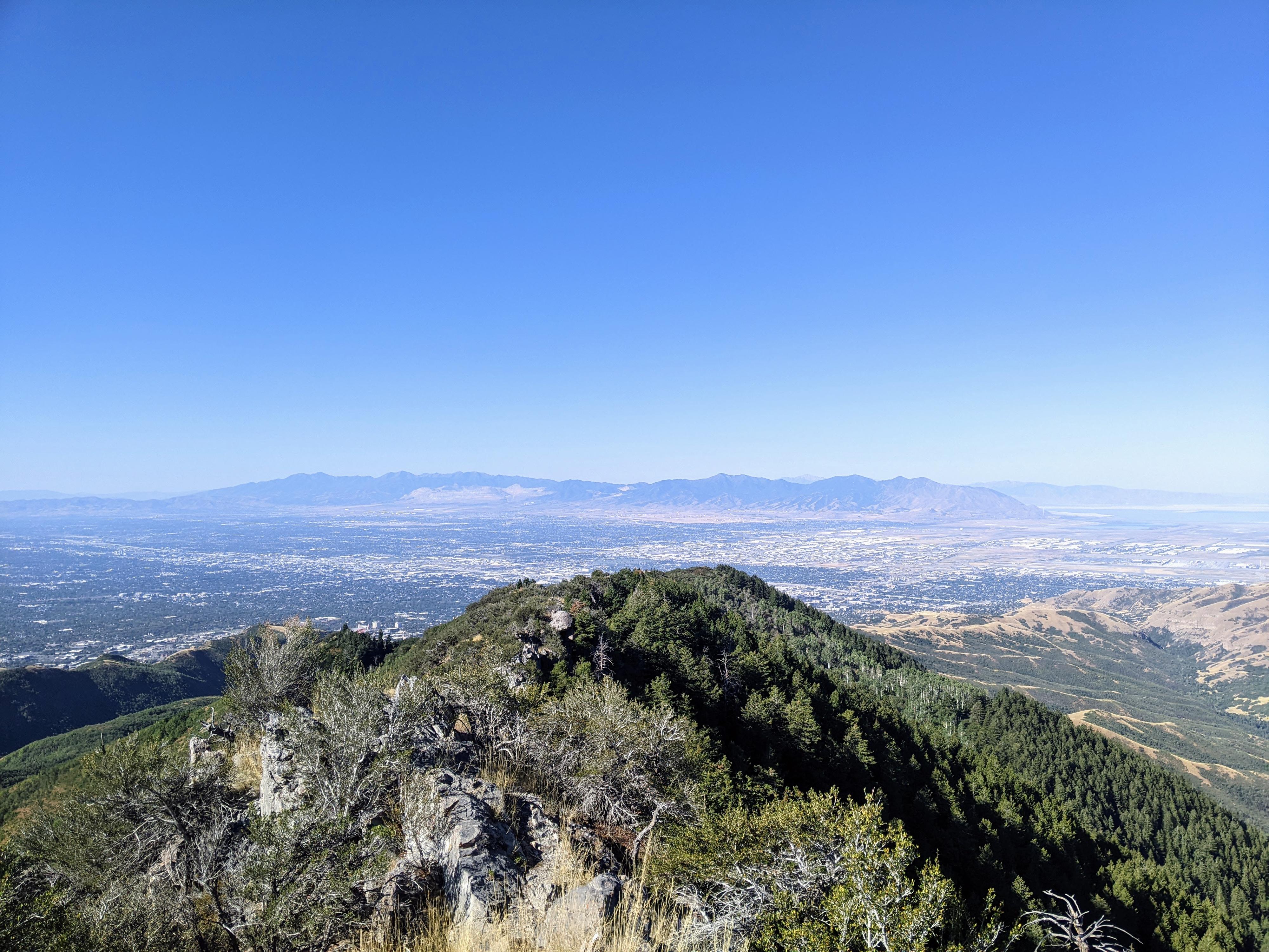
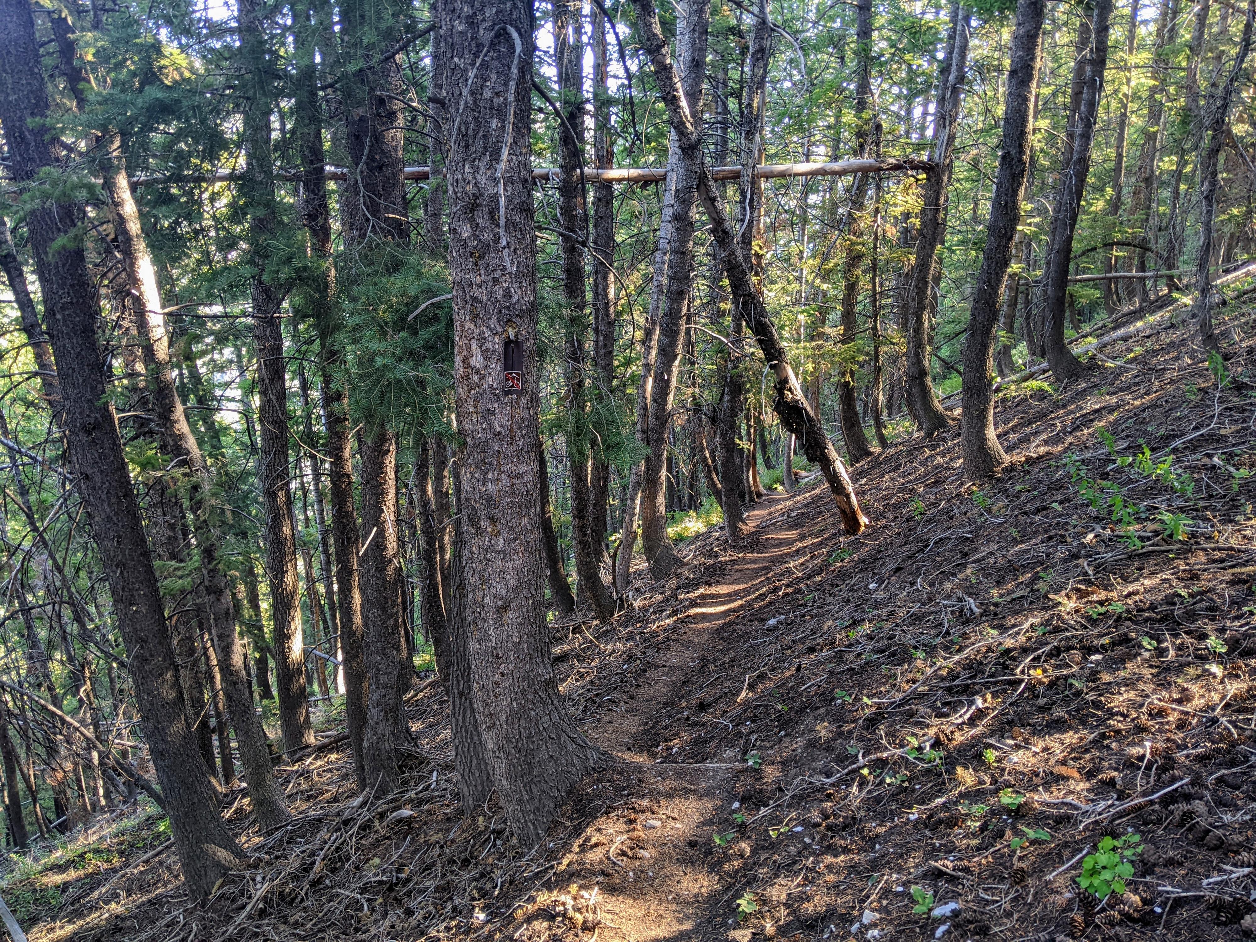
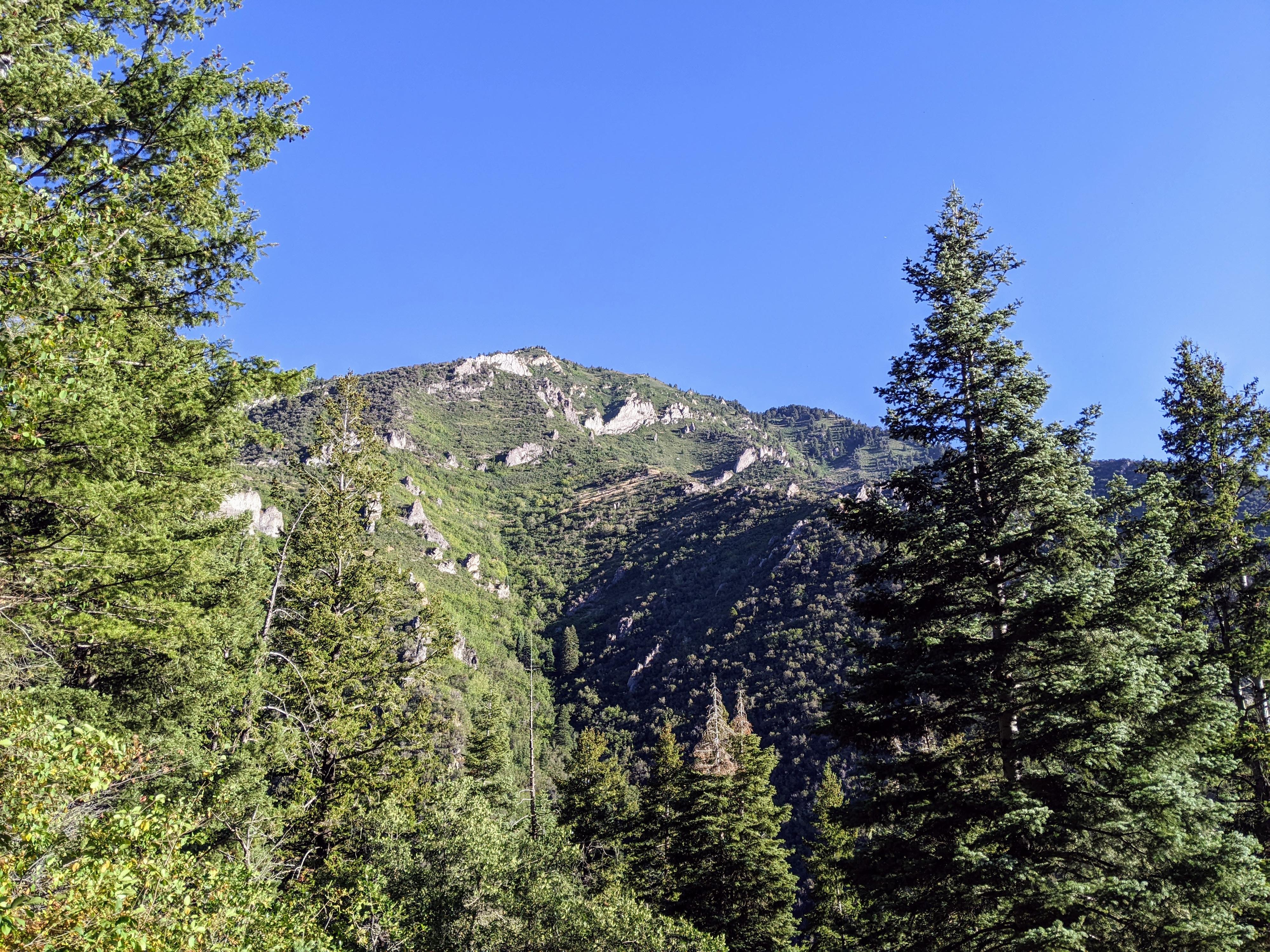
The hike is steep and heavily forested, with only occasional glimpses out to Grandview Peak across the canyon or to the more distant Great Salt Lake. It isn’t until the ridge that views become a prime attraction. I enjoyed the history of the hike, but wouldn’t recommend it for the views. It makes a nice alternative route to the summit of Little Black Mountain if you have done Little Black Mountain from the avenues.

Typical forested scene along the way.

Typical forested scene along the way.

Getting There

Note: Reaching the trailhead is only accessible by vehicle on even number days from Memorial Day in May to the last even day in September. On odd days, or out of that season, reaching the trailhead requires a 5.6 miles one-way hike or bike. See the Salt Lake City site for current details. (https://www.slc.gov/utilities/city-creek-canyon/) Currently, in 2022, it costs $3 to drive up the canyon on even number days.

City Creek Canyon is reached via a one-way road connecting the Avenues neighborhood to the Marmalade Hill neighborhood. From downtown Salt Lake City, go east on South Temple to B Street. Go north up B Street to 11th Avenue. The left (west) on 11th Avenue. It curves and goes north into City Creek Canyon. Where the road curves back to head to the Capitol is a small side road on the right with a few parking spots. Head up this side road to the gate.

After paying the fee, continue up the canyon to its end in about 5.6 miles. The road ends at the trailhead.

A rare glimpse at the limestone features across the canyon.

A rare glimpse at the limestone features across the canyon.

Route

From the trailhead at the top of City Creek Canyon, follow the wide trail as is heads up along City Creek. There are a couple of crossing, but they have bridges. No need to get your feet wet!

About 0.4 miles (10-ish minutes), the Smugglers Gap trail is signed and leaves the main trail heading up the hillside on the right.

The trail climbs steeply and relentlessly! Hike up the steep and heavily forested hillside. The area doesn’t see much visitation, so keep an eye out for wildlife. It is about 1.75 miles from the junction at the bottom to the ridge at the top. Once at the ridge, bigger views come into focus.

At the ridge, the trail splits and becomes less used. Left continues east along the ridgeline, deep into the Upper City Creek area and eventually to Lookout Peak. Right heads west and visits the Little Black Mountain summit in about 0.5 miles. The trail along the ridge to Little Black Mountain is less defined than the Smugglers Gap trail, but still easy to follow. There are no obstacles or exposure to reach the summit. Return the same way.

Side Note: From the ridgeline, an old trail or road can be seen on the hillsides to the southeast. I assume the old Smugglers Gap trail crossed the ridge and continued on toward Fort Douglas via the old trail that can sporadically be seen in the distance.

Maps

Route / 5.34 miles / Elevation Range 5,987 - 8,015 ft.
Printable Maps:
Trailhead

12T 433069mE 4519586mN

N40° 49' 28" W111° 47' 37"

Smugglers Gap Jct

12T 433614mE 4519746mN

N40° 49' 34" W111° 47' 14"

Little Black Mountain

12T 432656mE 4518346mN

N40° 48' 48" W111° 47' 55"

Comments

Want to make a comment? Login and let yourself be heard.