 Hiking
Sunset Peak
Hiking
Sunset Peak
Big Cottonwood Canyon
Overview
The aptly-named Sunset Peak is THE place to see a sunset over the canyons. From the peak, the sunset of Brighton and surrounding ridges are spectacular. The hike to the summit passes Lake Mary, Lake Martha, and Lake Catherine en route, so there is much to see and do along the way. Being a camera and a picnic, and make a full evening of the outing.
I had procrastinated visiting this summit because I had heard it was often quite busy. On the evening I visited, I had the mountain and most of the hike to myself. The sunset from the peak didn't disappoint!
Getting There
Big Cottonwood Canyon is on the east side of the Salt Lake City Valley. Get there by taking I-215 to the east, taking exit 6 off the interstate and heading east.
Follow 6200 South which becomes Wasatch Blvd for 1.8 miles to the stop light and signs for Big Cottonwood Canyon.
Turn left at the light and reset your odometer.
Drive up Big Cottonwood Canyon 14 miles to the small community of Brighton. At the loop, go right, with Brighton Ski resort just ahead. Parking in the large parking lot near the main Brighton Ski Resort Building.
Route Description
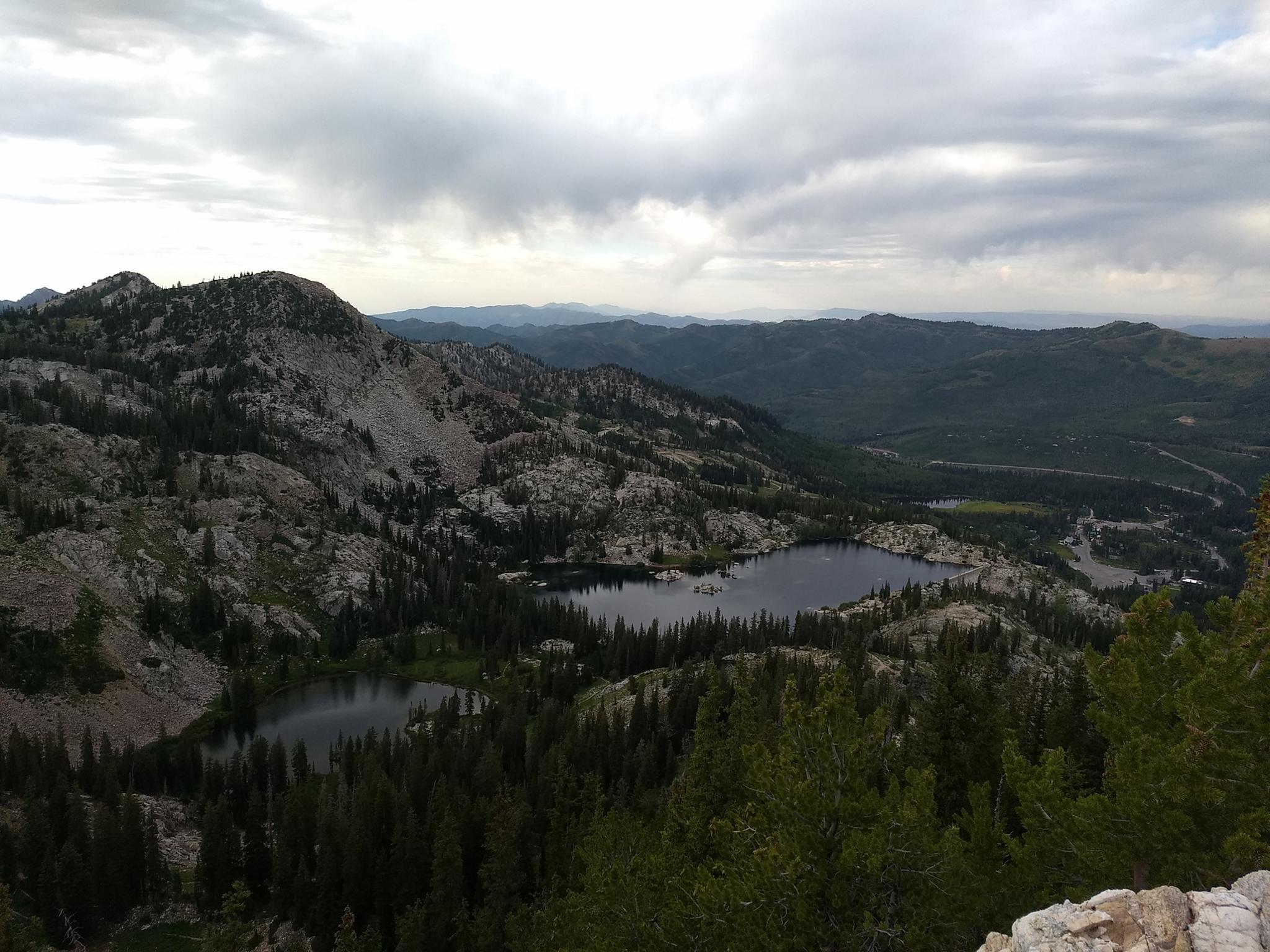
To Lake Mary (1.25 miles one way)
From the Brighton parking lot, go just right (south) of the main Brighton building. A path leads up the slope, then heads right and passes between large logs to become a single narrower track. The single track switchbacks up the hillside, crossing under the ski lifts, before heading more south. After a short steep section is a junction to Dog Lake.
Dog Lake is a recommended side trip and takes only a few minutes. At the intersection to Clayton Peak, stay right for Dog Lake.
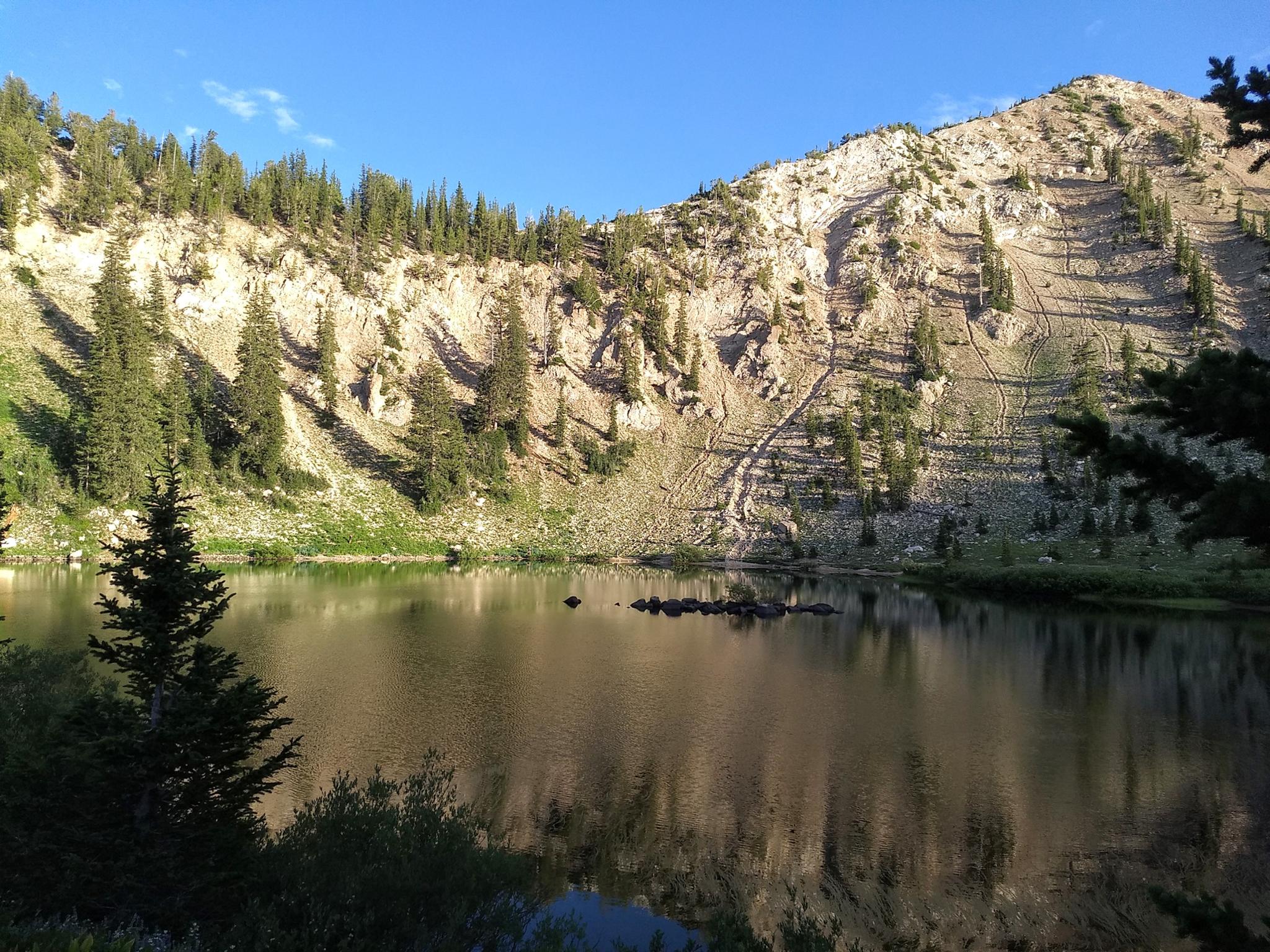
From the Dog Lake junction, it is a couple of minutes to the Lake Mary/Twin Lakes junction. Stay left here, passing under the Lake Mary Dam, then up to the lake proper.
To Lake Catherine (1 mile from Lake Mary)
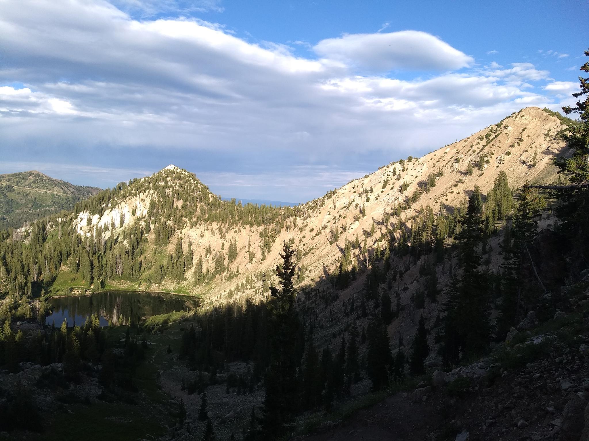
From Lake Mary, the trail follows the shoreline south, then begins climbing. You can see Lake Martha below as the trail climbs, but it is not directly along the trail.
Past Lake Martha, the trail continues to climb steeply, leaves the trees, and the headwall of Catherine Pass comes into view. At the junction, left goes to Lake Catherine in a minute or two and is a nice side trip. For Sunset Peak, stay right.
To The Summit ( 1 mile from Lake Catherine)
The trail soon climbs the steep rocky slope to Catherine Pass with glimpses into Little Cottonwood Canyon and the ridges to the south. The ridge is a mess of trails from here. Stay on the most used trail that climbs the ridge via a couple of switchbacks.
At the ridge, go right for a minute or two to another junction, then left at a signed junction for TR 157. From this junction, the trail stays closer to the ridgeline proper and is easy to follow — the trail winds around the east side of the peak and up to the summit.
Maps

12T 450565E 4494340N
40°35'54"N 111°35'03"W
12T 450661E 4494222N
40°35'50"N 111°34'59"W
12T 450580E 4493357N
40°35'22"N 111°35'02"W
12T 450499E 4493365N
40°35'23"N 111°35'06"W
12T 449904E 4492595N
40°34'57"N 111°35'31"W
12T 449766E 4492456N
40°34'53"N 111°35'37"W
12T 449337E 4492387N
40°34'51"N 111°35'55"W
12T 449450E 4492039N
40°34'39"N 111°35'50"W
12T 449358E 4492051N
40°34'40"N 111°35'54"W
12T 449751E 4491982N
40°34'38"N 111°35'37"W