Devils Gate |

Snake Valley

Hiking Devils Gate - Snake Valley Hiking Devils Gate

Snake Valley

Overview

RATING: Easy hike
LENGTH: 1 hour
MAPS: SPRING MOUNTAIN, NV

Sun

Mostly sunny, with a high near 60. Northwest wind 5 to 10 mph.

60 | 37

Mon

Sunny, with a high near 67.

67 | 41

Tue

Sunny, with a high near 66.

66 | 38

Wed

Sunny, with a high near 62.

62 | 39

Thu

Sunny, with a high near 68.

68 | 41

View Full Weather Details
SEASON: Any when roads are dry. Roads likely impassable in the winter. Hot in the summer.
GEAR: Standard Hiking Gear
WATER: None, bring all you need.
NOTES: The road to the trailhead requires medium clearance. A sedan will likely not make it. Roads will be impassable when snowy or very wet.

Sun

Mostly sunny, with a high near 60. Northwest wind 5 to 10 mph.

60 | 37

Mon

Sunny, with a high near 67.

67 | 41

Tue

Sunny, with a high near 66.

66 | 38

Wed

Sunny, with a high near 62.

62 | 39

Thu

Sunny, with a high near 68.

68 | 41

View Full Weather Details
Not Devils Gate yet, a small cliffed section near the parking area.

Not Devils Gate yet, a small cliffed section near the parking area.

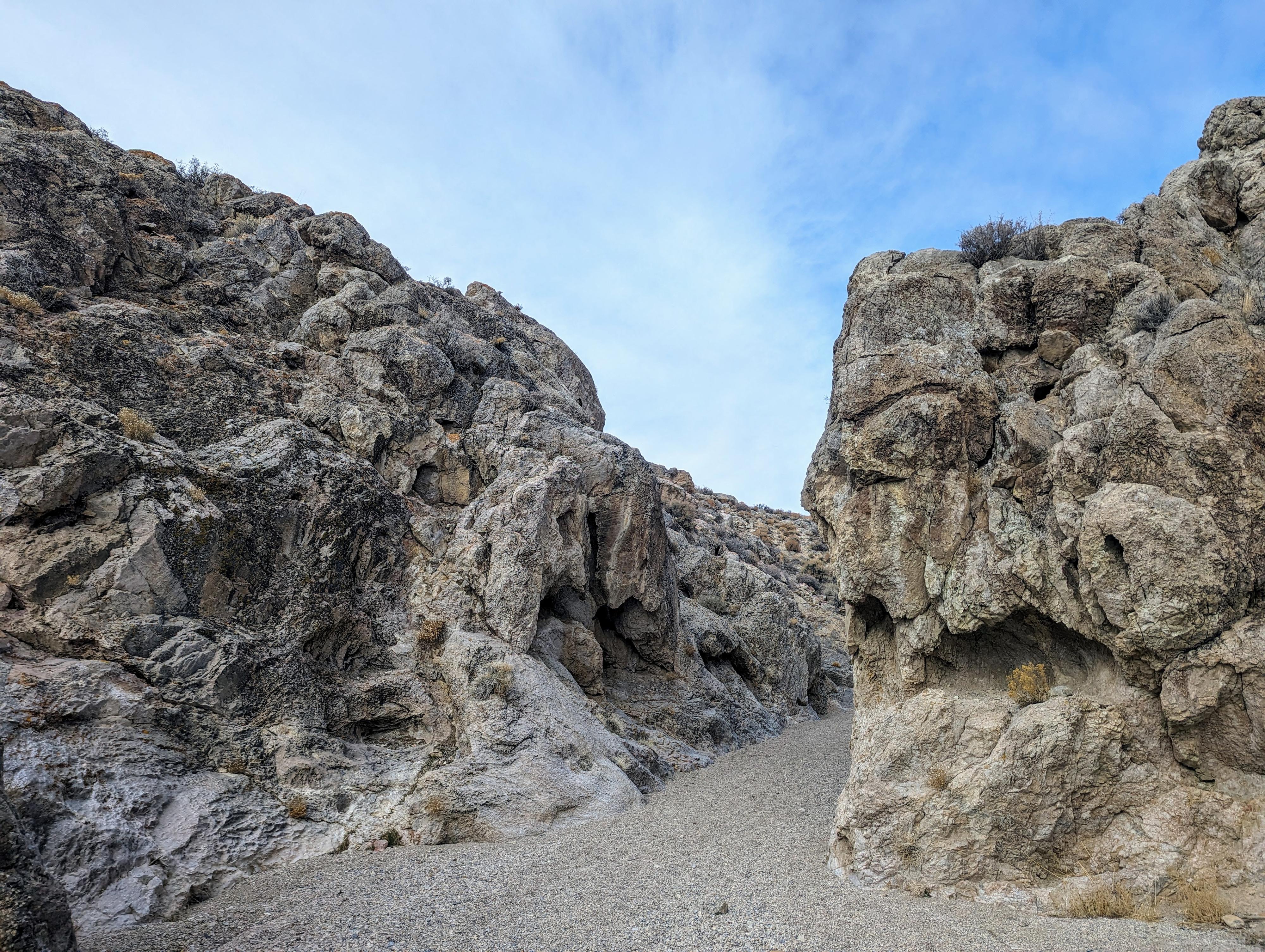
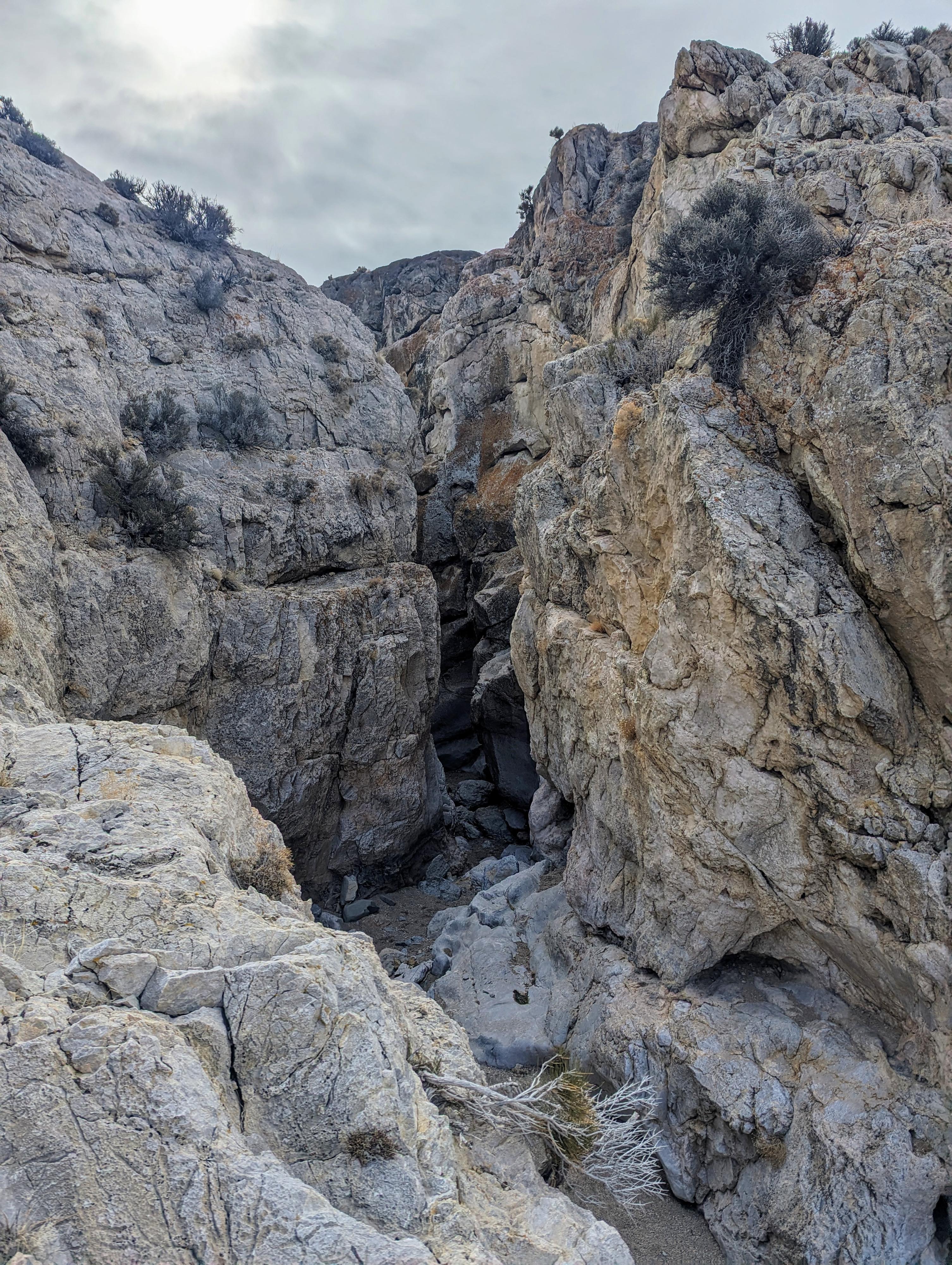
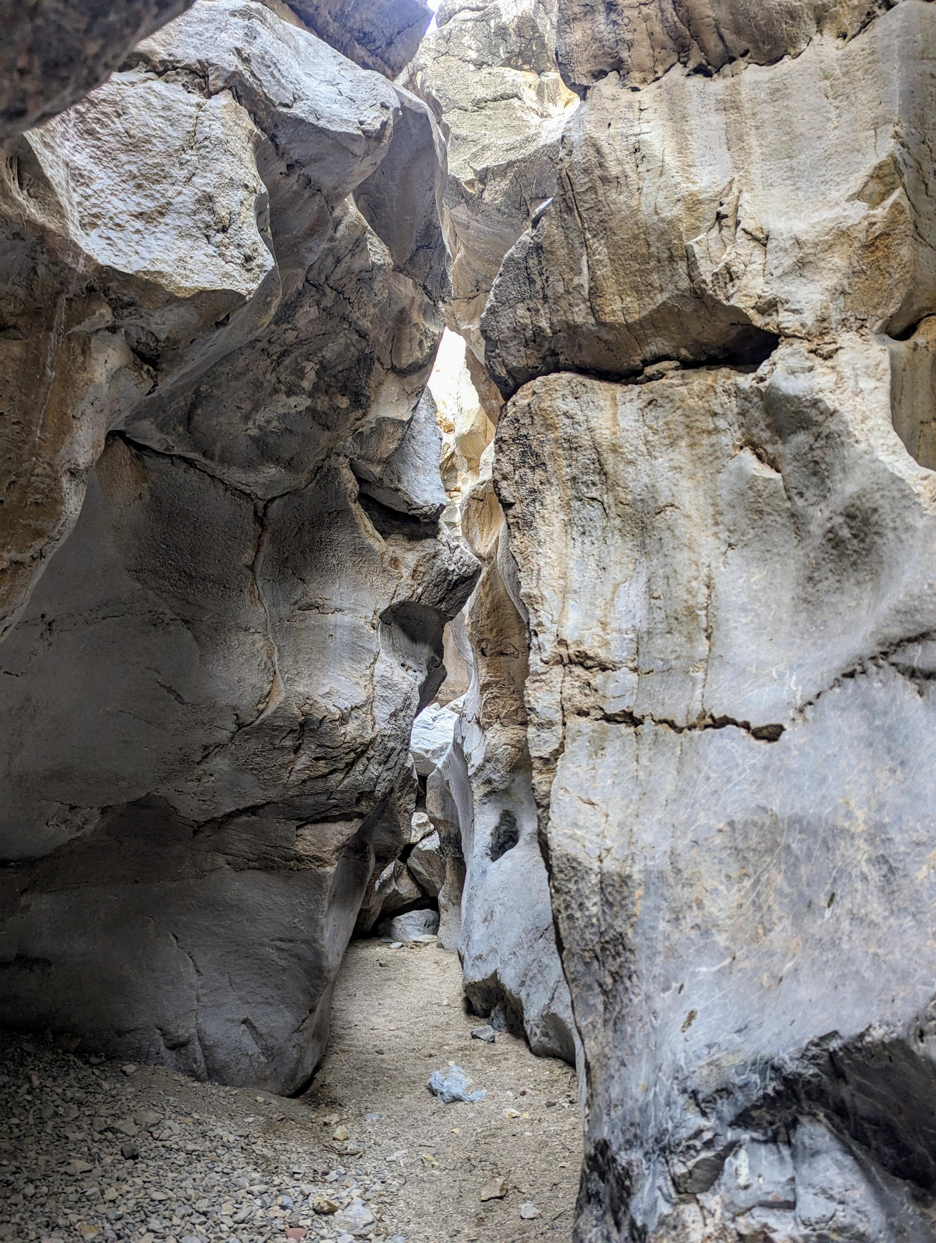
Devil's Gate is tucked on the very eastern edge of Nevada, just across the Utah/Nevada border from Gandy Warm Springs. This is a short but dramatic canyon. The good is that it is stunning and dramatic in deep limestone with relatively easy passage and an easy few minute approach. The bad, well, as mentioned above, it is very short. It takes just a few minutes to hike the narrow section.

Our family thoroughly enjoyed the canyon, but I wouldn't recommend coming all the way out to visit without seeing some other sights in the area.

If you spend a day visiting Devil's Gate, Gandy Warm Springs, and take a Crystal Ball Cave tour, you will have had an outstanding day of sights that is a very worthwhile use of the drive in my opinion.

The start of Devils Gate

The start of Devils Gate

Abby pondering the downclimb and deciding to wait.

Abby pondering the downclimb and deciding to wait.

Getting There

Reaching the trailhead involves over 30 miles of dirt road one way. Make sure you have plenty of fuel, water, and supplies. There are no services available one you leave pavement.

From the Nevada/Utah stateline on US-6, go east into Utah and turn left (north) at mile marker 0.7 on the Gandy Road. This is about 88 miles west of Delta Utah on highway 6 if coming from that area.The Gandy Road is dirt, but typically very well graded and relatively fast to drive.

  • MP 0.7 on US-6 ( 11S 756419mE 4327195mN / N39° 03' 22" W114° 02' 12" )
  • 27.5 miles from US-6 - Go left toward the signed Bates Ranch. Reset your odometer. ( 12S 242045mE 4370257mN / N39° 26' 36" W113° 59' 51" )
  • 1.1 miles - 4-way junction - Go left. Stay on the main dirt road after this junction, ignoring a side road on the right that goes to a house. ( 11S 757106mE 4371534mN / N39° 27' 18" W114° 00' 43" )
  • 2.7 miles - Junction. The main road goes right to Gandy Warm Springs. Go left. There are a few side road through this section. Stay on whatever road looks the best while crossing the wide wash. Once on the other side, the roads coalesce. ( 11S 754627mE 4371625mN / N39° 27' 24" W114° 02' 26" )
  • 4.1 miles - Small side road leaves on the right. Stay left. ( 11S 753373mE 4373419mN / N39° 28' 23" W114° 03' 16" )
  • 6.7 miles - The road crosses a wide wash. This is the Devils Gate trailhead. ( 11S 749595mE 4373923mN / N39° 28' 43" W114° 05' 53" )
Stunning narrows in Devils Gate

Stunning narrows in Devils Gate

Devils Gate Canyon

Devils Gate Canyon

Route

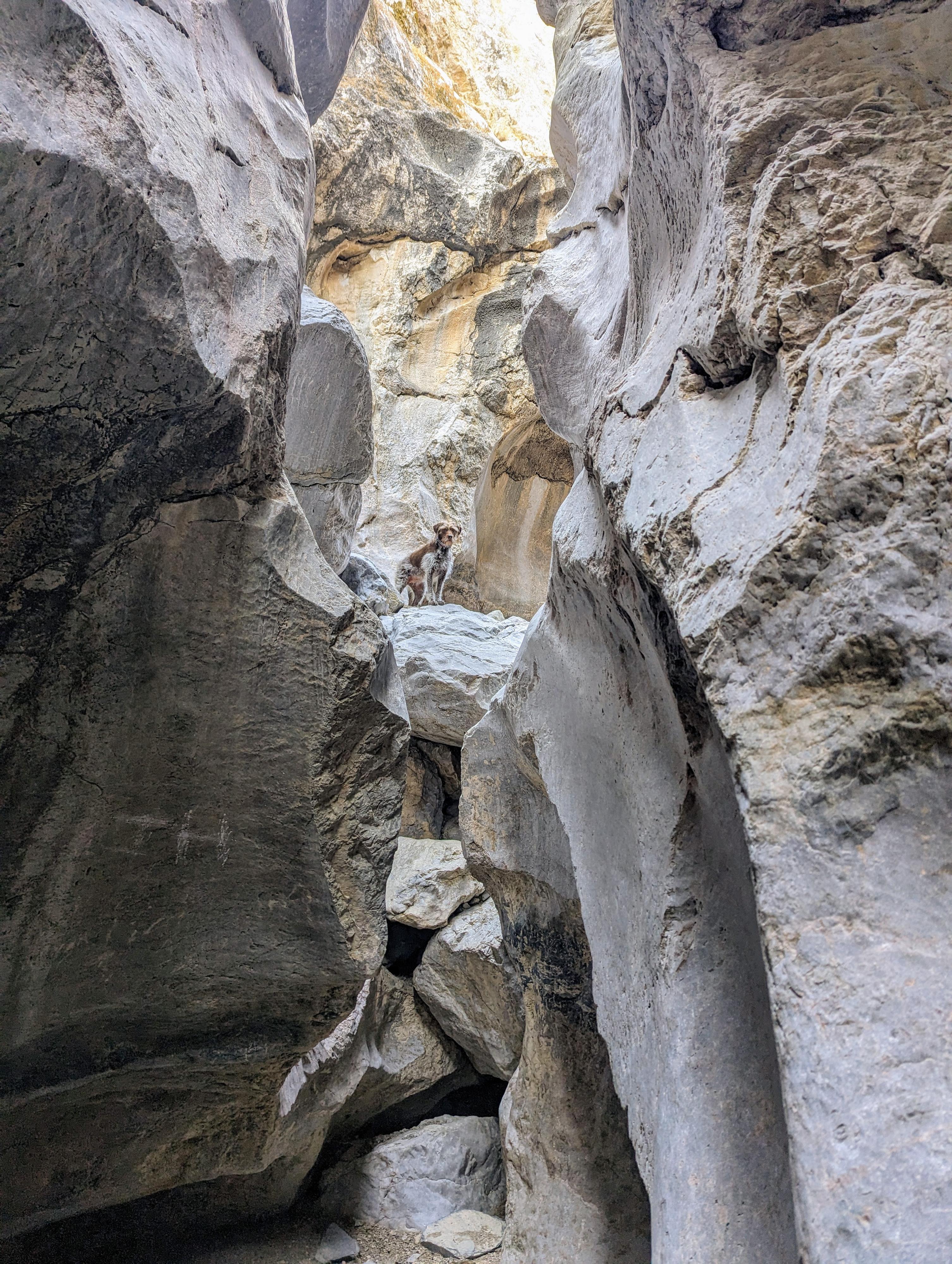
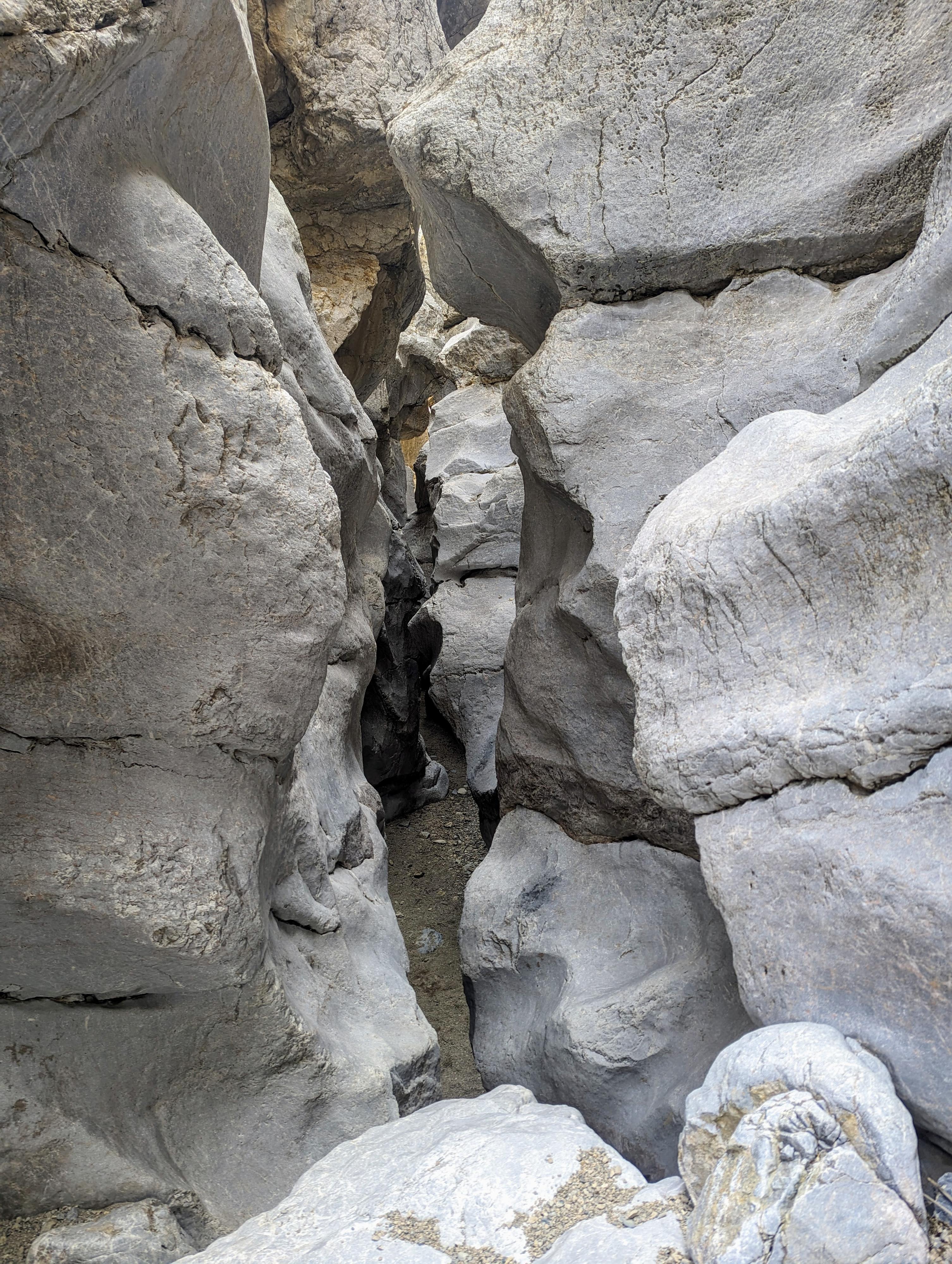
From the trailhead, walk down the wash. It narrows a little, briefly, on a bend. Continue down another minute or two to where the canyon bends again. Here is Devil's Gate, where the canyon quickly and dramatically passes through a slot section. There is one down climb in this section that may give beginners and most certainly dogs problem. If needed, you can rim walk around the narrows on the left (north) side and visit up from below.

Past the down climb is the narrowest section, but all too soon it opens, and a small old dam crosses the canyon floor. Just past the dam, the canyon opens back into a wide wash.

Return the same way.


Videos

Hiking through Devils Gate ryancornia

Maps

Printable Maps:
Devils Gate Trailhead

11S 749595mE 4373923mN

N39° 28' 43" W114° 05' 53"

Devils Gate

11S 749780mE 4373841mN

N39° 28' 41" W114° 05' 46"

Comments

Want to make a comment? Login and let yourself be heard.