Floating Island |

Silver Island Mountains

Hiking Floating Island - Silver Island MountainsRoadside Attraction Floating Island - Silver Island Mountains Floating Island

Silver Island Mountains

Overview

RATING: Easy Hike / Roadside Attraction
MAPS: FLOATING ISLAND, UT

Sat

Mostly sunny, with a high near 69. Northeast wind around 7 mph.

69 | 43

Sun

Mostly sunny, with a high near 76.

76 | 48

Mon

Mostly sunny, with a high near 66.

66 | 46

Tue

Mostly sunny, with a high near 71.

71 | 46

Wed

Mostly sunny, with a high near 75.

75 | 52

View Full Weather Details
SEASON: Spring, Fall, Winter (if dry and no snow)
GEAR: Standard Hiking Gear
WATER: None.
NOTES: The road is generally good, but does have a few rough spots. High clearance recommended.

Sat

Mostly sunny, with a high near 69. Northeast wind around 7 mph.

69 | 43

Sun

Mostly sunny, with a high near 76.

76 | 48

Mon

Mostly sunny, with a high near 66.

66 | 46

Tue

Mostly sunny, with a high near 71.

71 | 46

Wed

Mostly sunny, with a high near 75.

75 | 52

View Full Weather Details
The highpoint on the left looking north.

The highpoint on the left looking north.

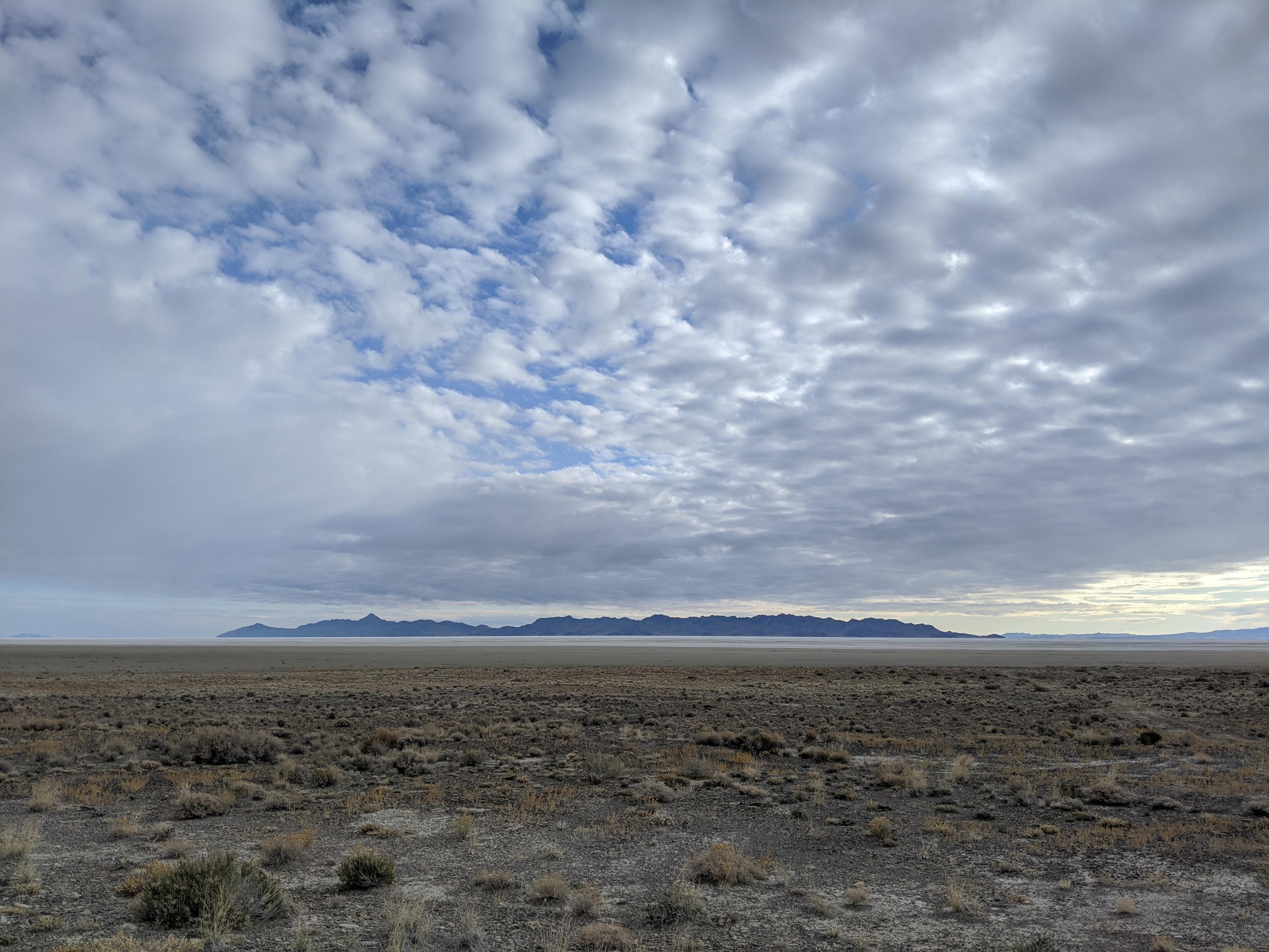
If you have driven the interstate east of Wendover on a sunny day, it is easy to see where the Floating Island gets its name. The small mountain sits in the vast flats of the Great Salt Lake desert. The flats, radiating sunlight, create a mirage of water around the mountain making it look very much like an island in the desert. This solitary mountain has historical significance. The Hastings Trail used by pioneers and prospectors heading to California between 1846 and 1850, passes on the north side of the Floating Island en route to Pilot Peak. The island is visible for long distances, and so we a prominent landmark used when making the crossing.

The island Is small, with the peak rising less than a thousand feet above the surrounding desert floor. Surrounded by mud and salt flats, this is a solitary place to visit with an otherworldly feel. A drive to the island is interesting, but if time and energy allow, visiting the high point is highly recommended.

Historical Note: The Hastings Trail was a shorter route to California that saved about 300 miles over the standard route through Idaho. It is best known because the ill-fated Donner Party was one of the first groups of pioneers to use the route. This trail traversed the desolate mud flats from near the Cedar Mountains on the east side to Pilot Peak on the west. The distance across the between the two points is about 60 miles, but the terrain with its lack of water and impossibly thick mud in places made this an exceedingly difficult and dangerous part of the journey west. Wagons and even livestock that got stuck in the mud sometimes had to be abandoned. Thirst and dehydration claimed many livestock en route.
Newfoundland Mountains from the north side of the Floating Island

Newfoundland Mountains from the north side of the Floating Island

Getting There

Reaching the trailhead starts by going north off I-80 at exit 4. This is a few miles east of Wendover, UT, and about 115 miles west of Salt Lake City.

Once off the freeway, reset your odometer on the north side of the freeway and head north toward Bonneville Salt Flats.

  • Reset Odometer at stop sign off the Interstate ( 12T 249228mE 4514613mN / N40° 44' 39" W113° 58' 12" )
  • 1.2 miles - left onto a paved road. ( 12T 249287mE 4516575mN / N40° 45' 43" W113° 58' 13" )
  • 1.95 miles - Right onto dirt road. This is the Silver Island Mountain Byway/East side. ( 12T 248455mE 4517420mN / N40° 46' 09" W113° 58' 49" )
  • 2.1 miles - Stay right on the main dirt road. ( 12T 248375mE 4517714mN / N40° 46' 19" W113° 58' 53" )
  • 11.4 miles - Silver Island Loop side road. Stay right on byway. ( 12T 257616mE 4527436mN / N40° 51' 44" W113° 52' 33" )
  • 12.85 miles - Lamus Peak two track side road on the left. ( 12T 259823mE 4527946mN / N40° 52' 03" W113° 50' 60" )
  • 19.6 miles - Graham Peak side road on the left. Stay right. ( 12T 268487mE 4533385mN / N40° 55' 08" W113° 44' 57" )
  • 21.5 miles - Floating Island side road on the right. Scenic byway left. Go right. ( 12T 271071mE 4534506mN / N40° 55' 47" W113° 43' 08" )
  • Floating Island Side Road - 4.0 miles - Floating Island. A smaller two track goes right. If climbing the high point, park here or follow the sandy track a few hundred feet and park. Beware, this road can be very sandy. Don't get stuck! ( 12T 276788mE 4533217mN / N40° 55' 11" W113° 39' 03" )
  • Floating Island Side Road - 6.2 miles - Jct. Left goes to military facility (no trespassing), right deteriorates and goes to the south end of the island. This is a good turn around spot. ( 12T 278862mE 4531582mN / N40° 54' 20" W113° 37' 32" )
Newfoundland Mountains from the high point.

Newfoundland Mountains from the high point.

Route

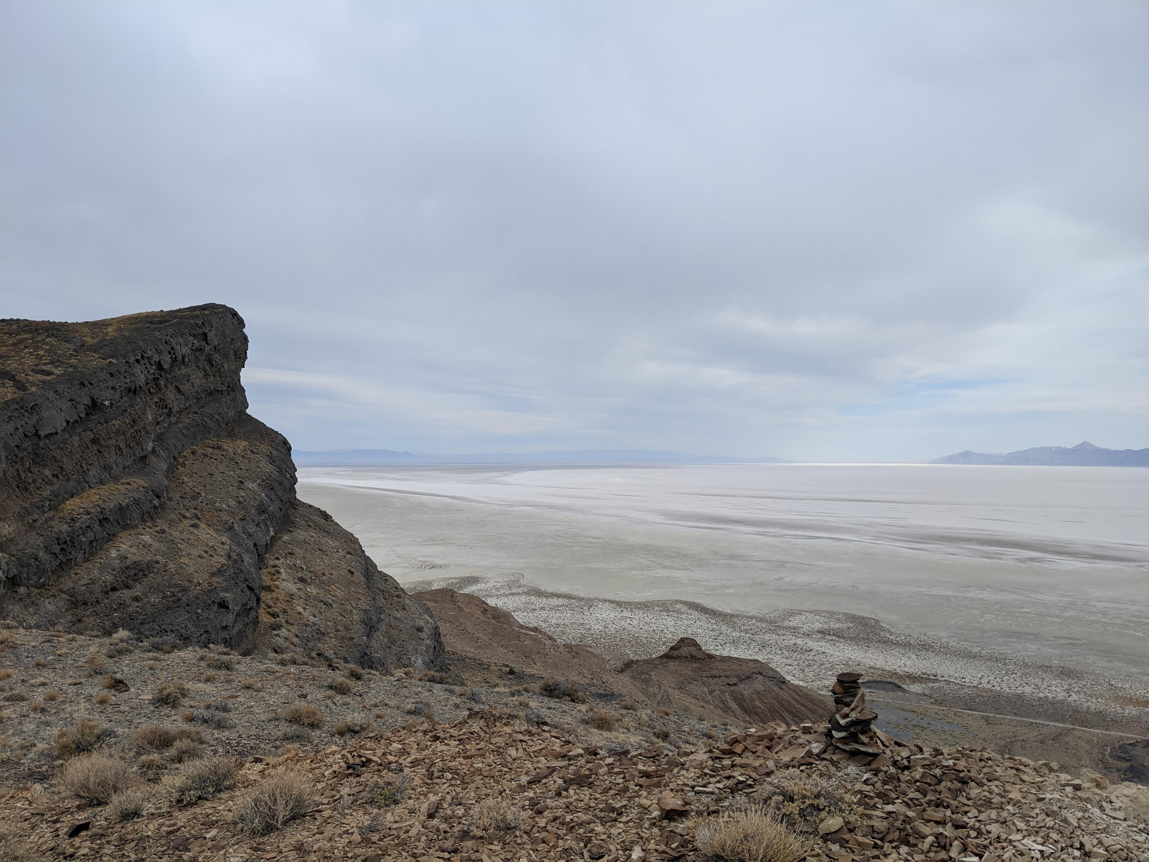
The highpoint is easily hiked from the west side. Once on the island, take the two-track on the right a short distance and park. From the parking area, simply head east up whatever seems to be the easiest path. The open slopes make for easy hiking and the views get better and better on the way up. The summit is perched on the edge of a cliff band and has excellent views.

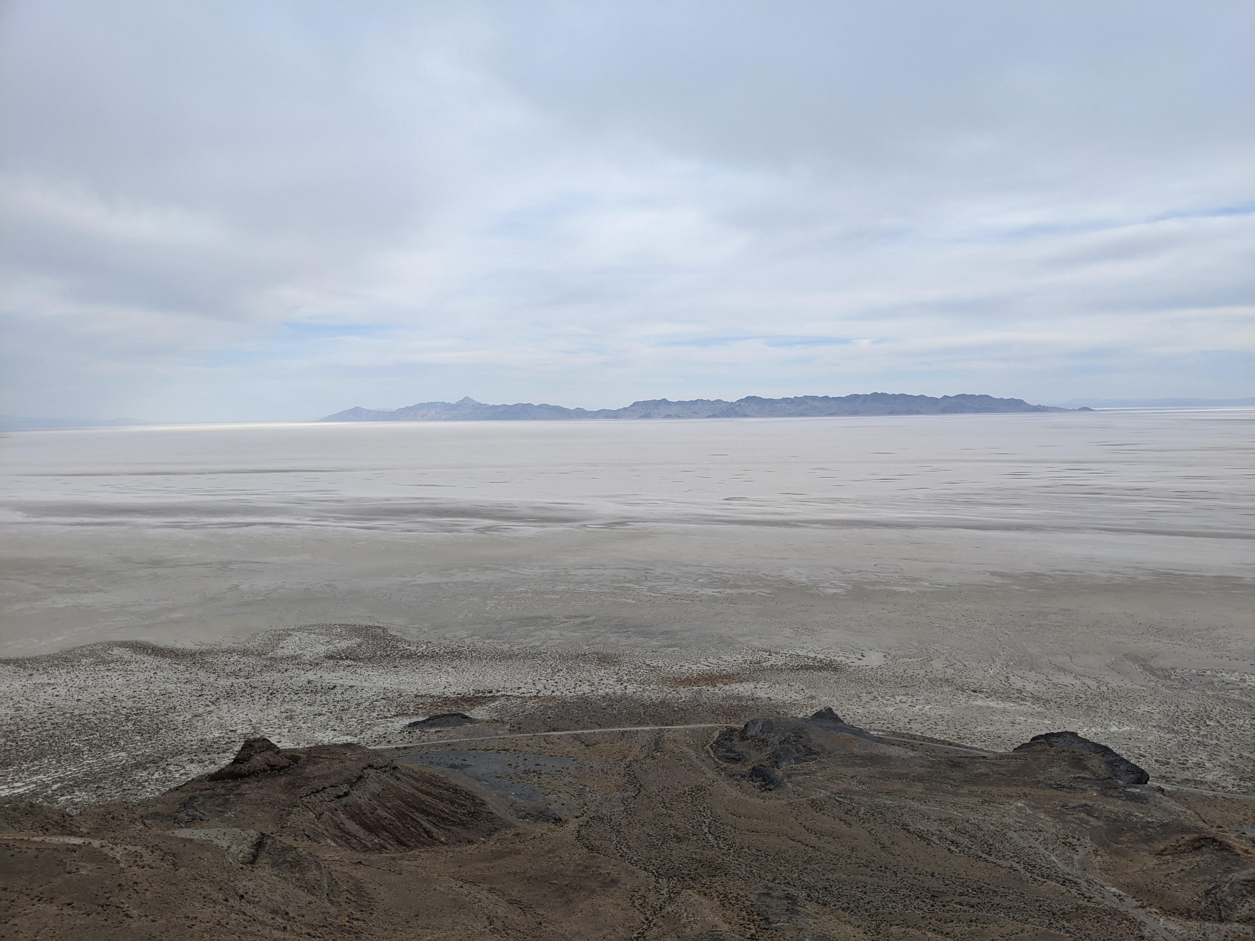
From the summit, the Silver Island Mountains are to the west, with Crater Island separated from the Silver Island Mountains a short distance on the north end. The range to the north is the seldom visited Newfoundland Mountains. To the east is part of the militaries Utah Test and Training Range and to the south is Bonneville Salt Flats and I-80.


Videos

A trip to the Floating Island ryancornia

Maps

Highpoint / 2.64 miles / Elevation Range 4,243 - 5,074 ft.
Printable Maps:
Trailhead

12T 276737mE 4533178mN

N40° 55' 09" W113° 39' 05"

Summit

12T 277814mE 4532737mN

N40° 54' 56" W113° 38' 18"

Comments

Want to make a comment? Login and let yourself be heard.