 Hiking
Stansbury Island Trail
Hiking
Stansbury Island Trail
Stansbury Island
Overview
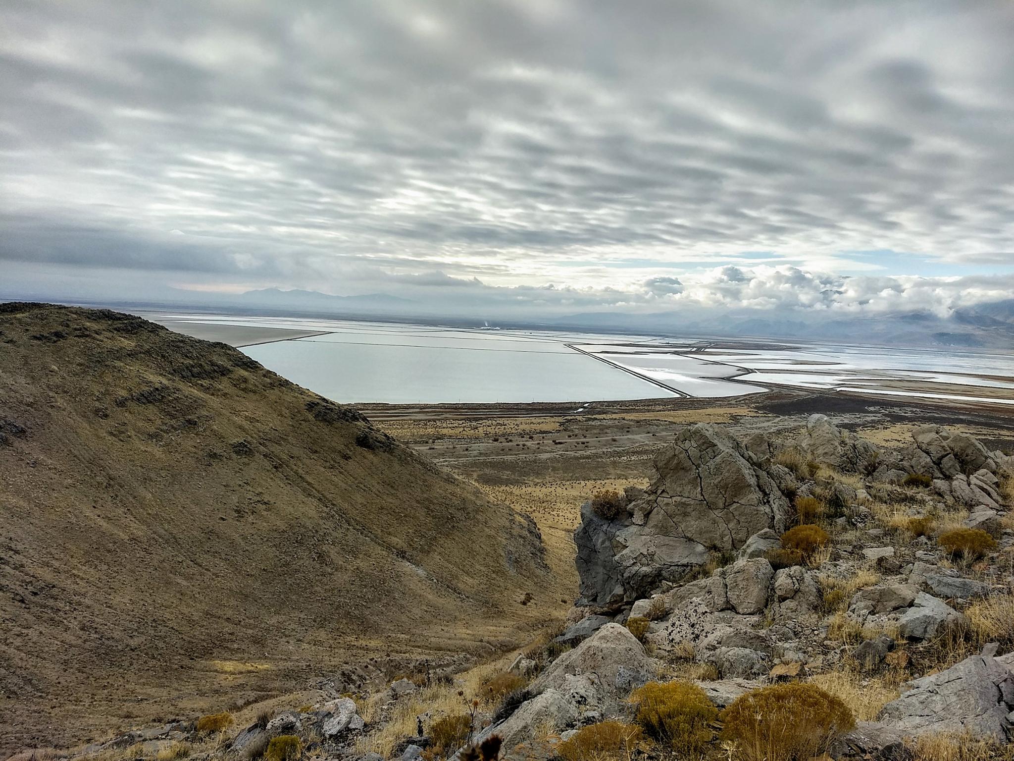
Stansbury Island is a world away from the hustle and bustle of the Wasatch Front. The island is named after Howard Stansbury, who surveyed the Great Salt Lake in 1849. Some of the island is private property and access is difficult since the private property surrounds the road. On the BLM land on the southern end, however, is a 5.3 mile (one way) single-track trail. The trail, aside from an initial steep climb, is an excellent amble along the shoreline of the ancient Lake Bonneville. Views of the Great Salt Lake and surroundings are outstanding.
The trail is said to be popular with mountain bikers. On my several visits, I've never run into anyone else on the path, and generally very few signs of use. You are more likely to run into cows than other hikers or bikers on this outing! Bikers typically ride the single track (6-miles), descend a dirt road to the base of the island, then follow dirt roads back to the trailhead, making an 11-mile loop. Hikers can do out-and-back hikes as far as they like or set up a car shuttle for a one-way hike.
My preference is to do the hike as a trail run out and back on the single track. If doing the full single track trail out-and-back, it is just over 11 miles.
Getting There
Travel west from Salt Lake City on I-80 toward Wendover. Take the second Grantsville exit (Exit 84). The exit is about 30 miles west of Salt Lake City.
Once off the freeway, turn left on the frontage road (Stansbury Island Road) and follow it for 7.2 miles. There are a few side roads, stay straight at all junctions. At 7.2 miles, just after a gravel pit, there is a side road on the right. Take this bumpy side road 0.2 miles (staying right at the junction) to a small parking area that is the trailhead. There is a BLM sign at the trailhead.
Route Description
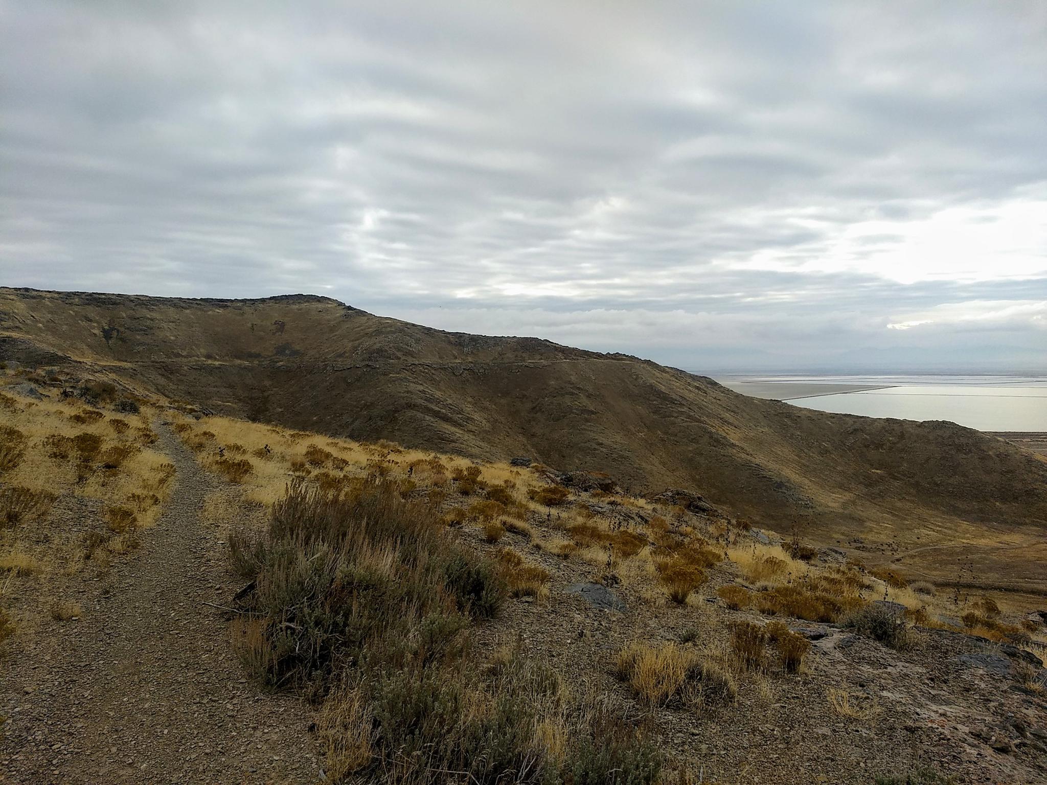
From the trailhead, the single track heads south across the flats. It joins an old road and begins climbing. The old road soon becomes a single track again and switchbacks up to the ridgeline. This first climb is the big one of the day. Once at the ridge, several switchbacks down the other side lead to the flatter and more mellow section.
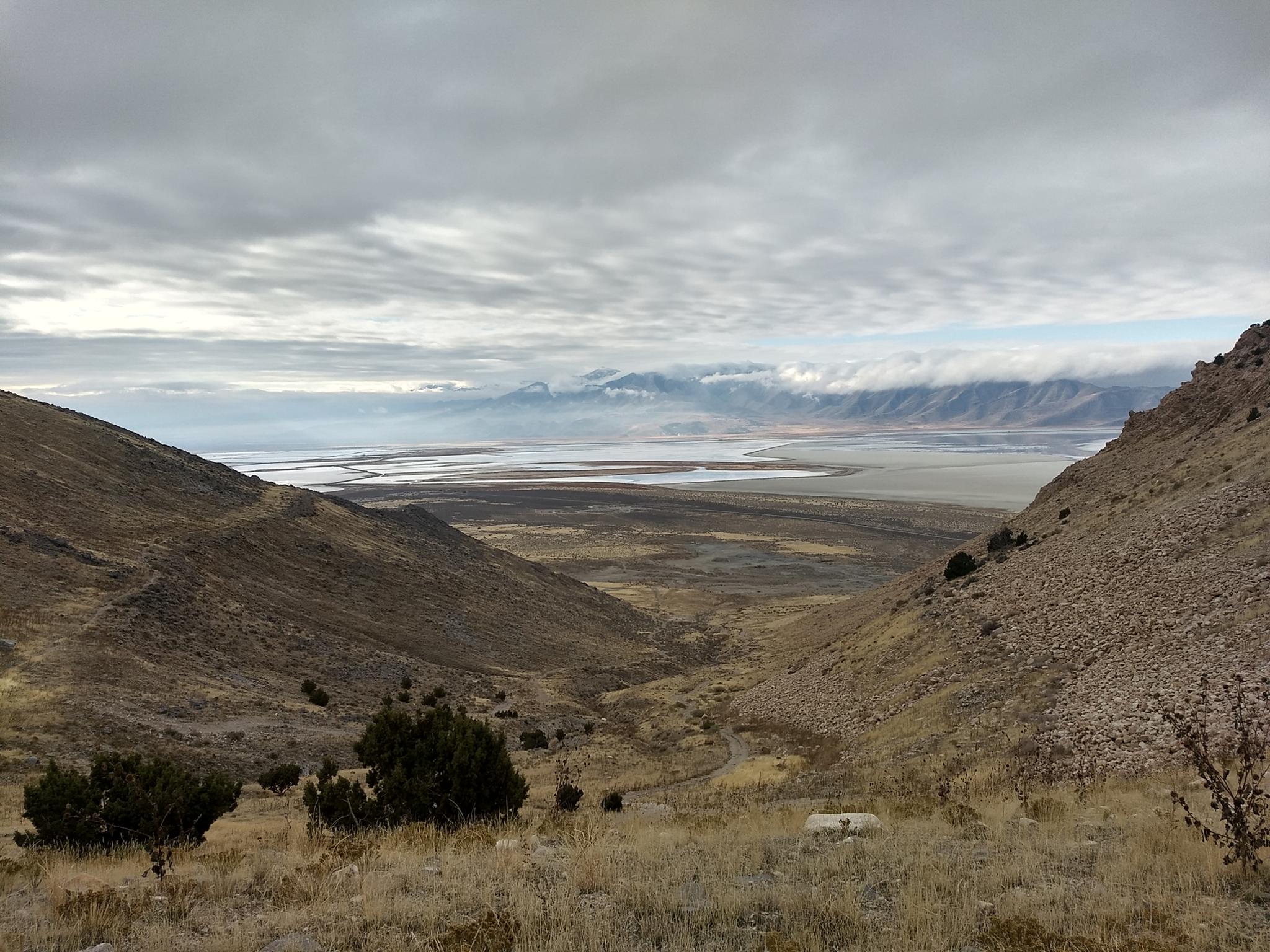
Once on the shoreline, the trail ambles along with a bit of elevation gain/loss as it crosses side drainages. The first major drainage, Tabby's Canyon, has long sweeping views. The trail crosses the road before continuing along. If a short loop is desired, you can descend the Tabby's Canyon road and follow dirt roads along the base of the mountains back to the trailhead.
After contouring around Tabby's Canyon, the trail contours along another smaller side drainage, then into a third more substantial drainage. At the head of this third drainage, a single track allows for a descent down to the base. Continuing a short distance from the single track descent, the trail meets a steep road. This steep road is used if making a loop. Descend to the base of the mountains and follow dirt roads west, then north back to the trailhead.
Maps

12T 371741E 4518378N
40°48'23"N 112°31'14"W
12T 372348E 4517409N
40°47'52"N 112°30'47"W
12T 373348E 4517464N
40°47'54"N 112°30'05"W
12T 373563E 4516717N
40°47'30"N 112°29'55"W
12T 373928E 4516541N
40°47'25"N 112°29'39"W
12T 374075E 4516406N
40°47'20"N 112°29'33"W