The Blocks | San Rafael Swell

Hiking The Blocks - San Rafael Swell Hiking The Blocks

San Rafael Swell

Overview

RATING: Easy Hiking, Moderate Route Finding.
MAPS: The Blocks, UT

Tue

Patchy smoke and a chance of showers and thunderstorms after noon. Mostly sunny. High near 92, with temperatures falling to around 86 in the afternoon. South southwest wind 6 to 12 mph. Chance of precipitation is 30%.

92 | 67

Wed

A slight chance of showers and thunderstorms after noon. Sunny, with a high near 91. West wind 7 to 12 mph. Chance of precipitation is 20%.

91 | 67

Thu

Mostly sunny, with a high near 89.

89 | 64

Fri

A slight chance of showers and thunderstorms after noon. Partly sunny, with a high near 85.

85 | 67

Sat

A chance of showers and thunderstorms after noon. Mostly sunny, with a high near 86.

86 | 64

View Full Weather Details
SEASON: Any, although summers could be hot.
GEAR: Standard Hiking Gear
WATER: None.

Tue

Patchy smoke and a chance of showers and thunderstorms after noon. Mostly sunny. High near 92, with temperatures falling to around 86 in the afternoon. South southwest wind 6 to 12 mph. Chance of precipitation is 30%.

92 | 67

Wed

A slight chance of showers and thunderstorms after noon. Sunny, with a high near 91. West wind 7 to 12 mph. Chance of precipitation is 20%.

91 | 67

Thu

Mostly sunny, with a high near 89.

89 | 64

Fri

A slight chance of showers and thunderstorms after noon. Partly sunny, with a high near 85.

85 | 67

Sat

A chance of showers and thunderstorms after noon. Mostly sunny, with a high near 86.

86 | 64

View Full Weather Details
Amazing Overlook Into South Coal Wash

Amazing Overlook Into South Coal Wash

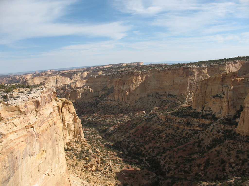
The Blocks, just north of I-70 in the Swell has always intrigued me. The topo map shows an area of large towers, and impressively deep canyons along the way. The area doesn't disappoint. En route to The Blocks, you are treated to outstanding views of deep canyons and far off domes and towers. This is a hike to be enjoyed by those craving open space, and sweeping views. Part of the hike follows and ATV trail, but don't let that deter you. Once off the ATV trail, this area is seldom visited. Begin the hike at sunrise for amazing photographic opportunities as the sun's first rays light the domes on fire.

The aptly named Blocks

The aptly named Blocks

Getting There

Note: You used to be able to get off the freeway near Dutchman arch. This is no longer the case, you now need to follow the longer directions listed below.

Take exit 131 from I-70 (about 30 miles west of Green River). Go south off the freeway.

  • Reset your odometer on the south side of the freeway. ( 12S 529655E 4303563N / 38°52'50"N 110°39'29"W )
  • 3.8 miles from the freeway you will find a signed junction for Head of Sinbad. Go right at this junction toward Head of Sinbad. ( 12S 525540E 4299475N / 38°50'37"N 110°42'20"W )
  • 1.0 miles past this junction a road comes in on the left, stay right. ( 12S 524095E 4298719N / 38°50'13"N 110°43'21"W )
  • Stay on this main road for 3.4 more miles (4.4 from the first junction) to a signed junction to Dutchman Arch. ( 12S 519546E 4301513N / 38°51'44"N 110°46'29"W )
  • Go right, crossing under the freeway in 0.5 miles. ( 12S 519168E 4302140N / 38°52'04"N 110°46'45"W )
  • After the freeway the road branches into several forks, you should go left on road #641, following the fence a short distance then turning north. 0.2 miles from the highway is a junction, go left and Dutchman Arch will be on your right in 0.5 miles. ( 12S 518799E 4302532N / 38°52'17"N 110°46'60"W )
  • Continue past Dutchman Arch 0.7 miles (1.2 from the crossing under the highway) to a parking place on the left before the road climbs a small hill and deteriorates, becoming a difficult 4x4 trail. Park here off the road. ( 12S 517697E 4303348N / 38°52'44"N 110°47'46"W )
One of the towers at The Blocks.

One of the towers at The Blocks.

Lucy heading to the blocks.

Lucy heading to the blocks.

Route

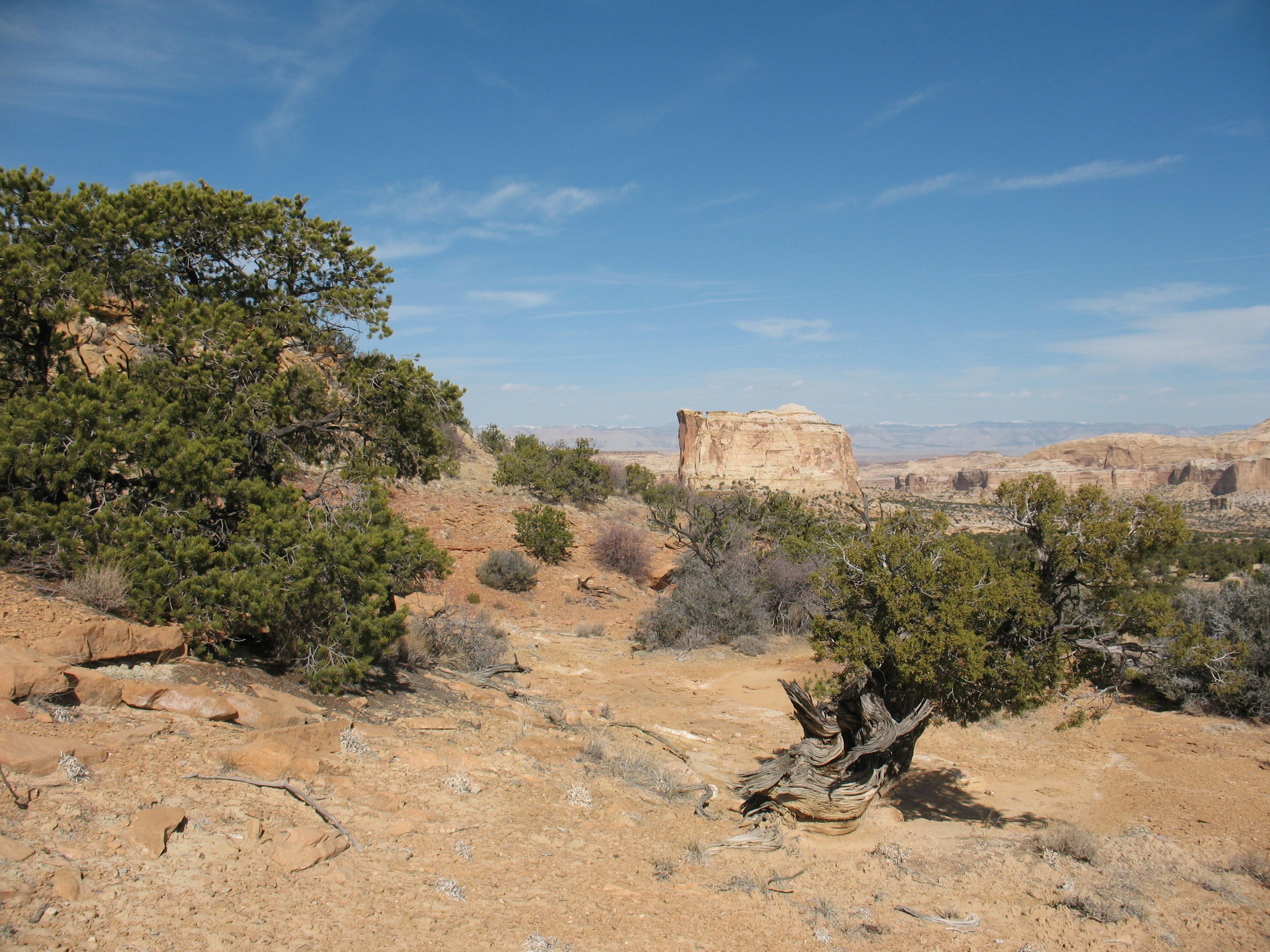
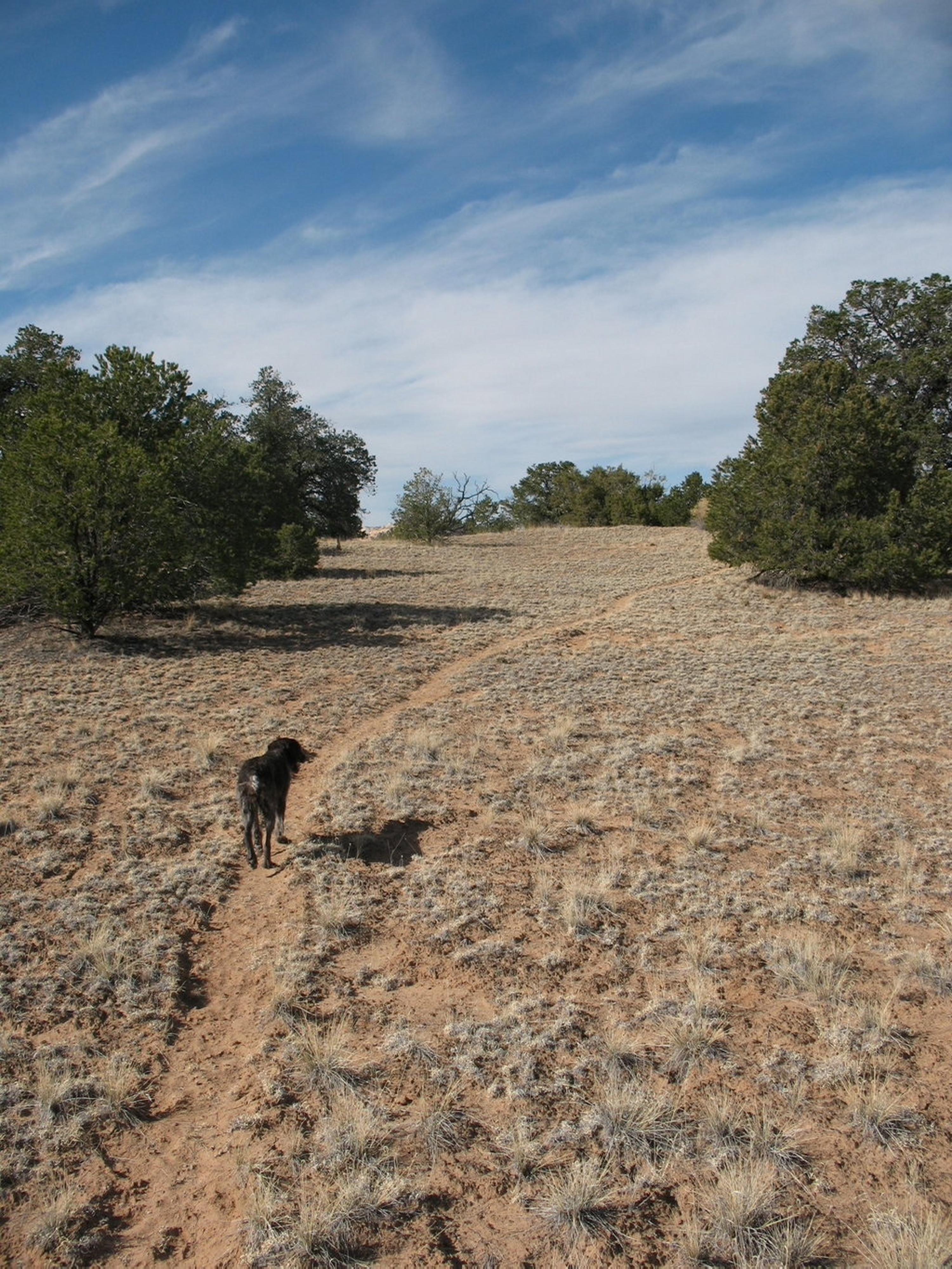
From the trailhead, follow the ATV/4x4 trail. About 5 minutes from the car, you will find an information kiosk with a map of the area, and information on the Devils Racetrack Trail. Chimney Rock Dome is the large dome a short distance away to your left. It is perched high above the south fork of Coal Wash, and provides a visible landmark you can see for most of the hike.

Continue along the trail (trail #641) about 45-60 minutes until you reach a fabulous overlook on your right into the north fork of Coal Wash. This is one of the most amazing views on the hike and makes a great short break. Just past the overlook (1 minute), there is a wooden fence on the left (west) blocking an old road. Go behind the fence, following the vague road. Although a bit vague at first, it becomes more defined as it winds its way out to an old drill hole site. Follow the road to its end at the drill hole. (90 minutes from the trailhead).

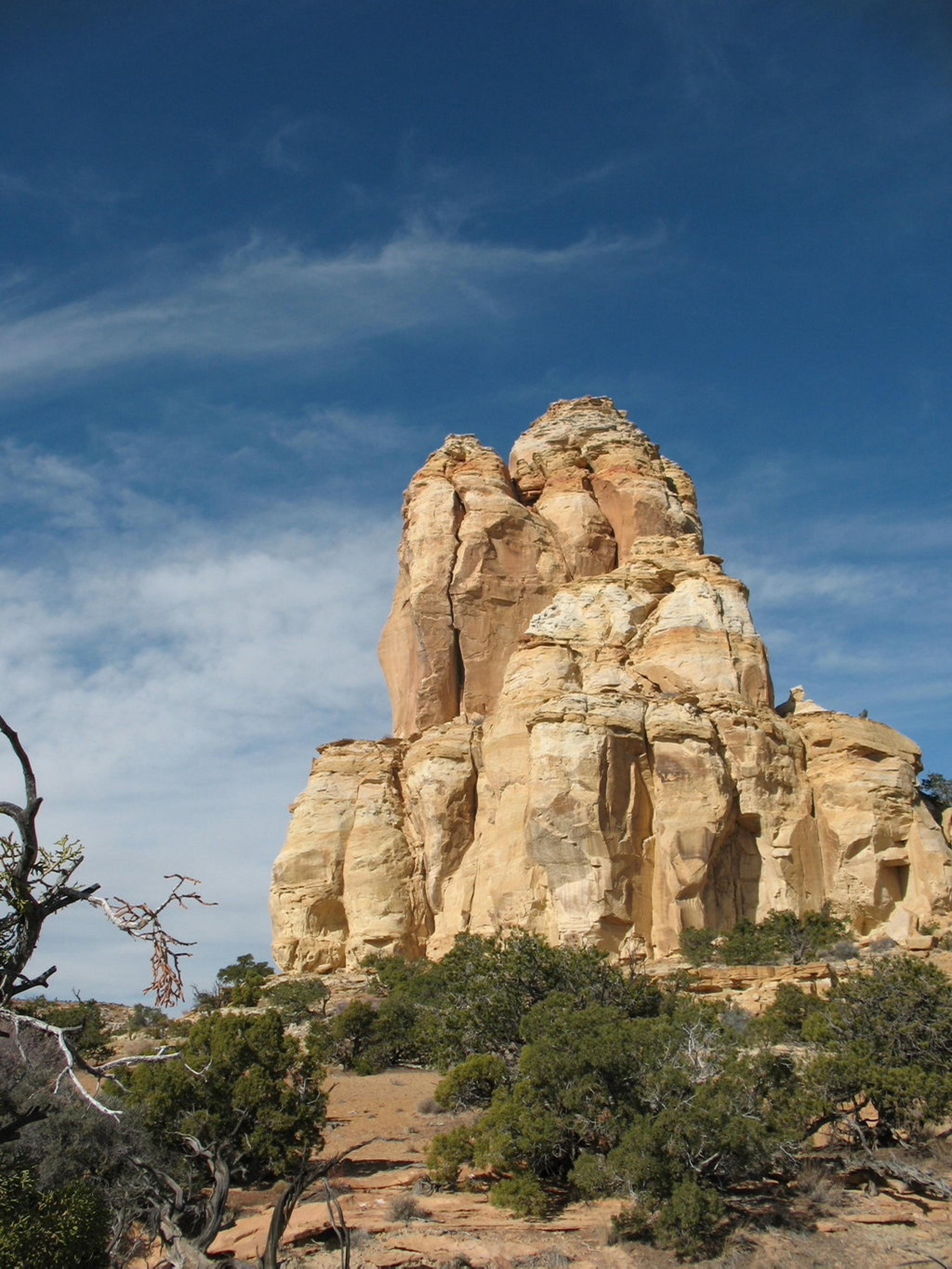
At the drill hole, The Blocks are easily visible a short distance away. Getting to them is very easy, simply hike cross country. Beware, though, finding the drill hole on the return is a little trickier because there are no obvious landmarks. Pay attention to your route out to The Blocks, so you can reverse it when done.

Once at The Blocks, it's a very easy area to wander around, visiting the various towers and domes. If time permits, you can also hike due south to the rim of the south fork of Coal Wash, which presents some great views. When finished return the way you came.


Maps

Route / 9.13 miles / Elevation Range 6,468 - 7,180 ft.
Printable Maps:

Trailhead

12S 517695E 4303349N

38°52'44"N 110°47'46"W

Overlook

12S 517304E 4305476N

38°53'53"N 110°48'02"W

Drill Hole

12S 515740E 4305722N

38°54'01"N 110°49'07"W

Comments

Want to make a comment? Login and let yourself be heard.