Black Dragon Wash |

San Rafael Swell

Roadside Attraction Black Dragon Wash - San Rafael Swell Roadside Attraction Black Dragon Wash

San Rafael Swell

Overview

RATING: Easy Walking
MAPS: Spotted Wolf Canyon, UT

Wed

Sunny, with a high near 70. West wind 5 to 10 mph.

70 | 36

Thu

Sunny, with a high near 71.

71 | 37

Fri

Mostly sunny, with a high near 71.

71 | 41

Sat

Mostly sunny, with a high near 70.

70 | 42

Sun

A chance of rain. Partly sunny, with a high near 60.

60 | 40

View Full Weather Details
SEASON: Any

Wed

Sunny, with a high near 70. West wind 5 to 10 mph.

70 | 36

Thu

Sunny, with a high near 71.

71 | 37

Fri

Mostly sunny, with a high near 71.

71 | 41

Sat

Mostly sunny, with a high near 70.

70 | 42

Sun

A chance of rain. Partly sunny, with a high near 60.

60 | 40

View Full Weather Details
Black Dragon Panel

Black Dragon Panel

Black Dragon wash has a great petroglyph and pictograph panel. It's proximity to I-70 make it a great roadside diversion when in the Green River area. If time permits, Petroglyph and Double Arch Canyons are nearby and worth the short side trip.

Amazing pictographs at Black Dragon Wash

Amazing pictographs at Black Dragon Wash

Getting There

Note: Reaching the panel requires a high clearance vehicle. There is no camping allowed near Black Dragon Panel, but several good spots along the way. If you do not have high clearance, it is an easy 1 mile round trip hike from the low clearance parking area.

The trailhead is just west of Green River Utah.

  • From Green River, head west (toward Salina) approximately 14 miles to mile marker 147. Here, a gated side road goes north (right) off of I-70. ( 12S 550549mE 4308636mN / N38° 55' 31" W110° 25' 01" )
  • From the gate (please close behind you), head north 0.1 miles, and turn left at the junction, crossing a wash. ( 12S 550540mE 4308809mN / N38° 55' 36" W110° 25' 01" )
  • Follow the main road here through several sandy spots for 1 mile to a signed junction. Go left, heading up Black Dragon Wash, and into the reef. If you have low clearance, park here at the left and walk. It is only 0.5 miles from here to the panel one way. ( 12S 550409mE 4309939mN / N38° 56' 13" W110° 25' 06" )
  • Note: 0.1 miles after starting up Black Dragon Wash, a side road on the left can be a good option. Depends on recent floods which path is easiest!
  • It is 0.5 miles from the signed Black Dragon turn to the panel (1.5 miles total from the highway). The last 0.2 miles was in bad shape (as of summer 2019), so we parked before the actual panel and walked the final short distance. ( 12S 549883mE 4310589mN / N38° 56' 34" W110° 25' 28" )
View from the panel.

View from the panel.

Route

Rock Art and Historic Site Etiquette
Rock art and historic sites are fragile, non-renewable cultural resources that, once damaged, can never be replaced. To ensure they are protected, please:
  • Avoid Touching the Petroglyphs: Look and observe, BUT DO NOT TOUCH!
  • Stay on the Trails: Stay on the most used trails when visiting sites, and don't create new trails or trample vegetation.
  • Photography and Sketching is Allowed: Do not introduce any foreign substance to enhance the carved and pecked images for photographic or drawing purposes. Altering, defacing, or damaging the petroglyphs is against the law -- even if the damage is unintentional.
  • Pets: Keep pets on a leash and clean up after them.
  • Artifacts: If you happen to come across sherds (broken pottery) or lithics (flakes of stone tools), leave them where you see them. Once they are moved or removed, a piece of the past is forever lost.
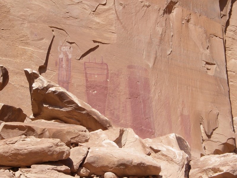
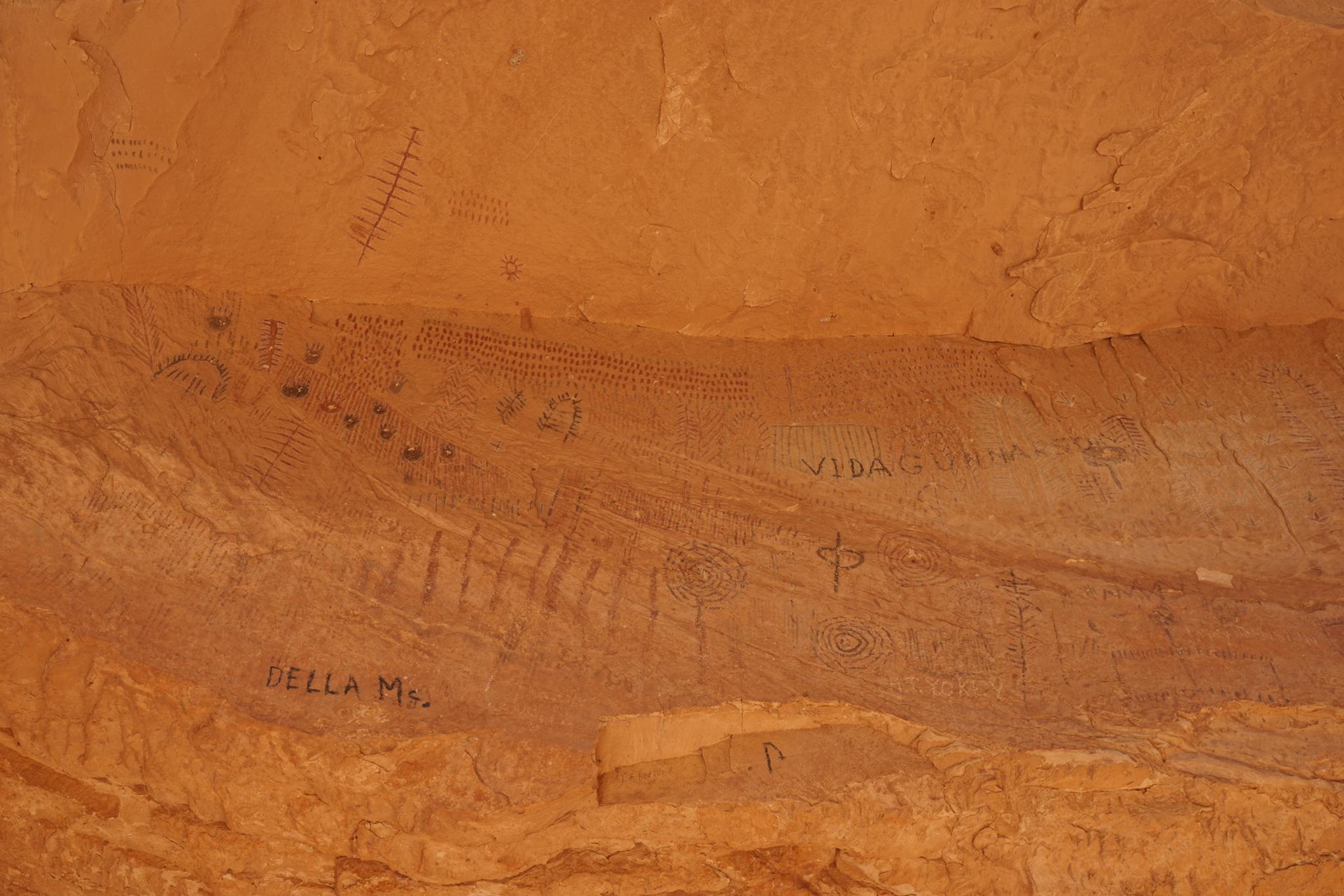
Pictographs
The panel is marked as a fenced area. Black Dragon, the namesake of the area, is on the left while other panels are to the right of it. All of the panels are amazing.
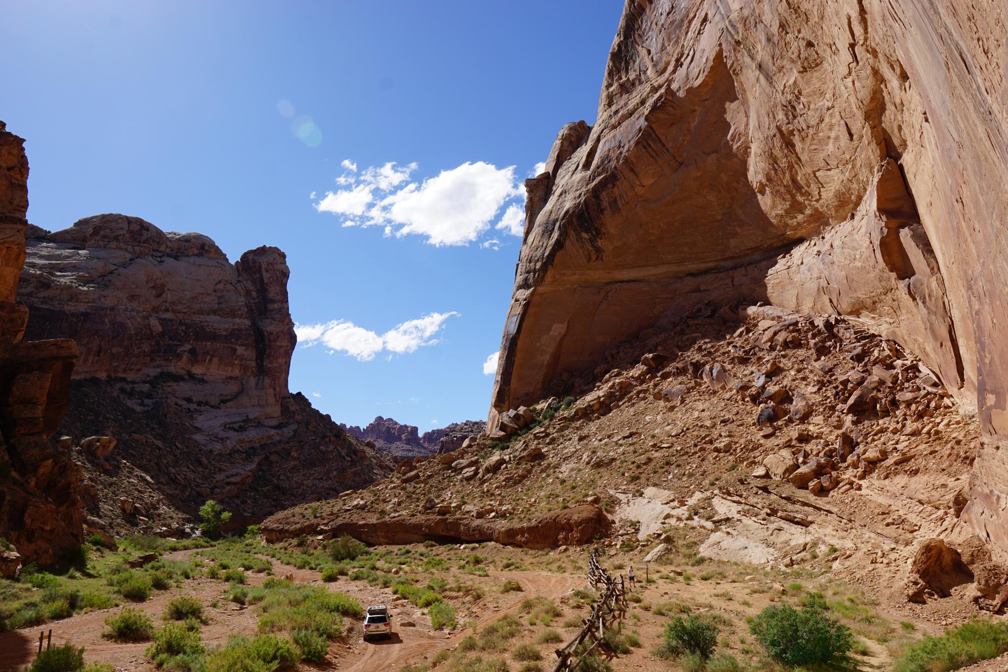
Black Dragon Cave
While visiting the panels, be sure to visit the Black Dragon Cave as well! From the pictograph panels, follow social trails west up the boulder and rubble pile. Near the top of the boulder pile, the trails coalesce near the cliff base. At the cliff base, there are several routes down into an alcove below that has been closed off by the rubble pile. The alcove is immense, with a steep sandy slope and trail going into its depths. A headlamp is useful, though if you visit on a sunny day and spend a few minutes in the cave, your eyes adjust pretty well. A must do side trip for kids!


Videos

A visit to the Black Dragon! ryancornia

Maps

Printable Maps:
Black Dragon Panel

12S 549780mE 4310626mN

N38° 56' 35" W110° 25' 32"

Comments

Want to make a comment? Login and let yourself be heard.