 Canyoneering
Crumbling Canyon
Canyoneering
Crumbling Canyon
Spanish Fork Canyon
Overview
Crumbling Canyon is a canyon that truly lives up to its name! The canyon, cutting a steep path down through conglomerate rock, is more of a steep gully than a canyon. This is an outing I wanted to love. It has a lot going for it on paper, a short approach, a short canyon section, and only a few relatively short rappels. It seemed the perfect family outing!
Well, it turned out more crumbly and more arduous than perhaps it looked on paper. The approach is short, but steep! Once up, the descent down into the canyon is steep AND loose, requiring a fair bit of care to navigate safely. We took our 5-year-old through the canyon, and it was definitely one of the least favorite ones she has done and least favorite of mine that I have taken her through. I would recommend this canyon for intermediates or better. The canyon itself is straightforward with easy rappels, but the route finding down loose slopes to get to the canyon bottom is likely to cause beginners a fair bit of stress. With good route finding the approach is very do-able without a rope, but good route finding will be needed.
Getting There
The trailhead is off of highway 6 at mile post 190.9. This is about 18 miles from Spanish Fork as you head up highway 6 toward Price.
At about mile post 190.9, there is a small dirt road on the north side of the highway with a gate. It goes up into an area with several visible congolemerate towers and cliffs. Turn off highway 6 onto this dirt road and follow it to its end in 0.4 miles. Please close the gate after passing through it. The road is rough in spots, high clearance likely required, but it is short enough to easily be walked if needed. The end of the road has space for a couple of vehicles to park and a fire ring. The road beyond is no longer travelled and quickly deteriorates.
Route Description
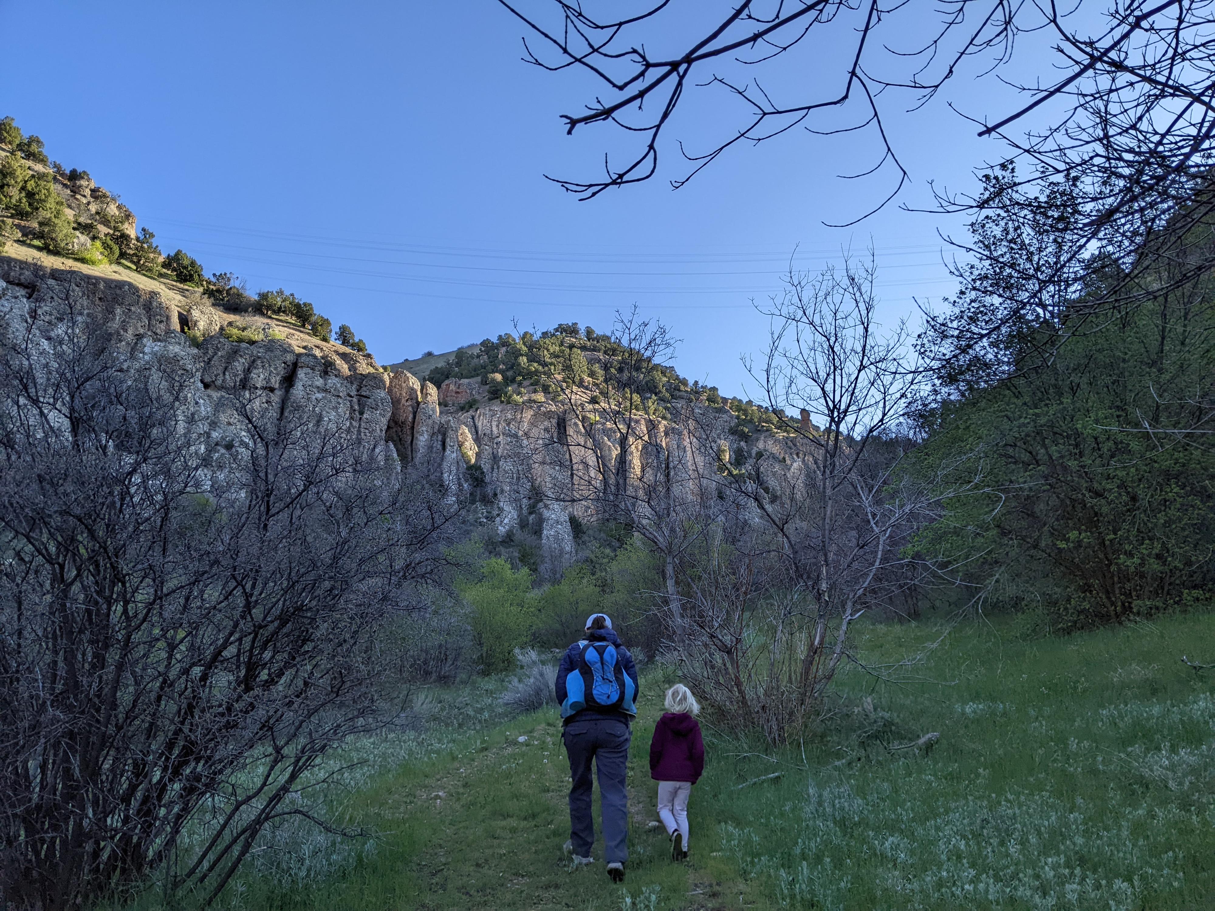
Approach
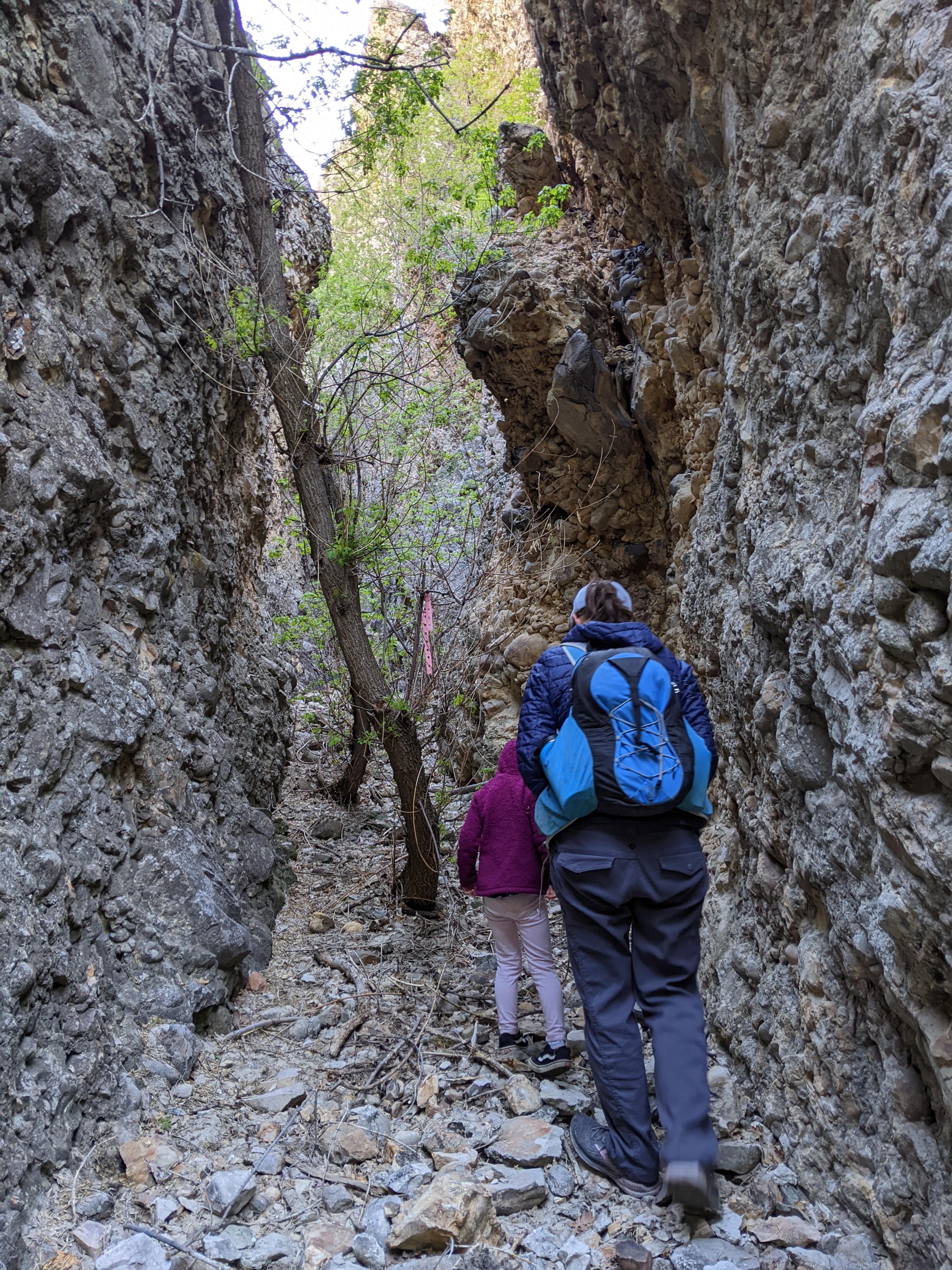
From the parking spot, walk up the old road. As the road ends, a social trail leaves on the left and heads to the canyon bottom. Follow the social trail up canyon along the canyon floor. At the first major canyon coming in on the left, the trail splits. Go left, up the side canyon. A minute up the side canyon, a social trail leaves on the right up a steep slope. This is NOT the route. Go left up the bottom of the canyon instead. Follow the canyon up as it steeply ascends.
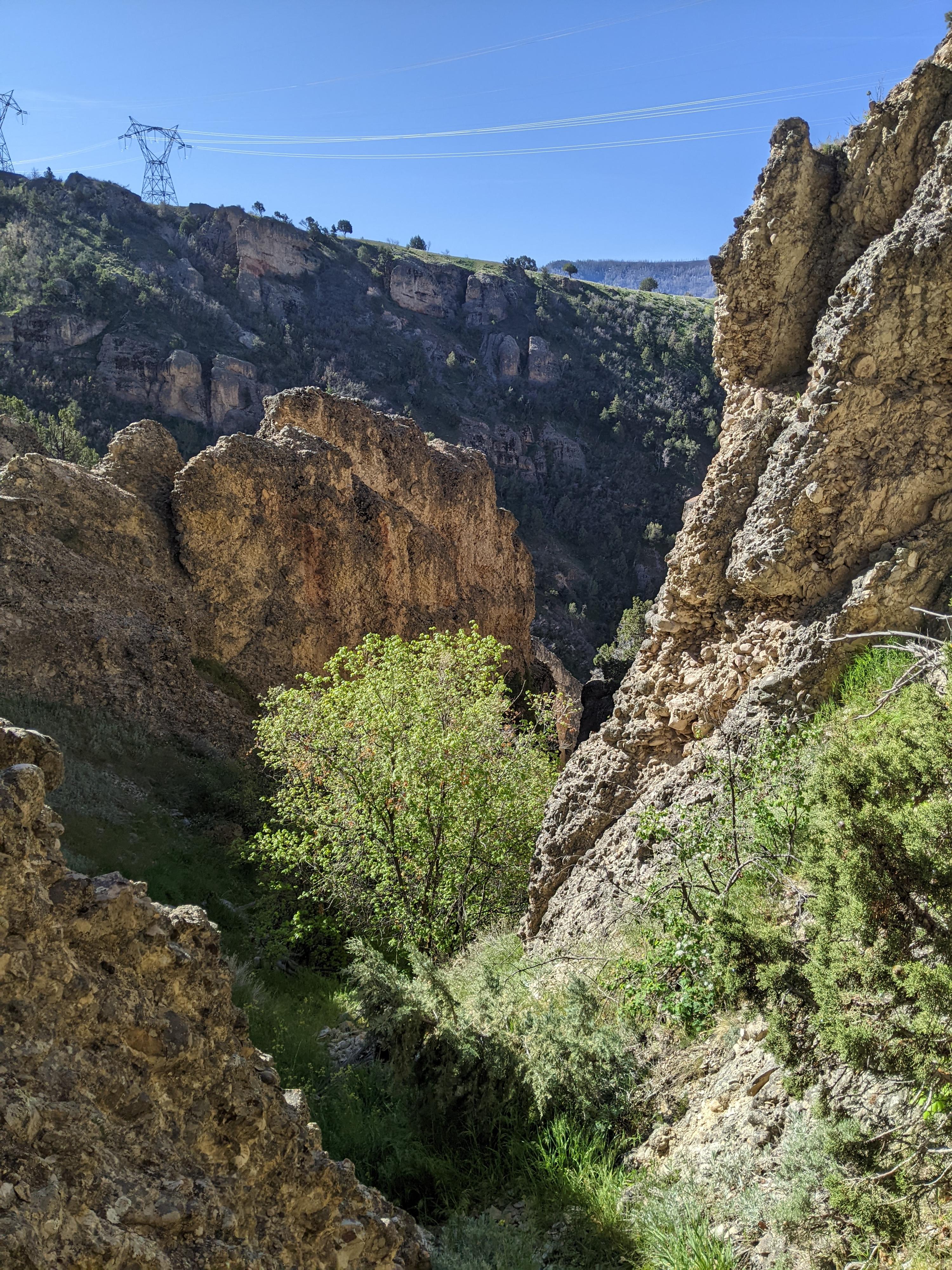
A junction is reached with a corridor/canyon on the right that has a boulder visible at the end. Stay left here, instead of going up the right fork. From this point, the social trail seemed to become less defined. Stay mostly straight/left at junctions, working up to more open slopes. Once on open slopes, head to the ridge, trending right. There are lots of options. The ridge looks directly down into Crumbling Canyon. Walk down the ridge, looking for a reasonable place to travel east down into Crumbling Canyon.
Canyon
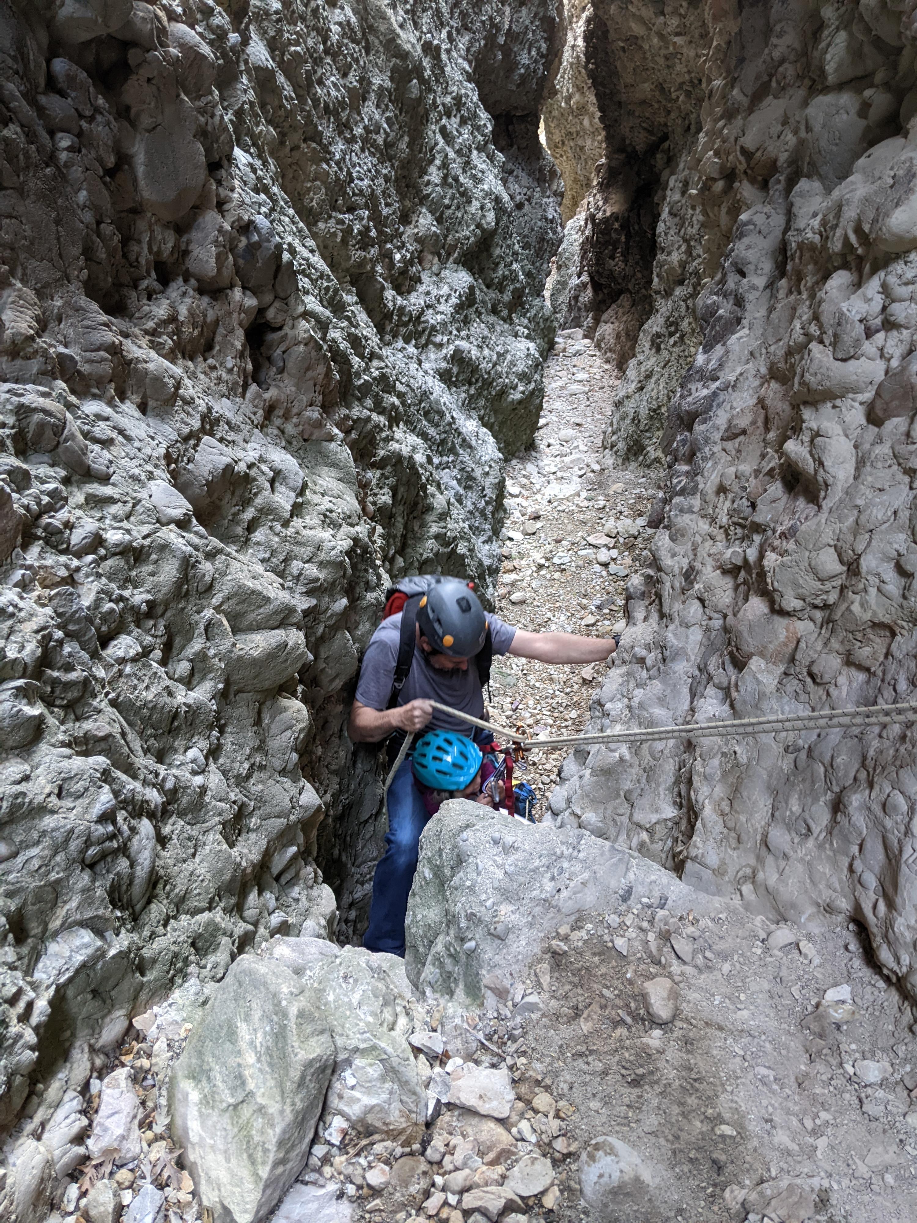
From the top of the ridge, the route finding challenge begins! Our path was to work down a very short distance (20-30 vertical feet), then cut left and over to a steep gully that drops straight down. This is steep and loose. Beginners will probably want a rope. Everyone needs to be cautious of loose rock.
To ease descent, we rappelled about 30 m ( 99 ft. ) to just past a steep rock band where there was an overhang on the right (looking downhill). The overhang provided a safe space to wait for others to climb down to this point.
From here, we did a second 60 m ( 197 ft. ) rappel down to where the gully splits, continuing down the left side (looking downhill) at the split on an emerging social trail. With a 60 m ( 197 ft. ) rope, we ended right in the canyon bottom. This second rappel is easier to down climb than the first. It is best if the last man down can clean the rope and down climb for both drops. If pulling the rope, be very cautious of rock fall as the rope comes down.
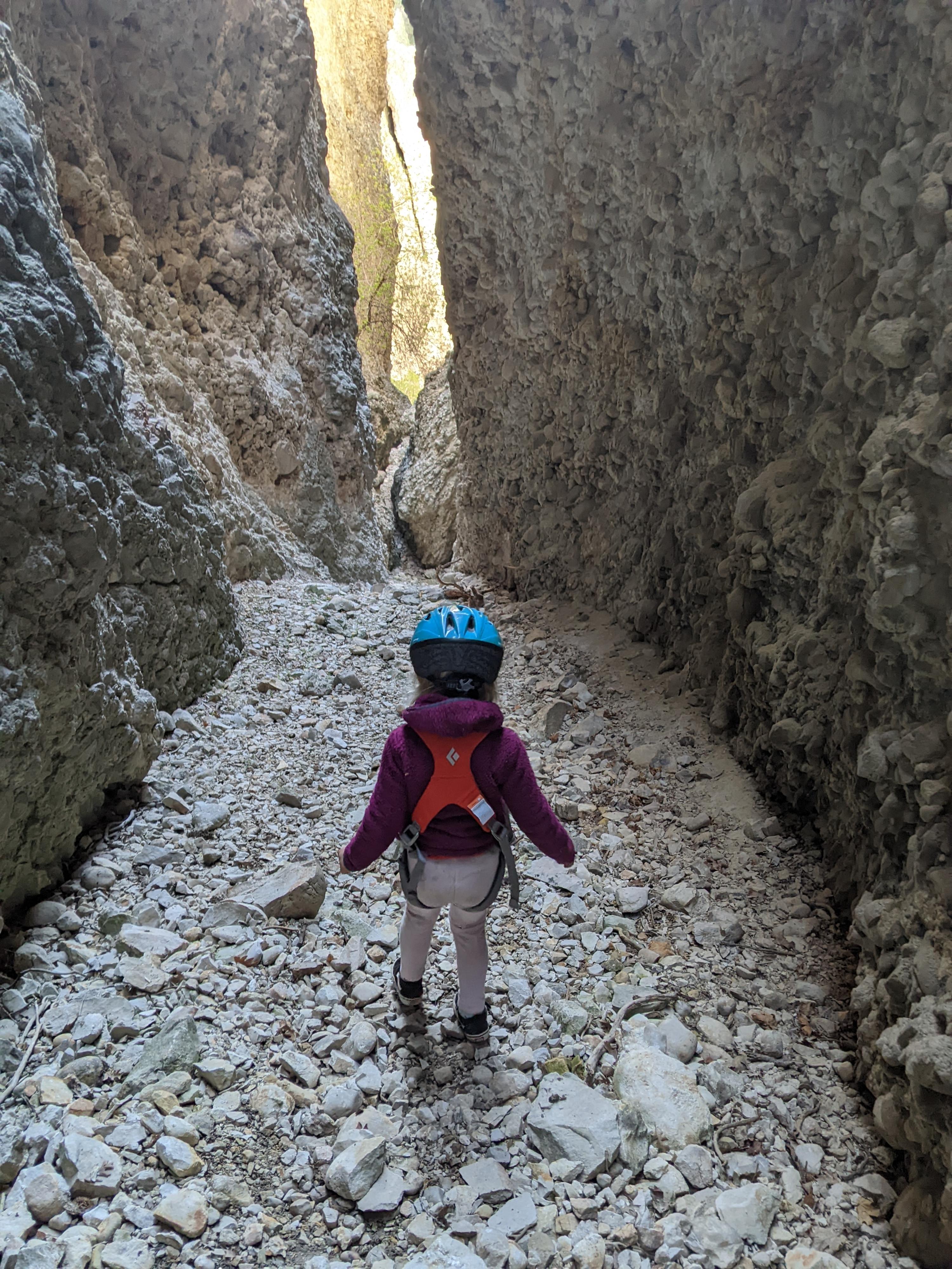
Once in the canyon bottom, head down canyon. It is steep and loose, but easier than the approach hillside. It is just a couple of minutes to the first rappel where the canyon narrows and deepens considerably.
R1 - 8 m ( 27 ft. ) - A tree can be used as an anchor for this rappel, but as of 2022, there were two good bolts on the left that made for an easier rappel and better pull.
A 2 m ( 7 ft. ) down climb just below R1 leads quickly to R2.
R2 - 3 m ( 10 ft. ) - Currently, a single bolt on the right protects this short rappel.
From the bottom of rappel 2, the canyon continues dropping and is quite dramatic. A couple of short down climbs in this section lead to a narrow short slot between boulders.
Just past the squeeze, the floor drops out at the final rappel. There is a hole in the floor, and a couple of bolts past this hole in the floor.
R3 - 15 m ( 50 ft. ) - The hole in the floor can be rappelled, though is tight and awkward. This drop is a bit under 15 m ( 50 ft. ). Alternatively, recommended for most, is to climb over the hole and rappel at the last anchors where the canyon opens. This drop is about 15 m ( 50 ft. ).
Once down the final rappel, head down the canyon on the social trail. It reaches the main canyon and goes right down to the approach trail which is followed back to the trailhead.
Photos
Videos

Crumbling Canyon at Night - Summer 2023
Maps

12T 465287E 4428043N
40°00'07"N 111°24'24"W
12T 465390E 4428222N
40°00'13"N 111°24'20"W
12T 465341E 4428336N
40°00'16"N 111°24'22"W
12T 465480E 4428529N
40°00'23"N 111°24'16"W
12T 465551E 4428544N
40°00'23"N 111°24'13"W
12T 465557E 4428513N
40°00'22"N 111°24'13"W
12T 465576E 4428437N
40°00'20"N 111°24'12"W