 Hiking
Parrish Creek
Hiking
Parrish Creek
Centerville
Overview
One of the great things about living along the Wasatch Front is the large number of amazing hikes and things to see just minutes away in the foothills. Parrish Creek, east of Centerville, is a short jaunt from civilization but feels a world away in both space and time.
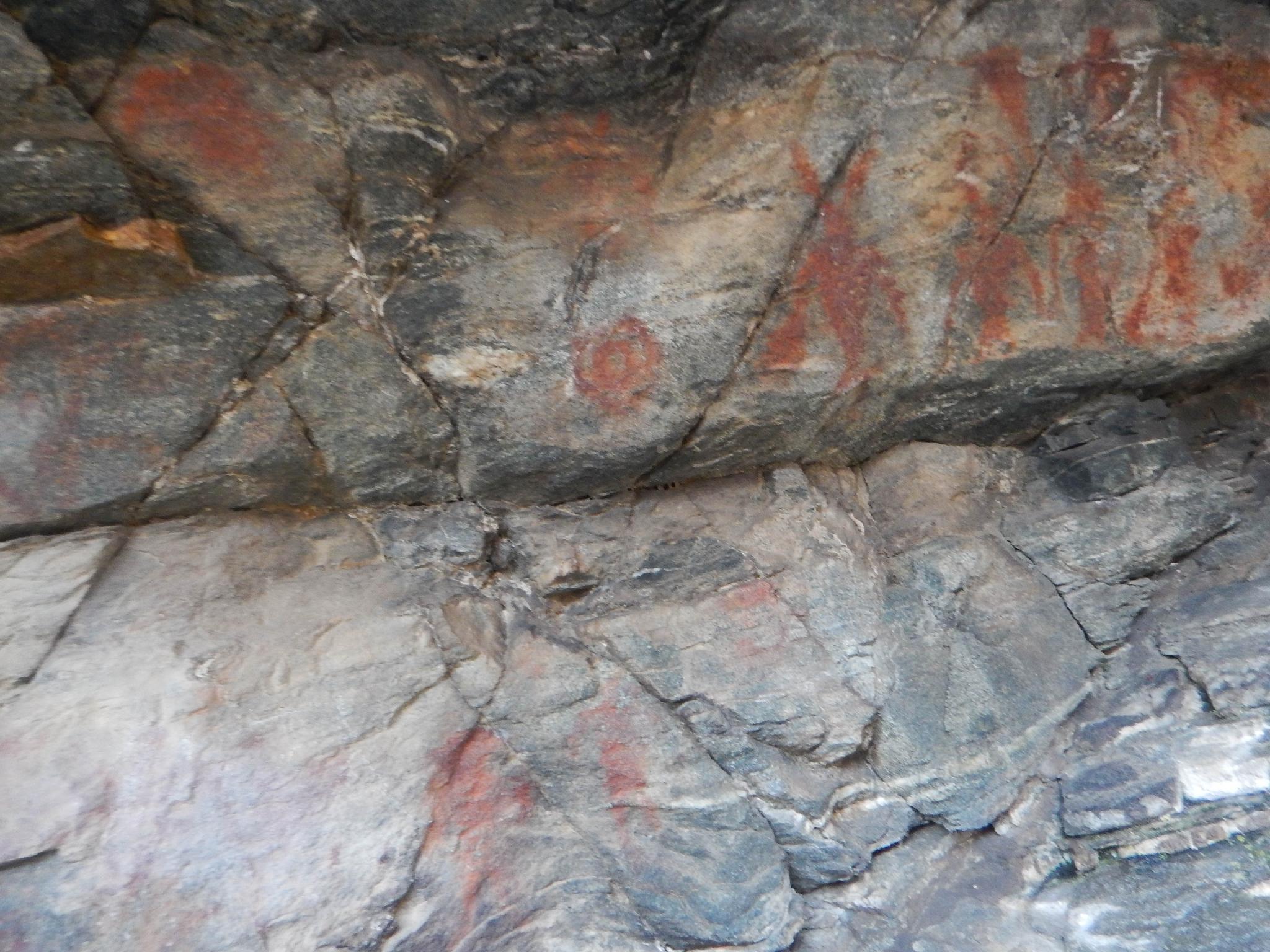
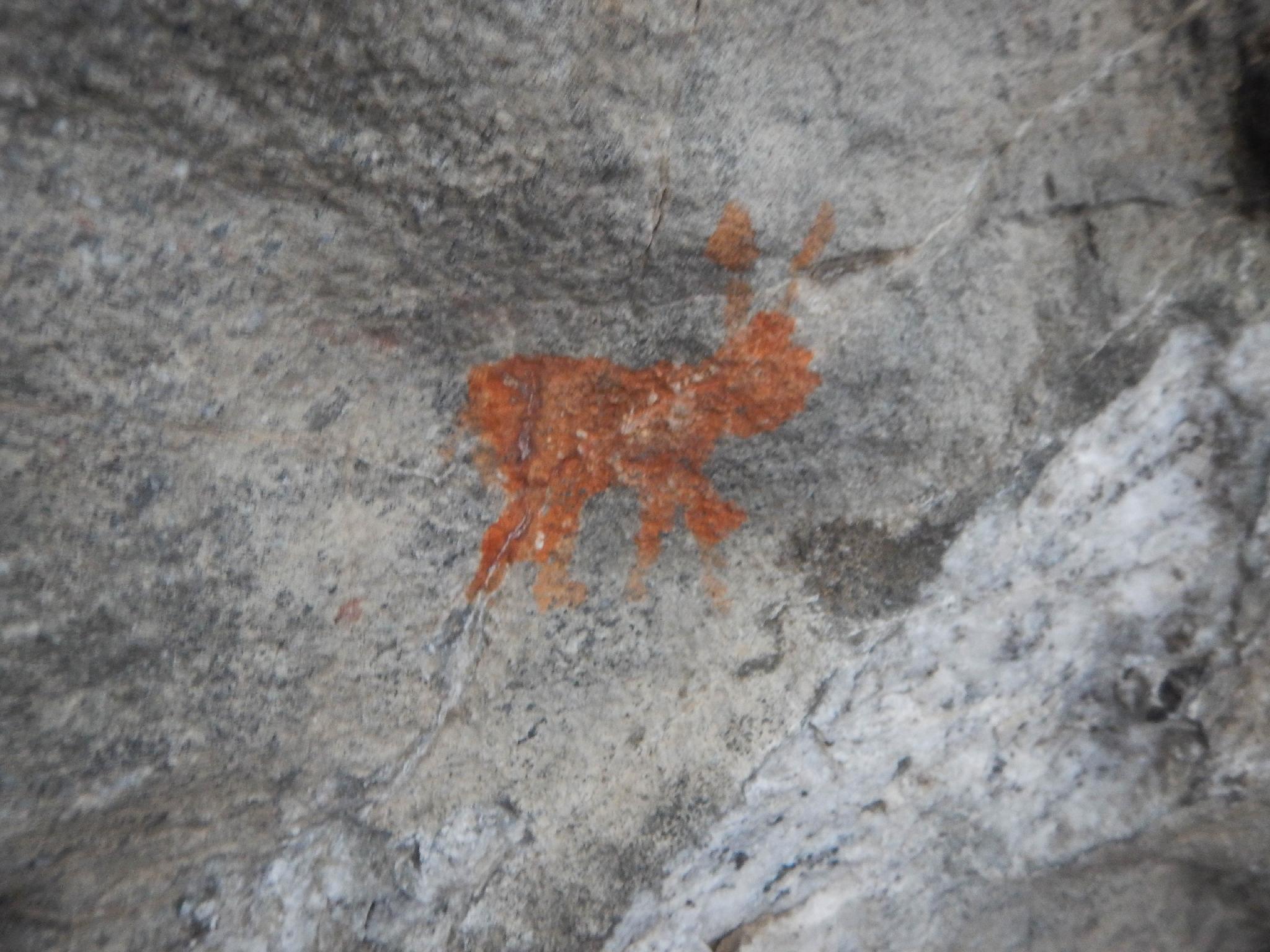
This is a short family friendly hike that visits a pictograph. The small pictograph panel is not spectacular by pictograph standards but is unique in that there aren't many to be found along the Wasatch Front. Those lacking motivation can return the same way in a short hour or so outing.
Looking for a bit longer outing? The Parrish Sunset Trail makes a great addition and makes for a nice 2-3 hour outing that is still fun for the whole family.
Getting There
The trailhead is in Centerville. From SLC, go north on I-15 about 10 miles to exit 319 (400 N / Parrish Ln). Go east off the highway toward the foothills on 400 north. After 1.2 miles, 400 north ends at a T-junction. Go left a short distance up to the parking area and trailhead.
Route Description
Rock art and historic sites are fragile, non-renewable cultural resources that, once damaged, can never be replaced. To ensure they are protected, please:
- Avoid Touching the Petroglyphs: Look and observe, BUT DO NOT TOUCH!
- Stay on the Trails: Stay on the most used trails when visiting sites, and don't create new trails or trample vegetation.
- Photography and Sketching is Allowed: Do not introduce any foreign substance to enhance the carved and pecked images for photographic or drawing purposes. Altering, defacing, or damaging the petroglyphs is against the law -- even if the damage is unintentional.
- Pets: Keep pets on a leash and clean up after them.
- Artifacts: If you happen to come across sherds (broken pottery) or lithics (flakes of stone tools), leave them where you see them. Once they are moved or removed, a piece of the past is forever lost.
From the parking area, take the narrow single track trail that climbs up the hillside. In just a few minutes, the trail comes to a 4-way junction with the Bonneville Shoreline Trail. Go left on the wider Shoreline Trail as it meanders around the hillside and descends to a footbridge.
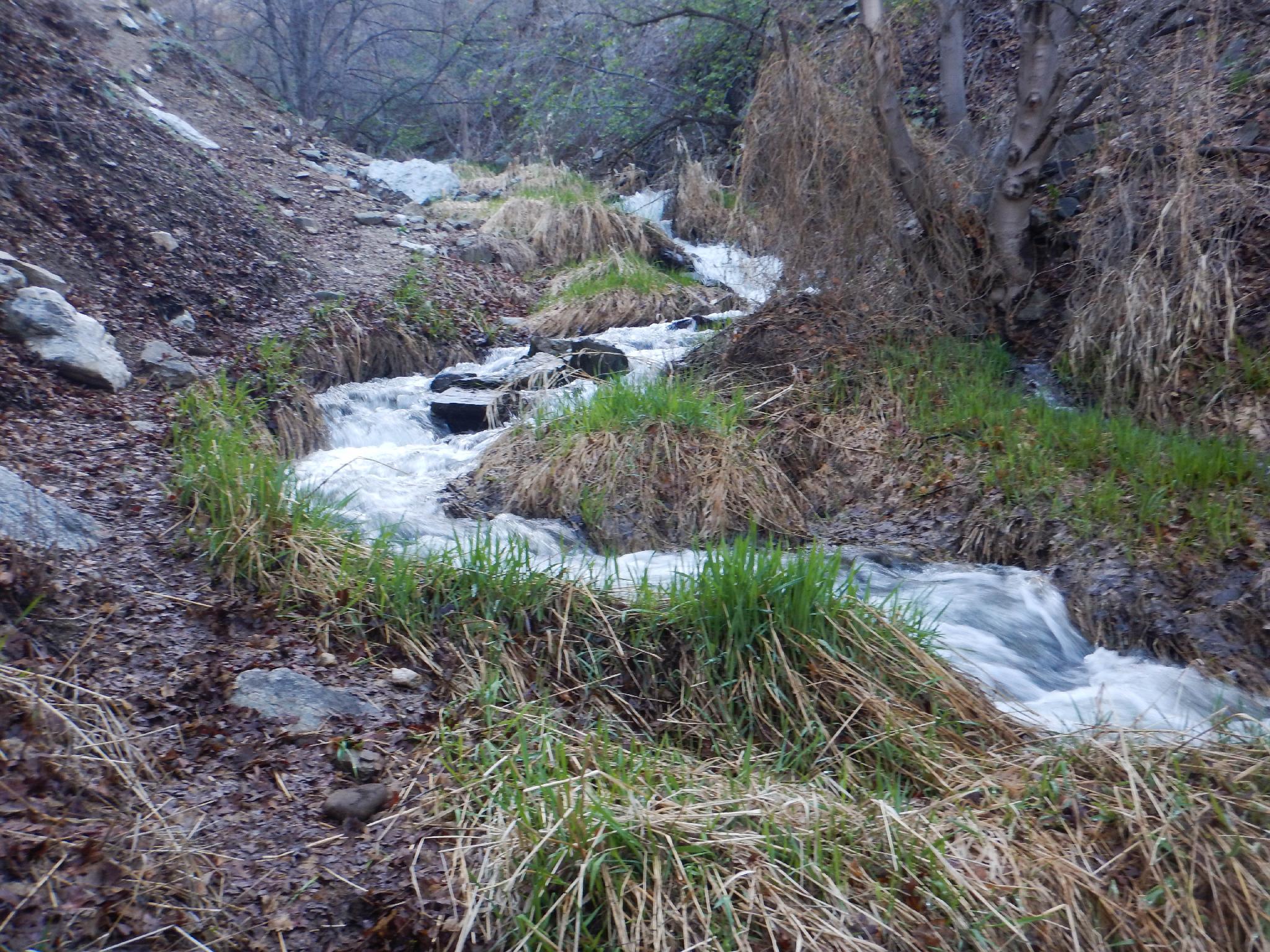
On the north side of the footbridge, leave the Shoreline Trail and follow the social trail that meanders up along the stream. The panel is under the obvious rock overhang 10-15 minutes up from the bridge. Continuing up along the stream becomes tough going and is not particularly recommended.
Return the same way.
Parrish Sunset Bonus:
If motivated, the Parrish Sunset addition adds some great views and a bit more cardio to the hike. Once back to the foot bridge, instead of returning the way you came, go right on the shoreline trail.
As the trail bends north out of Parrish Creek, a signed side trail leaves on the right. This is before the wooden informational board.
Follow the side trail as it works its way up the hillside. There are quite a few social trails here, stay on the most traveled. The trail eventually levels out and descends slightly to a large boulder near Parrish Creek. This is the usual turn around point, though a less used social trail does continue up along the creek. Views along the way of the Great Salt Lake, Antelope Island, and the Wasatch Front are excellent.
Maps

12T 427053E 4530528N
40°55'21"N 111°51'59"W
12T 427189E 4530490N
40°55'20"N 111°51'53"W
12T 427293E 4530664N
40°55'26"N 111°51'49"W
12T 427483E 4530691N
40°55'27"N 111°51'41"W
12T 427182E 4530658N
40°55'26"N 111°51'53"W
12T 427987E 4530735N
40°55'28"N 111°51'19"W