Tule Valley Hardpan |

West Desert

Roadside Attraction Tule Valley Hardpan - West Desert Roadside Attraction Tule Valley Hardpan

West Desert

Overview

RATING: Roadside Attraction
LENGTH: 1+ hours
MAPS: BURNOUT CANYON, UT; THE BARN, UT

Thu

A chance of showers and thunderstorms after noon. Mostly sunny. High near 69, with temperatures falling to around 65 in the afternoon. West southwest wind 7 to 14 mph. Chance of precipitation is 30%.

69 | 46

Fri

Rain and a chance of thunderstorms. Cloudy, with a high near 58. West northwest wind around 10 mph. Chance of precipitation is 90%.

58 | 45

Sat

A chance of rain showers. Partly sunny, with a high near 58. Chance of precipitation is 30%.

58 | 40

Sun

Mostly sunny, with a high near 65.

65 | 39

Mon

Sunny, with a high near 75.

75 | 44

View Full Weather Details
SEASON: Spring, Fall. Summers are hot. Winters can be lovely if there is no/little snow, but can be cold and muddy after snow.
WATER: None

Thu

A chance of showers and thunderstorms after noon. Mostly sunny. High near 69, with temperatures falling to around 65 in the afternoon. West southwest wind 7 to 14 mph. Chance of precipitation is 30%.

69 | 46

Fri

Rain and a chance of thunderstorms. Cloudy, with a high near 58. West northwest wind around 10 mph. Chance of precipitation is 90%.

58 | 45

Sat

A chance of rain showers. Partly sunny, with a high near 58. Chance of precipitation is 30%.

58 | 40

Sun

Mostly sunny, with a high near 65.

65 | 39

Mon

Sunny, with a high near 75.

75 | 44

View Full Weather Details
Ruby and Abby enjoying the evening light on the hardpan.

Ruby and Abby enjoying the evening light on the hardpan.

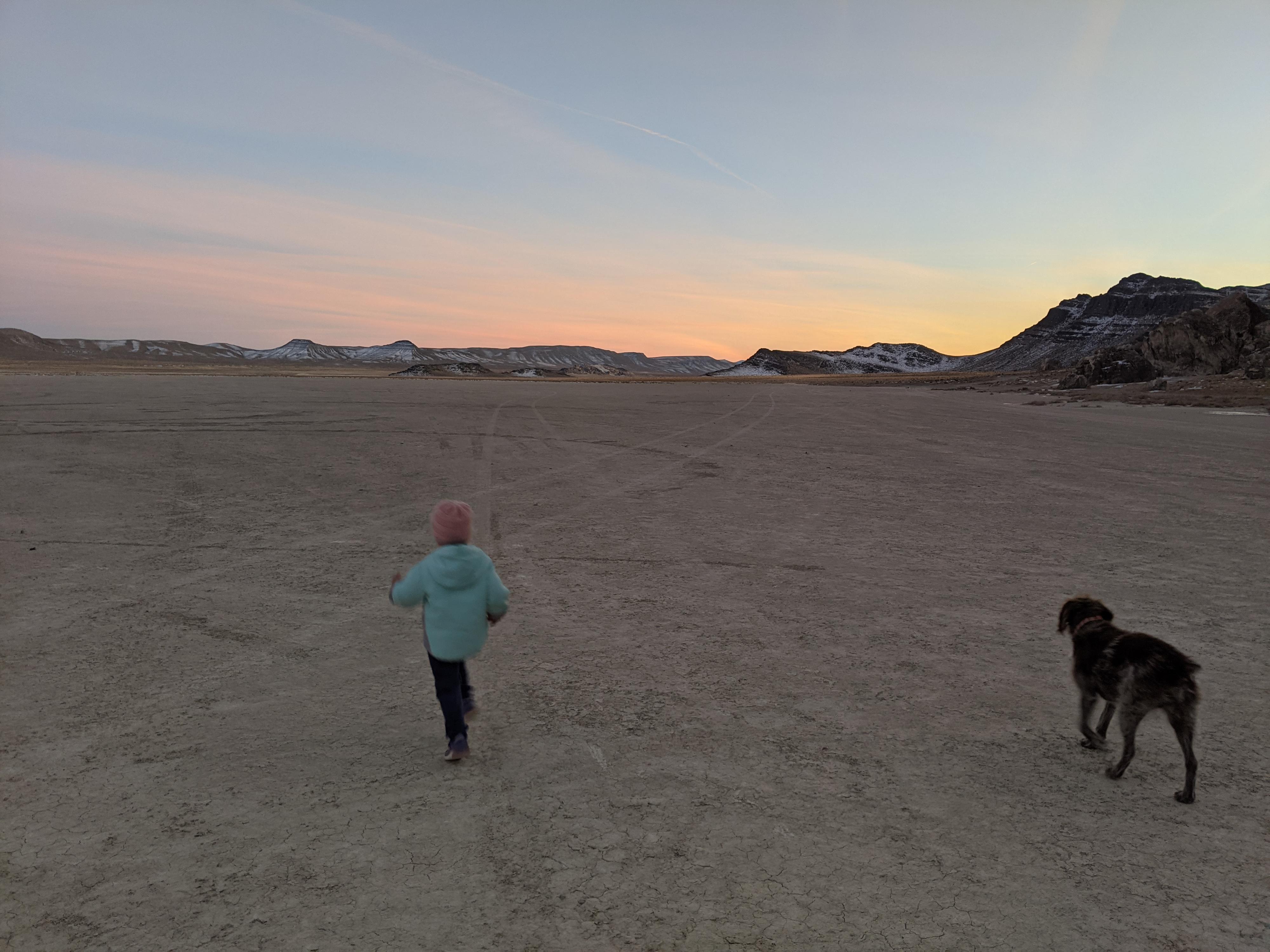
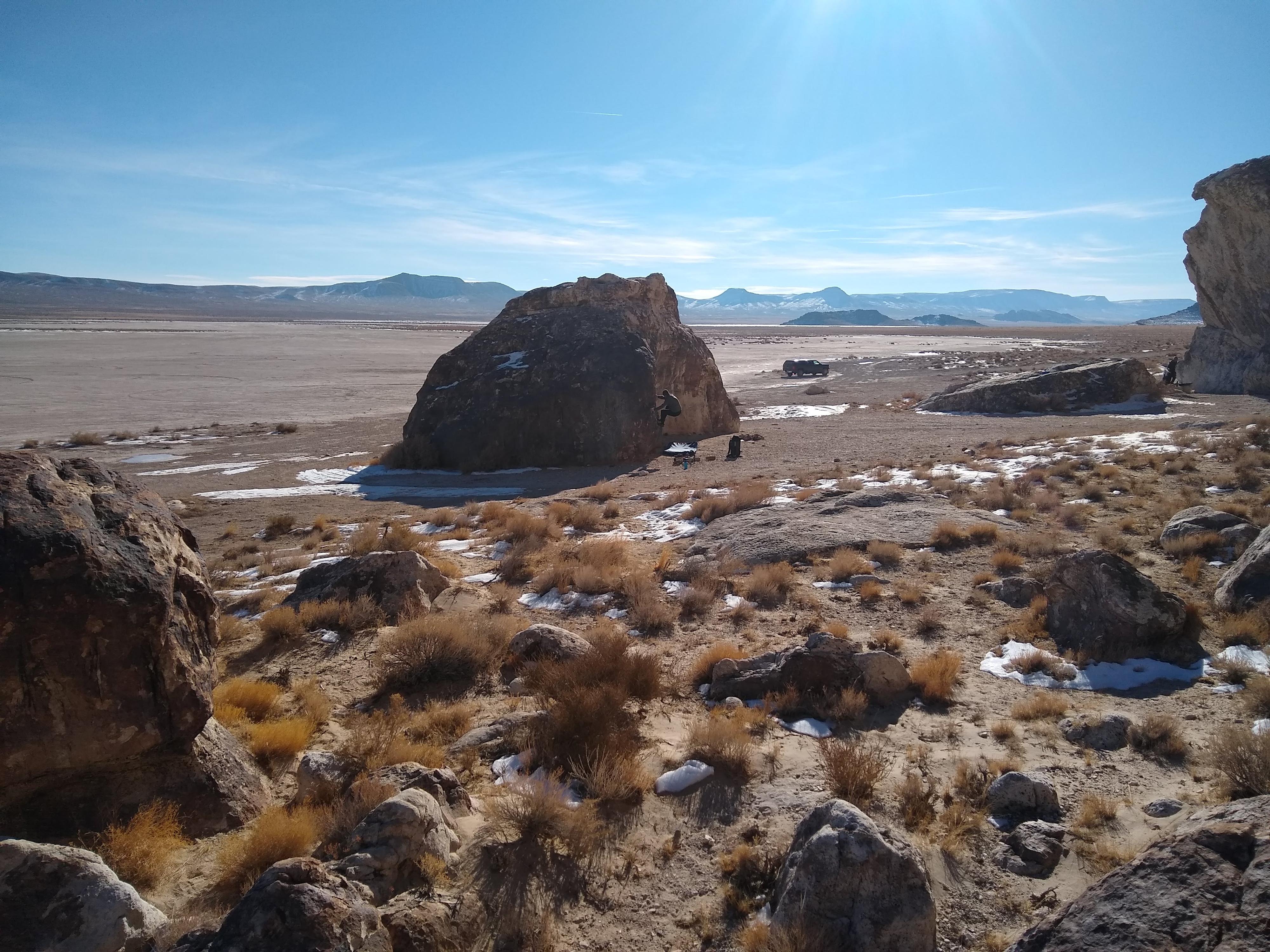
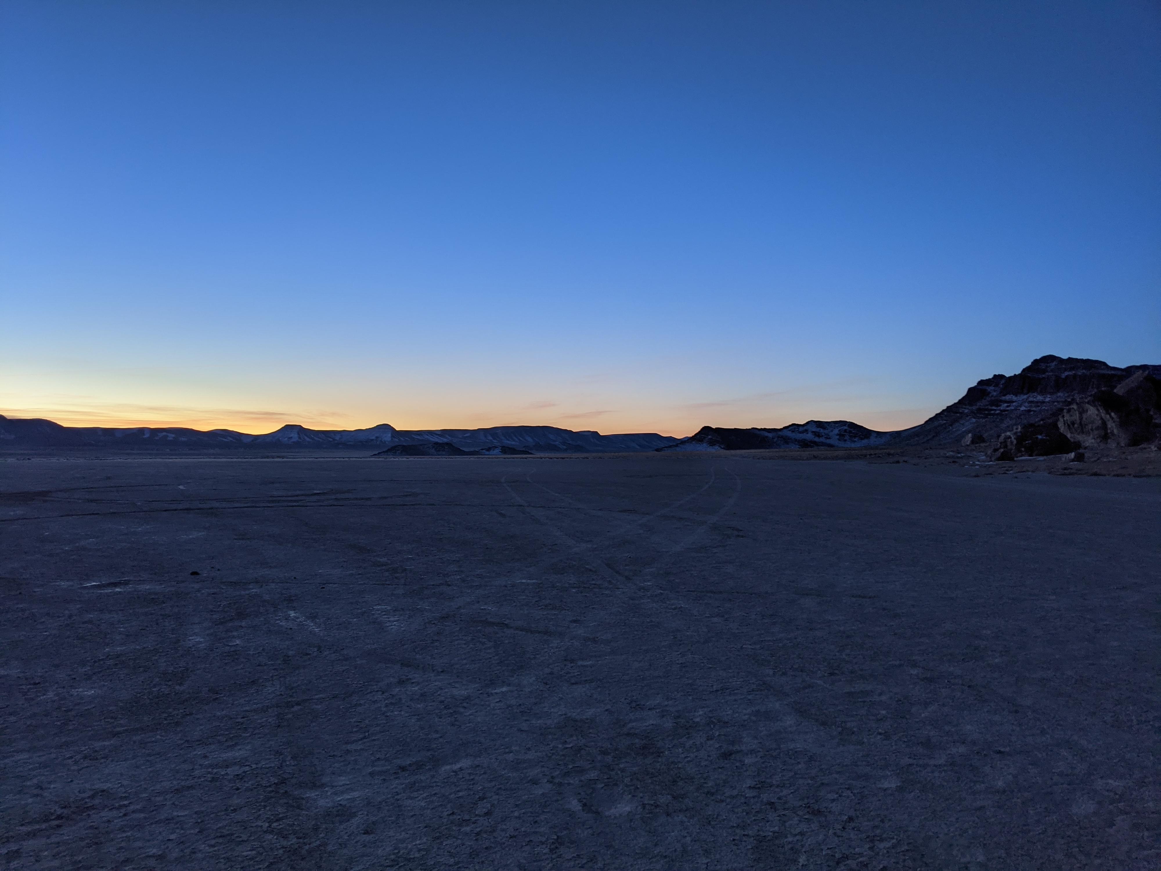
The Tule Valley Hardpan is a fun place to visit. The large flat hardpan is popular with backcountry pilots, while the cliffs and boulders on the west side of the hardpan, known as the Ibex Crags, is very popular with climbers. The contrast between the flat hardpan and the jagged cliffs and boulders is striking. We visited to do some climbing but enjoyed the views and camping on the hardpan as much or more than the climbing. If you visit, especially with children, a kite is recommended! This is a perfect place to spend a lazy spring or fall day taking in the views, flying a kite, or testing your bicycling speed on the hardpan.

Camping Note: The area has excellent primitive camping but be forewarned. If the hardpan is at all damp or wet, DO NOT DRIVE ON IT! Best case you will make a rutted mess out of it, but more likely, you will become hopelessly stuck in the mud. Because the area is seeing increased use, be mindful to clean up any litter you find, and please do not create additional fire rings. Pack it in, pack it out!
Naming Note: Tule (Schoenopletus acutus) is a tall (3 m / 9 ft) grass like plant. The plant is common in Utah’s West Desert near marshes and other wetlands. Tule was an important part of daily life of Native Americans. The roots have been used for food, and other parts of the plant for shelter, sandals, etc... Tule Valley is named because of an abundance of the Tule plant in the area north of hardpan across the highway.
Bouldering at Ibex.

Bouldering at Ibex.

Getting There

The hardpan is about 50 miles west of Delta on US-6. Leave Delta heading west on US-6 to mile post 39.25 where a major dirt road leaves on the south side of US-6.

  • MP 39.25 - Reset your odometer as you turn off US-6. ( 12S 295462mE 4322006mN / N39° 01' 24" W113° 21' 46" )
  • 0.9 miles - Major Junction. Go left. (south) ( 12S 294457mE 4320915mN / N39° 00' 47" W113° 22' 26" )
  • 2.0 miles - Side road on the right. This heads directly across the hardpan to the cliffs. The road has a few rough spots that can generally be avoided if needed. If wet, do NOT drive on this road. ( 12S 294835mE 4319209mN / N38° 59' 52" W113° 22' 09" )
  • 3.1 miles - Ibex cliffs. A dirt road goes both north and south along the hardpan. There are many good primitive campsites in this area. ( 12S 293198mE 4318643mN / N38° 59' 33" W113° 23' 16" )
Evening on the hardpan.

Evening on the hardpan.

Route

The driving directions give end at the Ibex Crags. There are many good campsites along here, as well as a dirt road the goes north and south along the cliffs. South provides access to the largest area of the hardpan. There is a rocky island jutting out in the middle of the hardpan that is a fun short hike to visit. There is often a flag on its summit.

The main dirt road on the east side of the hardpan is easily passable by most vehicles but doesn’t have, in my opinion, as good of access to primitive camping.


Maps

Printable Maps:
Island

12S 294378mE 4316525mN

N38° 58' 25" W113° 22' 25"

Ibex Boulders/Cliffs

12S 293167mE 4318655mN

N38° 59' 33" W113° 23' 17"

Comments

Want to make a comment? Login and let yourself be heard.