
 Petroglyph Canyon
Zion
Overview
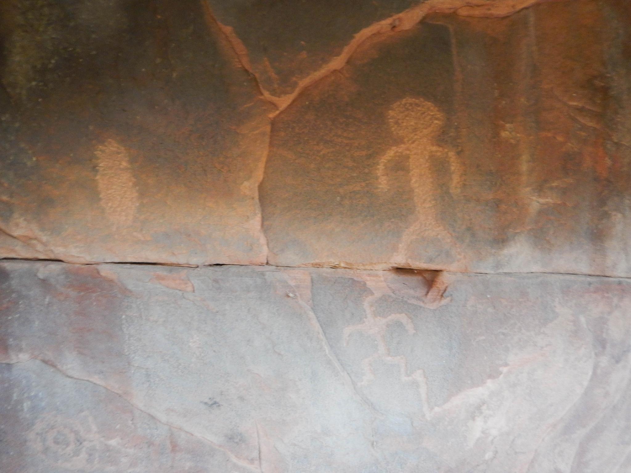
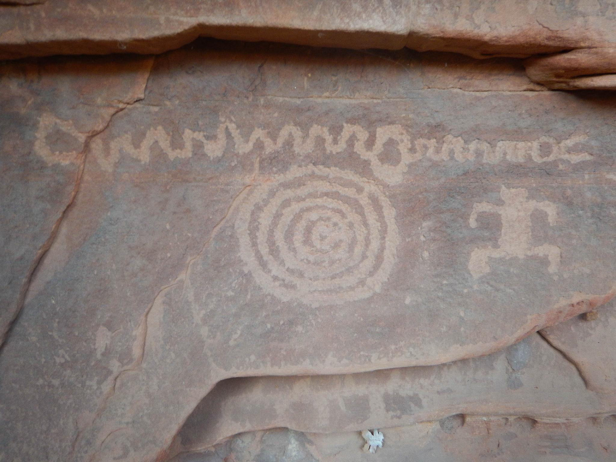
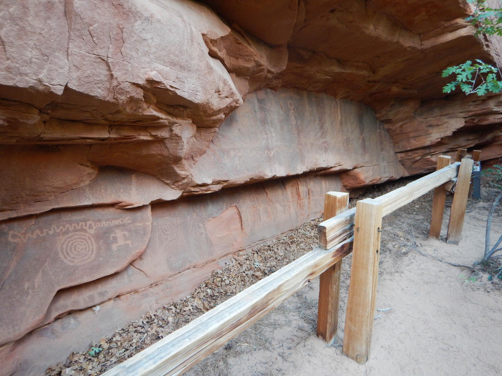
Though Zion was frequently inhabited by Native Americans long before modern man found its wonders, few visitors to Zion notice the signs and evidence of these first settlers. Petroglyph Canyon offers a very short hike, accessible to most, to a petroglyph panel just off the highway.
The panel is in good shape and has various designs along a fairly long stretch of the canyon wall.
Getting There
West Entrance
From the visitor center, follow UT-9 through the park. After going through the first major tunnel, a second tunnel is passed through. From the end of the SECOND tunnel, it is 1.4 miles to a pullout on the right with a log fence. This is the trailhead, and about 8.7 miles from the west entrance / visitor center.
East Entrance
From the paybooth at the east entrance, continue on UT-9 for 2.5 miles to a pullout on the left with a log fence. If you reach a tunnel, you have gone too far. Go back 1.4 miles.
Route Description
Rock art and historic sites are fragile, non-renewable cultural resources that, once damaged, can never be replaced. To ensure they are protected, please:
- Avoid Touching the Petroglyphs: Look and observe, BUT DO NOT TOUCH!
- Stay on the Trails: Stay on the most used trails when visiting sites, and don't create new trails or trample vegetation.
- Photography and Sketching is Allowed: Do not introduce any foreign substance to enhance the carved and pecked images for photographic or drawing purposes. Altering, defacing, or damaging the petroglyphs is against the law -- even if the damage is unintentional.
- Pets: Keep pets on a leash and clean up after them.
- Artifacts: If you happen to come across sherds (broken pottery) or lithics (flakes of stone tools), leave them where you see them. Once they are moved or removed, a piece of the past is forever lost.
From the trailhead, follow the road downhill a minute or two to the first side canyon coming in on the right. Walk up the side canyon a few minutes to the obvious panel on the left.
Maps

12S 330619E 4121508N
37°13'29"N 112°54'33"W
12S 330509E 4121704N
37°13'35"N 112°54'38"W