
 Hiking
Steamboat Point
Hiking
Steamboat Point
Bighorn Mountains
Overview

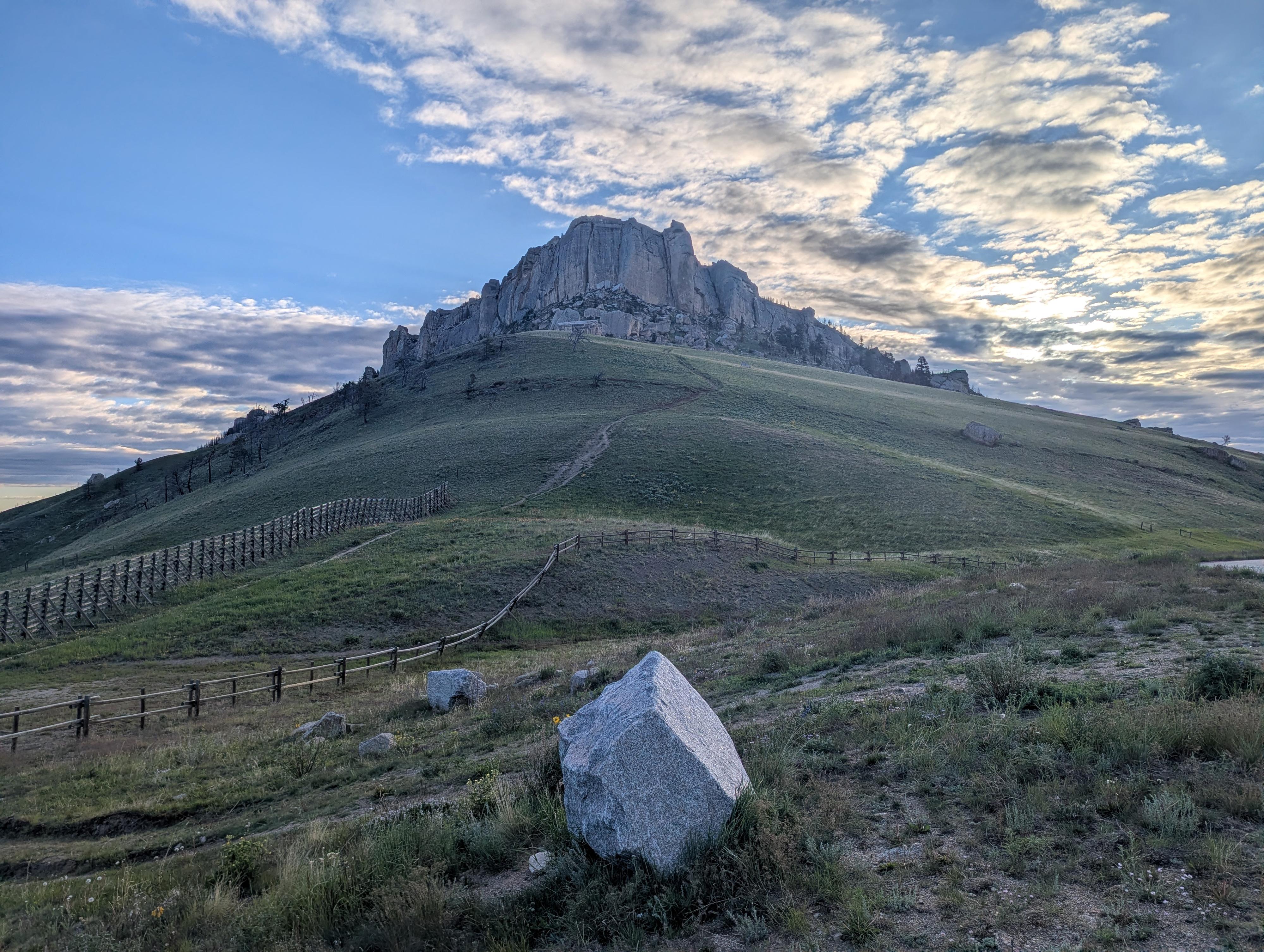
Steamboat Point is a prominent landmark next to US-14 as you drive from Dayton up into the Bighorn Mountains. The point, comprised of Bighorn Dolomite rock, rises about 700 feet above the surrounding area. From many angles, it is easy to see how it got its name, as it looks like the bow of a ship.
The trail, #630, that goes to the top is relatively short and steep! It meanders up to near the base of the cliffs, then east below the cliffs, and finally climbs and circles back up to the top. I did the hike in the early morning, and watching the sunrise on the Bighorns during the hike was exquisite! The views from the top are never-ending. The marmots (aka "rock chucks" or "whistle pigs") that were out as the sun started warming up the rocks they lived in and spring wildflowers made the hike even more memorable. I think this is a must-do if passing through the area and only takes 1-2 hours, but it is a steep hike.
Getting There
Head west out of Dayton Wyoming on US-14 toward Lovell. Follow the highway as it winds its way into the Bighorn Mountains. About 13 miles from Dayton, after climbing out of the canyon, there is a side road and huge parking area on the right, just below Steamboat Point that is the trailhead. This is about milepost 70.2.

Route Description
From the large parking area, follow the obvious trail that heads east, steeply up the hill toward the point. As it nears the rock cliffs, it traverses east and climbs steeply before circling back to the top. The trail is generally easy to find and follow, but if you find yourself scrambling or climbing rock with your hands, you're off the trail. It shouldn't require any scrambling or climbing.
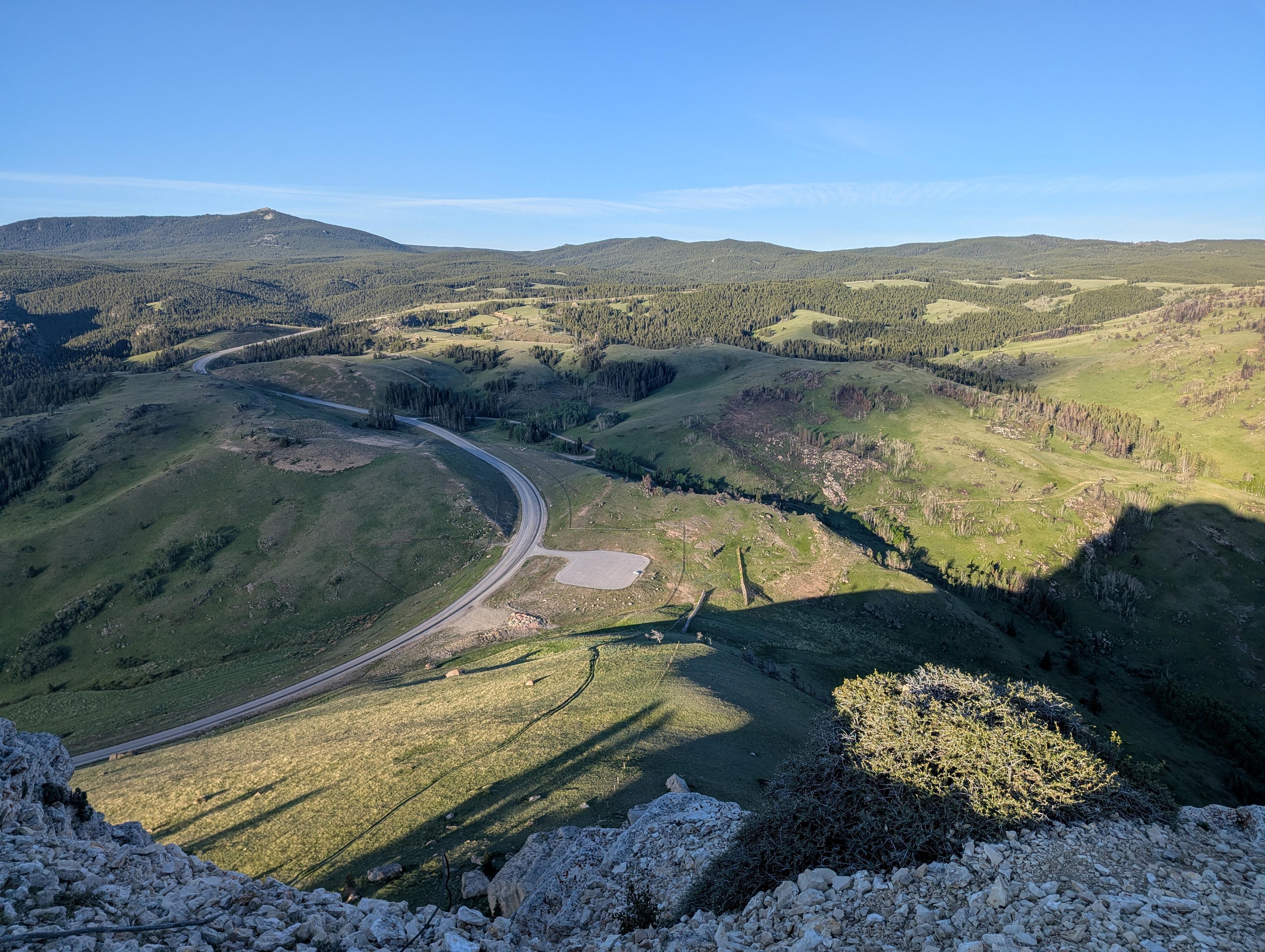
From the top, you are surrounded by the Bighorns to the north, west, and south. In the distance south, you can usually see the Cloud Peak Wilderness area, often with snow covered peaks well into the summer. To the east are the flats that comprise much of eastern Wyoming.
Return the same way.
Photos
Maps
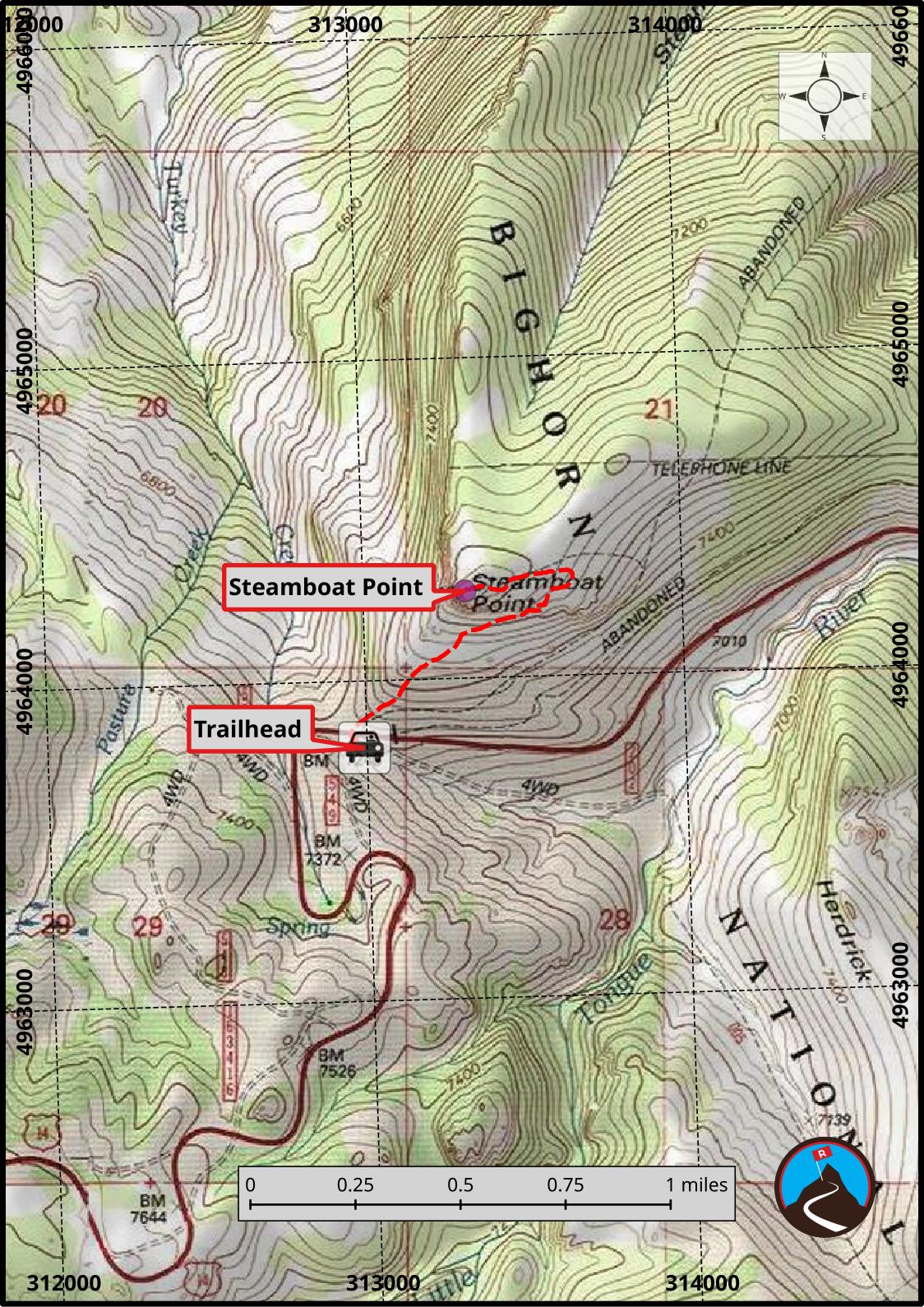
13T 312991E 4963791N
44°48'11"N 107°21'53"W
13T 313320E 4964271N
44°48'27"N 107°21'38"W