 Roadside Attraction
Arch Canyon Overlook
Roadside Attraction
Arch Canyon Overlook
Cedar Mesa
Overview
Tue

98°
|
71°
Wed
97°
|
70°
Thu
97°
|
69°
Fri
97°
|
69°
Sat
97°
|
70°
RATING:
Roadside Attraction
LENGTH:
less than 1 hour
MAPS:
South Long Point, UT
SEASON:
Any, roads may be impassable in the winter or after heavy rain.
WATER:
None.
Tue
98°
|
71°
Wed
97°
|
70°
Thu
97°
|
69°
Fri
97°
|
69°
Sat
97°
|
70°
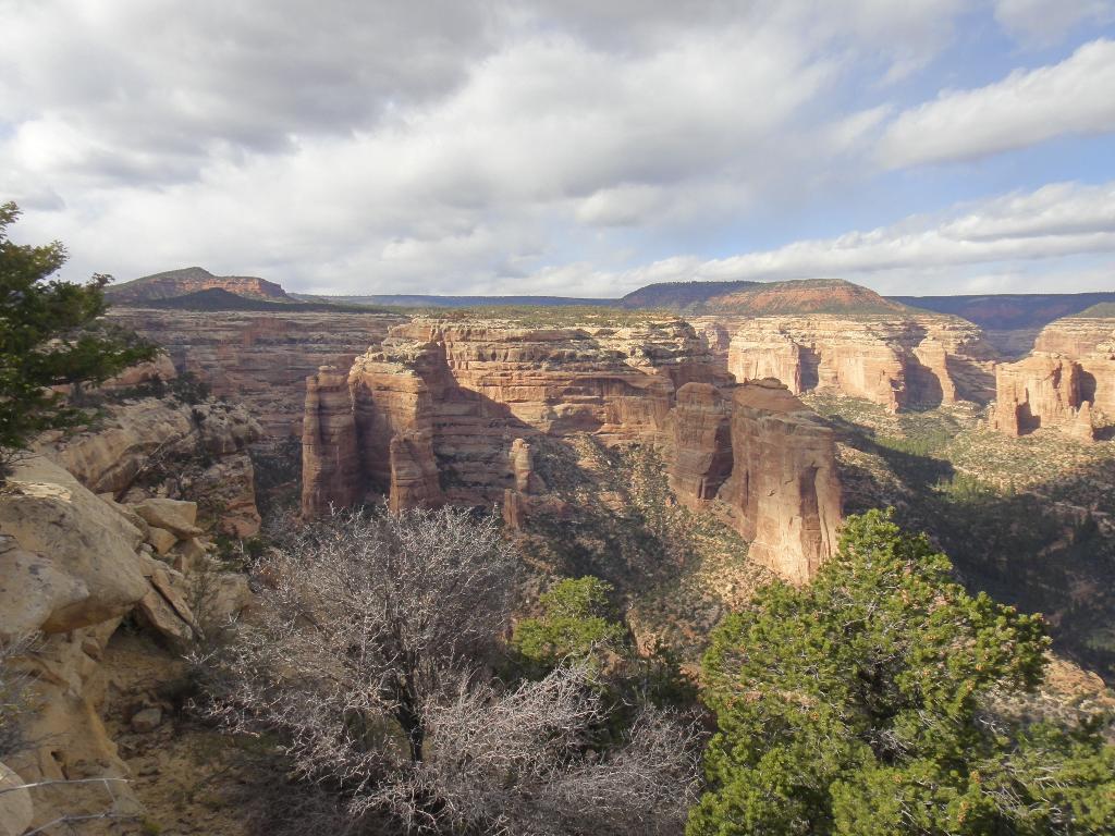
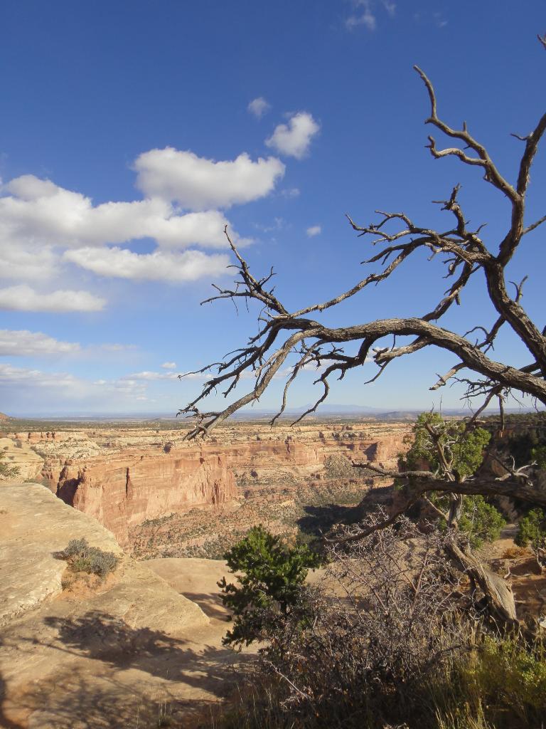
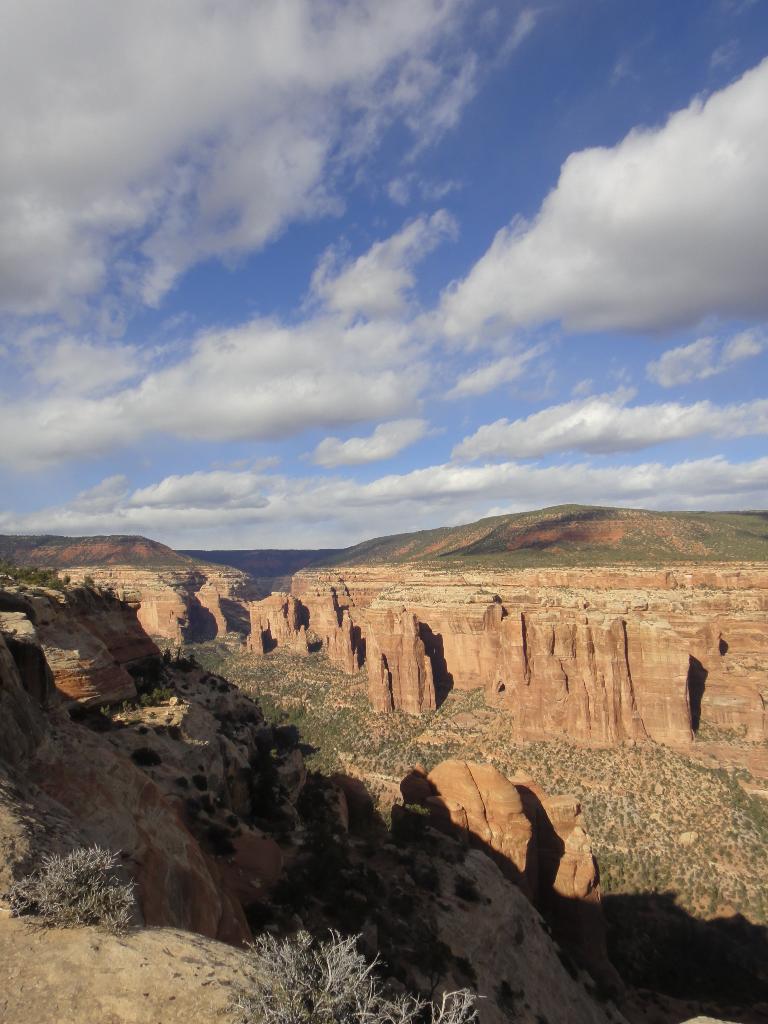
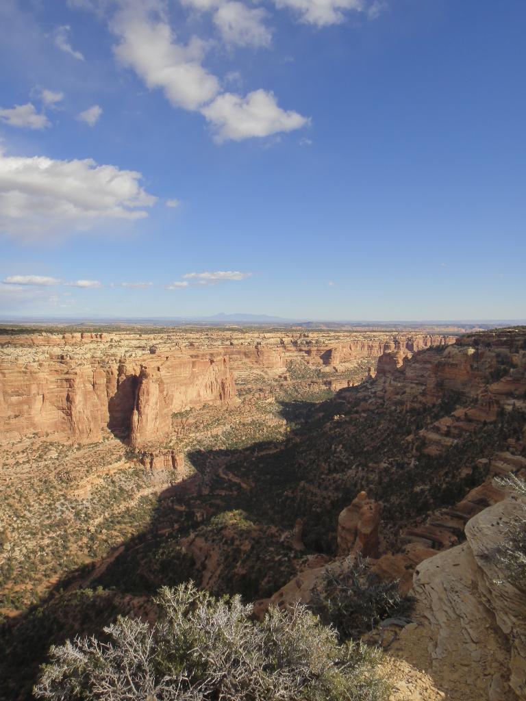
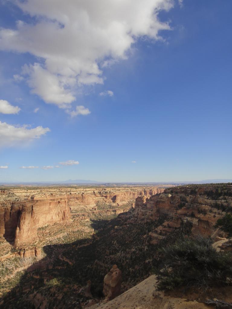
Arch Canyon overlook has to be one of the best primitive campsites around. The lofty overlook is perched high above Arch Canyon and provides big views into Arch Canyon and the surrounding area. A few ruins tucked under the viewpoint are the icing on the cake.
Getting There
Take highway 95 to milepost 101.8, which is 101.8 miles south east from Hanksville, or about 23 miles west of Blanding.
Reset your odometer as you leave the highway.
12S 611559E 4155183N
/
37°32'13"N 109°44'14"W
Follow this road (County Road 263) at 0.35 miles it crosses the South Fork of Mule Canyon.
12S 612010E 4155242N
/
37°32'15"N 109°43'56"W
It crosses the North Fork of Mule at 1.0 miles.
12S 612300E 4156009N
/
37°32'39"N 109°43'44"W
Just after crossing the North Fork of Mule Canyon is a junction, go left.
12S 612379E 4156028N
/
37°32'40"N 109°43'40"W
5.2 junction, stay right on the most used road.
12S 609449E 4160003N
/
37°34'50"N 109°45'38"W
Continue to 6.4 miles where a spur road goes off on the right. Most vehicles can make it this far. Some may want to walk the last 0.2 miles down to the overlook. It is a bit steep and rough.
12S 608839E 4161860N
/
37°35'51"N 109°46'01"W
Route Description
From the parking spot, a metal staircase allows easy access out to the point and its lofty views.
Walking either up or down canyon along the rim for a couple of minutes, then looking back at the point, shows several ruins well hidden right under the point. There appears to be no easy, non-technical way to reach them from above.
Maps
Printable Maps:


Overlook
12S 609018E 4162048N
37°35'57"N 109°45'54"W