San Rafael Knob |

Central Swell

Hiking San Rafael Knob - Central Swell Hiking San Rafael Knob

Central Swell

Overview

RATING: Hiking with some scrambling (class 4)
MAPS: Copper Globe, UT; San Rafael Knob, UT

Sat

Mostly sunny, with a high near 65. Northwest wind 6 to 14 mph.

65 | 44

Sun

Sunny, with a high near 69.

69 | 43

Mon

Mostly sunny, with a high near 70.

70 | 48

Tue

Sunny, with a high near 68.

68 | 46

Wed

Sunny, with a high near 68.

68 | 47

View Full Weather Details
SEASON: Any, when no snow. Can be hot in the summer.
GEAR: Standard Hiking Gear
WATER: None

Sat

Mostly sunny, with a high near 65. Northwest wind 6 to 14 mph.

65 | 44

Sun

Sunny, with a high near 69.

69 | 43

Mon

Mostly sunny, with a high near 70.

70 | 48

Tue

Sunny, with a high near 68.

68 | 46

Wed

Sunny, with a high near 68.

68 | 47

View Full Weather Details
San Rafael Knob

San Rafael Knob

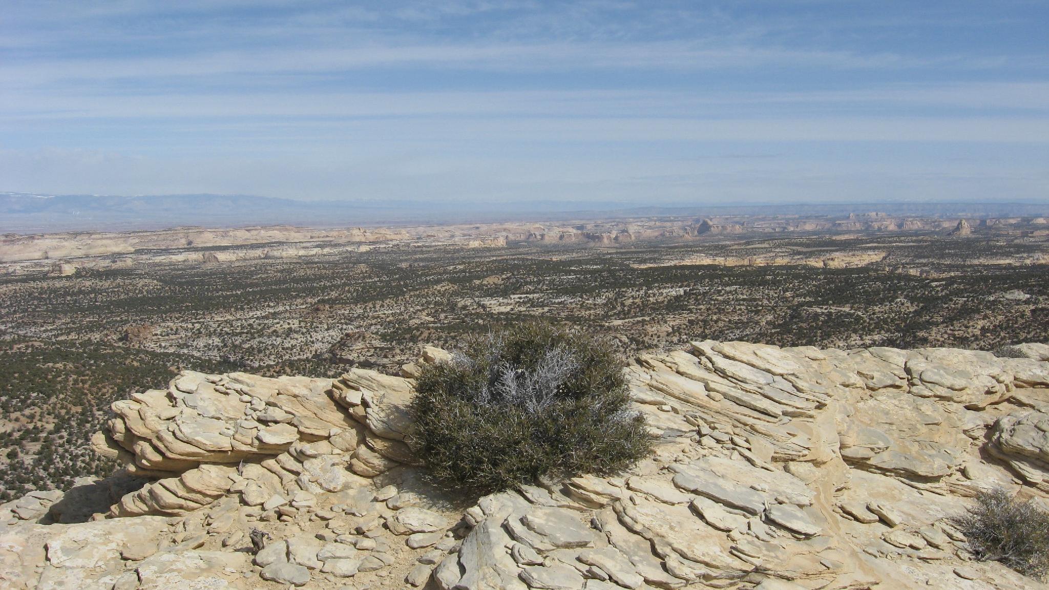
At 7921ft (2414 meters) the San Rafael Knob is the highest point in the Swell. The hike to the base is easy, the climb fairly moderate, and the summit breathtaking. The San Rafael Knob is a must do for any Swell explorer.

Big views all the way to the Henry Mountains from the top

Big views all the way to the Henry Mountains from the top

Getting There

Take exit 116 off of I-70, and head south. This is the same exit as the Moore cutoff road, and about 45 miles west of Green River.

  • Reset your odometer on the south side of the highway. Stay on the main road as it parallels the freeway heading east, there are many campsites and small roads leaving the main road. ( 12S 507450mE 4300683mN / N38° 51' 18" W110° 54' 51" )
  • At 2.1 miles, the road turns and begins it's descent into Devil's Canyon. The road worsens as you descend into Devil's Canyon. Go as far as comfortable. ( 12S 510456mE 4299191mN / N38° 50' 29" W110° 52' 46" )
  • It is about 1.2 miles from the top to the bottom of Devil's Canyon. There are several pullouts and campsites en route. Stop when you get to the bottom of Devil's Canyon (3.4 miles from the highway.) ( 12S 508858mE 4298639mN / N38° 50' 11" W110° 53' 53" )
Big views from the top of the knob.

Big views from the top of the knob.

Route

If you stop short of the bottom, hike to the bottom of Devil's Canyon.

From the bottom of the canyon, continue following the road a short distance to a junction. Go left up a wash. 5 minutes from this junction is another junction, go left again. This ATV trail is signed route #824. Continue up the trail for about 2 miles to another junction. Go right at this junction, heading directly towards the knob. As you get close to the knob, you will encounter another (final) junction. Go left here, with the road taking you near the northwest side of the knob.
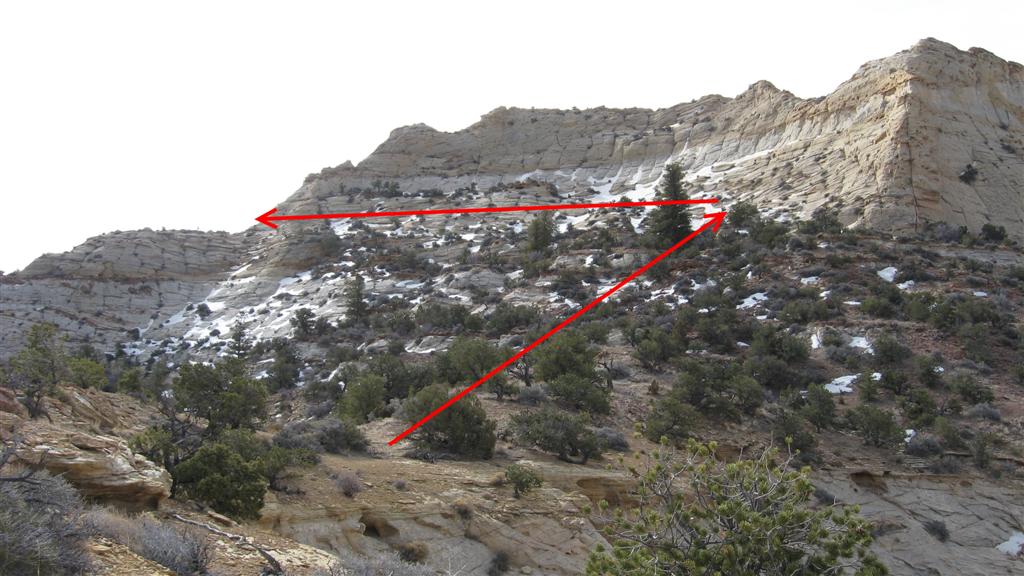
Getting Up:

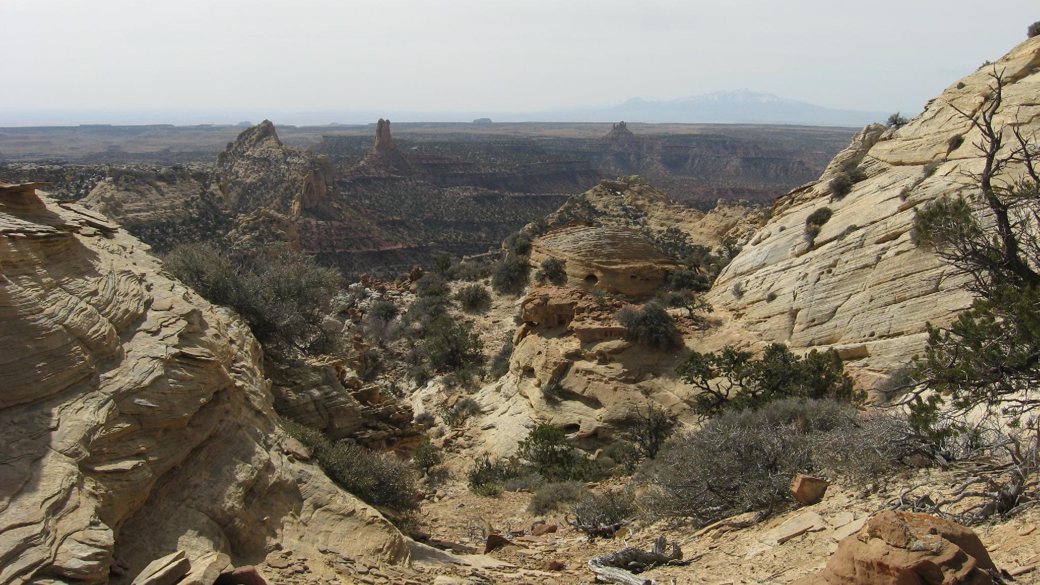
The northwest side of the knob has a ridge leading up the first level. Once you are up a level, there is an emerging trail that traverses east as it climbs the knob. The crux is traversing from the north to the east face. The moves are easy, but with much exposure. Once on the east side, follow a large ledge around to the southeast corner of the knob. This section has amazing views. On the southeast corner, easy slabs take you to the top.

Return the way you came.


Maps

Route / 6.92 miles / Elevation Range 6,721 - 7,895 ft.
Printable Maps:
Trailhead

12S 508856mE 4298683mN

N38° 50' 13" W110° 53' 53"

Junction (Right)

12S 511737mE 4297212mN

N38° 49' 25" W110° 51' 53"

Junction (Left)

12S 512157mE 4296704mN

N38° 49' 09" W110° 51' 36"

Comments

Want to make a comment? Login and let yourself be heard.