
 Buckskin Gulch
Paria
Overview
Buckskin Gulch is occasionally referred to as the longest slot canyon in the world. I think that is a bit of a stretch, it is a big world, however Buckskin is likely one of the longest on the Colorado Plateau. It is stunning, with miles of absolutely incredible slot. By slot, think 10-or-so-foot-wide slot, not have-to-turn-sideways to pass slot. I would put it in my short list of canyons I have done on the Plateau for scenery and overall fun factor. It is amazing to me that such a long slot is relatively easy to navigate, with no major obstacles requiring technical gear. One small boulder section requires a hand line for most, but is easily passably with a little teamwork.
The bad side of Buckskin is that it has become very busy and requires a permit from the BLM for all overnight trips. For current details on the permit system, see the BLM site. Currently (2014), there is a limit of 20 people for all overnight permits, however day permits are self service with no limit. Very strong hikers can do Buckskin and out Paria in a day (approximately 20 miles), but it would be tough to recommend. Without a permit, it is still worth doing a long dayhike as far down as you can and returning back the same way. If possible, get a permit and do this as a two day backpack. Day 1 is spent in Buckskin, while day 2 is a shorter exit up Paria. A car shuttle is required for the full route.
Getting There
Exit Trailhead
Follow highway 89 east out of Kanab for about 44 miles to mile post 20.9, signed Paria Canyon. Follow this road to its end in 2.2 miles to White House Campground. This is a good place to camp the night before starting your trip.
Trailhead
Go back to highway 89 and head west (toward Kanab) for 4.9 miles to a dirt road on the left (south side). Follow this generally well maintained road for 8.6 miles to the signed Wire Pass Trailhead. It is a parking area with a pit toilet.
- Circle Tours - Kyle Walker, PO Box 3681, Page, AZ 86040, (928) 691-0166
- End of the Trail Shuttles - Betty Price, PO Box 6135, Marble Canyon, AZ 86036, (928) 355-2252-Shuttles
- Paria Outpost - Susan and Stephen Dodson, PO Box 410075, Big Water, UT 84741, (928) 691-1047-Shuttles
Route Description
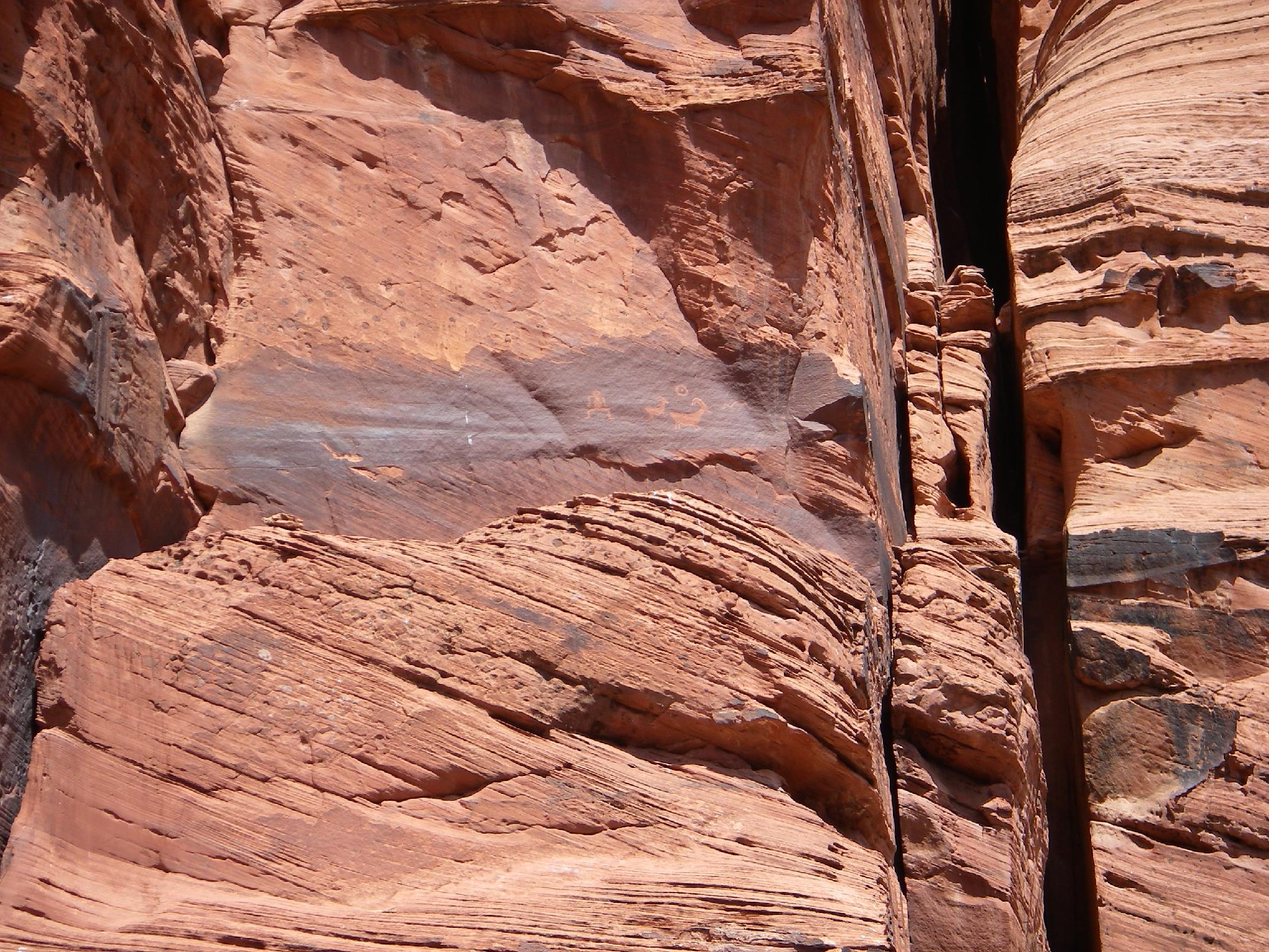
Rock art and historic sites are fragile, non-renewable cultural resources that, once damaged, can never be replaced. To ensure they are protected, please:
- Avoid Touching the Petroglyphs: Look and observe, BUT DO NOT TOUCH!
- Stay on the Trails: Stay on the most used trails when visiting sites, and don't create new trails or trample vegetation.
- Photography and Sketching is Allowed: Do not introduce any foreign substance to enhance the carved and pecked images for photographic or drawing purposes. Altering, defacing, or damaging the petroglyphs is against the law -- even if the damage is unintentional.
- Pets: Keep pets on a leash and clean up after them.
- Artifacts: If you happen to come across sherds (broken pottery) or lithics (flakes of stone tools), leave them where you see them. Once they are moved or removed, a piece of the past is forever lost.
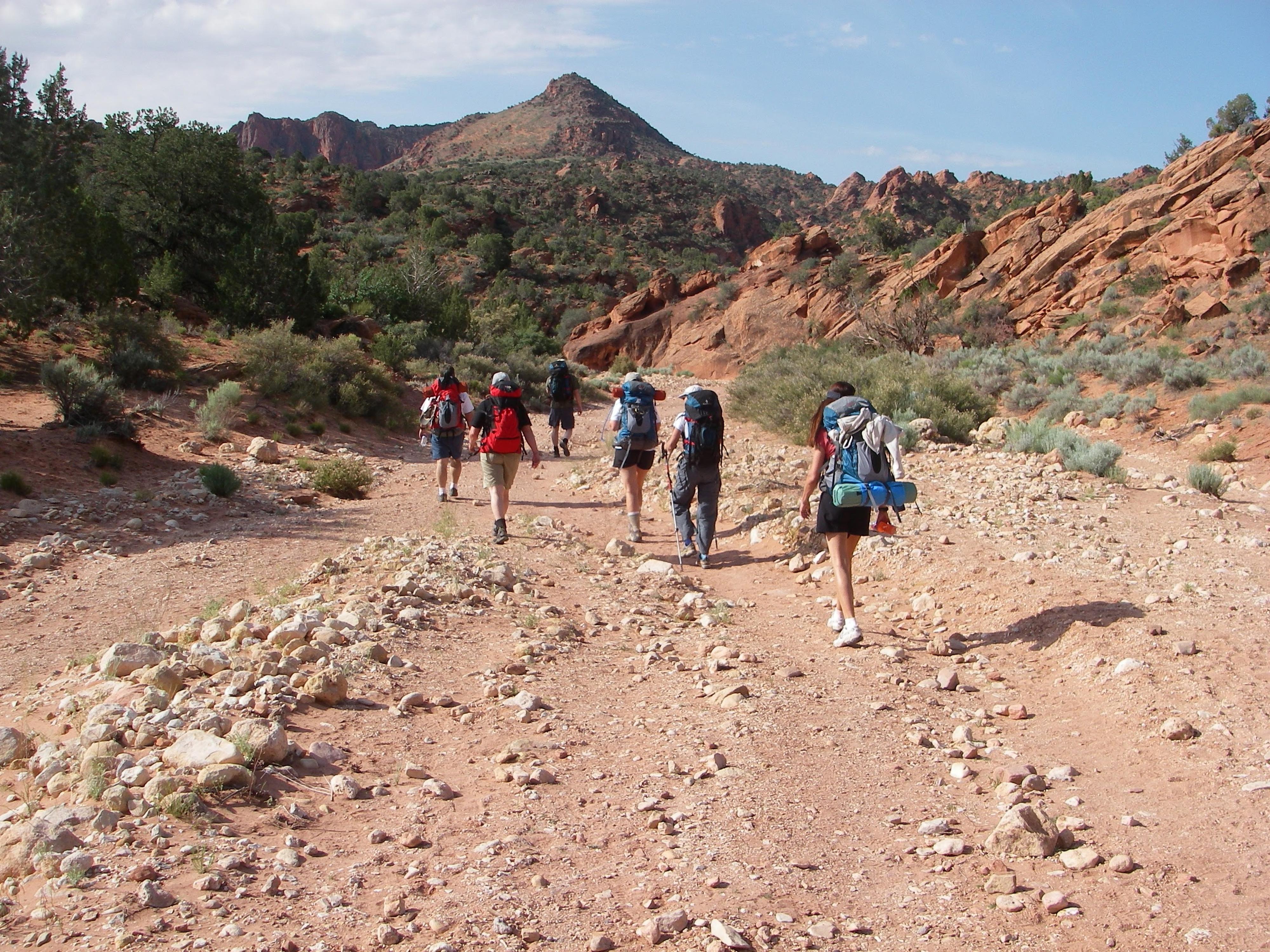
To Buckskin Gulch (40 minutes)
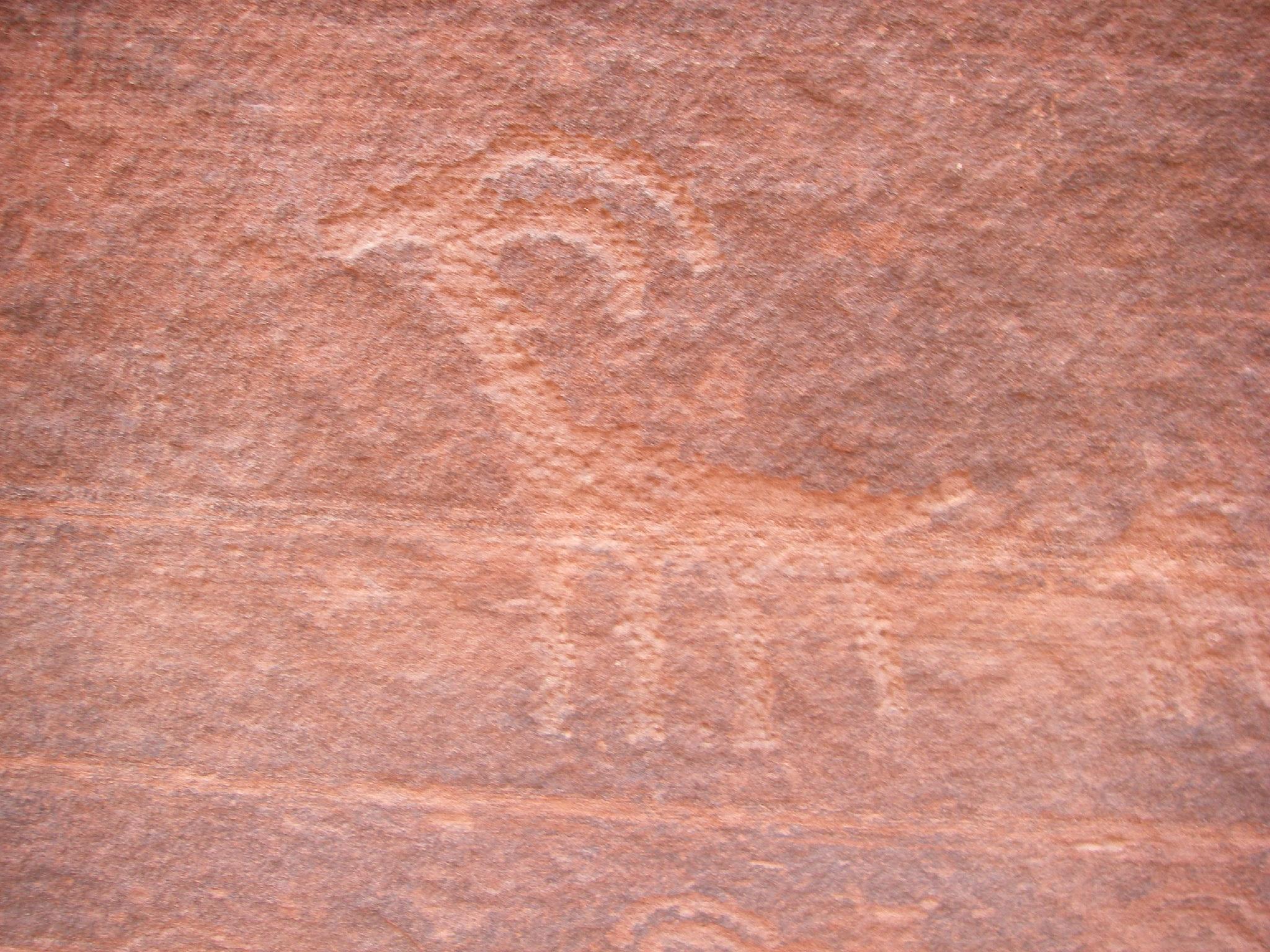
From the parking area, follow the signed trail as it follows the wash, then drops into the wash proper. The canyon soon changes from an open wash to a deepening sandstone slot. It is about 40 minutes to the junction with Buckskin Gulch proper. Just before the junction, look for petroglyphs on the right side of Wire Pass Wash.
Down Buckskin to Middle Exit (3 hours)
The slot is just getting good and continuous! Head down canyon, the next landmark is about 6.5 miles down canyon where the slot opens at what is known as Middle Trail (or Exit). This is the only exit between the Wire Pass / Buckskin Junction and the Paria. If weather is threatening, this can be used as an emergency exit. The route is generally cairned, but is fairly obvious as the narrows crack running up the wall.
To Paria (3-4 hours)
My favorite section, below Middle Trail the canyon is deep and stunning. An hour or so down from Middle Trail is the rockfall that marks the crux of the route. Sometimes there is a small hole that can be climbed through from behind, though most of the time you will be using a hand-line to descend a series of cut moki steps on the left. Though easy, be careful, this is no place for a slip.
Below the rockfall a series of seeps marks the nearing of Paria, and good clear water to pump. Just before Paria there are two large sand banks, one on each side of the canyon. These are the normal camping spots, and quite good. If they are taken, and you want solitude, you will have to go 30-40 minutes DOWN Paria to find another campsite. (Not recommended since you will have to go back up Paria in the morning for the exit.)
Out Paria (7 miles / 3 hours)
From the Buckskin and Paria confluence, go left, up Paria. It is stunning and generally easy going. About 30 minutes from the confluence is Slide Arch. From here, Paria opens and becomes less stunning. Hopefully, if its hot, you got an early start! The exit trailhead is easy to spot on the right.
Photos
Maps
")
")
")
")
")
")
12S 408966E 4097593N
37°01'12"N 112°01'24"W
12S 410804E 4097528N
37°01'11"N 112°00'10"W
12S 418018E 4098719N
37°01'52"N 111°55'18"W
12S 422979E 4095384N
37°00'05"N 111°51'56"W
12S 420823E 4104094N
37°04'47"N 111°53'27"W