 Hiking
Sheep Creek
Hiking
Sheep Creek
Paria
Overview
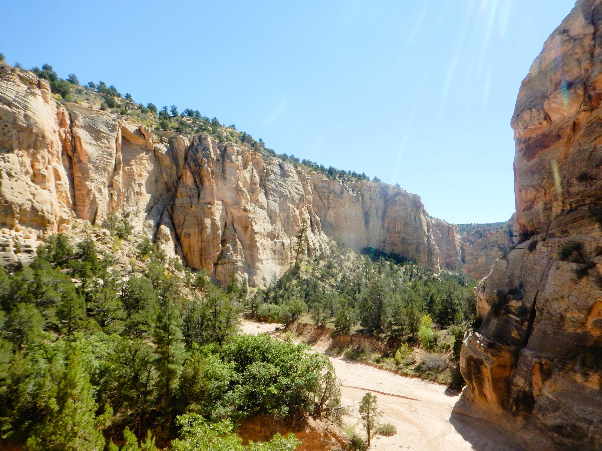
The wide and open canyon of Sheep Creek is often overlooked for its more sinuous neighbors, Bull Valley Gorge and Willis Creek However, as Sheep Creek meanders down from the road, it deepens with colorful and striking walls. The walls, colors, and general scenery alone make this a worthwhile hike. Two excellent rock art panels in Sheep Creek make a great addition to all the other charms.
The panels make a great destination. At about 3.5 miles round trip through relatively easy terrain, this makes for a family friendly outing. The hike can be done any time of year but can be brutally hot in the summer months. If visiting in the summer, get an early start and bring plenty of water. Winter is a great time to visit as long as the roads are passable.
Getting There
Head south out of Cannonville toward Kodachrome basin on the Kodachrome Basin road for 2.7 miles to the Skutumpah Road.
Route Description
Rock art and historic sites are fragile, non-renewable cultural resources that, once damaged, can never be replaced. To ensure they are protected, please:
- Avoid Touching the Petroglyphs: Look and observe, BUT DO NOT TOUCH!
- Stay on the Trails: Stay on the most used trails when visiting sites, and don't create new trails or trample vegetation.
- Photography and Sketching is Allowed: Do not introduce any foreign substance to enhance the carved and pecked images for photographic or drawing purposes. Altering, defacing, or damaging the petroglyphs is against the law -- even if the damage is unintentional.
- Pets: Keep pets on a leash and clean up after them.
- Artifacts: If you happen to come across sherds (broken pottery) or lithics (flakes of stone tools), leave them where you see them. Once they are moved or removed, a piece of the past is forever lost.
From the parking area, follow the social trail/old road as it descends into Sheep Creek. This is an easy navigation route, head down canyon! In about 1-1.5 hours (1.75 miles), a side canyon comes in on the right. This is Willis Creek.
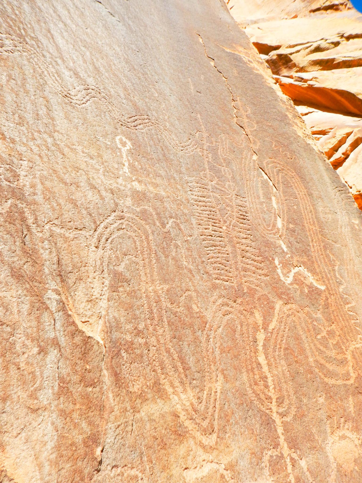
At the confluence of Willis Creek and Sheep Creek, a large panel is on the right, just downstream from the confluence. A well used social trail climbs to visit the panel. Be sure to follow the cliff band around and to the south for the best panel.
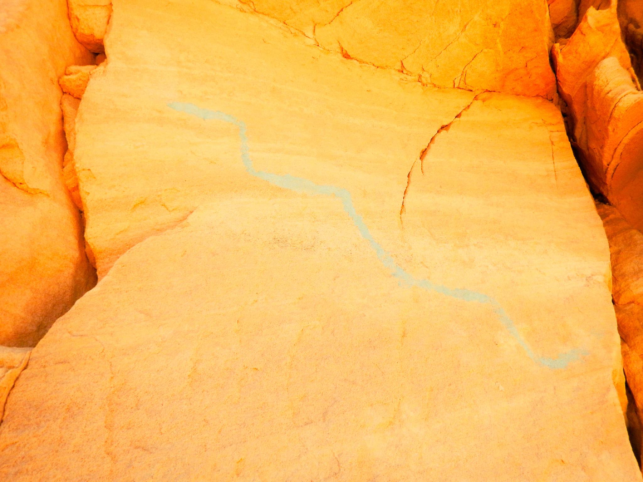
Blue Snake Panel
The Blue Snake Panel is easier to find on the way back then on the way to Willis Creek. To find the Blue Snake Panel, walk back up Sheep Creek toward the trailhead. About 5-10 minutes from the confluence of Willis Creek and Sheep Creek, look for a tall ponderosa tree on the left. Blue Snake Panel is on the left (south) side of the canyon, under a small overhang behind the ponderosa. An emerging social trail makes this relatively easy to find.
Maps

12S 405816E 4149969N
37°29'31"N 112°03'55"W
12S 405929E 4149741N
37°29'23"N 112°03'51"W
12S 405645E 4148498N
37°28'43"N 112°04'02"W
12S 405717E 4147863N
37°28'22"N 112°03'59"W