 Hiking
Bells Canyon
Hiking
Bells Canyon
Salt Lake City
Overview
Bells Canyon is a very popular and scenic hike on the edge of Salt Lake City. The hike offers something for everyone. For the family, or the less motivated, a short 15-minute hike leads to the lower reservoir and an excellent short outing. More motivated groups can continue 2 miles from the trailhead to the photogenic and impressive Lower Bells Canyon waterfall. Still motivated? The crowds subside at the lower falls, but an additional 20 minutes up the trail is the almost equally impressive Upper Bells Canyon Falls.
The trail continues past the upper falls to the Upper Bells Canyon Reservoir, though this is about 5 miles one way and a fairly strenuous endeavor. Snow can linger, particularly above the Upper Bells Canyon Falls, well into mid-summer in a heavy snowpack year. The elevation gain and distance from the trailhead to the reservoir make for a long, strenuous day for most. Be prepared if venturing that far.
Getting There
All three trailheads are fairly close together. The hike starts on the southeast side of the Salt Lake Valley in Sandy.
Take I-125 to exit 6 and go east. This is the same exit to get to Big Cottonwood Canyon.
Follow Wasatch Blvd past the mouth of Big Cottonwood. 2.3 miles past the entrance to Big Cottonwood, turn right to stay on Wasatch Blvd. About 1.2 miles from this junction is a major junction with Little Cottonwood Canyon Road / UT-209. This 4-way intersection is the starting point for getting to the 3 trailhead.
Boulders Trailhead
Continue straight through the stoplight, staying on Wasatch Blvd about 0.7 more miles to the trailhead that is signed on the left side of the road. It is fairly small and often fills up quickly.
Preservation Trailhead
Continue straight through the stoplight, staying on Wasatch Blvd. Take the first left after the stoplight that is signed for the Preservation Trailhead. Follow it to the top and park near the top if possible. There are restrooms at the trailhead.
Granite Trailhead
Turn LEFT at the stoplight and head up toward Little Cottonwood Canyon. In just 500 feet, the Bells Canyon Granite trailhead is on the right side of the road. It is small and often fills up quickly on weekends.
Route Description
From the Boulder Trailhead to the Reservoir (0.6 miles)
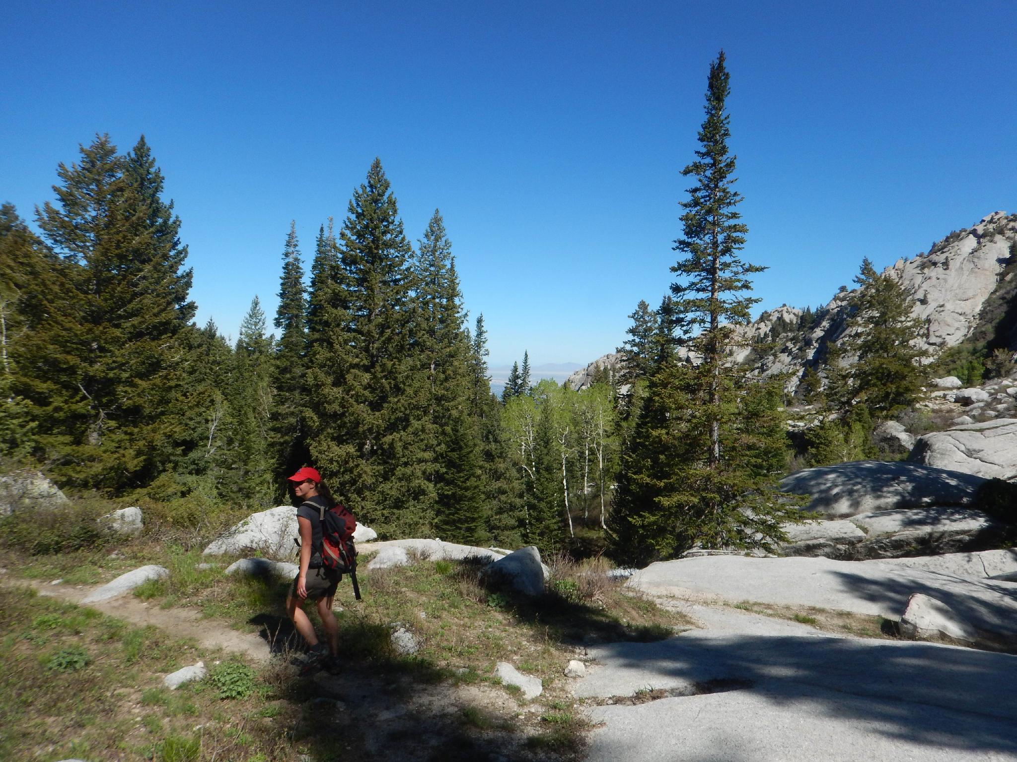
From the trailhead, follow the well-used and well-signed trail as it winds through the neighborhood, crosses the creek, and climbs a short, steep boulder section to the Lower Reservoir. This is a good stopping point for those looking for a short hike. From the Lower Reservoir, views of the upper section of Bells Canyon come into view. Stunning!
From the Granite Trailhead to the Preservation Trailhead (0.1 miles)
From the Granite Trailhead, simply follow the trail uphill for about a tenth of a mile to where it joins the trail from the Preservation Trailhead.
From the Preservation Trailhead to the Reservoir (0.6 miles)
The trickiest part of our visit is finding the start of the trail! On our visit, it wasn't marked. Leave the east side of the upper parking lot. Head east, as the trail begins to narrow, with the Granite Trailhead trail joining just a minute from the trailhead. The trail climbs via a handful of switchbacks heading east. Once up on the ridge, it begins a sweeping curve to the reservoir that is over the next ridge south. You can see the Bell Canyon Reservoir Access Road down below the trail along the way.
From the Reservoir to the Lower Falls (1.6 miles)
Follow the left side of the reservoir on an old jeep road. Once around the reservoir, a signed trail junction is reached. Go left here, turning off the old road and onto the single-track trail. A sharp eye up canyon will reveal the Lower Falls in the distance along this section of the hike.
The trail becomes more shaded as it winds up Bell Canyon. It crosses a bridge, then enters the Wilderness Area. Once in the wilderness area, the trail begins climbing in earnest and becoming steeper. After a particularly steep, rocky section and crossing a small side stream, keep an eye out on the left for a major side trail. This is hard to miss, but some groups do. At this junction, the main trail goes left for about 4 minutes to the Lower Falls. The right branch is less traveled and continues to the upper falls.
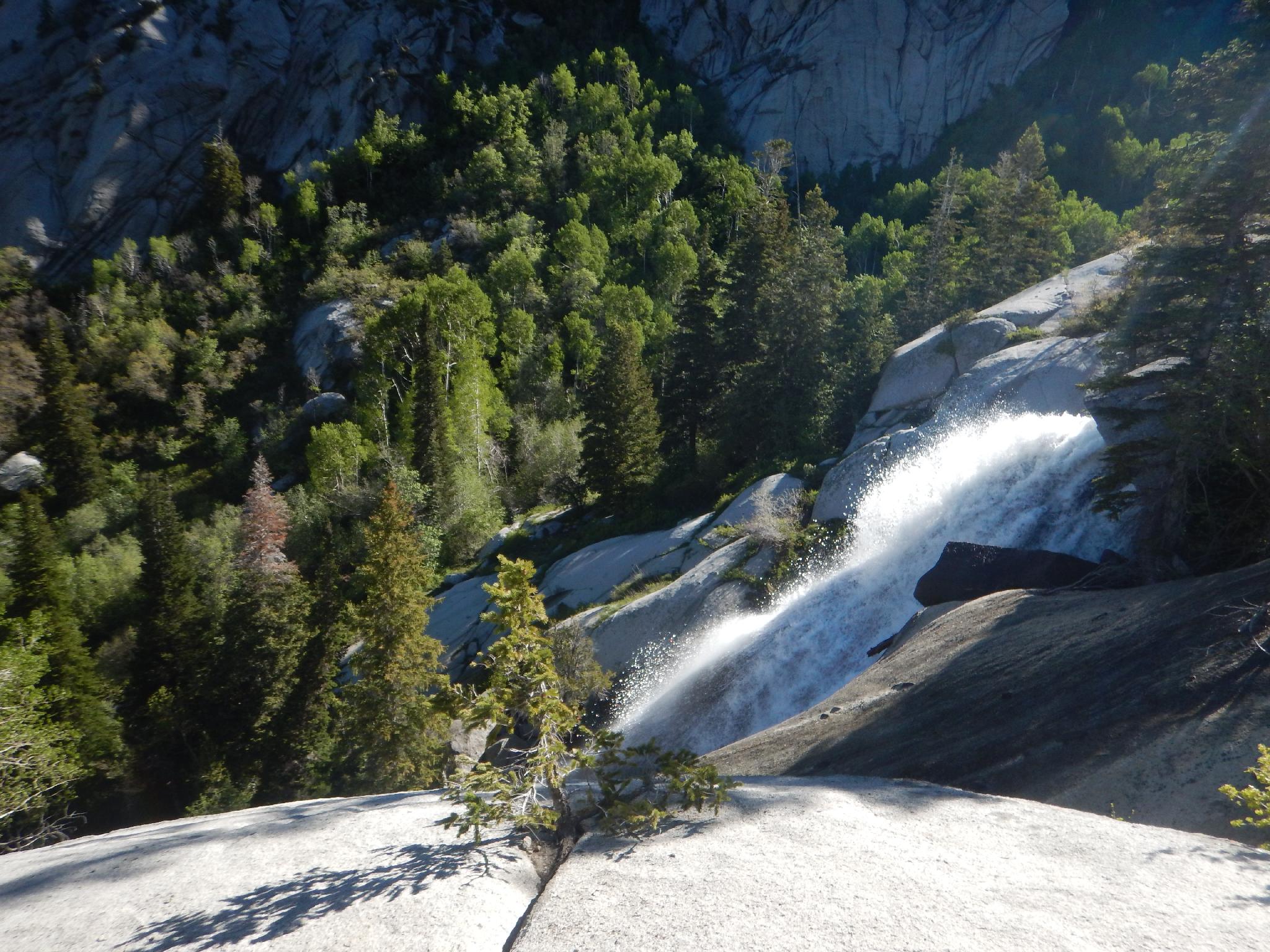
From the Lower to the Upper Falls (0.7 miles)
From the junction with the lower falls, continue climbing up the right-hand trail. This is rocky and a bit less traveled than the section below. Not far above the lower falls junction (5-10 minutes or so) a side trail goes off on the left. This goes over to Bells Towers on the north side of the canyon and is used by climbers. Stay right!
The trail meanders up past a bit of a meadow to the top of a small cascade. This is not the upper falls, keep going. The obvious upper falls will be on the left not far above with a granite slab to view the falls from and hang out on.
From the Upper Falls to the Upper Reservoir (1.8 miles)
Above the upper falls, the trail continues to the Upper Reservoir. 15 or so minutes past the Upper Falls is another excellent waterfall.
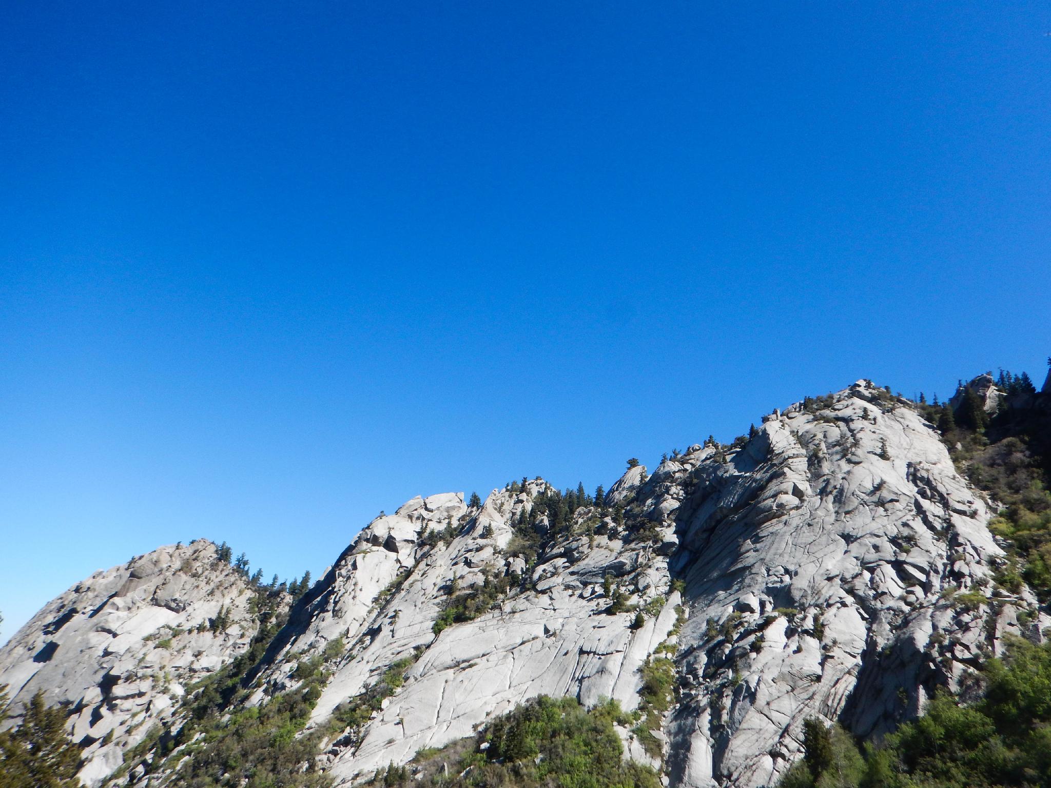
Above there the trail crosses a wooden log bridge, then begins a steep ascent to the reservoir. The scenery is magnificent!
Return the same way.
Photos
Maps
")
")
")
12T 431964E 4490813N
40°33'55"N 111°48'13"W
12T 432465E 4491486N
40°34'17"N 111°47'52"W
12T 432555E 4491528N
40°34'18"N 111°47'49"W
12T 432511E 4491453N
40°34'16"N 111°47'50"W
12T 432511E 4490809N
40°33'55"N 111°47'50"W
12T 432566E 4490912N
40°33'58"N 111°47'48"W
12T 432635E 4490959N
40°34'00"N 111°47'45"W
12T 432828E 4490875N
40°33'57"N 111°47'37"W
12T 433409E 4490499N
40°33'45"N 111°47'12"W
12T 433635E 4490463N
40°33'44"N 111°47'02"W
12T 434770E 4490254N
40°33'38"N 111°46'14"W
12T 434772E 4490322N
40°33'40"N 111°46'14"W
12T 434926E 4490266N
40°33'38"N 111°46'07"W
12T 435528E 4490020N
40°33'30"N 111°45'42"W
12T 435748E 4489811N
40°33'24"N 111°45'32"W
12T 436056E 4489517N
40°33'14"N 111°45'19"W
12T 436480E 4488130N
40°32'29"N 111°45'00"W