 Hiking Ibapah Peak
Juab County Highpoint
Overview
|
Sat 46 | 32 |
Sun 52 | 32 |
Mon 60 | 37 |
Tue 59 | 34 |
Wed 59 | 36 |
| View Full Weather Details | ||||
|
Sat 46 | 32 |
Sun 52 | 32 |
Mon 60 | 37 |
Tue 59 | 34 |
Wed 59 | 36 |
| View Full Weather Details | ||||
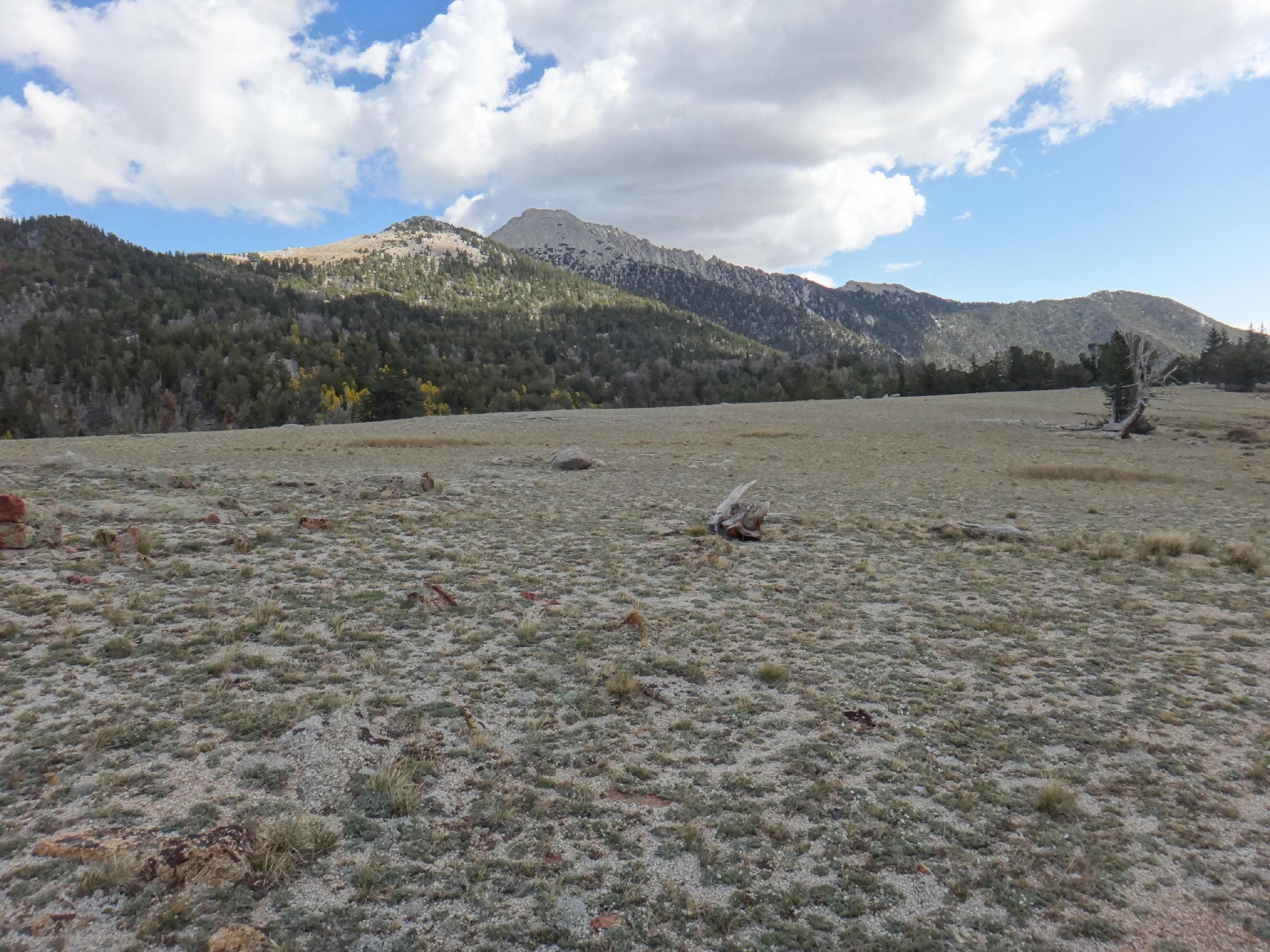
Sub Peak and Ibapah from the upper meadow.
Ibapah is one of the more difficult county highpoints in Utah. Kings and Gilbert are longer, but typically done as backpacking trips, while Ibapah is often done as a long day. At 12,087 feet, it is lofty, and very isolated in the West Desert. Be fit and ready for a long day on this one, or backpack in. There is a good stream near the trail in many places to about 10,000', making it easy to get water for a pleasant backpack if a 9+ hour day isn't appealing.
OK, aside from being a long day, Ibapah is an amazing peak. Granite Canyon, the approach canyon, is absolutely stunning with high granite cliffs, spires, and slabs. The area is not as often frequented as others in Utah, giving it much solitude and a great place to get away for a few days. Once up on the ridge to Ibapah, the views to the east of the West Desert and west into Nevada are astounding. This is a peak not to be missed by the fit peak bagger looking for something off the beaten path.
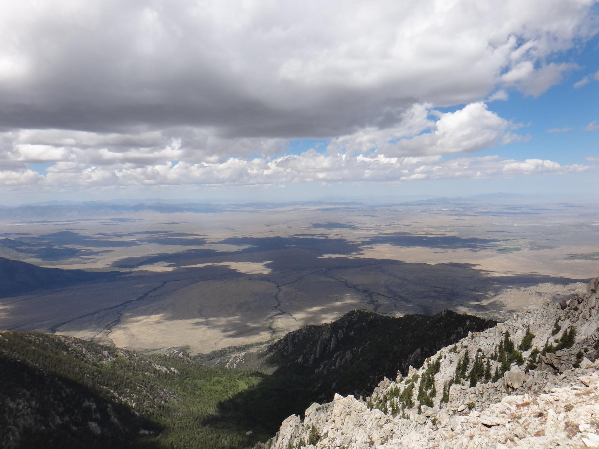
Nevada from the summit of Ibapah
Getting There
The first step is to get to Callao, UT a small town (no services) near the Deep Creek Range. This can be reached via the Pony Express Trail, but is a lot more dirt road. From Wendover (described below), it is still a lot of dirt road, but less than the Pony Express Trail. Reaching the 2wd trailhead should be reachable by most vehicles, but will make for a VERY long day. A 4x4 is recommended, or plan on doing this one as a backpack.
- From downtown Wendover, go south on Alt 93 in Nevada. Follow this for 27.6 miles to a signed left turn to Ibapah. Reset your odometer.
- Follow the paved road toward Ibapah for 29.5 miles (mile post 14.9) to where the Pony Express Trail leaves the highway on the left (east) side. The rest of the road will be dirt. Reset your odometer.
- Follow the Pony Express Trail 6.1 miles to a junction. Go right here toward Callao, resetting your odometer.
- 1.3 miles, stay right toward Callao
- 5.7 miles, Cherry Canyon station on the right after passing through Overland Canyon. Stay on the main road straight.
- 12.9 miles, stay left.
- 13.9 miles, right, staying on the Pony Express Trail.l
- 18.0 miles, go right. Toolee and Geo beds are signed to the left.
- 22.3 miles, CCC Campground on the left. This makes a good camping spot.
- 22.8 miles, stay right
- 28.1 miles, Granite Creek road on the right, reset your odometer.
Granite Creek Road
- 0.9 miles, go left. Straight goes to the Douglass Ranch.
- Stay straight on the main road through here as it heads up Granite Creek. There are several good camping spots just off the road through here.
- 3.6 miles first stream crossing. The road gets rocky and rough just past the crossing. 2WD and low clearance vehicles will likely want to park before or just after the crossing.
- 4.4 miles, gate and second stream crossing The crossing is somewhat hidden, but seemed quite good in 2014. Some may wish to park here, though after the second crossing, the road is good, and worth making the crossing if it looks passable.
- 4.7 (ish) miles. A closed side road on the right. This closed road makes a short hike to a large boulder/overhang with a pictograph panel. A very worthwhile diversion. (10 minutes round trip)
- 5.2 miles, a good camping spot and pull-out on the left, and a steep, rocky section of road above. This will stop most, and is the recommended trailhead. The road above was recently opened after a publicized lawsuit about primitive roads and county rights. It is open and passable for some distance, but a bit overgrown and rough in spots. Not recommended except for ATV's and serious 4x4 enthusiasts. A trail from the parking spot goes up to a marvelous camping area on the rocks with a great view.
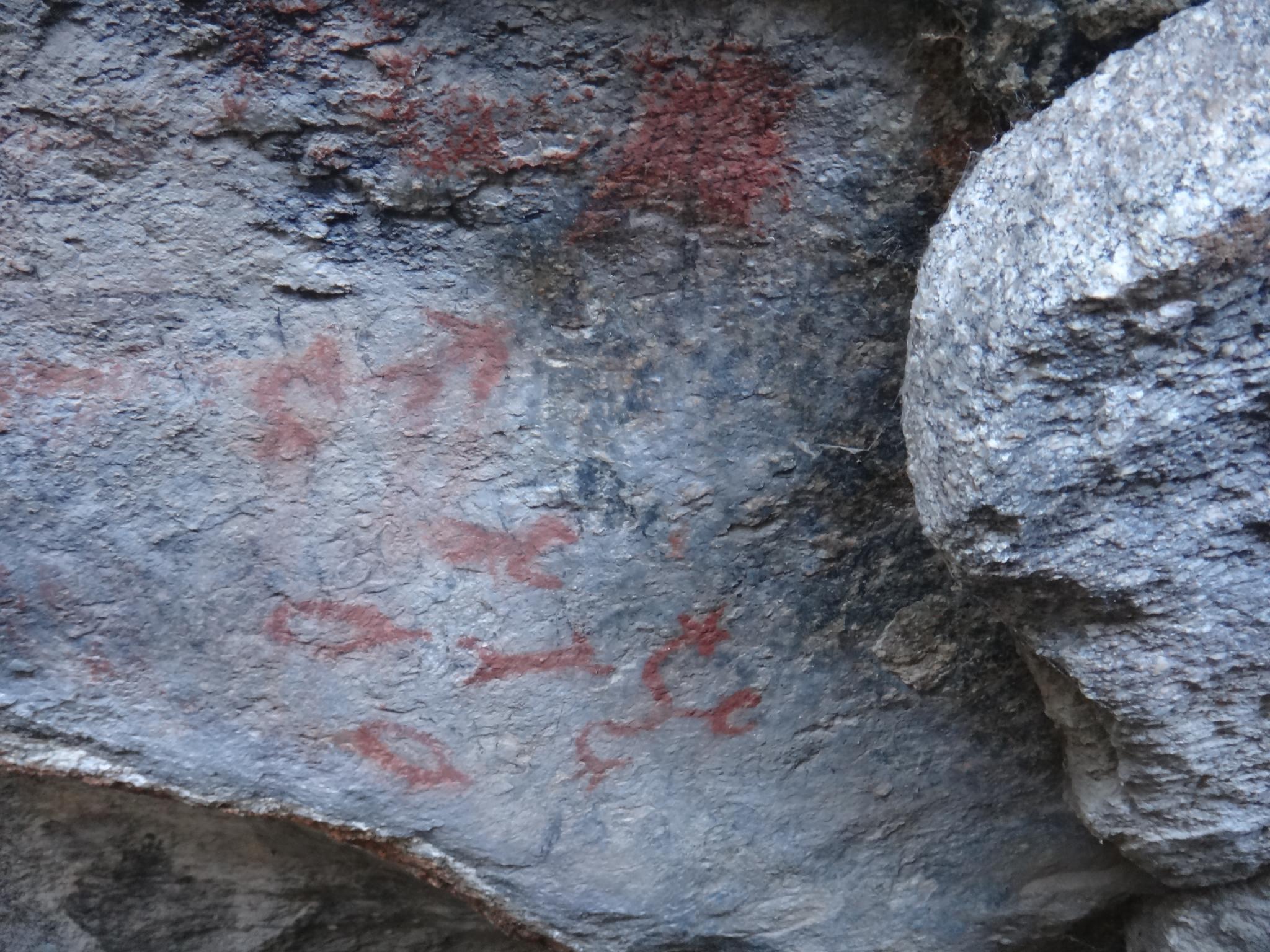
pictographs
Route
Summit: 3684 m ( 12087 ft. )
Trailhead: 2089 m ( 6854 ft. )
From the high 4x4 trailhead, follow the road. After about a mile and 500' of gain a junction is reached with a gate. To the right is a clearing and Camp Ethel, and the end of the road. Go left, past the gate up the closed road. It has become very overgrown in spots. The trail, however, is easy to follow. In a few spots, it meanders around dead fall. If you loose it, stop and backtrack a few steps to find it.
From the closed gate, the trail climbs steeply for about 2.75 miles to 10,000' feet. It has mercilessly few switchbacks, but does cross the stream a few times. Near 10,000', before opening into a large meadow, is the last water available on the hike. Filter here if needed.
Once in the large meadow, Ibapah is clearly visible to the north as the granite topped peak with a small peak between the meadow and the summit. Leave the trail, cross the meadow, and work to contour around the sub-peak to the pass between the sub-peak and Ibapah. There is a fairly well cairned trail for the last 1/2 of this, but it is frustratingly hard to find and follow on the way up. Follow the map carefully to try and hit it, but if all else fails, simply contour around to the saddle.
Almost there! From the saddle, a well worn trail meanders up to the summit and a couple of rock shelters. Enjoy the view. The peak to the north is Haystack, while the red peak to the south that has been prominent much of the day is the aptly named Red Peak. Return the same way, hopefully with some success staying on the cairned trail until the large meadow.
Photos
Maps

| 2wd Trailhead |
12S 254507mE 4407209mN N39° 46' 46" W113° 51' 60" |
| Alt Trailhead |
12S 253663mE 4408022mN N39° 47' 11" W113° 52' 36" |
| 4wd Trailhead |
12S 253528mE 4408864mN N39° 47' 39" W113° 52' 43" |
| Gate |
12S 252076mE 4409178mN N39° 47' 47" W113° 53' 44" |
| Upper Meadow |
12S 248558mE 4410712mN N39° 48' 33" W113° 56' 14" |
| Summit |
12S 250129mE 4412761mN N39° 49' 41" W113° 55' 11" |
| Panel |
12S 253733mE 4408601mN N39° 47' 30" W113° 52' 34" |