 Hiking
Bullion Falls
Hiking
Bullion Falls
Marysvale
Overview
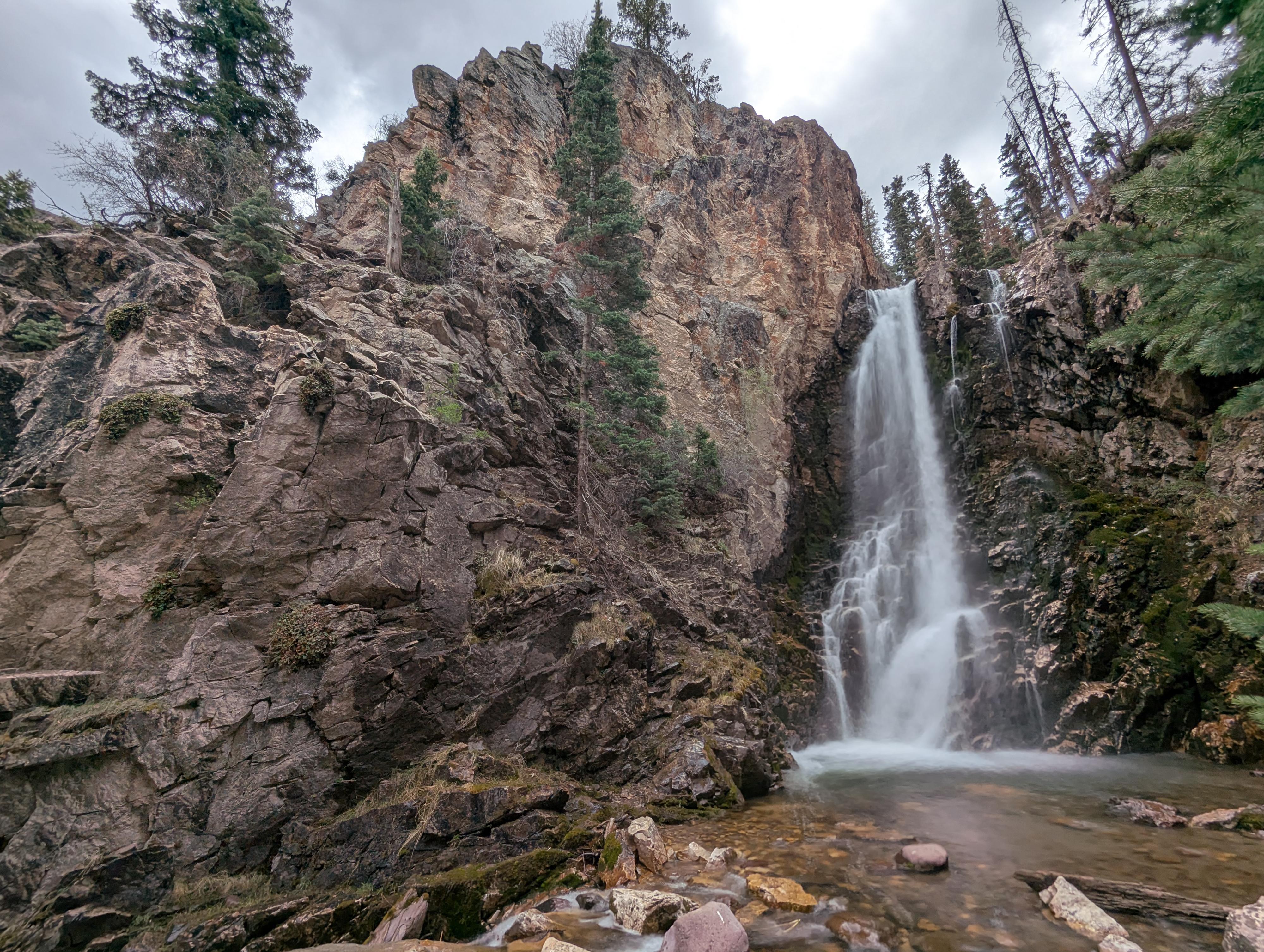
Nestled deep within the rugged Tushar Mountains just west of Marysvale, the hike to Bullion Falls visits a stunning waterfall surrounded by mining history. This trail leads through the "Canyon of Gold," where the dense forest, interesting rock formations, and mining ruins provide a beautiful backdrop to the roaring 60-foot waterfall. The waterfall is fed by snowmelt from some of the highest summits in the state. Particularly in spring, when flowing well, I think the falls are absolutely stunning.
The trail, according to my device, was about 2.2 miles roundtrip. Much of the trail is open to and used by ATVs (less than 60" wide), with a short section at the end that must be hiked by all. I think this is a very accessible trail to almost any hiker, though the final short section down to the falls is steep and loose. On our visit there were a couple of fixed lines here to help. If wanting to visit the base of the falls, some may find this steep section a little challenging. You can see a good view of the falls before this steep, loose point, though.
Getting There
Reaching the trailhead starts in the small town of Marysvale. The road is a fairly good dirt road, though I would recommend medium clearance.
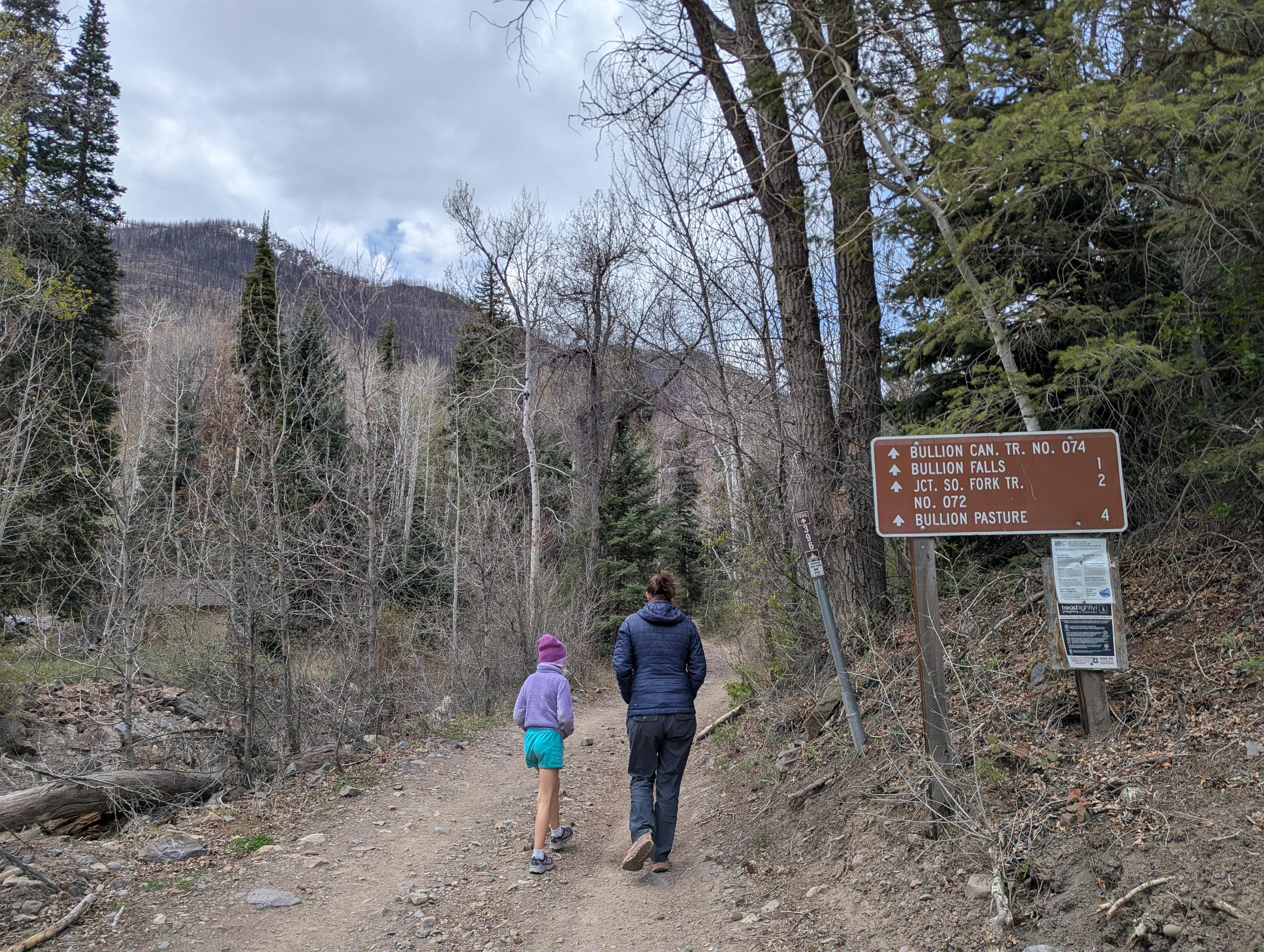
From US-89 that runs through town, turn east on Bullion Canyon Rd. This is signed for Miner's Park and Bullion Canyon.
Follow this west, taking a slight left at 1.2 miles and a slight right at 4.5 miles to continue on Bullion Canyon Road. About 6.2 miles the road crosses the creek, Pine Creek, and there is a parking area. This is the trailhead and is well signed.
Route Description
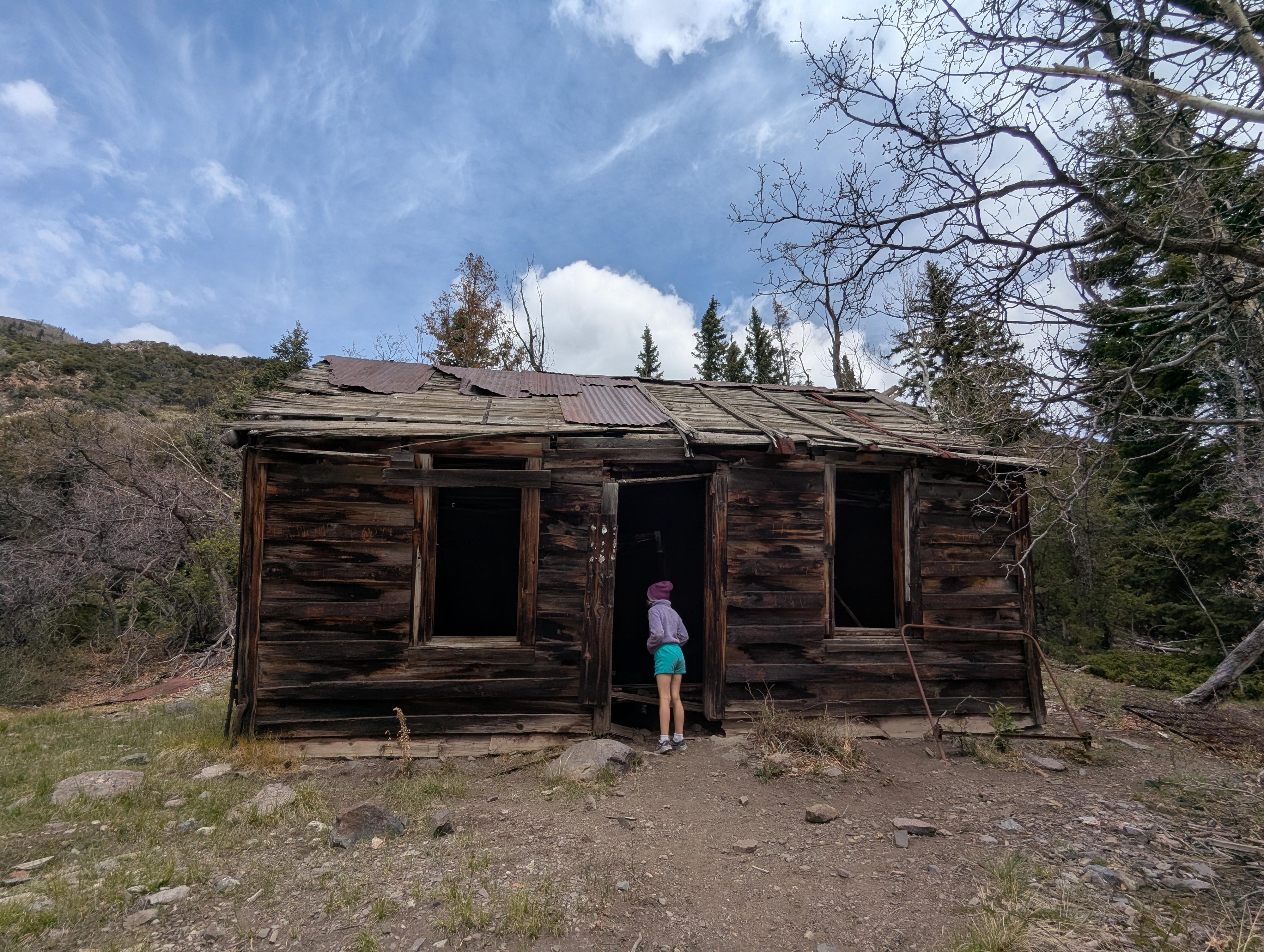
From the trailhead, cross back across the bridge, and follow the signed ATV trail (#074) as it climbs along the north side of the creek. In a few minutes (1/3 of a mile), you'll pass an old miner's cabin. It has a pretty good lean to it these days; I wonder how long it will stay standing!
Continue along the ATV trail. A little under a mile from the trailhead, the parking area and end of the ATV trail are reached. En route, just before the parking area, Cascade Falls is visible across the canyon. A sign next to the trail points it on.
From the end of the ATV trail, continue on the single-track trail for about 1/10th of a mile to a junction. At the junction, go left. Bullion Falls is visible from a nice viewpoint just before the trail drops steeply and gets much rougher to the base of the falls. Return the same way.
Maps

12S 384117E 4252584N
38°24'50"N 112°19'38"W
12S 383659E 4252362N
38°24'43"N 112°19'57"W
12S 383012E 4252220N
38°24'38"N 112°20'24"W
12S 382814E 4252164N
38°24'36"N 112°20'32"W
12S 382788E 4252127N
38°24'35"N 112°20'33"W
12S 382791E 4252089N
38°24'34"N 112°20'33"W