 Hiking
Maligne Canyon
Hiking
Maligne Canyon
Jasper National Park
Overview
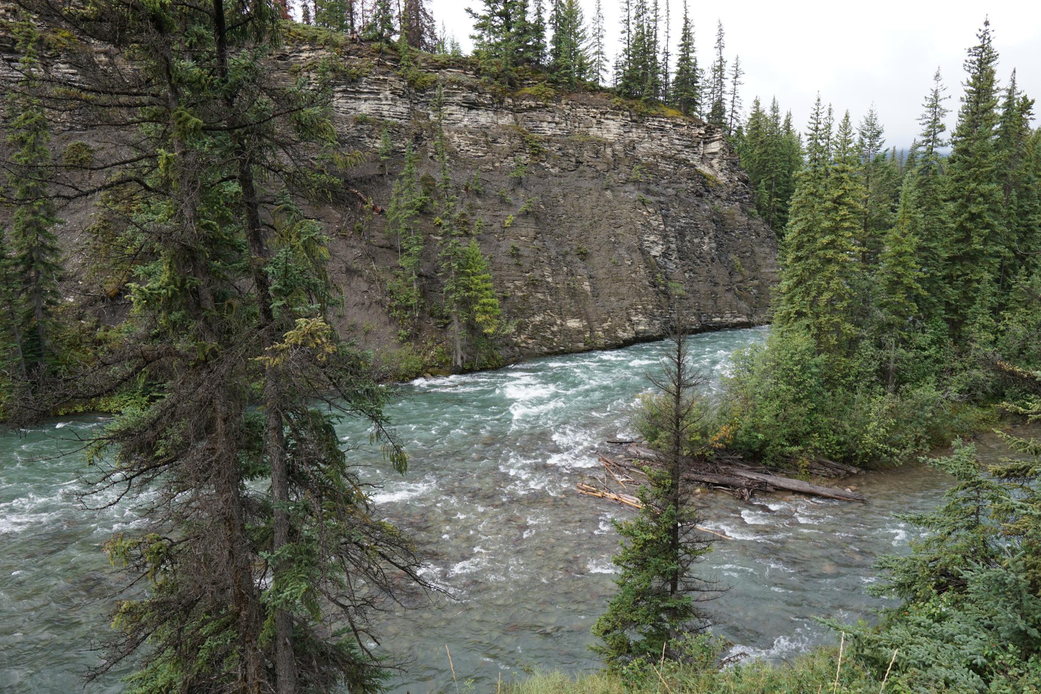
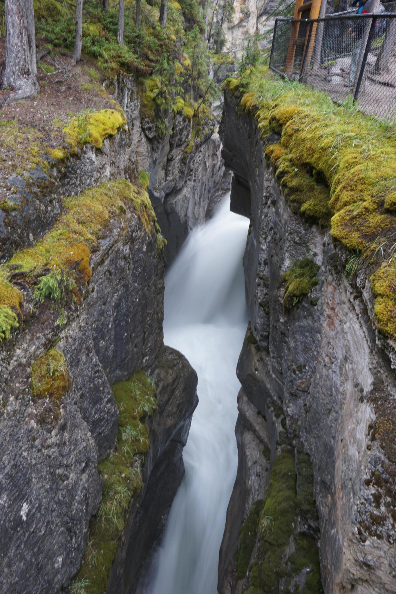
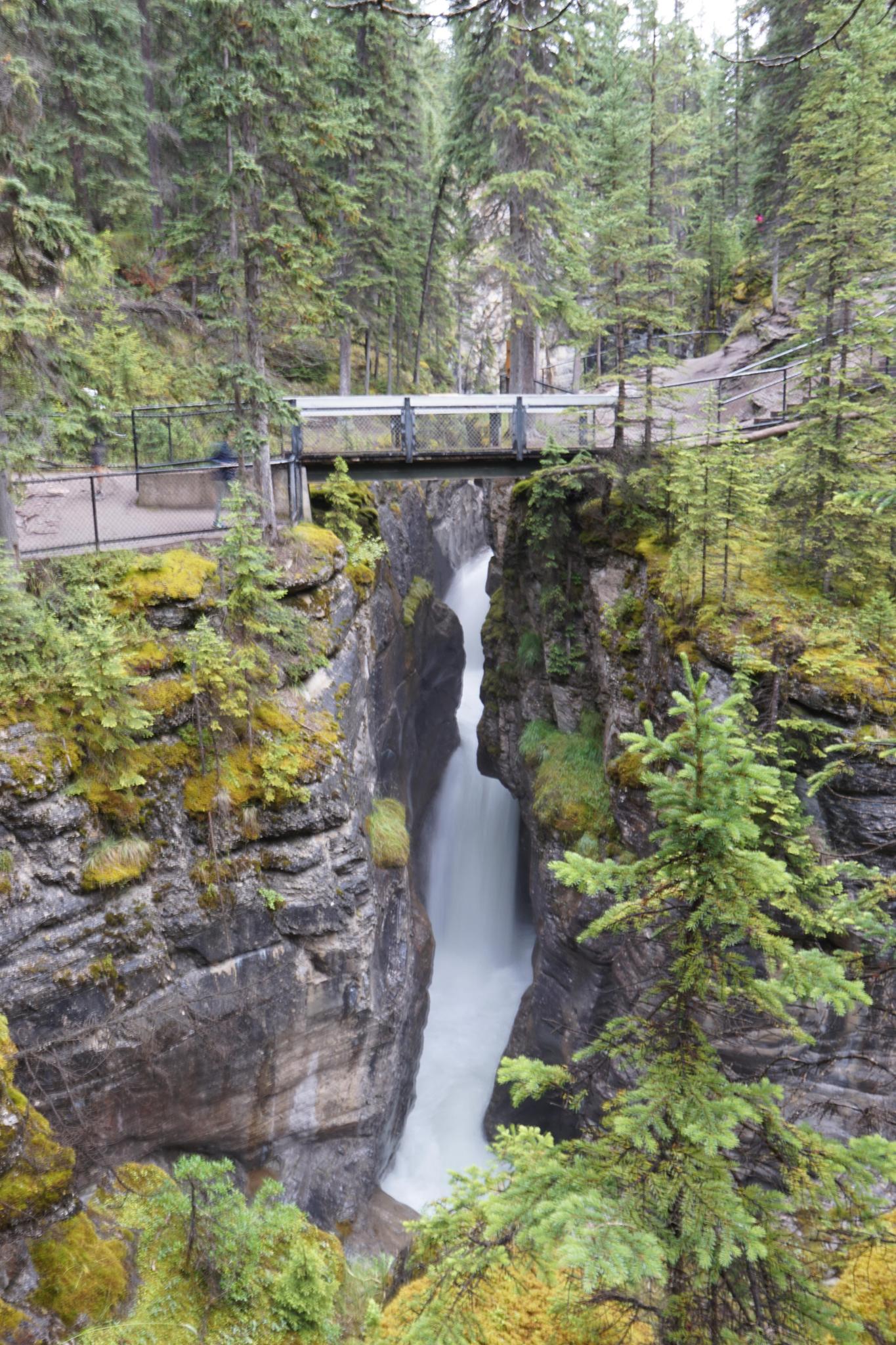
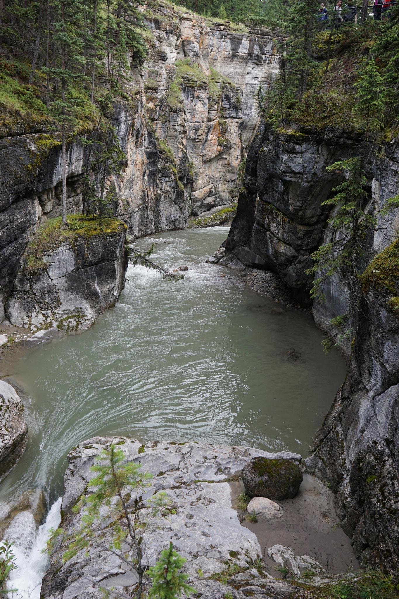
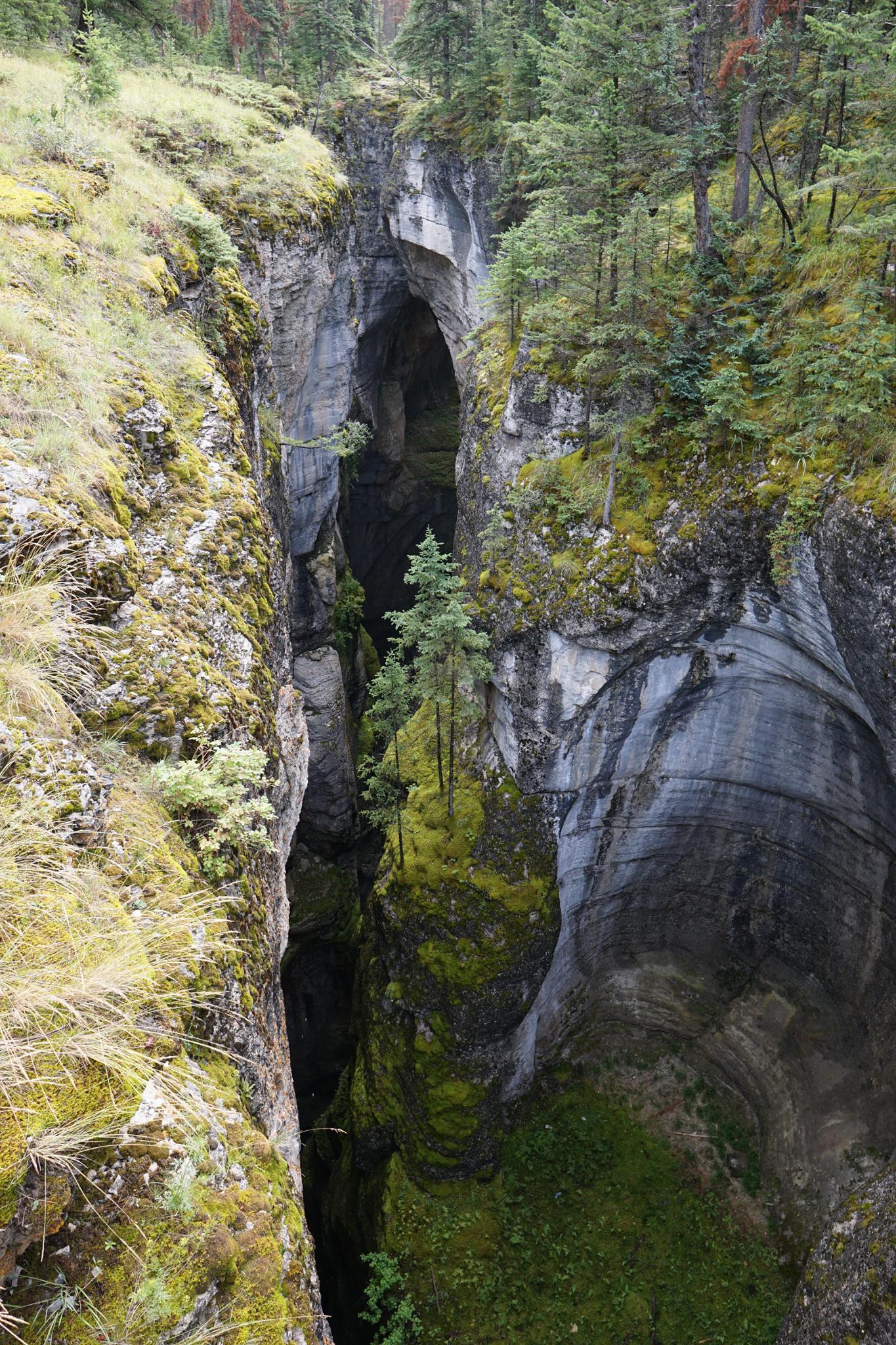
One of the must-do sights near Jasper is Maligne Canyon. A short hike visits a stunning canyon section where the Maligne River has cut deeply into the limestone layer, eroding a gorge that is, in spots, only 2 meters (6 feet) wide and 50 meters (160 feet) deep. A trail follows along the top of the gorge, crossing at several points to give close views of the tumultuous waters ragging in the canyon floor below.
Maligne Canyon is one of the most popular hikes in the area, and quite busy. Those wanting a short walk should start at the upper trailhead. The most dramatic sections of the canyon are near the upper trailhead and within just a few minutes of the parking lot. For those looking for a bit longer journey, I recommend hiking from the lower trailhead to the upper trailhead and back. Hike from the bottom and back sees the full canyon twice and a nice outing.
Getting There
Lower Trailhead
Head north out of Jasper on 16A to its junction with AB-16. Turn left on AB-16 toward Edmonton. After 1.8km, turn right onto Maligne Lake Rd.
The Malign Lake road crosses the Athabasca River. Follow it for 3.1km to a signed Malign Canyon Trailhead sign. Turn left and follow the side road 700 meters to its end at the trailhead.
Upper Trailhead
Instead of turning off the Malign Canyon road, stay on it for an additional 3 km. The signed Malign Canyon upper trailhead is on the left. There is a restaurant at the trailhead and a large parking lot. On weekends, this parking area can fill up early.
Route Description
Lower Trailhead
From the lower trailhead, the trail crosses the Maligne River, then heads upstream climbing reasonably steeply. At the first junction, go right, then right again at the second junction which stays closer to the river and is more scenic, in my opinion.
From here, it is an amble up along the river as the canyon deepens and becomes more and more dramatic. At the upper bridges, there is a trail on either side of the canyon. There are lots of options to see the canyon from different viewpoints. Return when you reach the upper parking lot.
Upper Trailhead
Follow the trail as it follows the canyon rim downstream. Several bridges and trails allow for excellent views into the gorge. Return the same way when motivation or time runs out.
Maps

11U 432731E 5863915N
52°55'14"N 118°00'02"W
11U 431666E 5864010N
52°55'17"N 118°00'59"W