Lily Lake Ski Area |

North Slope of the Uintas

Hiking Lily Lake Ski Area - North Slope of the Uintas Hiking Lily Lake Ski Area

North Slope of the Uintas

Overview

LENGTH: 1+ hours
MAPS: DEADMAN MOUNTAIN, UT

Sun

Sunny, with a high near 58. Southwest wind 6 to 13 mph.

58 | 28

Mon

Mostly sunny, with a high near 55.

55 | 32

Tue

A slight chance of rain showers after noon. Partly sunny, with a high near 58.

58 | 30

Wed

A chance of rain showers after noon. Partly sunny, with a high near 59.

59 | 34

Thu

A chance of rain showers before 9am, then a chance of rain and snow showers between 9am and noon, then a slight chance of thunderstorms and rain and snow showers likely. Partly sunny, with a high near 53.

53 | 33

View Full Weather Details
SEASON: Winter (Late November through March or early April)
GEAR: Standard Cross Country Ski or Snowshoe Gear

Sun

Sunny, with a high near 58. Southwest wind 6 to 13 mph.

58 | 28

Mon

Mostly sunny, with a high near 55.

55 | 32

Tue

A slight chance of rain showers after noon. Partly sunny, with a high near 58.

58 | 30

Wed

A chance of rain showers after noon. Partly sunny, with a high near 59.

59 | 34

Thu

A chance of rain showers before 9am, then a chance of rain and snow showers between 9am and noon, then a slight chance of thunderstorms and rain and snow showers likely. Partly sunny, with a high near 53.

53 | 33

View Full Weather Details
View of the high Uinta Mountains from the trailhead

View of the high Uinta Mountains from the trailhead

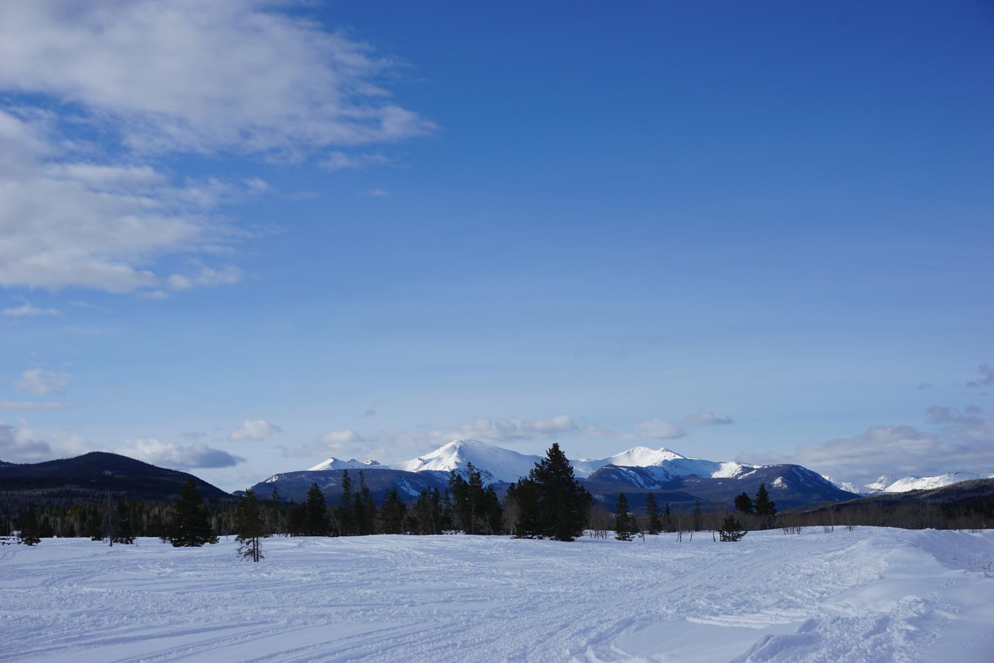
About 30 minutes south of Evanston, on the north slope of the Uinta Mountains, the Lily Lake Ski area is a gem with about 12 kilometers of groomed skate ski and traditional tracks. Loops can be combined of the various ways to make for either short outing or a full day in the mountains.

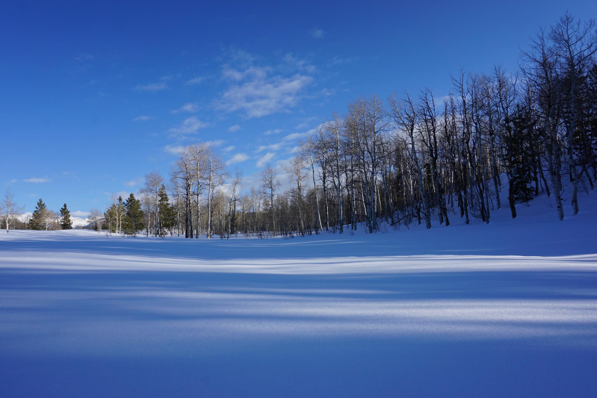
The trails meander in loops through the forest and open meadows. It is a family-friendly and picturesque place to ski. Most of the terrain is flat or very gently rolling, making a pleasant ski outing for beginners. Dogs are allowed, so be sure to bring the whole family including Fido.

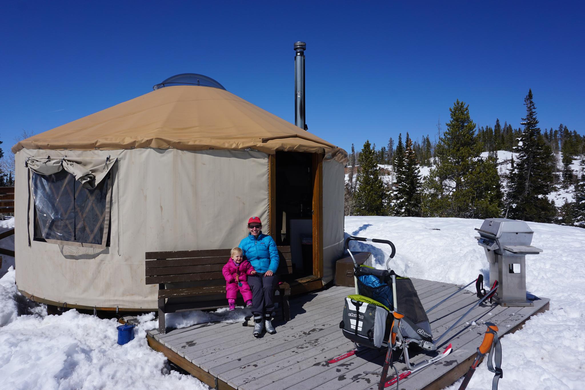
In addition to great skiing, the non-profit organization Bear River Outdoor Recreation Alliance works in conjunction with the Forest Service to groom the trails and maintain six yurts for members to rent. Becoming a member is easy, and the yurt rentals quite affordable. See the B.R.O.R.A. site for more information ( https://brorayurts.org/reservations ).

Note: The yurts are great, allow dogs, and are available in summer as well. The catch? They fill up quickly on winter weekends. If planning a yurt trip, you need to make a reservation in the fall when the reservation window is open. In my experience, getting a non-weekend reservation is much easier, so I have made yurt trips on Sunday/Monday's. Pro tip: The yurts I have stayed in have all had miserably flat mattresses. Bring a backpacking sleeping pad. Also, especially if traveling with children, I like a later winter trip. March, in particular, is excellent because there is daylight longer in the evening for the kids to play outside.

East Fork Yurt

East Fork Yurt

Getting There

From Evanston, Wyoming, travel south on WY-150 signed for the Uinta Mountains/Mirror Lake. Follow this, passing into Utah after about 23 miles. About 30 miles from Evanston, the road is closed and gated in the winter. Turn left just before the gate to reach a large parking area. Park on the right, it is signed XC Trail Parking. The area is often busy with both skiers and snowmobilers.

Note: There is a recreation fee to visit this part of the Uinta Mountains. As of 2019, it is $6 for a 3-day pass, payable at the trailhead in a self-serve kiosk. Be sure to have exact change or a check.
Untouched snow.

Untouched snow.

Route

From the trailhead, the groomed ski trail heads south across the flats before making a steep descent to the East Fork. Beginners will want to walk down the hill. Once across the river and up the other side, the trail branches into many loops. Each junction is well signed and easy to navigate. Trails do occasional change; an up-to-date map is available on the B.R.O.R.A. website ( https://brorayurts.org/map-of-ski-trails ).


Maps

Printable Maps:
XC Ski Trailhead

12T 514604mE 4529172mN

N40° 54' 49" W110° 49' 36"

Comments

Want to make a comment? Login and let yourself be heard.