Surprise Canyon |

Notom Road

Hiking Surprise Canyon - Notom Road Hiking Surprise Canyon

Notom Road

Overview

RATING: Easy Hiking
MAPS: The Post, UT; Wagon Box Mesa, UT

Tue

Sunny, with a high near 62. South wind around 7 mph.

62 | 38

Wed

Sunny, with a high near 67. West wind 5 to 8 mph.

67 | 40

Thu

Sunny, with a high near 69.

69 | 41

Fri

Sunny, with a high near 69.

69 | 43

Sat

Sunny, with a high near 66.

66 | 44

View Full Weather Details
SEASON: Any, hot in summer
WATER: None, bring all you need.
FLASHFLOOD: Medium

Tue

Sunny, with a high near 62. South wind around 7 mph.

62 | 38

Wed

Sunny, with a high near 67. West wind 5 to 8 mph.

67 | 40

Thu

Sunny, with a high near 69.

69 | 41

Fri

Sunny, with a high near 69.

69 | 43

Sat

Sunny, with a high near 66.

66 | 44

View Full Weather Details
Surprise Canyon Trailhead

Surprise Canyon Trailhead

Surprise Canyon Narrows

Surprise Canyon Narrows

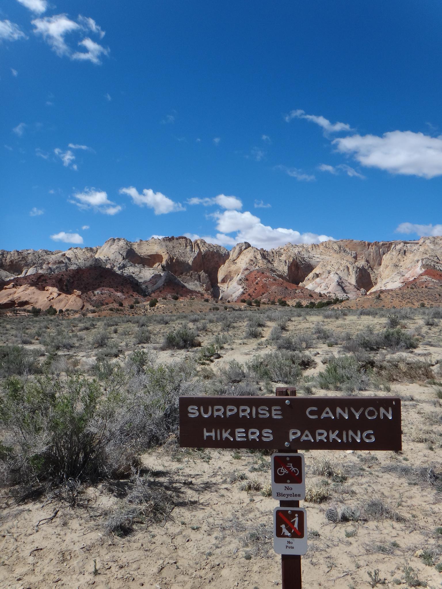
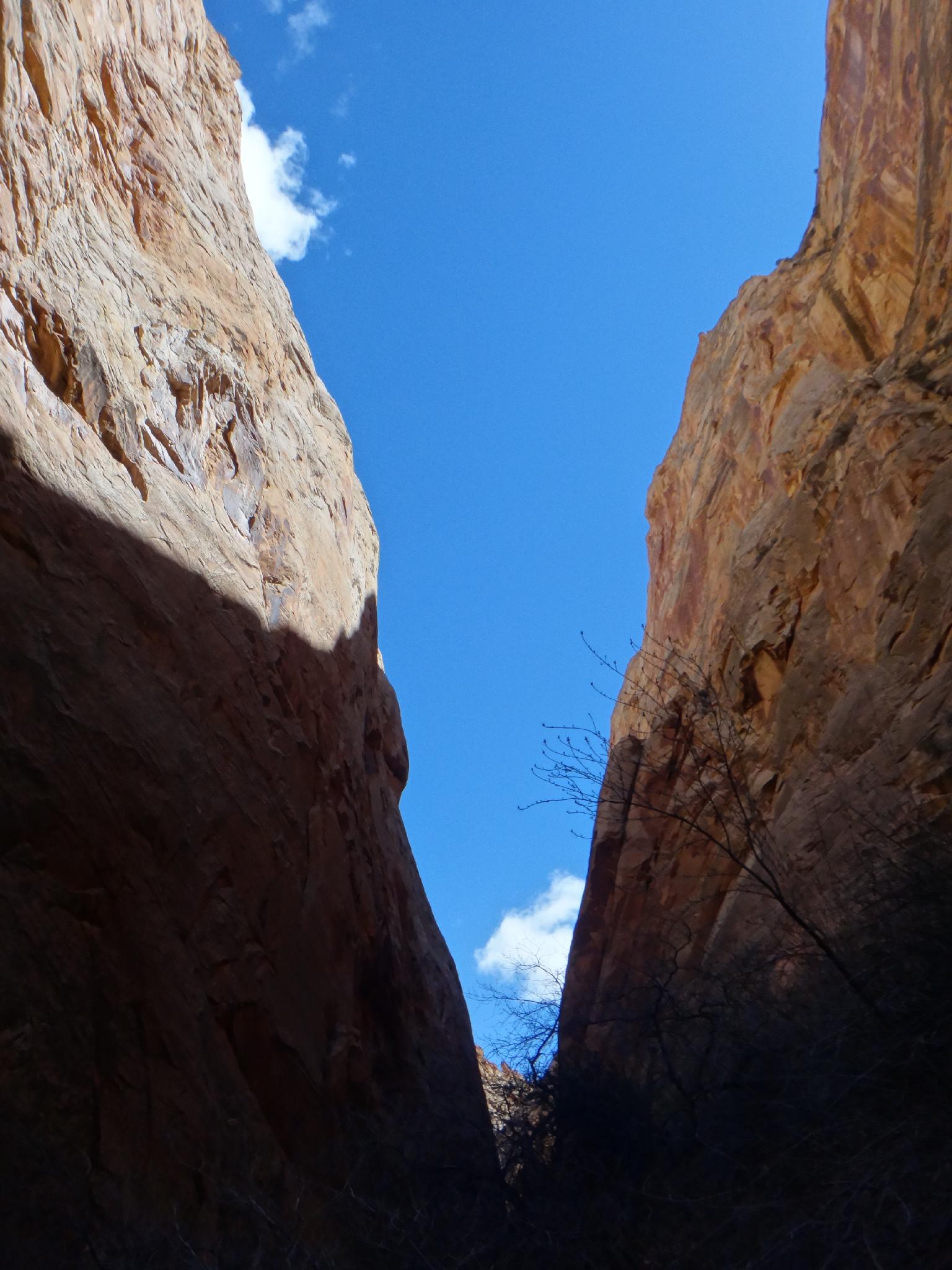
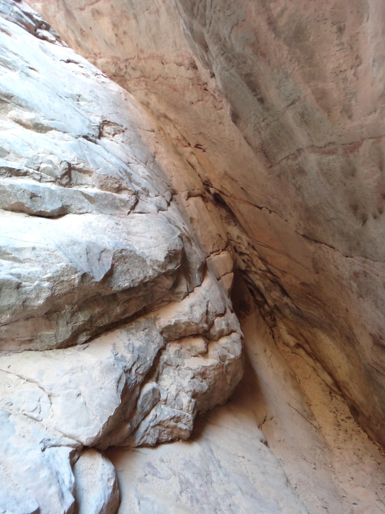
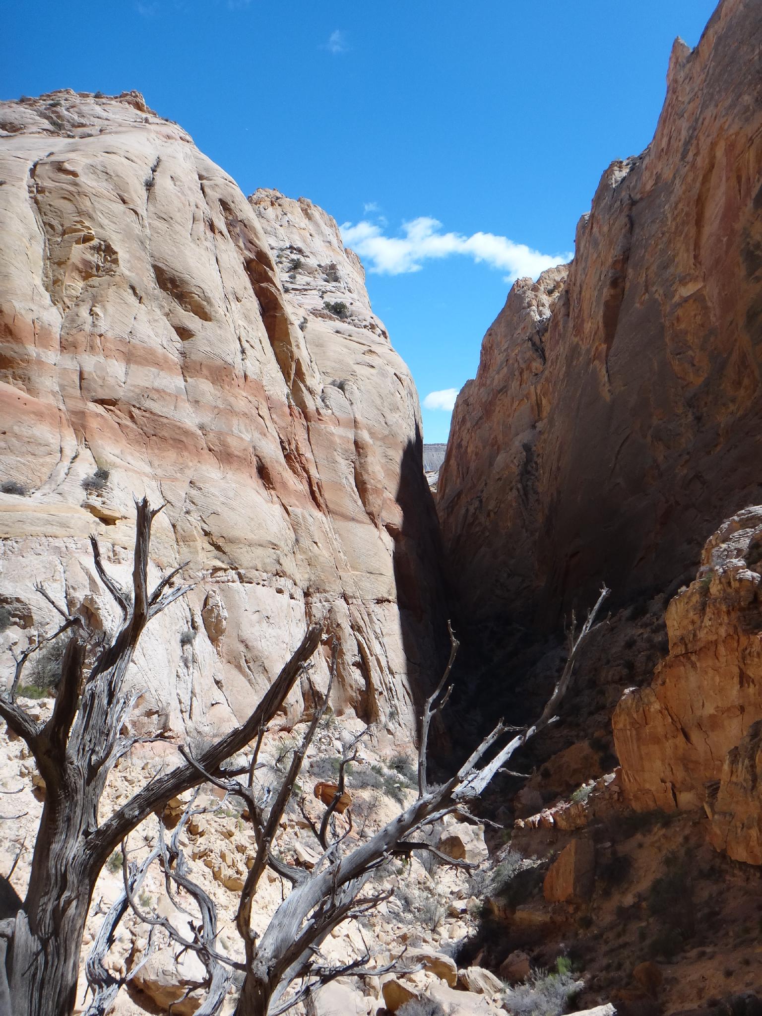
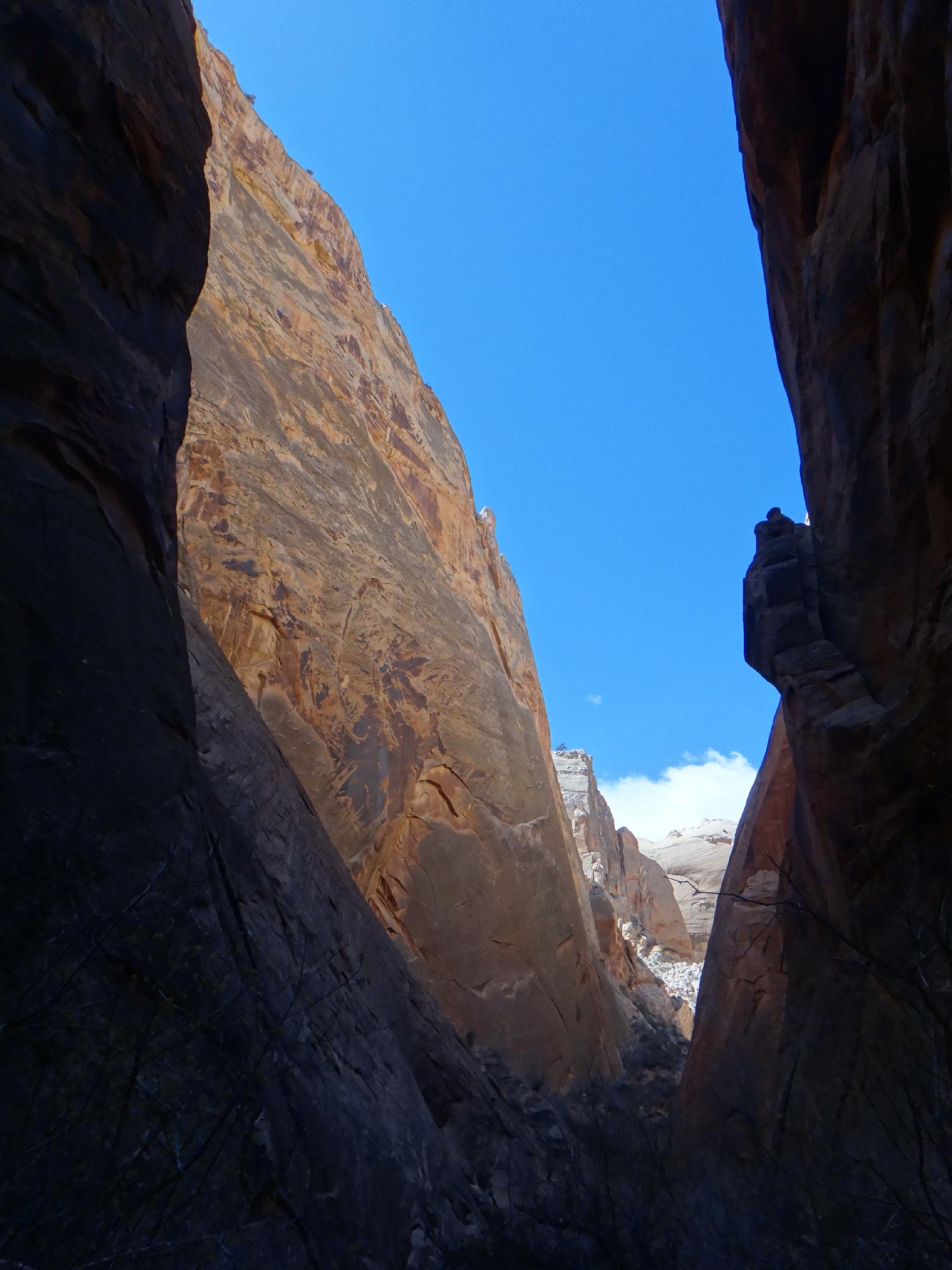
Surprise Canyon is a good, short family friendly hike to a short section of narrows that cut into the Waterpocket Fold near the Burr Trail. The narrows are some of the easiest to visit in Capitol Reef, and make a great short trip. Though narrow, this isn't a slot and is generally dry. Near the end of the narrows a short dryfall and potential pool mark the scenic turn around spot for most. The fall is just challenging enough that canyoneers may enough the up climb. Others can climb around the falls if motivated, but the best section of the canyon is over.

Dryfall in Surprise Canyon

Dryfall in Surprise Canyon

Looking back down Surprise from the top

Looking back down Surprise from the top

Getting There

Travel east out of Capitol Reef National Park on highway 24. Just past the park, 0.25 miles, is the well signed Notom road.

  • Turn south onto Notom Road and reset your odometer. ( 12S 488763mE 4237262mN / N38° 17' 00" W111° 07' 43" )
  • At 13.6 miles, is the Sandy Creek Junction. Stay right on the Notom road here. ( 12S 493913mE 4217290mN / N38° 06' 12" W111° 04' 10" )
  • At 13.9 miles, is the second Sandy Creek Junction. Stay right on the Notom road here. ( 12S 494104mE 4216858mN / N38° 05' 58" W111° 04' 02" )
  • 21.2 miles to the Cedar Mesa Campground on the right (west) side of the road. ( 12S 492760mE 4206611mN / N38° 00' 26" W111° 04' 57" )
  • Burr Trail junction is at 32.5 miles. Stay straight, heading toward Bullfrog. ( 12S 498890mE 4189788mN / N37° 51' 20" W111° 00' 45" )
  • 34.3 miles from highway 24, the Surprise Canyon trailhead is a small turn out on the right (west) side and is signed. ( 12S 500983mE 4187875mN / N37° 50' 18" W110° 59' 20" )
Good View in the Narrows

Good View in the Narrows

Route

Follow the trail west and it heads for the obvious canyon. Several social trails exist, but once the main trail enters the wash, stay in the wash. It is a short 10-15 minutes to the bottom of the canyon proper. As you continue heading up the canyon, the narrows are encountered shortly and end in a dryfall and likely pool. This obstacle is up climb-able, or can be bypassed by a social trail on the south (right looking down canyon).

Above the dryfall, the canyon opens and becomes a bit of a boulder jumble. A social trail climbs high up to the headwall, though once past the dryfall, the canyon is less interesting. Return the same way.


Videos

Surprise Canyon richardpattison

Maps

Route / 2.18 miles / Elevation Range 4,902 - 5,297 ft.
Printable Maps:
Trailhead

12S 500984mE 4187875mN

N37° 50' 18" W110° 59' 20"

Comments

Want to make a comment? Login and let yourself be heard.