Climbing Pensive Putterman
Kane Creek
Overview
Fri 94 | 67 |
Sat 93 | 70 |
Sun 94 | 68 |
Mon 97 | 69 |
Tue 93 | 74 |
View Full Weather Details |
Fri 94 | 67 |
Sat 93 | 70 |
Sun 94 | 68 |
Mon 97 | 69 |
Tue 93 | 74 |
View Full Weather Details |
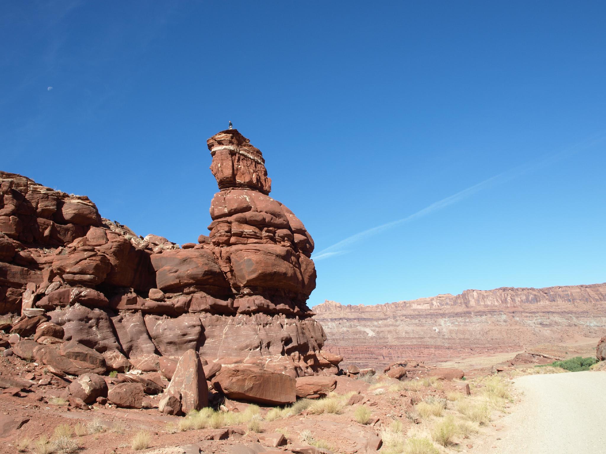
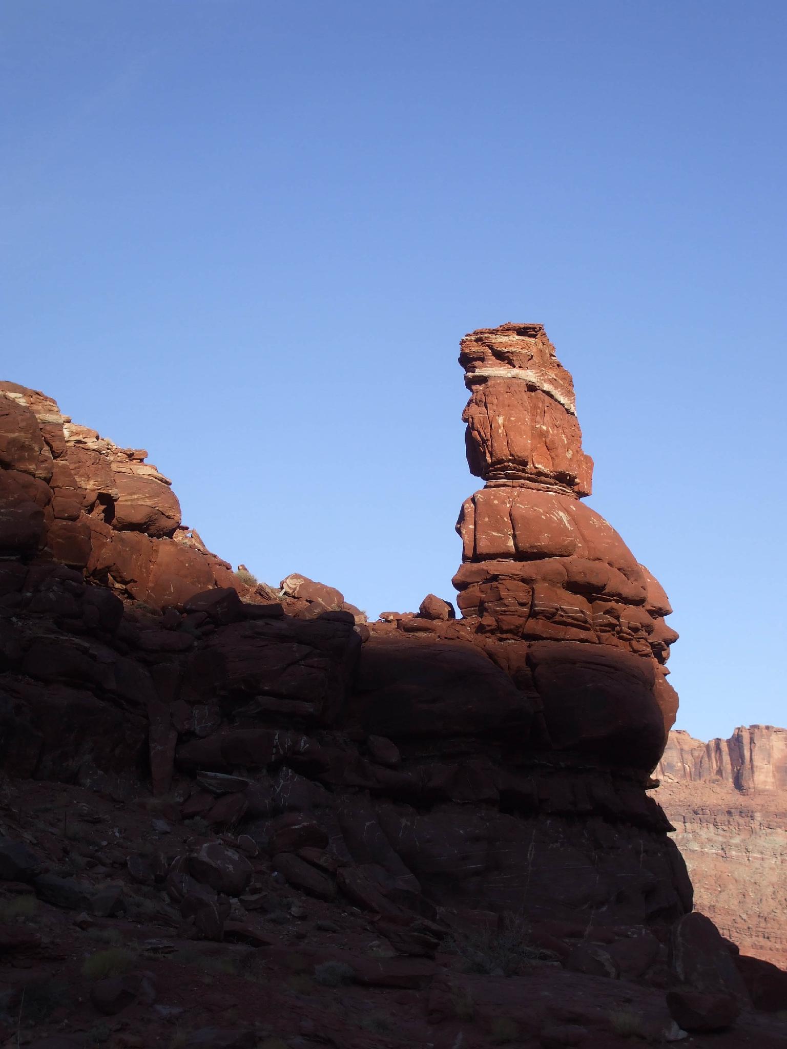
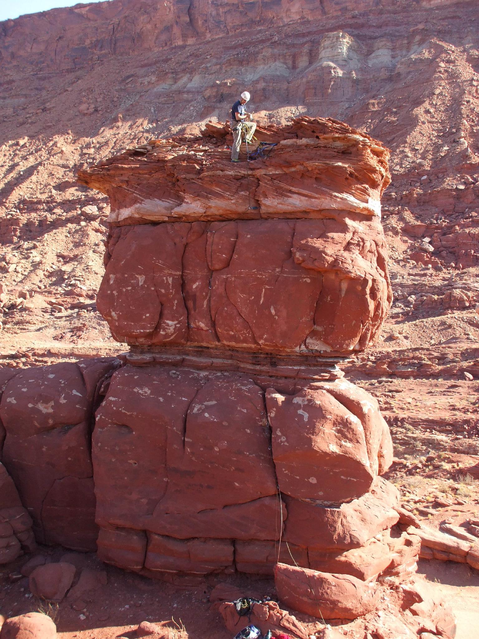
Pensive Putterman, just off Kane Creek road, is another short, easy tower to summit. Due to it's proximity next to the road, climbing it often draws a crowd of on-lookers. If you are doing Happy Turk Hoodoo across the road, be sure to climb this as well.
Getting There
From downtown Moab, head to south to Kane Creek Blvd. Turn right on Kane Creek Blvd. (This is currently where the McDonald's and Burger King are.)
- Reset odometer as you turn onto Kane Creek Blvd. ( 12S 626362E 4269376N / 38°33'50"N 109°32'59"W )
- 2.6 miles - Moab Rim Trailhead and Pit Toilet on the left. ( 12S 623455E 4268771N / 38°33'32"N 109°34'59"W )
- 2.7 miles - King Bottom Campground ( 12S 623368E 4268646N / 38°33'28"N 109°35'03"W )
- 3.05 miles - Moonflower Campground / Trailhead on the left and rock art panel. ( 12S 623137E 4268307N / 38°33'17"N 109°35'12"W )
- 3.5 - Dirt road goes off on the left and up a hill. This is the Elephant Panel Trailhead. ( 12S 622637E 4267587N / 38°32'54"N 109°35'34"W )
- 4.0 miles - Small Sheep Rock art panel next to the road on the left. ( 12S 622334E 4267010N / 38°32'35"N 109°35'46"W )
- 4.3 miles - Small petroglyph panel next to the road on the left. ( 12S 622112E 4266521N / 38°32'19"N 109°35'56"W )
- 4.6 miles - Pritchett Canyon Trailhead ( 12S 622059E 4266123N / 38°32'07"N 109°35'58"W )
- 4.7 miles - Road turns to dirt with a big parking area on the left. ( 12S 622011E 4266036N / 38°32'04"N 109°36'00"W )
- 5.1 miles - Small parking area and trail going up to a panel on the left. ( 12S 622546E 4265578N / 38°31'49"N 109°35'39"W )
- 5.3 miles - Large parking area on the right. This is the False Kiva Trailhead, and also the Amasa Back Trail Parking area. ( 12S 622314E 4265360N / 38°31'42"N 109°35'48"W )
- 5.8 miles - Amasa Back Trail ( 12S 621895E 4264888N / 38°31'27"N 109°36'06"W )
- 6.1 miles - Birthing Rock on the right. Small parking area. This is also the trailhead for Map Panel. ( 12S 621821E 4264647N / 38°31'19"N 109°36'09"W )
- 6.18 miles - Boulder with petroglyph on the right. ( 12S 621845E 4264524N / 38°31'15"N 109°36'08"W )
- 6.2 miles - Parking are on the left just after cresting a hill and starting down the other side. This is the Funnel Arch Trailhead. ( 12S 621995E 4264439N / 38°31'12"N 109°36'02"W )
- 6.9 miles - Spring Site Walk in Campground ( 12S 622505E 4264245N / 38°31'05"N 109°35'41"W )
- 7.7 miles - Hunter Canyon Campground ( 12S 622319E 4263329N / 38°30'36"N 109°35'49"W )
- 8.0 miles - Ice Cream Parlor Climbing Area on the left. ( 12S 622006E 4263348N / 38°30'37"N 109°36'02"W )
- 9.5 miles - Ledge A Campground ( 12S 621541E 4261386N / 38°29'33"N 109°36'23"W )
- 9.9 miles - Ledge B Campground ( 12S 621699E 4260561N / 38°29'06"N 109°36'17"W )
- 10.2 - Happy Turk Hoodoo / Pensive Putterman ( 12S 621873E 4260234N / 38°28'56"N 109°36'10"W )
Route
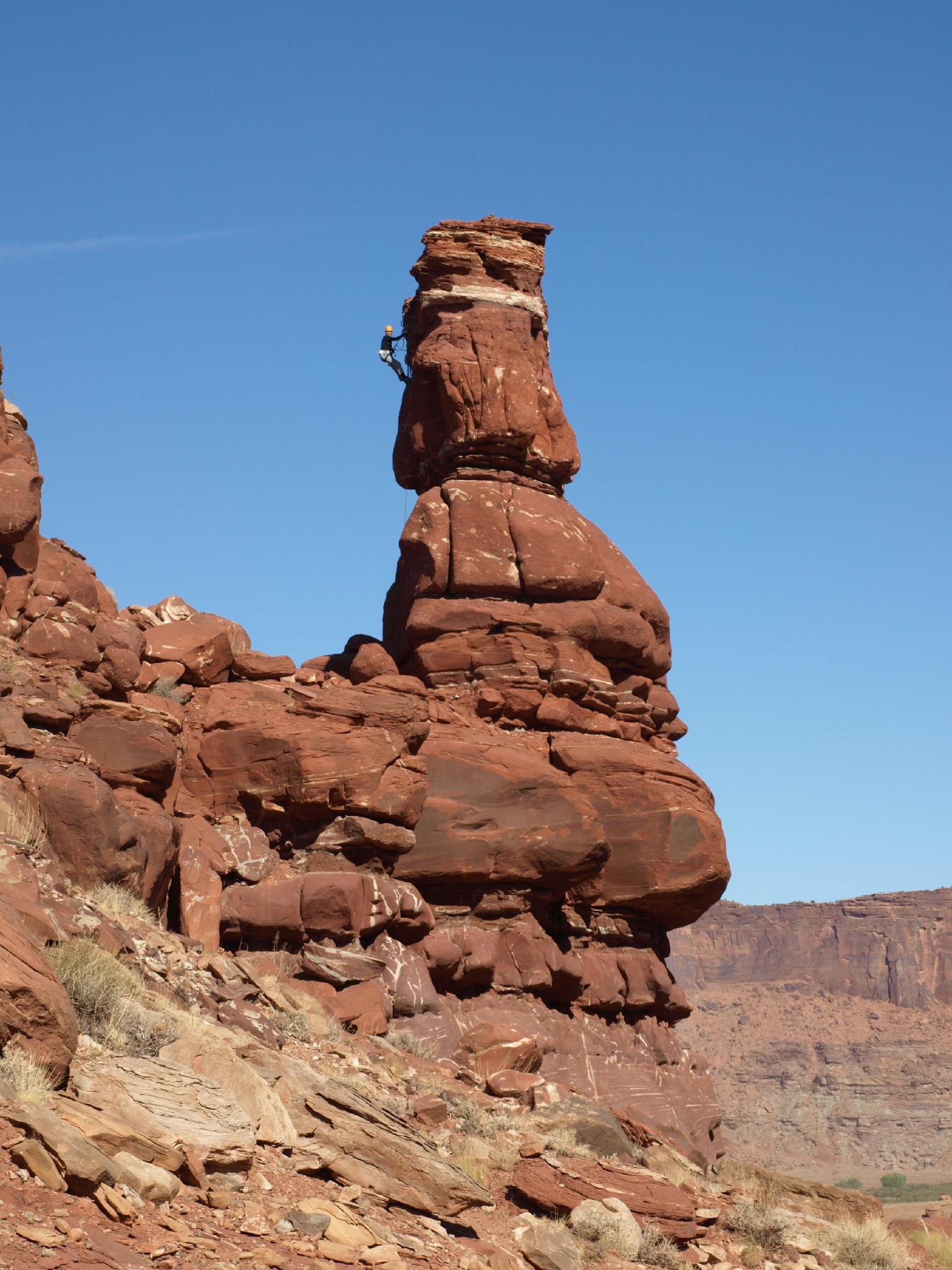
Route: All Along the Putt-Tower
The route starts on the back side of the tower, away from the road. Scramble up to the base. There are 2 bolts without hangers out on the right, which are not part of the route. Instead, look for 3 pitons up the middle of this back side.
To reach the first piton, free climb or aid the crack to the right of the piton crack. Once up 15 feet to a ledge, traverse over, place a piece or two, then either aid up to, or stick clip the first piton. If aiding, the crack left of the piton crack accepts better gear. From the first piton, follow another piton directly above, then lean out right and clip a third piton before summiting.
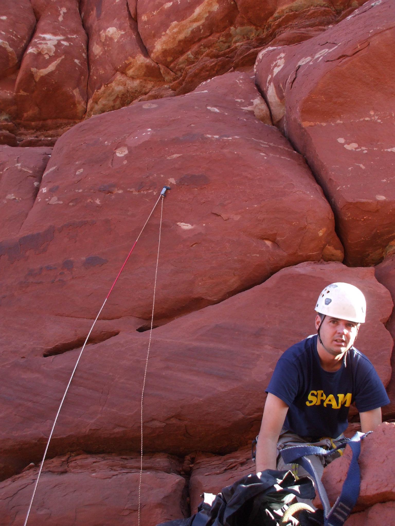
Rappel the route using an interesting, but seemingly solid anchor.
Pensive Putterman |
12S 621845E 4260227N 38°28'55"N 109°36'11"W |
Happy Turk Hoodoo |
12S 621998E 4260297N 38°28'58"N 109°36'05"W |