 Floating
Oneida Narrows
Floating
Oneida Narrows
Southeast Idaho
Overview
Oneida Narrows is an excellent beginner-friendly tubing or kayaking float not far from Preston, Idaho. This is a float I had not heard about until my then-girlfriend, now wife, invited me to join her and her friends to float it many years ago. It is a really fun outing! On a warm summer day, dozens of tubes are likely to be seen in the canyon. I think, given the traffic, it is beginner-friendly but does have some riffles and rocks to avoid. On my first visit, I used a canoe, which proved challenging at my skill level but still very fun. Our last trip, with a 9-year-old, was in an inflatable kayak and a packraft. It was easier for me than a canoe and as fun and beautiful as I had remembered it!
A few things to know:
- The water you will be floating in came out from a dam minutes upstream. This means the water is generally pretty cold. If tubing, you will want a HOT day.
- This section is becoming popular for packrafters and, I think, makes an excellent beginner packrafting section. The rocks and obstacles are all straightforward at most flows. Spring can be an excellent time for packrafters, when it is still too cold for tubers.
- Commonly, a 4.5-mile section is floated. If you want more, you can continue on to the highway bridge that makes for about a 6-mile float but adds 2 obstacles that are probably class II+/III. If you want to go even further, you can continue another 4.5 miles or so (10.5-ish total) to a takeout at Riverdale Campground near the junction of SR-34 and SR-36 or even continue beyond.
- Winds can affect your time, and it can be slow going in an inner tube. For reference, in an inflatable kayak and packraft, we did the 6-mile stretch in about 2.5 hours at about 880 CFS.
- Flows are dam controlled. You can see the schedule at https://www.pacificorp.com/community/recreation/water-release/bear-river/below-oneida-dam.html .
- What flows are best? 500CFS would be my recommended minimum, though 600-800 would be my preferred minimum. Above about 1,200+ it will be fast, and people in tubes are more likely to flip and have a challenging time.
- There is a shuttle and rental company near the section, https://familyfuntubing.com, though it is also an easy bike shuttle. On our last trip, from the put-in to the highway bridge took about 35-40 minutes round trip to drop off the car and bike back up.
Getting There
The directions here start from the junction of Highway 34 and 36, which is about about 6 miles north of Preston on ID-34. For clarity, put-ins and take-outs are listed as you come to them. From the junction of ID-34 and ID-36, just north of the Bear River, go right (east).
Riverdale Campground - Take Out Side Trip
After the ID34/ID36 junction, as you head east on ID-36, go right on the first side road, 3700N follow this road a short distance to just before the bridge. Riverdale Campground is signed on the left just before the bridge.
Continue on ID-36 for about 3 miles to the signed Oneida Narrows Bear River Road on the left.
Highway 36 Bridge - Take Out Side Trip
If taking out at the highway 36 bridge, continue on ID-36 for about 1/2 mile to the bridge over the Bear River. There is a good parking spot on the east side of the bridge at the top of the takeout.
Head up Oneida Narrows Bear River Road, which is initially paved. About 1/2 mile for ID-36 the pavement turns to dirt right where the pipeline crosses the river. If planning on floating this rapid, it might be worth scouting on the drive up.
About 1.75 miles from ID-36 is the diversion dam below the standard takeout. If floating this rapid, it may be useful to scout it on the drive up. At 1.8 is the usual takeout on the right. It has a fairly large parking area and usually a porta-potty.
The dirt road continues up, crosses a bridge, then passes the Redpoint Campground at about 4 miles for ID-36. Keep going to the put-in that is a large parking area on the left about 6.1 miles from ID-36. There is usually a porta-potty at the put-in.
Route Description
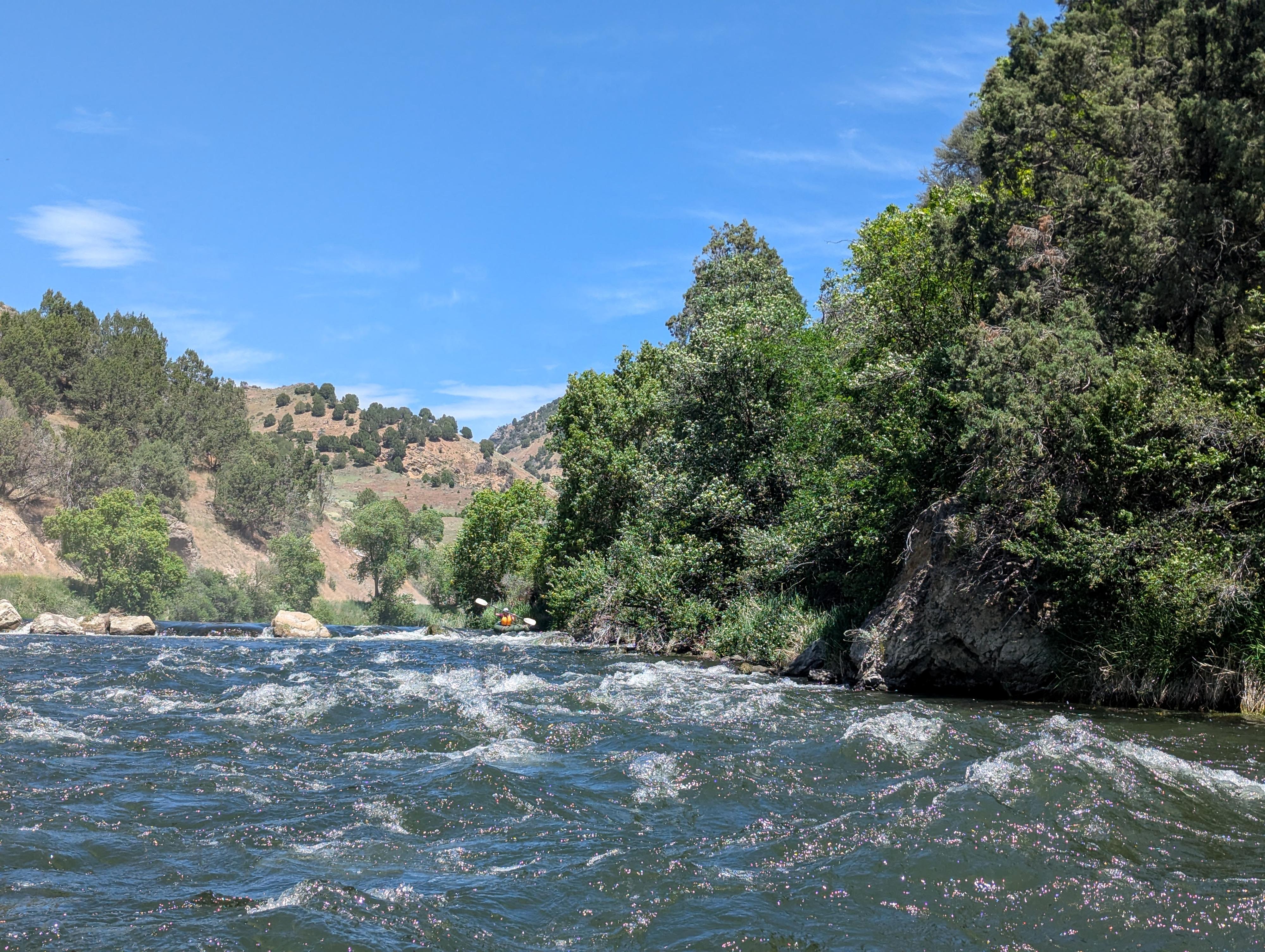
From the put-in, there are some riffles and rocks immediately as you put in and go under a bridge. From here down, follow the deepest-looking channel. Not far below the bridge, the river braids at some minor riffles. On our trip, left was the deepest. Tubers in the right channel ended up having to walk a bit. This upper section is open without many obstacles and only a few minor riffles. Lovely, big open views and oftens lots of birds.
At about 2.25 miles, the Redpoint Campground is on river left. There is a big eddy just downstream of the campground that makes a great break spot. From here down, the river has more rocks, riffles, and obstacles.
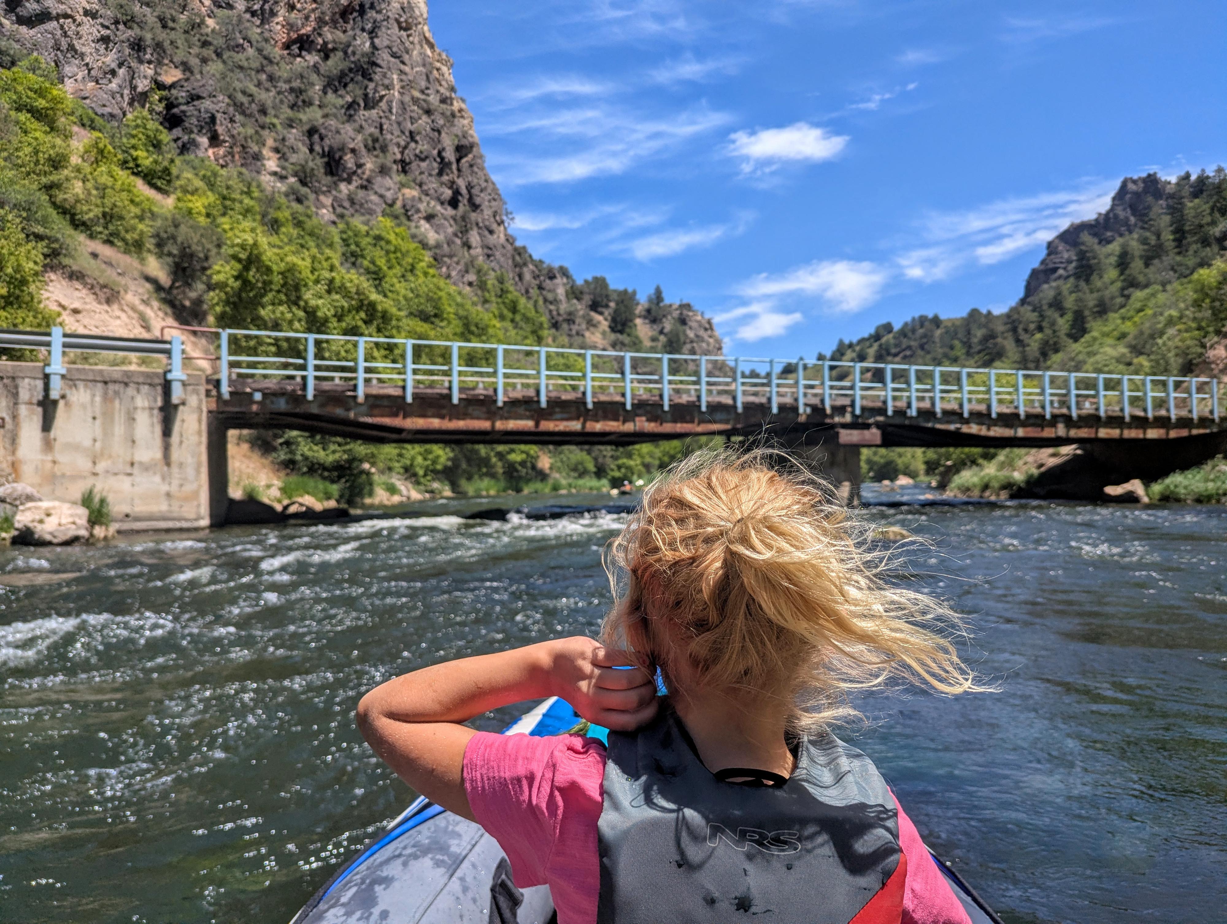
About 2.8 miles from the put-in, the river goes under a bridge. There are many rocks and riffles before and after the bridge. Fun!
At about 4.4 miles, on the right, is a large bank and standard takeout. Just below this takeout is a diversion and a more difficult rapid. Don't continue unless you are confident in your skills!
First Diversion Dam Rapid
The first diversion dam is just around the bend from the 4.4-mile takeout. You can scout it on either side. I have always found far left the easiest run, though still narrow and boulder-filled.
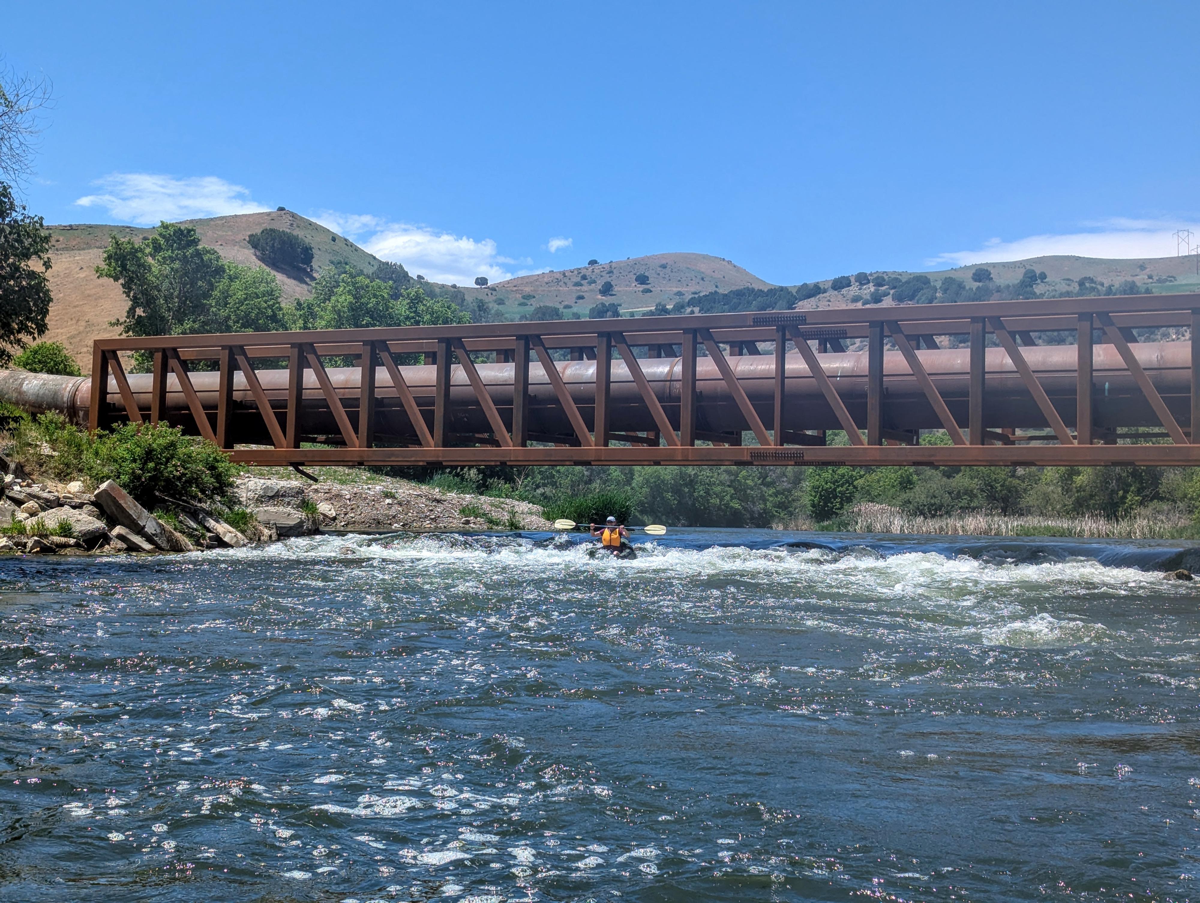
Pipeline Rapid
Easier floating takes you to the second major rapid on this section at about mile 5.7. It is directly underneath a pipeline that crosses above the river. It can be scouted from either side. I always run it just a bit left of the right side. This is down a steep but straightforward short rock pile.
Highway Bridge
Once past the pipeline, it is an easy float to the highway bridge just past mile 6. The takeout is on river left, just after the bridge.
Continuing to Riverdale
If you choose to continue to Riverdale Campground, it is about 4.5 miles more downstream. The section is more open and agricultural with the occasional riffles. About a mile from Highway 36, the river goes under a bridge. About 0.3 miles from the takeout, just after the river goes around a sharp bend and heads north, is a diversion dam that will likely need to be portaged on the right.
The takeout is right before the river goes under an old bridge. There is a concrete ramp on river right at Riverdale Campground.
Photos
Maps
")
")
12T 437941E 4679354N
42°15'50"N 111°45'09"W
12T 437769E 4678819N
42°15'33"N 111°45'16"W
12T 437348E 4676046N
42°14'03"N 111°45'33"W
12T 436632E 4675721N
42°13'52"N 111°46'05"W
12T 435561E 4673668N
42°12'45"N 111°46'50"W
12T 435322E 4673488N
42°12'39"N 111°47'01"W
12T 435286E 4671826N
42°11'45"N 111°47'02"W
12T 435729E 4671515N
42°11'35"N 111°46'42"W
12T 435089E 4670904N
42°11'15"N 111°47'10"W
12T 431845E 4668696N
42°10'03"N 111°49'30"W
12T 431326E 4668655N
42°10'01"N 111°49'53"W
12T 437920E 4679361N
42°15'50"N 111°45'10"W
12T 437479E 4677834N
42°15'01"N 111°45'28"W
12T 437363E 4676395N
42°14'14"N 111°45'33"W
12T 436397E 4675586N
42°13'48"N 111°46'15"W
12T 435936E 4674091N
42°12'59"N 111°46'34"W
12T 435216E 4672782N
42°12'16"N 111°47'05"W
12T 435700E 4671654N
42°11'40"N 111°46'44"W
12T 434884E 4670737N
42°11'10"N 111°47'19"W
12T 433822E 4670200N
42°10'52"N 111°48'05"W
12T 432368E 4669797N
42°10'39"N 111°49'08"W
12T 432022E 4668618N
42°10'00"N 111°49'23"W