 Canyoneering
Fire Canyon
Canyoneering
Fire Canyon
Capitol Reef
Overview
Off of the Frying Pan Trail and into the Fire (Canyon)! Though a short canyon, this is a fun romp with big views. The approach takes in the distant and dramatic views of Capitol Reef. The canyon meanders through Wingate and Navajo layers with several interesting sections.
Most of the canyon is an easy and straightforward amble. The crux section, however, requires a few downclimbs that are a bit exposed, and a bit hard! Every group needs a solid climber! Anchors aren't easily available at two of the crux drops.
Getting There
From the visitor center, take the scenic drive. It passes several visitor attractions at 1.0 miles, and the campground at 1.2. At 1.6 miles is a fee station. Currently (2017) the fee is $10 per car, or free with a National Parks pass. Continue to 3.4 miles where Grand Wash is on the left. Follow the Grand Wash road 1.2 miles to it's end.
Route Description
Approach (1.5-2 hours)
From the trailhead, follow the well-marked Cassidy Arch trail. The Cassidy Arch trail follows Grand Wash for 0.3 miles to a junction and then branches off on the left and begins the steep ascent to the arch. The trail is easy to follow to where it nears the arch. Here, at the final junction, go RIGHT, staying on the Frying Pan Trail.
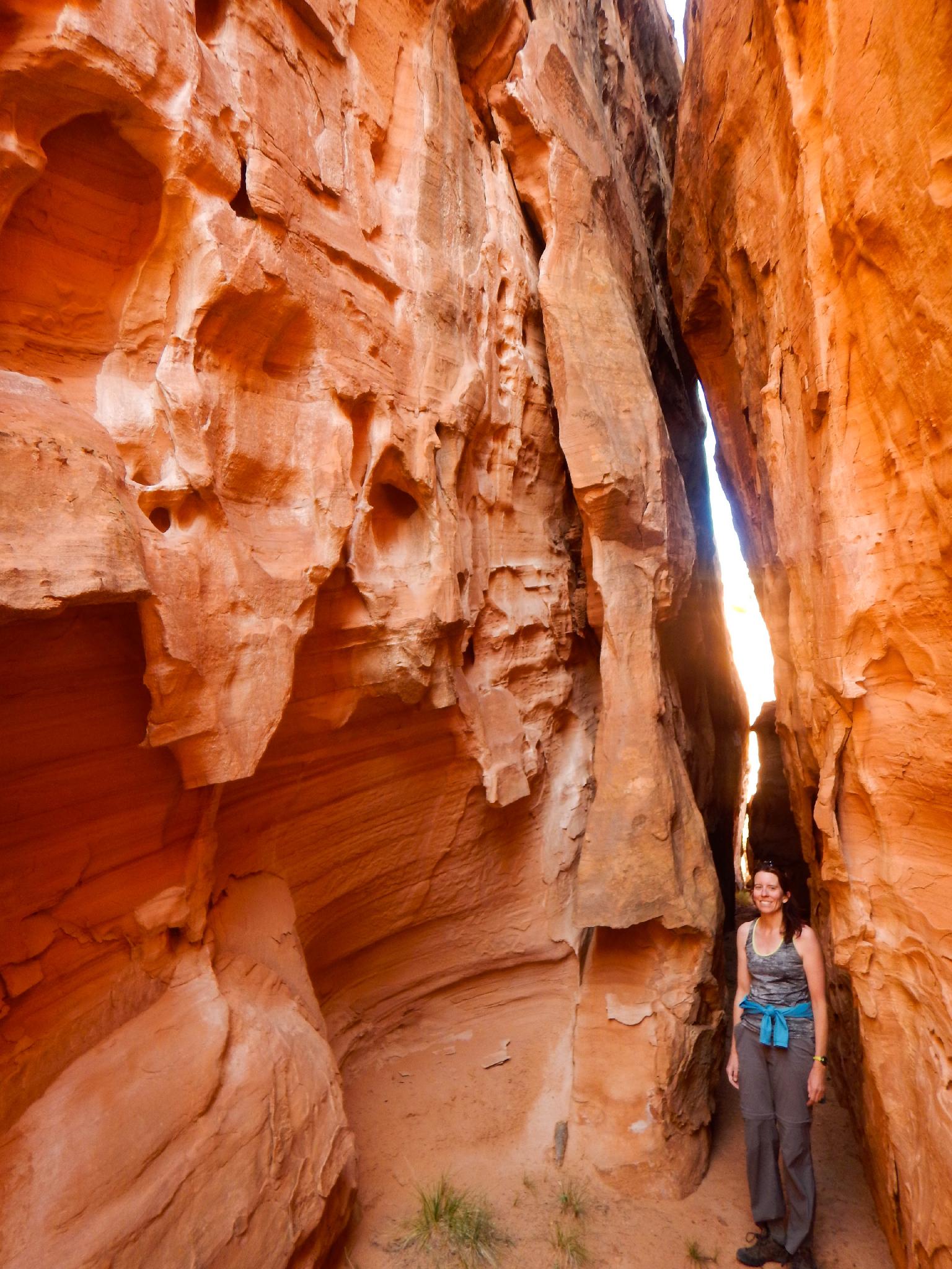
The trail continues to climb and meander up, though less steeply than before. When the trail crests a small ridge, and big views open up to the north, step off the Frying Pan Trail and head due west. The rim of Fire Canyon is a few short minutes off the main Frying Pan Trail.
Once along the rim of Fire Canyon, find an easy way down in. There are quite a few non-technical options.
Side Trip
Once in the canyon bottom, hiking up to its head reveals a couple of interesting short dark slot sections. Worth the 15-20 minutes round trip.
Canyon (2-3 hours)
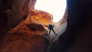
Head down the canyon to the first rappel. The canyon drops quickly. This rappel MAY be bypassable on the far left but seems more fun to rappel. Choose an anchor close to the edge to avoid leaving lots of webbing. We used the large tree just down the canyon on the left.
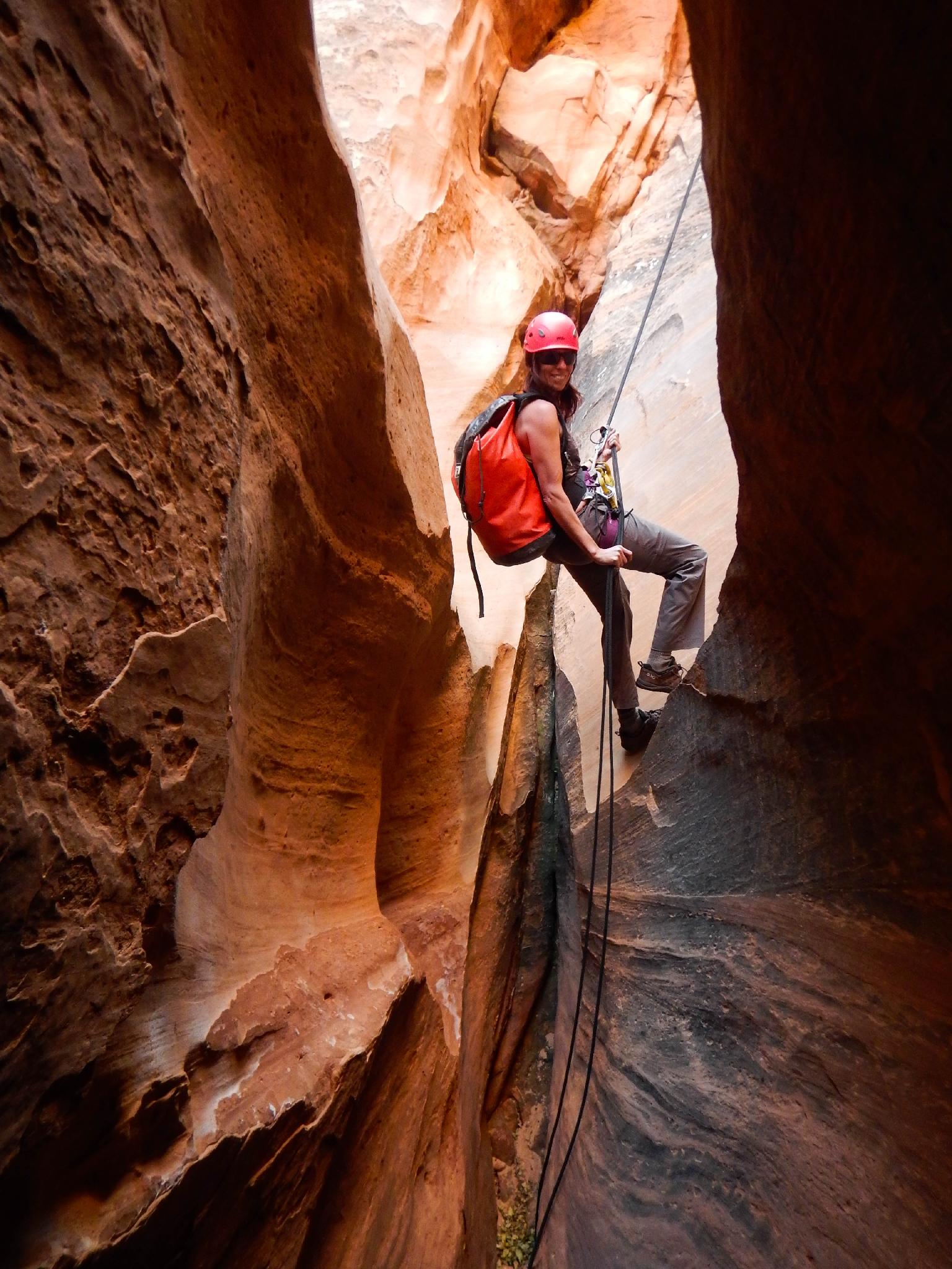
R1 - 30 m ( 99 ft. ) to 40 m ( 132 ft. ) off - Large tree on left. Continue all the way down to the red layer. Our rappel was 30 m ( 99 ft. ), but it seems some are needing more rope by using a different tree, or possibly not getting off rappel as soon.
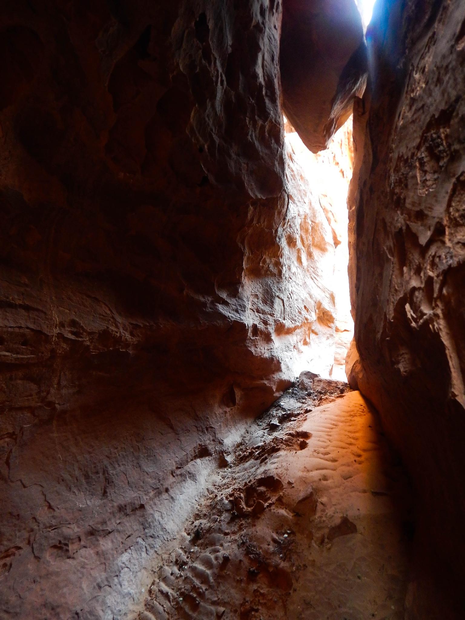
It is an easy amble continuing down. A dryfall is bypassable with easy climbing on the left.
R2 - 20 m ( 66 ft. )
Below R2 more easy walking leads to the next drop.
R3 - 20 m ( 66 ft. ) - Traverse into water course for this rappel.
R4 - 10 m ( 33 ft. ) - Either make a short rappel or traverse left to a tree and rappel to avoid the pool (if there is water). We opted for the tree rappel.
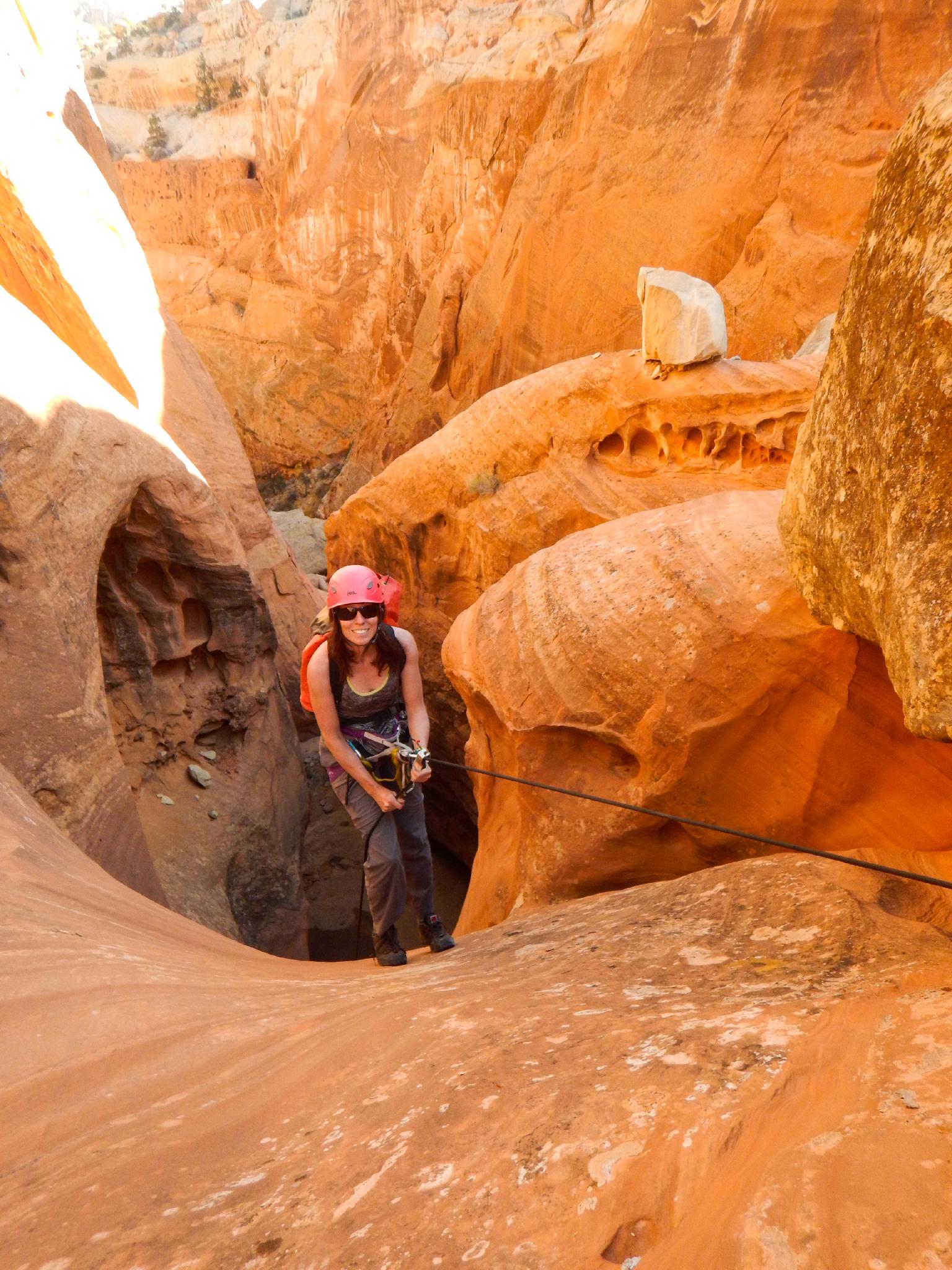
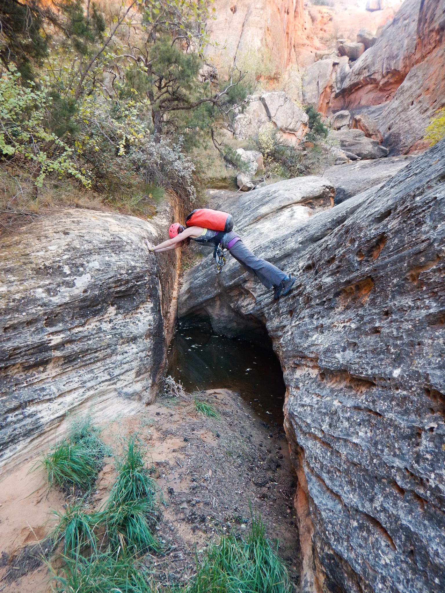
The canyon gets very interesting after R4. It drops a short drop into a 90-degree turn. Most will want to rappel this short drop, though it is a moderate downclimb. This was a pool and bout thigh deep on our trip.
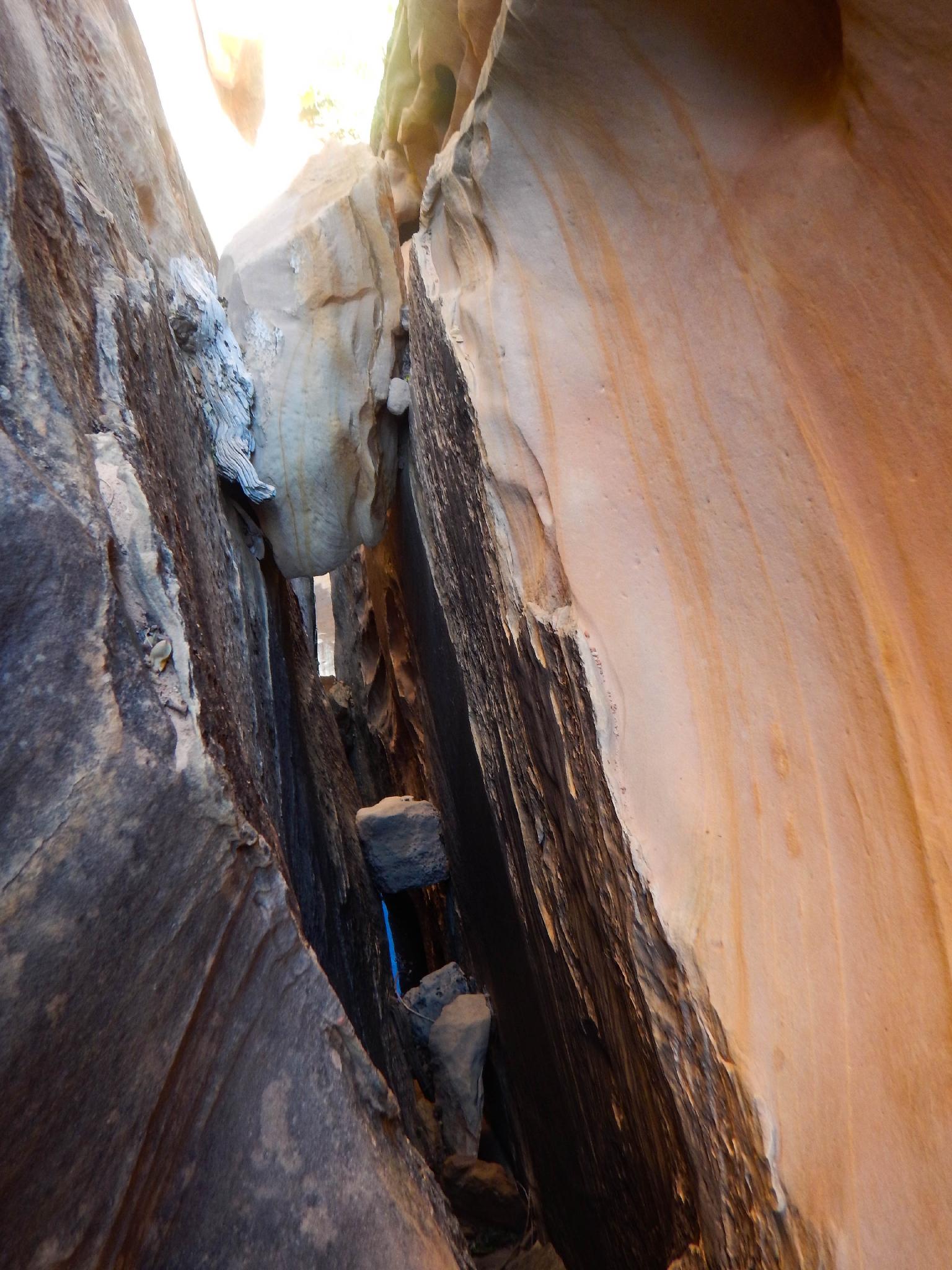
After the 90-degree bend is a steep downclimb. A human anchor here for all but your best climber is the ticket. At the bottom of this downclimb is a second downclimb down a chimney.
R5 - 5 m ( 17 ft. ) - The first part of the chimney is an easy chimney, the second half (5 m ( 17 ft. )) is slippery and much harder. A solid climber can downclimb the full drop, or set up an anchor of any of several wedged stones after the first part of the downclimb. There is a likely pool here.
A few minutes below R5 a short downclimb and easy walking leads to where the canyon opens wide. This is a great place to take off harnesses and wetsuits.
Exit (2 hours)
After the canyon opens, it coalesces with a major fork coming in on the left. Stay right and follow the drainage downstream. 5-10 minutes below the confluence of the two forks, the Frying Pan trail crosses the canyon. Take the trail right, as it climbs up to the pass used on the approach. Though easy to spot, this COULD be walked past if not paying attention!
Once at the ridge, follow the approach down to the trailhead.
Maps

12S 481112E 4235105N
38°15'50"N 111°12'57"W
12S 481333E 4235347N
38°15'57"N 111°12'48"W
12S 480338E 4235166N
38°15'52"N 111°13'29"W
12S 479270E 4235626N
38°16'06"N 111°14'13"W
12S 478917E 4235814N
38°16'12"N 111°14'28"W
12S 479127E 4235937N
38°16'16"N 111°14'19"W
12S 479377E 4236390N
38°16'31"N 111°14'09"W
12S 479749E 4236714N
38°16'42"N 111°13'54"W