 Hiking
Willow Springs
Hiking
Willow Springs
Moab
Overview
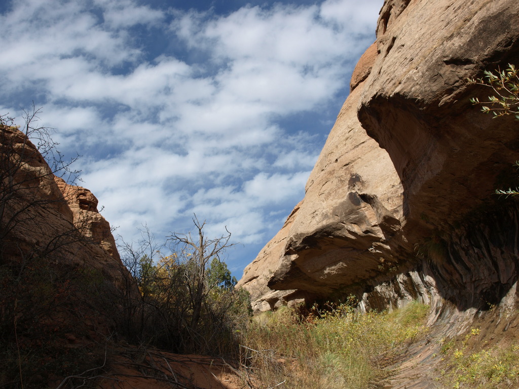
A hike in Arches National Park that is seldom done? And doesn't result in seeing an arch? That's un-possible?!?! No, that is Willow Springs, a lovely family suitable hike down a shallow canyon on the edge of Arches National Park. The canyon is not deep, and allows for easy exits whenever your inclined, but is punctuated with numerous deep potholes throughout it's length. This short hike is suitable for almost everyone, and provides a nice brief outing into a different side of Arches than most people see.
Getting There
To reach the trailhead, travel north out of Moab on highway 191 about 10 miles to milepost 138.6. This is the signed Willow Springs dirt road, on the east side of the highway.
Route Description
From the park boundary, walk or drive 0.6 miles to a small, old shed on the right. This is Willow Spring. Head down canyon past the shed. Initially the canyon is a bit wide and brush choked, persevere. Soon you pass a dripping spring on the left hand wall, magnificent!
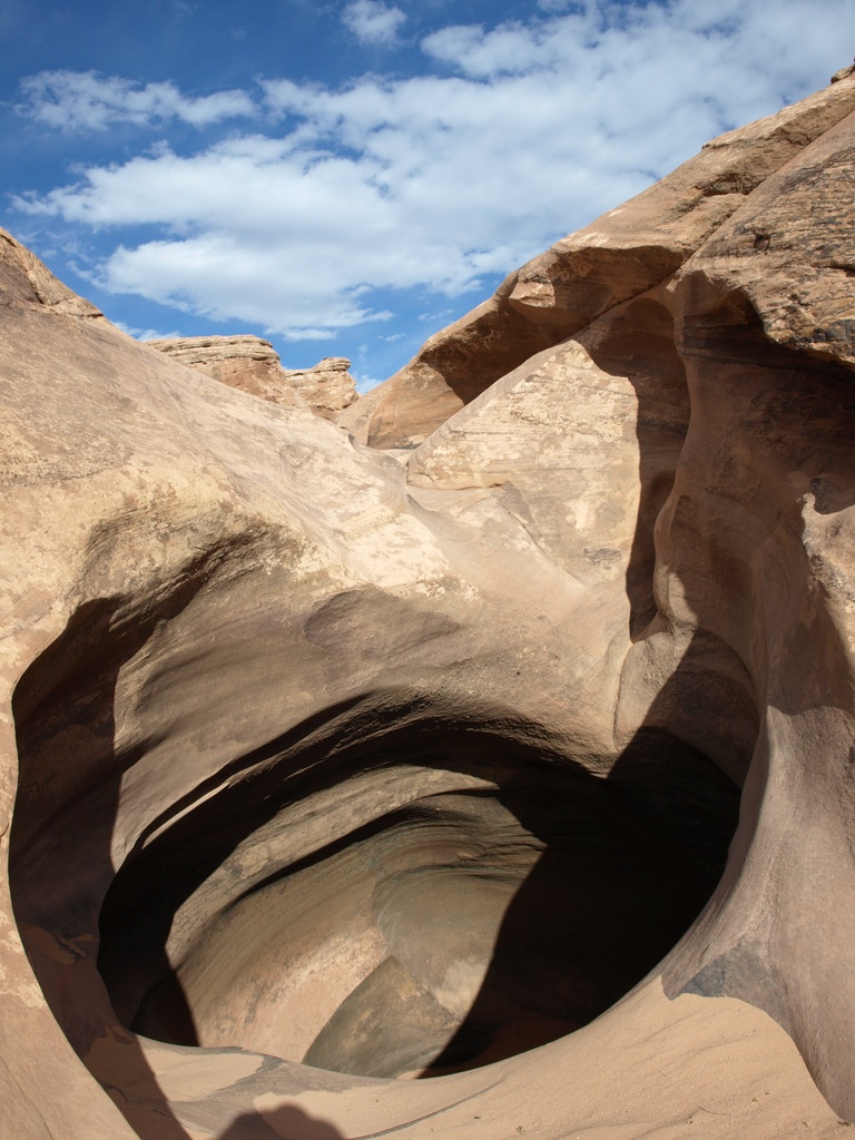
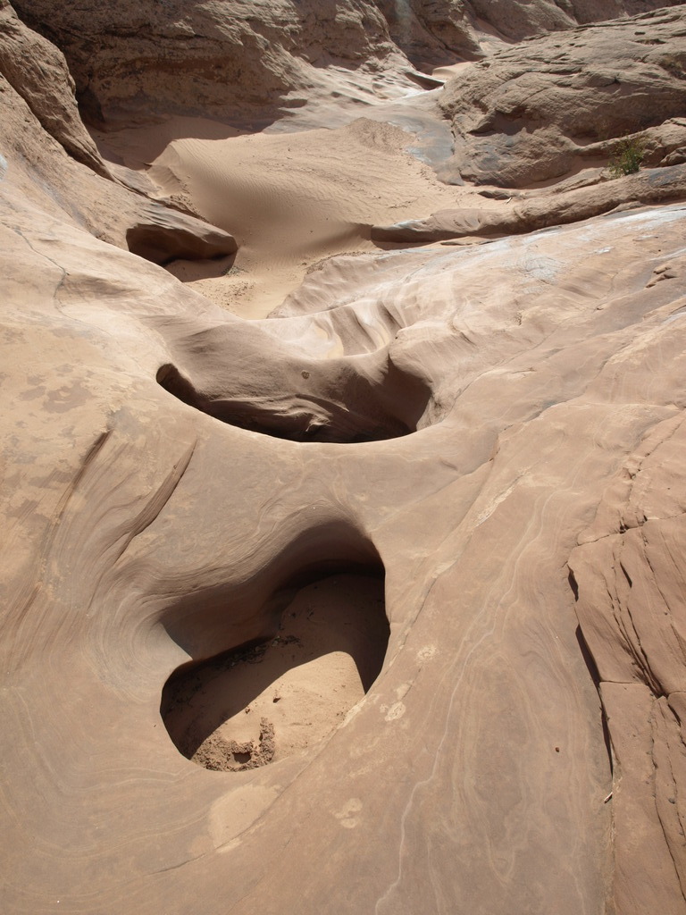
The small stream that has accompanied you this far drops underground, and the canyon floor becomes dry and sandy. Continuing down the canyon is a mix of sand and slickrock floor, punctuated by short sections of slot and potholes. Some of these potholes are impressive, up to 4 m ( 14 ft. ) deep. Fortunately a little route finding reveals easy paths around all of them on either the left or right.
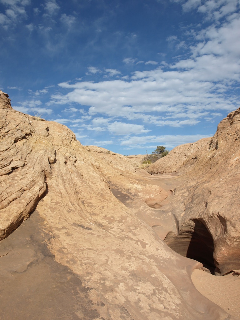
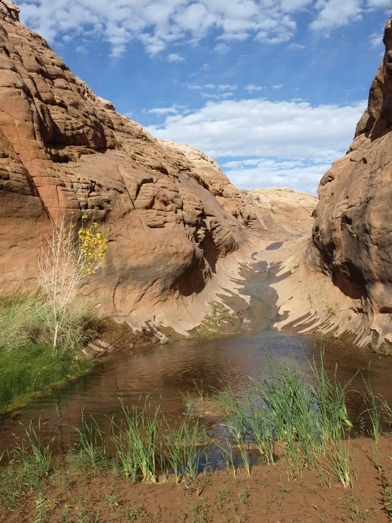
30-45 minutes from the small shack, the canyon floor becomes slickrock and U-shaped. The stream springs up again here through solid sandstone to create an impressive riparian oasis in the desert. This section culminates in a clear, pool surrounded by lush vegetation. Continuing down past the pool is not recommended. It is a dense bushwack and not particularly interesting.
To return, there are 2 good options:
Option 1:
Return the way you came. This is the easiest option.
Option 2:
Head back up canyon, and climb out on the left (looking up canyon) at any one of numerous places. Once out, you are looking at a sea of petrified sand dunes. Your goal is to head north/northeast toward the striped sandstone domes in the distance. This can be a bit slow going, and there is much cryptobiotic soil to avoid. Continue wanding toward the domes, however. If you reach a fence, don't cross it, but rather follow it east, then continue your north/northeast course once around it. 30-45 minutes of hiking will bring you to the road you drove in on almost exactly at the park boundary.
Maps

12S 618656E 4284522N
38°42'05"N 109°38'08"W
12S 617719E 4282711N
38°41'07"N 109°38'48"W