 Hiking
Golden Throne
Hiking
Golden Throne
Capitol Reef
Overview
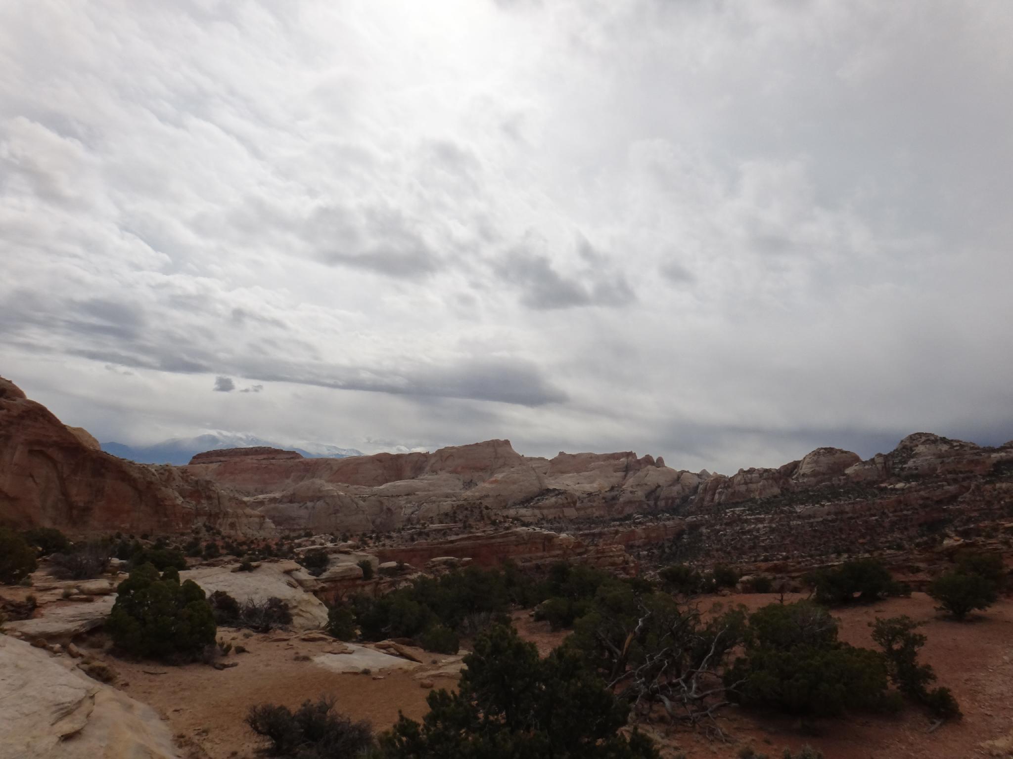
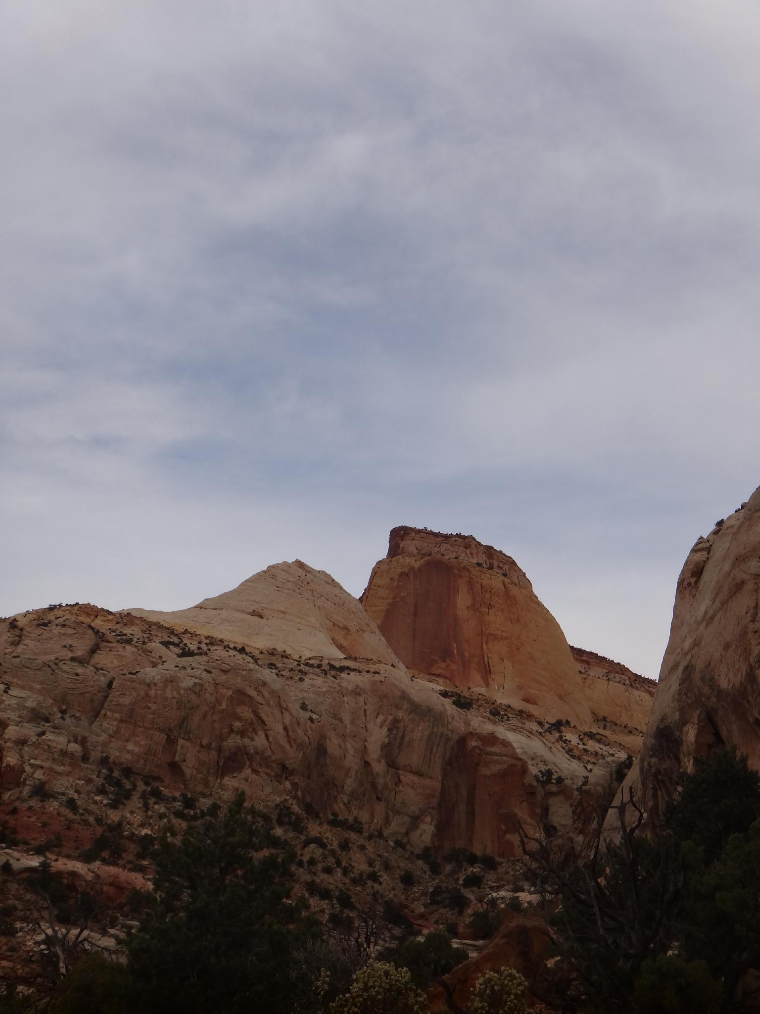
Visible from many areas of the park, the Golden Throne hike is a good hike for getting out of the canyon bottoms and seeing the big scenery the park offers. This hike offers very little shade, don't attempt it in the full heat of a summer afternoon. Though it gains a fair bit of elevation (220 m ( 722 ft. )), it feels fairly gradual.
For photos, evening lighting really lights up the Golden Throne and Capitol Gorge. From the end of the trail, there are big views of Miners Mountain, Boulder Mountain, and the Henry Mountains.
Getting There
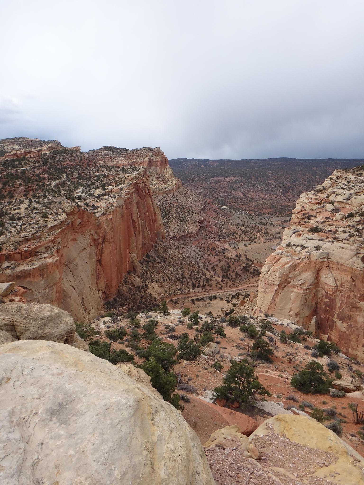
From the Capitol Reef Visitor Center, follow the Scenic Byway. At about 1.6 miles is the pay booth. At 7.9 miles, go left down the well signed Capitol Gorge road. There is a nice picnic area here.
Follow the Capitol Gorge dirt road about a mile to its end at the trailhead, and another nice picnic area. The trailhead starts on the west side or the parking, on the left as you drive in.
Route Description
Follow the trail as it quickly gains elevation above Capitol Gorge. The first 10-15 minutes is the steepest; then the trail levels a bit, and it meanders in and out of side canyons, always climbing. The Golden Throne is visible through this section on the right.
About an hour from the trailhead the end of the trail is reached. The end offers stunning views of the Golden Throne to the north/east, Boulder Mountain to the south/west, and the Henry Mountains off in the distance to the east. There is a great overlook of Capitol Gorge for a break, return the same way.
Maps

12S 485170E 4229066N
38°12'34"N 111°10'10"W
12S 483605E 4229605N
38°12'51"N 111°11'14"W