 Hiking
Gordon Creek Falls
Hiking
Gordon Creek Falls
Price
Overview
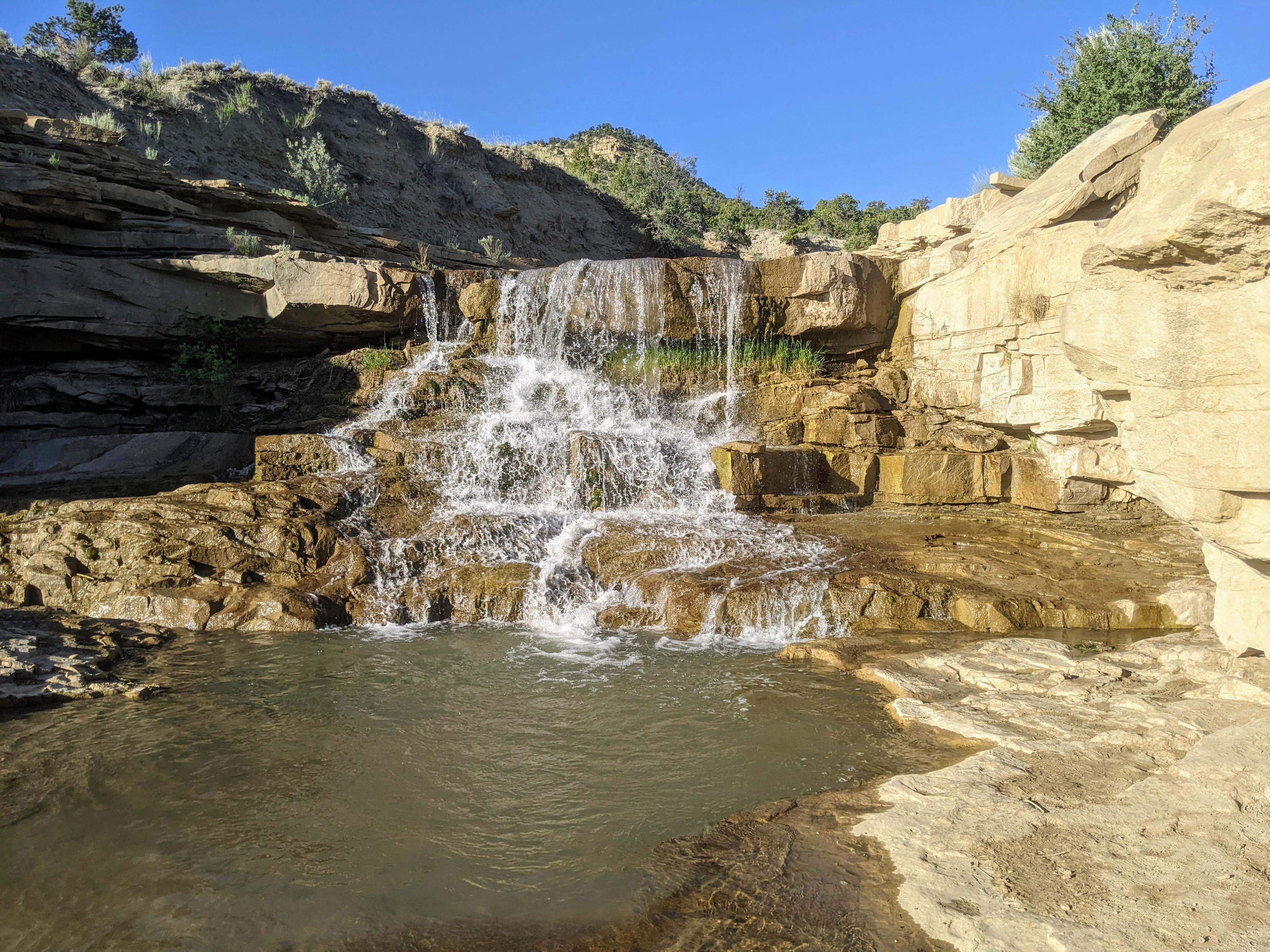
Gordon Creek has become a very popular attraction that Carbon County heavily promotes. The falls are quite spectacular, and it is easy to see why it has become one of the more popular hikes in the area. Being a fairly short hike, about 2 miles round trip to the lower falls, this is an excellent family friendly outing on easy hiking terrain. The trail to the lower falls is also open to those with bikes, OHV, or four-wheel-drive vehicles.
The stream provides a riparian habitat in an otherwise parched environment that is important for wildlife and birds in the area. It also provides summer grazing for sheep and cattle. An oasis in the desert.
Getting There
From Helper, continue south on Highway 6 toward Price. About 2 miles south of Helper, turn right (west) onto Consumers Road.
Follow Consumers Road 2.8 miles to Trestle Road on the left. This is just before Consumers Road crosses the railroad tracks. If you cross the railroad tracks, you have gone about 1/4 of a mile too far.
Reset your odometer as you turn onto Trestle Road. The road is a well-graded dirt road with many side roads. Stay on the main dirt road. At 2.5 miles, the road crosses the railroad tracks. Continue to 3.4 miles where the Gordon Creek Trailhead is on the right. Those hiking will want to park here.
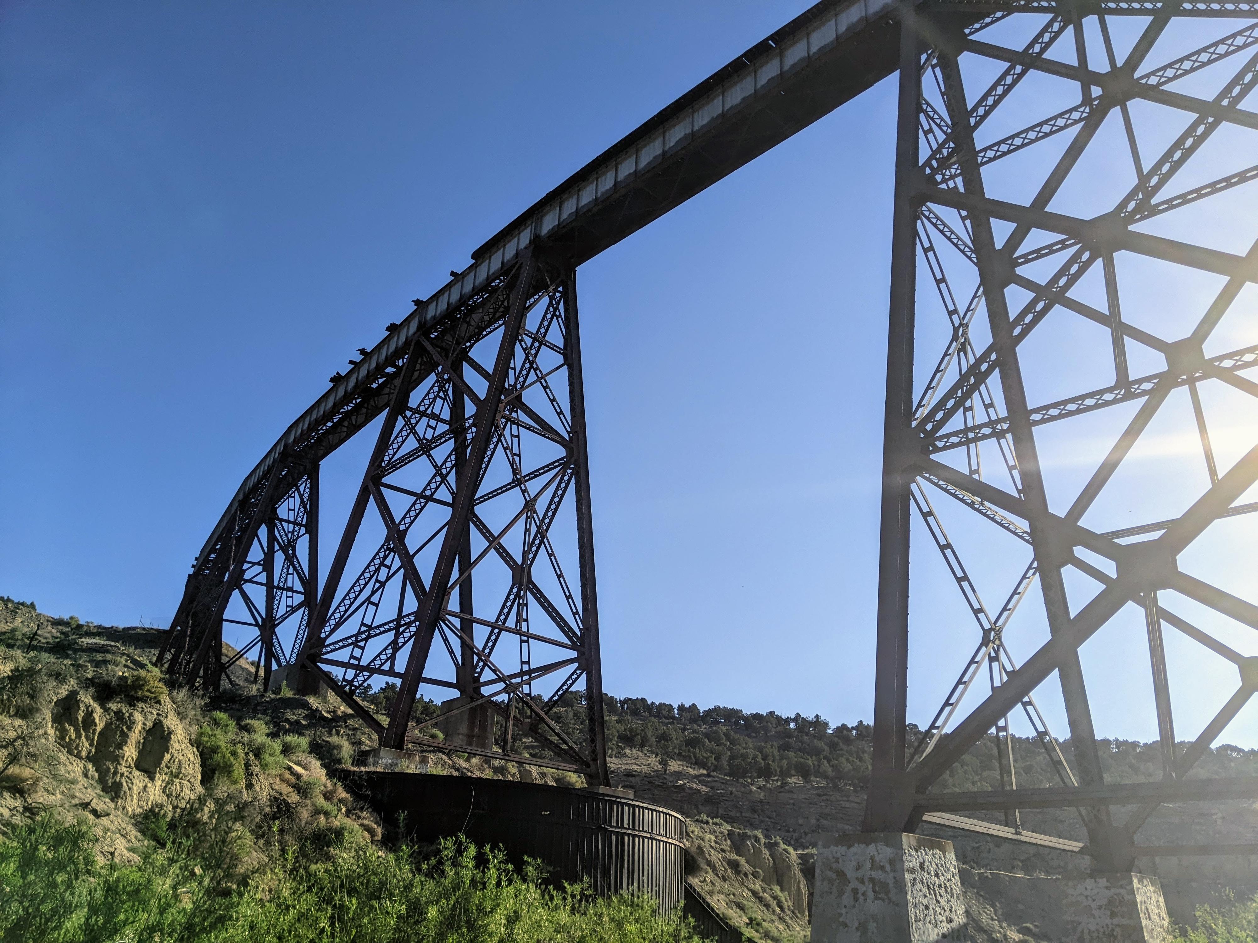
Gordon Creek Bridge Side Trip
From the trailhead, if you continue to follow the road along the train tracks an additional 0.4 miles, it descends into Gordon Creek and passes under the very impressive Gordon Creek Bridge. The bridge, about 135 feet high and 634 feet long, was built between 1912-1914 at an astonishing cost of over $3 million dollars. It connected Hiawatha and Mohrland to Martin, though has been out of service for a long time.
Route Description
To The Lower Falls (1.1 miles)
From the trailhead, follow the rough dirt road west. It is flat for a short distance, then makes a very steep descent into the North Fork of Gordon Creek. This section is not rocky, but very steep.
After crossing the north fork, which is usually just an easy hop across to keep your feet dry, the road begins an ascent out of the north fork. On my visit, the uphill section after the north fork was the roughest, with the most difficult spots coming near the top.
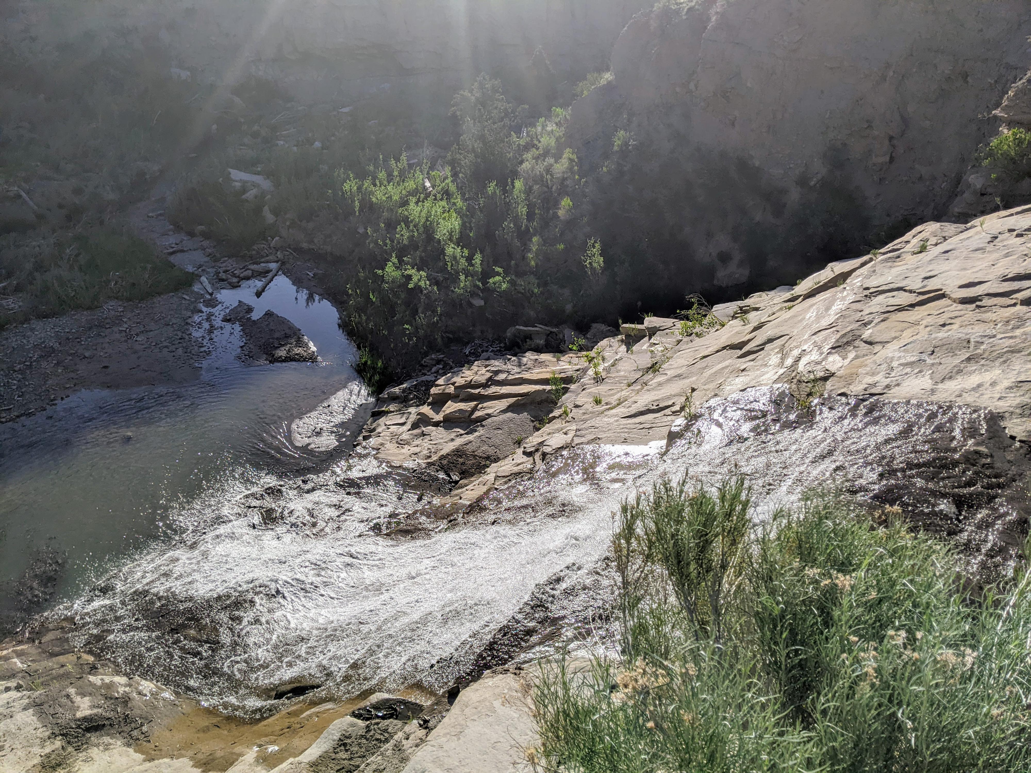
Once up the hill, the path flattens out and Gordon Creek comes into view on the left, with the falls also soon in view. The road has one more particularly rough spot just before it reaches the flat bench of Gordon Creek at the top of the falls.
Upper Falls and Summer House Cabin (1.4 and 2.1 miles past the lower falls)
From the falls, the road continues up along Gordon Creek and becomes a true ATV trail requiring vehicles less than 52 inches wide. About 1.4 miles above the lower falls, a side road goes to a second upper falls that is not as dramatic as the lower falls.
Finally, continuing above the upper falls about 0.7 miles, the trail ends at an old sheepherder’s cabin.
Photos
Videos
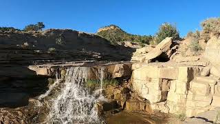
The trail to lower Gordon Creek Falls
Maps

12S 503955E 4385730N
39°37'17"N 110°57'14"W
12S 503970E 4385364N
39°37'05"N 110°57'13"W
12S 502874E 4385598N
39°37'13"N 110°57'59"W
12S 501328E 4385486N
39°37'09"N 110°59'04"W
12S 500406E 4385844N
39°37'20"N 110°59'43"W