 Hiking
Slickrock Trail
Hiking
Slickrock Trail
Needles District
Overview
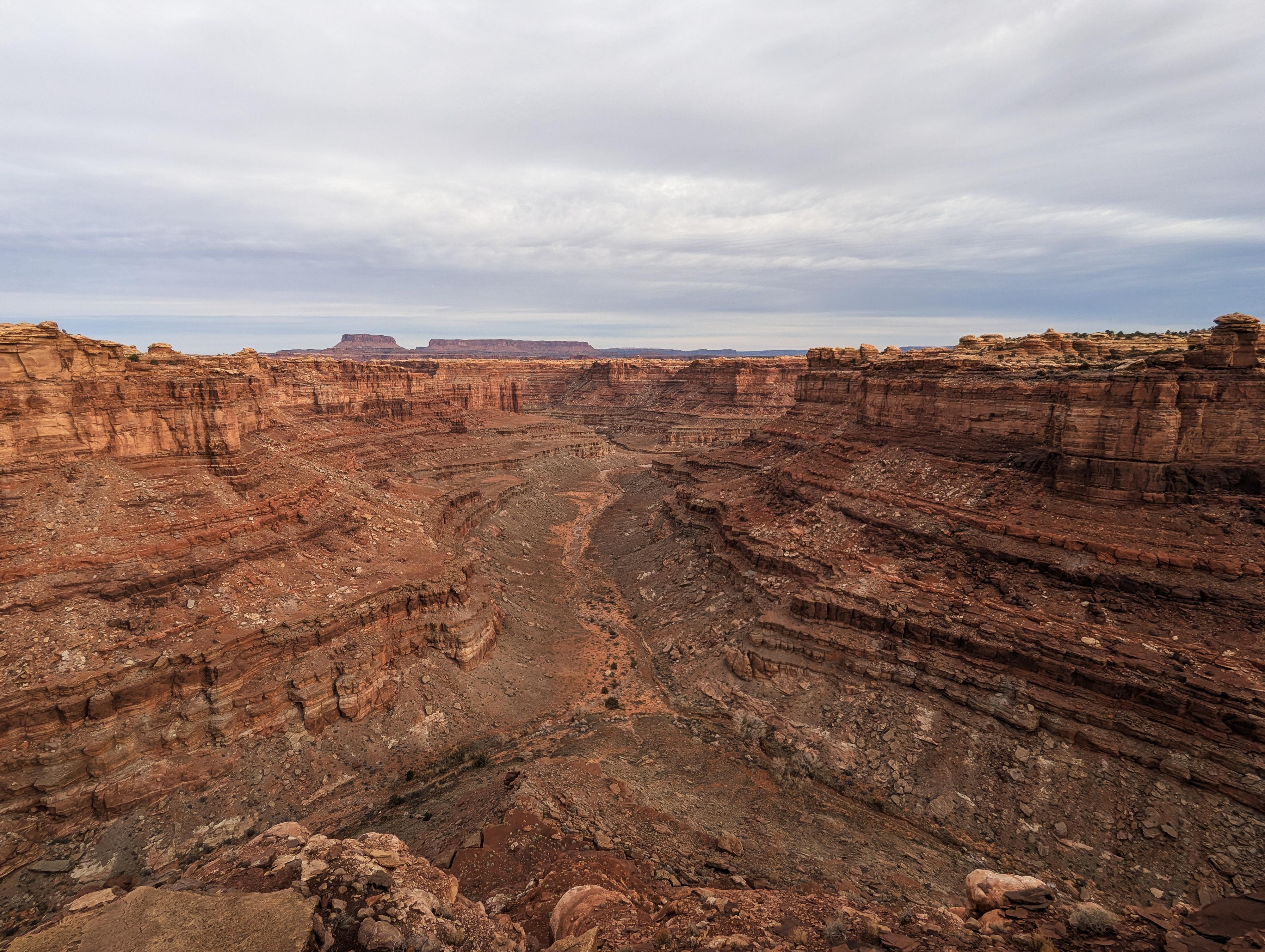
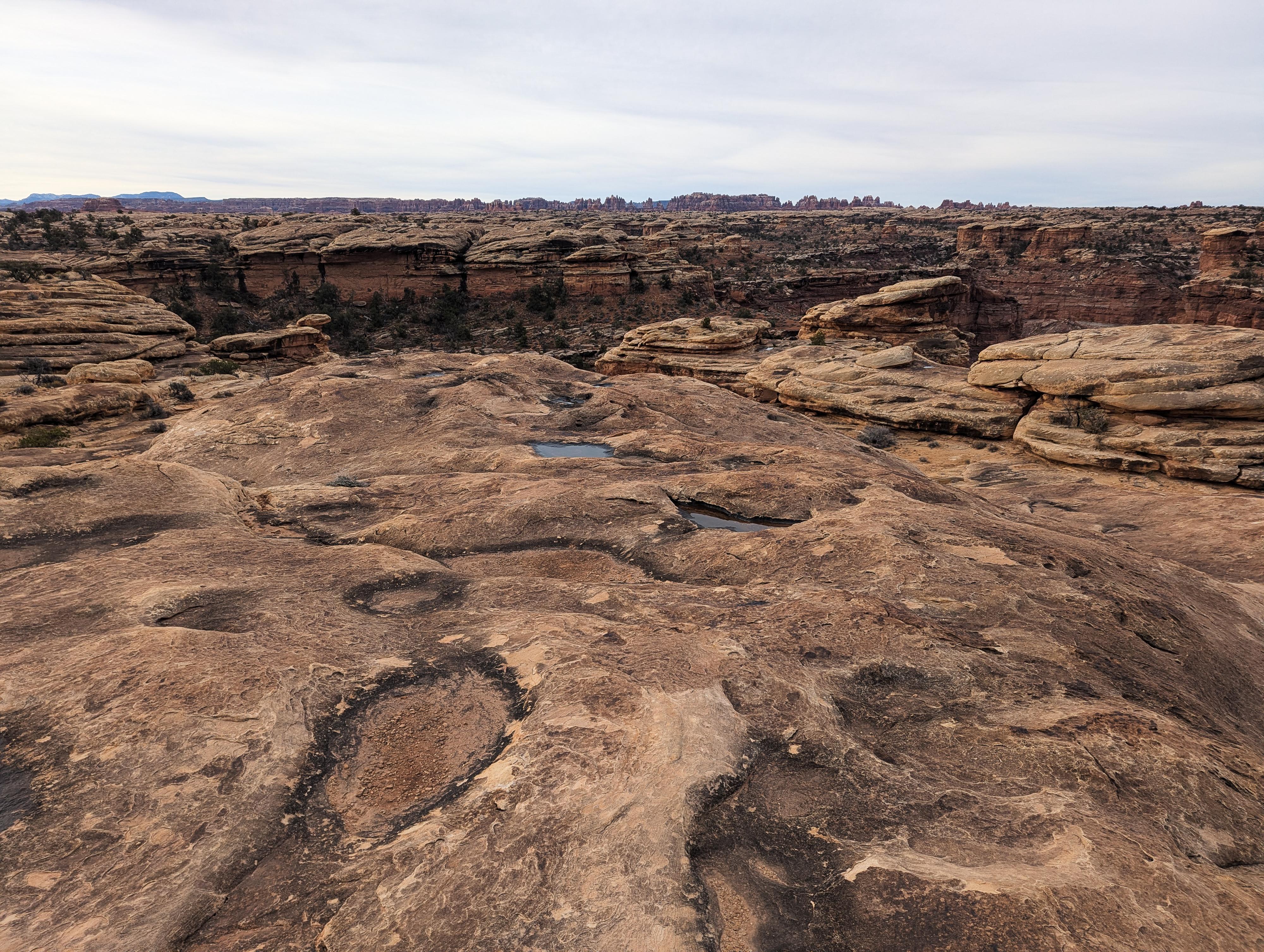
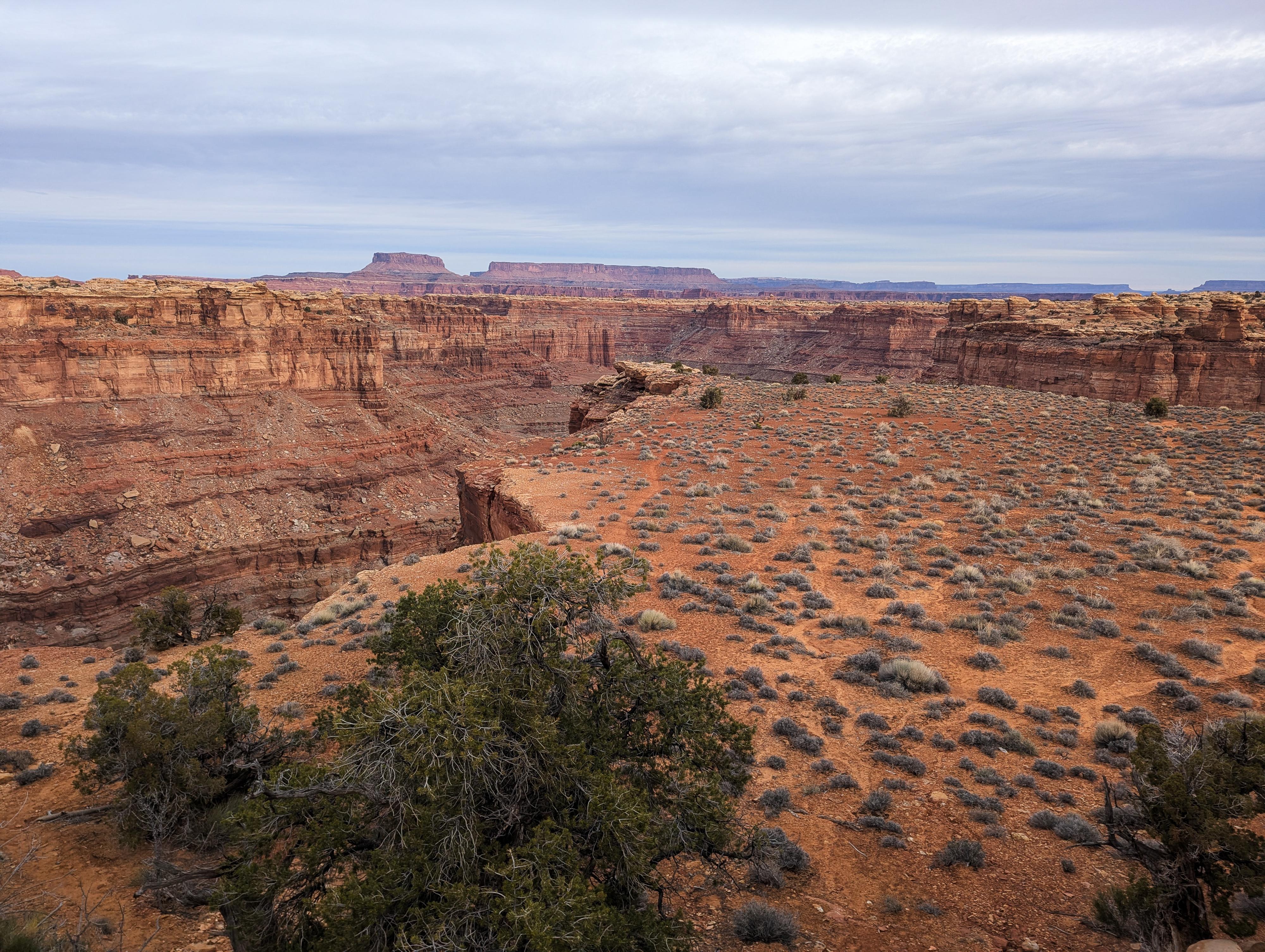
For a hike with expansive views, the Slickrock Trail is an exceptional choice. Unlike trails that descend into canyons, this route traverses across expanses of slickrock, with panoramic vistas of the surrounding mesas, canyons, and the distant La Sal Mountains. There are 4 official viewpoints and an unofficial one that overlooks the confluence of Little Spring and Big Spring Canyons. A really nice hike.
From the NPS Informational Sign
Slickrock Trail
“Slickrock” describes the smooth sandstone surfaces typical of this region. Moderately slippery during dry conditions, slickrock truly lives up to its name when wet or icy. Along this trail, four viewpoints provide stunning vistas of Canyonlands’ striking geologic landscape.
Getting There
The two closest towns to the Needles District are Monticello and Moab. Monticello is closer, but Moab is larger and has more services.
From Moab to the Visitor Center - Total Drive Time: Approx. 1 hour 15 minutes and ~75 miles from Moab
- From Moab, head South on US-191 S (Main Street).
- Stay on US-191 S for 39.6 miles. Keep an eye out for the junction with UT-211.
- Turn Right onto UT-211 W. This is the scenic road that leads directly into the Canyonlands area.
- Follow UT-211 W for 34.4 miles.
- As you approach the park entrance, follow the signs and turn Right into the Needles Visitor Center parking area.
From Monticello to the Visitor Center - Total Drive Time: Approx. 1 hour and ~50 miles
- Head North on US-191 N (Main Street) toward Moab.
- Follow US-191 N for 14.4 miles.
- Turn Left onto UT-211 W. You’ll see signs for Canyonlands National Park.
- Stay on UT-211 W for 34.4 miles.
- As you approach the park entrance, follow the signs and turn Right into the Needles Visitor Center parking area.
From the Visitor Center
Head into the park on the main road. Stay on this main road also known as the Scenic Drive for 6.2 miles to the trailhead and parking area that is signed on the right side of the road. This is just a short distance from where the Scenic Drive ends.
Route Description
From the trailhead, follow the trail as it angles up, passes the signed Viewpoint 1, and continues to the loop junction about 1/2 mile from the trailhead.
You can walk the route in either direction, but counterclockwise is described here.
Go right at the loop junction. The route, being on slickrock, uses cairns for markers. These should be easy enough to find and follow, but it does require keeping an eye out!
Viewpoint 2 is about 1/3 of a mile from the loop junction and is signed. You can follow cairns down to a notch with nice expansive views in the distance. The canyon below is Little Spring Canyon.
Viewpoint 3 is less than 1/4 of a mile from the viewpoint 2 junction and is also signed. It looks into Little Spring Canyon as well. .
From viewpoint 3, the trail heads northwest. Only about 800 feet from viewpoint 3, the trail makes a sharp turn to the south.
Viewpoint 4 is a minute or so from the sharp turn. The signed side trail goes a short distance to an overlook into Big Spring Canyon.
From viewpoint 4, it is about 1/2 mile more back to the loop junction, then another 1/2 mile back to the trailhead.
Maps

12S 603824E 4226128N
38°10'38"N 109°48'53"W
12S 604066E 4226413N
38°10'47"N 109°48'43"W
12S 603885E 4226675N
38°10'55"N 109°48'50"W
12S 604102E 4227051N
38°11'07"N 109°48'41"W
12S 603907E 4227314N
38°11'16"N 109°48'49"W
12S 603542E 4227935N
38°11'36"N 109°49'03"W
12S 603634E 4227371N
38°11'18"N 109°48'60"W
12S 603693E 4227370N
38°11'18"N 109°48'57"W