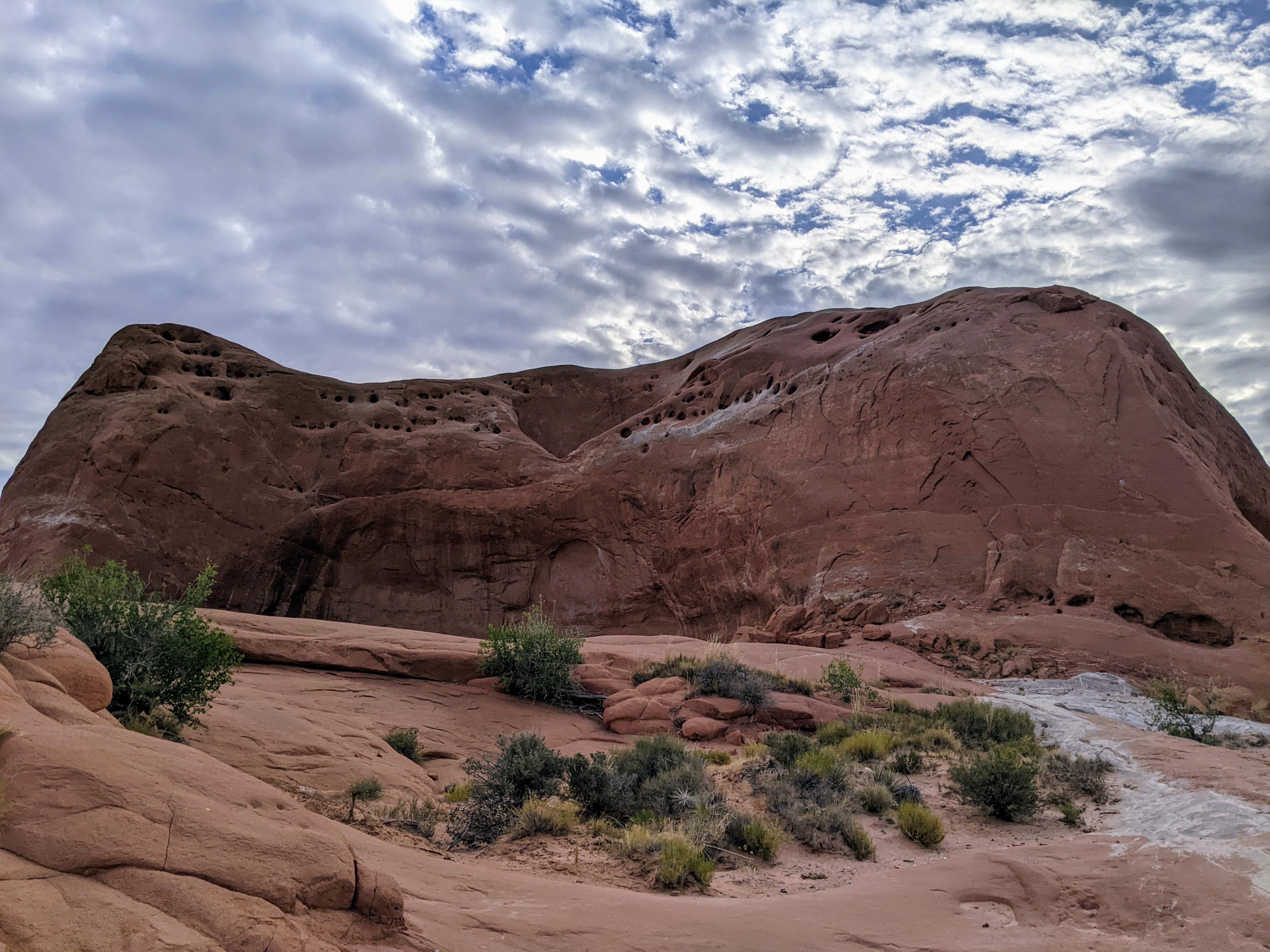
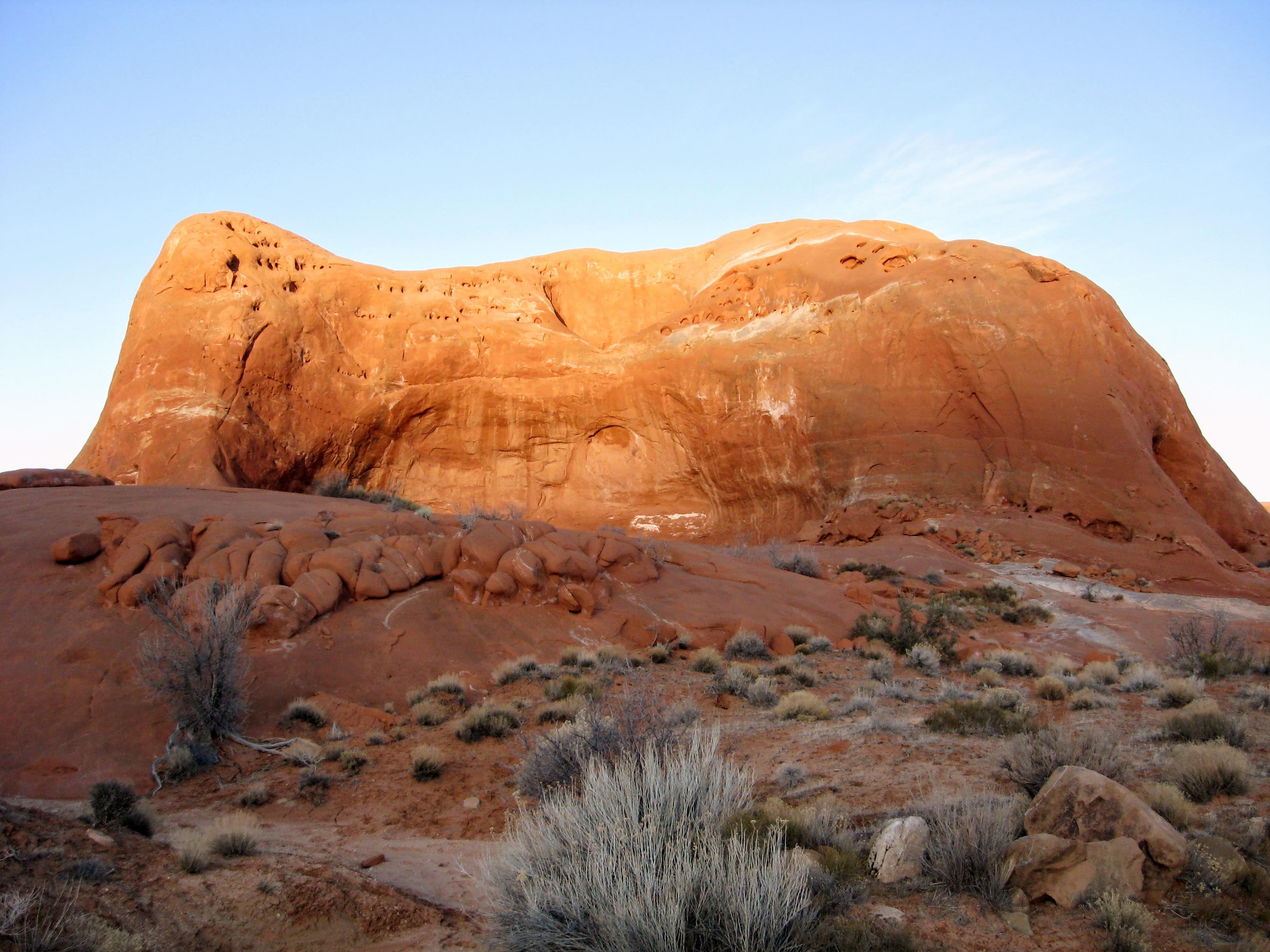
Roadside Attraction Dance Hall Rock
Hole In The Rock Road
Overview
Sun 94 | 66 |
Mon 97 | 70 |
Tue 96 | 73 |
Wed 93 | 72 |
Thu 91 | 70 |
View Full Weather Details |
Sun 94 | 66 |
Mon 97 | 70 |
Tue 96 | 73 |
Wed 93 | 72 |
Thu 91 | 70 |
View Full Weather Details |
In 1879, Mormon pioneers answered the call to colonize the southeast corner of Utah. Thus began an incredible and legendary journey from Escalante to Bluff. The terrain between the two places was inhospitable, rugged, and complex.
About 2 weeks into their journey, and 65 miles from Escalante, they reached the Colorado River Gorge and a major obstacle. To cross the river and continue their journey, they would need to manufacture a road down to the Colorado River through a narrow crack. This spot became known as the Hole-in-the-Rock.
It took six weeks to make Hole-in-the-Rock passable. During this time, Dance Hall Rock became a congregation place. The flat area and great acoustics made for a true dance hall experience. It must have been something to hear fiddle music and see dancing at Dance Hall Rock under the stars.
Today the site has an informational sign, a pit toilet, and a short trail that visits Dance Hall Rock proper.
Getting There
Head east out of the town of Escalante about 5 miles on highway 12 until the well signed Hole in the Rock road on the south side of highway 12. Reset the odometer as you turn onto this road.
- Mile 0 - Hole-In-The-Rock Road Turnoff ( 12S 453167E 4175716N / 37°43'39"N 111°31'53"W )
- 8.0 miles - Parking area after a cattle guard. This is the Zebra/Tunnel trailhead. ( 12S 460681E 4165896N / 37°38'22"N 111°26'44"W )
- 12.3 miles - Devil's Garden turn off on the right. The trailhead is about 1/4 of a mile down this road. No camping, but a pit toilet. ( 12S 463808E 4160175N / 37°35'17"N 111°24'36"W )
- 16.6 miles - Egypt road on the left. This access the Egypt and Neon trailheads ( 12S 468045E 4154960N / 37°32'28"N 111°21'42"W )
- 24.8 miles - Upper Dry Fork Trailhead on the right (south). This has a large parking area and pit toilet. ( 12S 478657E 4148035N / 37°28'44"N 111°14'29"W )
- 26.1 miles - Dry Fork Trailhead Road on the left (north). The trailhead is at the end of the road in about a mile. ( 12S 480198E 4146661N / 37°27'60"N 111°13'26"W )
- 30.9 miles - Red Well side road on the left. Follow this 1 mile to its end for the Red Well Trailhead. ( 12S 485669E 4141593N / 37°25'16"N 111°09'43"W )
- 33.1 miles - Chimney Rock side road on the left (north). ( 12S 487309E 4138502N / 37°23'36"N 111°08'36"W )
- 34 miles - Hurricane Wash Trailhead on the left. ( 12S 488275E 4137666N / 37°23'08"N 111°07'57"W )
- 36.3 miles - Fortymile Ridge side road on the left. This road goes to the Stock Tank and Fortymile Ridge trailheads commonly used for Coyote Gulch. This is also the road to Sunset Arch. ( 12S 489827E 4135057N / 37°21'44"N 111°06'54"W )
- 36.9 miles - Dance Hall Rock Trailhead on the left. There is a pit toilet at the trailhead and small parking area. ( 12S 490766E 4134519N / 37°21'26"N 111°06'15"W )
Route
From the parking area, it is a short walk along the gravel travel as it winds around an outcrop and up to Dance Hall Rock proper. Be sure to test the acoustics while visiting. This is a magnificent spot for a lunch break if travelling this far out on the Hole-in-the-Rock trail.
Trailhead |
12S 490773E 4134530N 37°21'27"N 111°06'15"W |
Dance Hall Rock |
12S 491088E 4134491N 37°21'26"N 111°06'02"W |