Fiftymile Spring | Hole In The Rock Road

Hiking Fiftymile Spring - Hole In The Rock RoadRoadside Attraction Fiftymile Spring - Hole In The Rock Road Fiftymile Spring

Hole In The Rock Road

Overview

RATING: Easy hiking.
LENGTH: 1+ hours
MAPS: SOONER BENCH, UT

Sun

Sunny, with a high near 102. Northeast wind 3 to 7 mph.

102 | 75

Mon

Sunny, with a high near 101.

101 | 75

Tue

Sunny, with a high near 102.

102 | 75

Wed

Sunny, with a high near 101.

101 | 74

Thu

A slight chance of showers and thunderstorms after noon. Sunny, with a high near 99.

99 | 74

View Full Weather Details
SEASON: Spring, Fall (Winter if the roads are dry, very hot in the summer)
GEAR: Standard Hiking Gear
WATER: None

Sun

Sunny, with a high near 102. Northeast wind 3 to 7 mph.

102 | 75

Mon

Sunny, with a high near 101.

101 | 75

Tue

Sunny, with a high near 102.

102 | 75

Wed

Sunny, with a high near 101.

101 | 74

Thu

A slight chance of showers and thunderstorms after noon. Sunny, with a high near 99.

99 | 74

View Full Weather Details
The entrada slopes at Fiftymile Spring

The entrada slopes at Fiftymile Spring

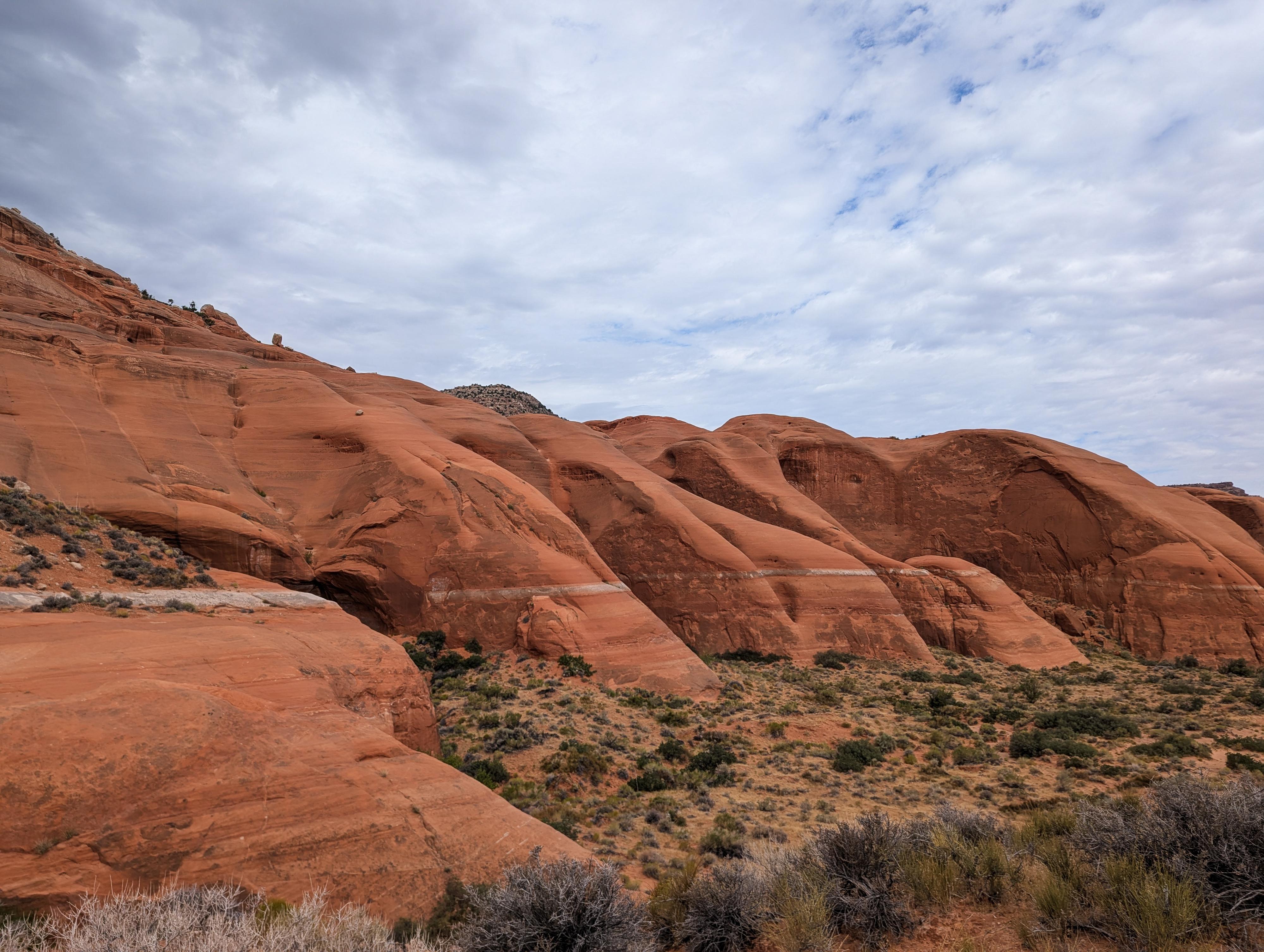
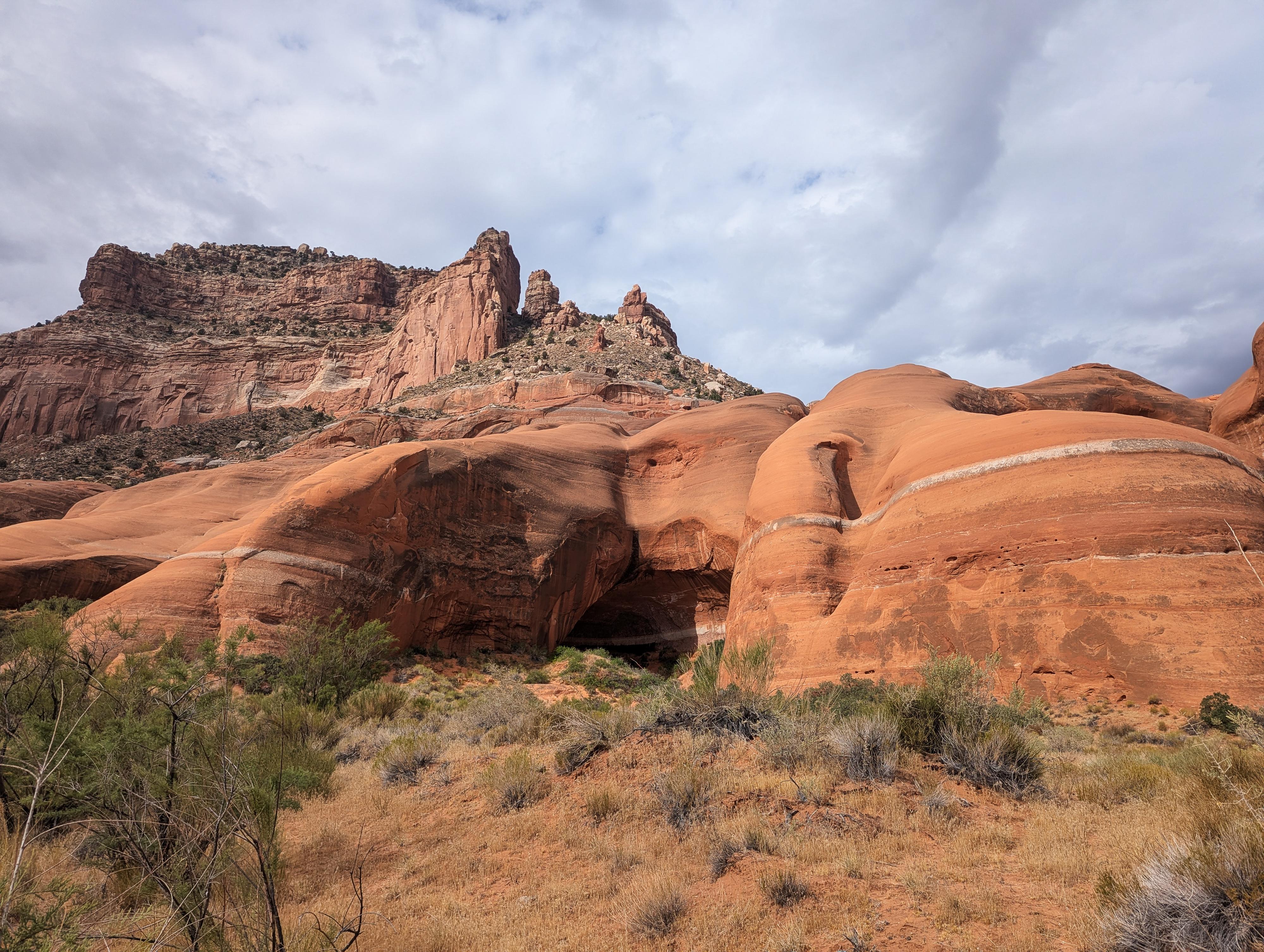
Just off the Hole-In-The-Rock road, about 1/2 of a mile, is Fiftymile Spring. Like Cave Point and Sooner Rocks, this is a visible area of Entrada Sandstone that has weathered and created interesting shapes and potholes. This area has several exceptional primitive campsites that are somewhat protected, depending on which direction the weather is coming from.

Like Cave Point, I don't think it is a destination hike, but the excellent camping in the area makes it a good campsite. If you wander up to the top of the Entrada layer, there are huge, deep potholes dotting the top of the formation and nice views to the north.

Looking along the top of Fiftymile Spring

Looking along the top of Fiftymile Spring

Getting There

Head east out of the town of Escalante about 5 miles on highway 12 until the well signed Hole in the Rock road on the south side of highway 12. Reset the odometer as you turn onto this road.

  • Mile 0 - Hole-In-The-Rock Road Turnoff ( 12S 453167E 4175716N / 37°43'39"N 111°31'53"W )
  • 4.5 miles - Small parking area on the north side of the road. This is the trailhead for West Big Horn/Big Horn Canyon. ( 12S 457467E 4170148N / 37°40'39"N 111°28'56"W )
  • 8.0 miles - Parking area after a cattle guard. This is the Zebra/Tunnel trailhead. ( 12S 460681E 4165896N / 37°38'22"N 111°26'44"W )
  • 12.3 miles - Devil's Garden turn off on the right. The trailhead is about 1/4 of a mile down this road. No camping, but a pit toilet. ( 12S 463808E 4160175N / 37°35'17"N 111°24'36"W )
  • 14.45 Miles - Left Hand Collet Road on the right. ( 12S 465665E 4157425N / 37°33'48"N 111°23'20"W )
  • 16.6 miles - Egypt road on the left. This access the Egypt and Neon trailheads ( 12S 468045E 4154960N / 37°32'28"N 111°21'42"W )
  • 24.8 miles - Upper Dry Fork Trailhead on the right (south). This has a large parking area and pit toilet. ( 12S 478657E 4148035N / 37°28'44"N 111°14'29"W )
  • 26.1 miles - Dry Fork Trailhead Road on the left (north). The trailhead is at the end of the road in about a mile. ( 12S 480198E 4146661N / 37°27'60"N 111°13'26"W )
  • 30.9 miles - Red Well side road on the left. Follow this 1 mile to its end for the Red Well Trailhead. ( 12S 485669E 4141593N / 37°25'16"N 111°09'43"W )
  • 33.1 miles - Chimney Rock side road on the left (north). ( 12S 487309E 4138502N / 37°23'36"N 111°08'36"W )
  • 34 miles - Hurricane Wash Trailhead on the left. ( 12S 488275E 4137666N / 37°23'08"N 111°07'57"W )
  • 36.3 miles - Fortymile Ridge side road on the left. This road goes to the Stock Tank and Fortymile Ridge trailheads commonly used for Coyote Gulch. This is also the road to Sunset Arch. ( 12S 489827E 4135057N / 37°21'44"N 111°06'54"W )
  • 36.9 miles - Dance Hall Rock on the left. ( 12S 490766E 4134519N / 37°21'26"N 111°06'15"W )
  • 40.8 miles - Sooner Rocks. Good primitive camping in the area. ( 12S 494749E 4131425N / 37°19'46"N 111°03'33"W )
  • 41.7 miles - Willow Gulch side road on the left. To reach the Willow Gulch/Sooner Bench trailhead, follow this road to its end in 1.4 miles. It requires medium to high clearance. ( 12S 496002E 4130621N / 37°19'20"N 111°02'42"W )
  • 45.7 miles - Small spur road on the right that goes to a wash. This is the Cave Point and Fiftymile Creek trailhead. There is OK primitive camping here as well. ( 12S 498172E 4127122N / 37°17'27"N 111°01'14"W )
  • 48.2 miles - Spur road on the right. This spur road goes a short distance (about 1/4 of a mile) to Fiftymile Spring. There is excellent primitive camping here, as well as hiking on the formation. ( 12S 499425E 4124446N / 37°15'60"N 111°00'23"W )
The slopes around Fiftymile Spring

The slopes around Fiftymile Spring

Route

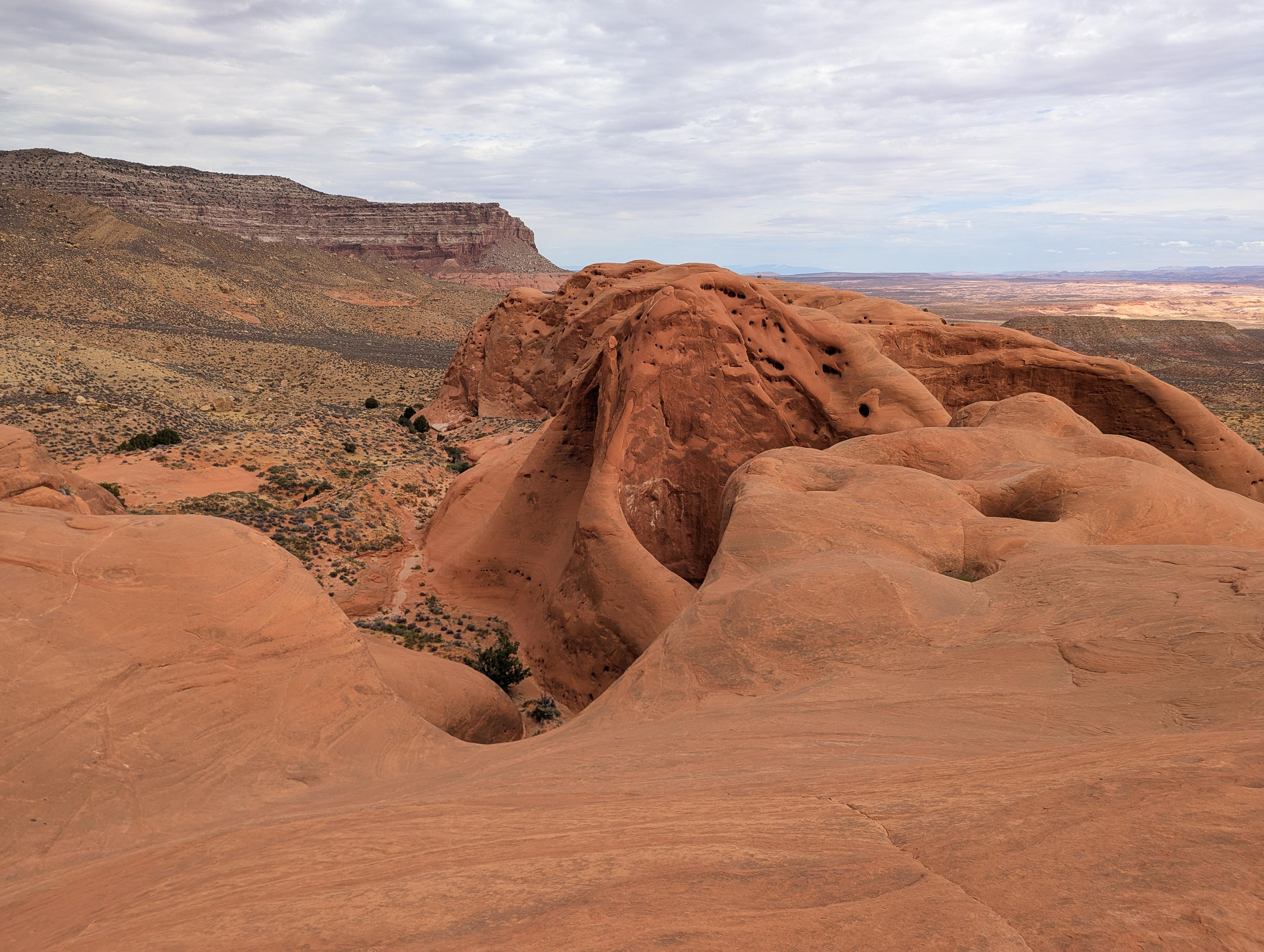
If wanting to reach the top of the Entrada Layer, I would recommend following its base south (left when facing the formation) to where dirt slopes allow easy climbing to the top. The slickrock slopes look inviting, but be cautious; they can get deceptively hard quickly and be difficult to downclimb.

Once on top, it is a fun place to wander with large, deep potholes. Return the same way.


Maps

Route / 0.00 miles / Elevation Range - 0 ft.
Printable Maps:

Campsite

12S 499243E 4124049N

37°15'47"N 111°00'31"W

Comments

Want to make a comment? Login and let yourself be heard.