Sooner Rocks |

Hole In The Rock

Hiking Sooner Rocks - Hole In The RockRoadside Attraction Sooner Rocks - Hole In The Rock Sooner Rocks

Hole In The Rock

Overview

RATING: Easy Hike
MAPS: SOONER BENCH, UT

Sat

A chance of rain showers before noon, then a chance of showers and thunderstorms. Mostly cloudy. High near 64, with temperatures falling to around 62 in the afternoon. West southwest wind 6 to 12 mph. Chance of precipitation is 40%.

64 | 46

Sun

Sunny, with a high near 71. West southwest wind 3 to 8 mph.

71 | 45

Mon

Sunny, with a high near 78.

78 | 48

Tue

Sunny, with a high near 82.

82 | 53

Wed

Sunny, with a high near 81.

81 | 54

View Full Weather Details
SEASON: Fall, Winter, Spring, Summer (Hot). Can be visited in the winter IF roads are dry.
GEAR: Standard Hiking Gear
WATER: None
NOTES: Reaching the trailhead requires a long dirt road that is often quite rough. Low clearance vehicles are often driven to the trailhead, but I would recommend high clearance. The washboard sections will be very slow in a low clearance vehicle.

Sat

A chance of rain showers before noon, then a chance of showers and thunderstorms. Mostly cloudy. High near 64, with temperatures falling to around 62 in the afternoon. West southwest wind 6 to 12 mph. Chance of precipitation is 40%.

64 | 46

Sun

Sunny, with a high near 71. West southwest wind 3 to 8 mph.

71 | 45

Mon

Sunny, with a high near 78.

78 | 48

Tue

Sunny, with a high near 82.

82 | 53

Wed

Sunny, with a high near 81.

81 | 54

View Full Weather Details
The largest pothole at Sooner Rocks

The largest pothole at Sooner Rocks

“…I’d sooner be home than out in this forsaken region…”
-Home Sick Shepherd

Sooner Rocks is quite a far-flung destination from, well, pretty much anywhere! It is easy to see how a shepherd may have felt in such a desolate region. His name has endured and stuck to the area.

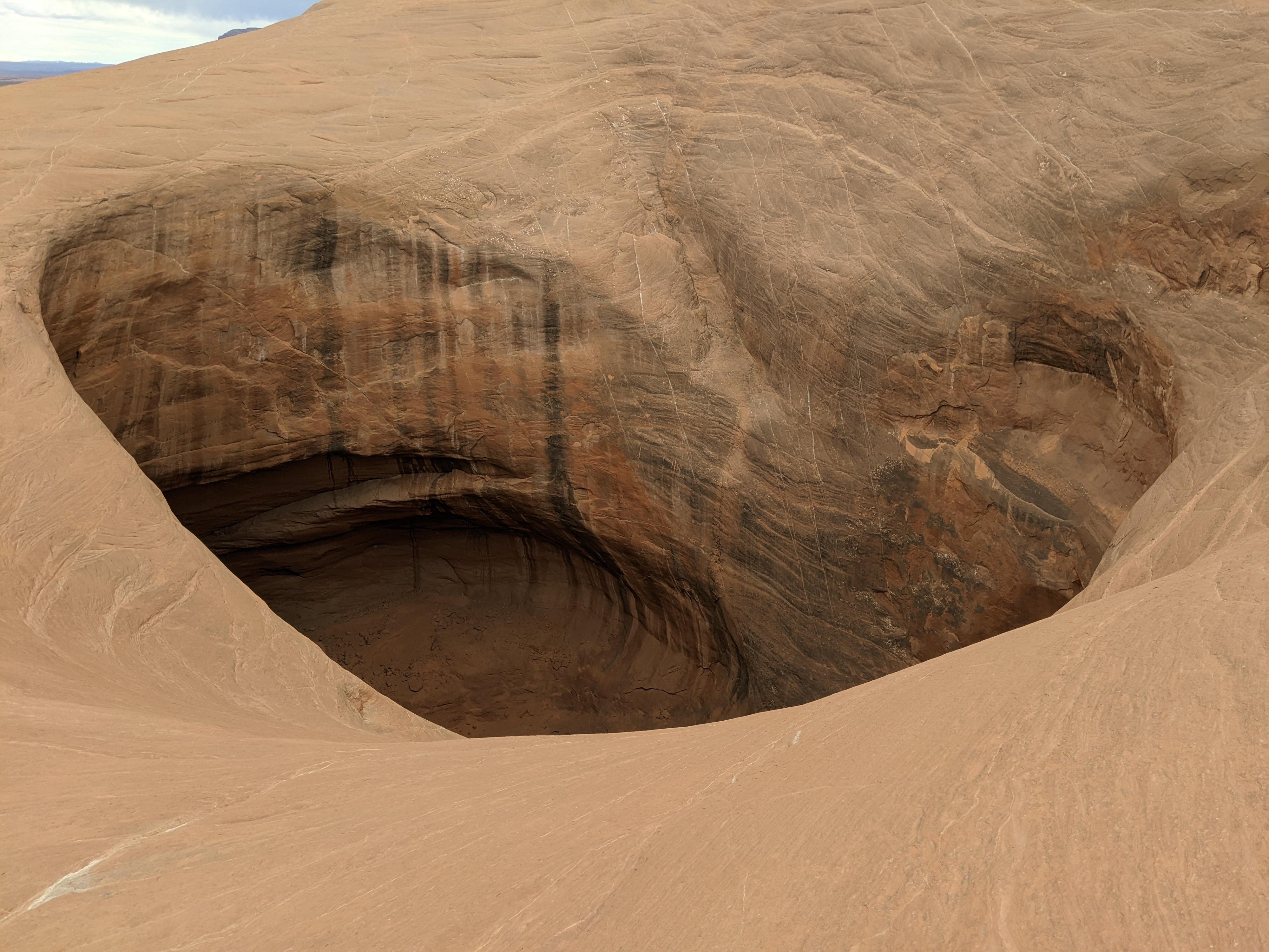
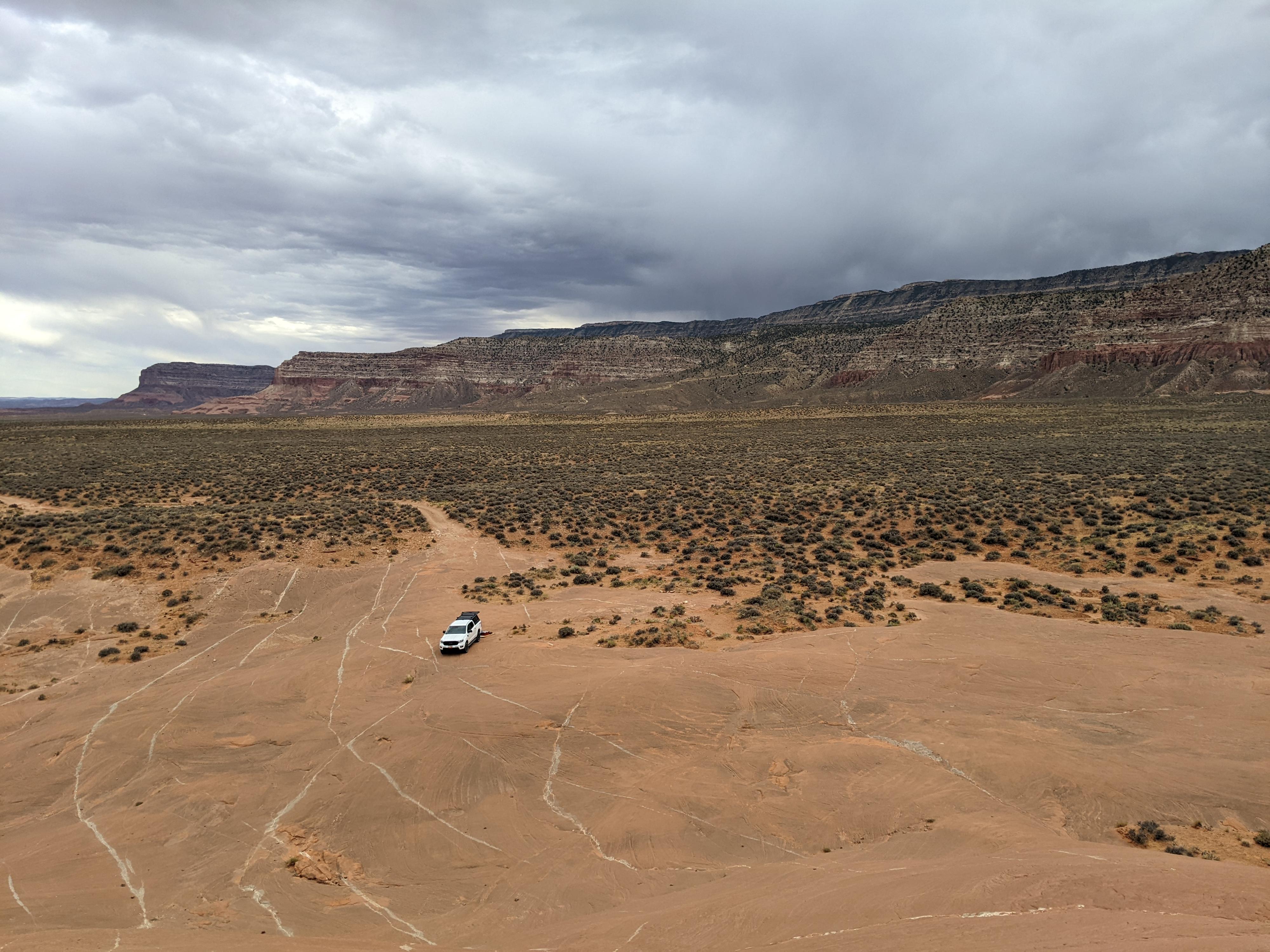
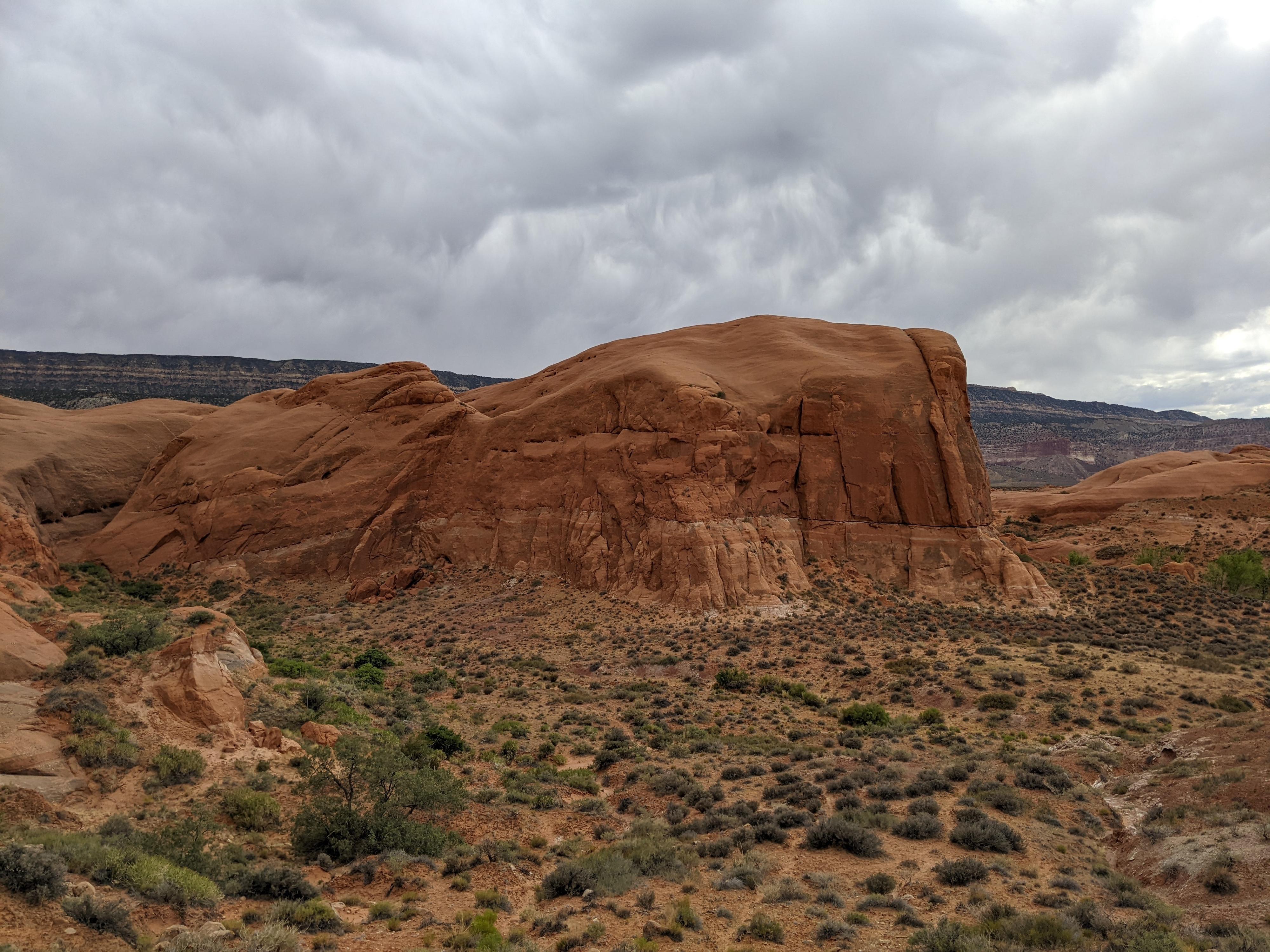
A long way down the Hole-in-the-Rock road, Sooner Rocks is an outcropping of one of the upper layers of Entrada sandstone that emerges from the surrounding flats about 40 miles down the Hole-in-the-Rock road. The outcropping offers one of the better campsites in the area, as it has places to get off the flats into out of the wind. It is also a fascinating place to wander around. From the road, you see curved domes of sandstone. A wander up on the domes, however, reveals absolutely immense potholes dotting the tops. As a canyoneer, many of these were intriguing to ponder trying to escape from. One was both awe-inspiring and terrifying in its scale. Probably 50 feet across and equally deep. It is quite the pothole!

The area makes a great campsite or evening wander if this far down the Hole-in-the-Rock road. Be careful around the potholes. A couple of small canyons drain into Sooner Rocks, cutting through the Entrada and are also interesting to explore.

Slick rock camping at Sooner Rocks with Fifty Mile Mountain in the background.

Slick rock camping at Sooner Rocks with Fifty Mile Mountain in the background.

Getting There

Head east out of the town of Escalante about 5 miles on highway 12 until the well signed Hole in the Rock road on the south side of highway 12. Reset the odometer as you turn onto this road.

  • Mile 0 - Hole-In-The-Rock Road Turnoff ( 12S 453167mE 4175716mN / N37° 43' 39" W111° 31' 53" )
  • 8.0 miles - Parking area after a cattle guard. This is the Zebra/Tunnel trailhead. ( 12S 460681mE 4165896mN / N37° 38' 22" W111° 26' 44" )
  • 12.3 miles - Devil's Garden turn off on the right. The trailhead is about 1/4 of a mile down this road. No camping, but a pit toilet. ( 12S 463808mE 4160175mN / N37° 35' 17" W111° 24' 36" )
  • 16.6 miles - Egypt road on the left. This access the Egypt and Neon trailheads ( 12S 468045mE 4154960mN / N37° 32' 28" W111° 21' 42" )
  • 24.8 miles - Upper Dry Fork Trailhead on the right (south). This has a large parking area and pit toilet. ( 12S 478657mE 4148035mN / N37° 28' 44" W111° 14' 29" )
  • 26.1 miles - Dry Fork Trailhead Road on the left (north). The trailhead is at the end of the road in about a mile. ( 12S 480198mE 4146661mN / N37° 27' 60" W111° 13' 26" )
  • 30.9 miles - Red Well side road on the left. Follow this 1 mile to its end for the Red Well Trailhead. ( 12S 485669mE 4141593mN / N37° 25' 16" W111° 09' 43" )
  • 33.1 miles - Chimney Rock side road on the left (north). ( 12S 487309mE 4138502mN / N37° 23' 36" W111° 08' 36" )
  • 34 miles - Hurricane Wash Trailhead on the left. ( 12S 488275mE 4137666mN / N37° 23' 08" W111° 07' 57" )
  • 36.3 miles - Fortymile Ridge side road on the left. This road goes to the Stock Tank and Fortymile Ridge trailheads commonly used for Coyote Gulch. This is also the road to Sunset Arch. ( 12S 489827mE 4135057mN / N37° 21' 44" W111° 06' 54" )
  • 36.9 miles - Dance Hall Rock on the left. ( 12S 490766mE 4134519mN / N37° 21' 26" W111° 06' 15" )
  • 40.8 miles - Sooner Rocks. Good primitive camping in the area. ( 12S 494749mE 4131425mN / N37° 19' 46" W111° 03' 33" )
Elephant? Interesting domes at Sooner Rocks.

Elephant? Interesting domes at Sooner Rocks.

Route

There are two side roads on the south (right) side of the Hole-in-the-Rock road as it descends into Sooner Rocks/Sooner Wash. Both have good primitive camp sites at their end. Both are also at the base of small upper forks of Sooner Wash that are interesting to hike up. I label these W Canyon and E Canyon the map.

For views, there is an additional side road if you continue on the Hole-in-the-Rock road as it climbs east out of Sooner Wash. This side road, also on the south, has a couple of primitive campsites as well that offer bigger views than being down in Sooner Wash. If heading to these, take the second side road after leaving Sooner Wash. The first is steep and requires 4wd. It merges shortly with a second, easier road. Campsite 3, on the map, is my favorite as it is on slickrock.

The map shows part of the route I wandered and what I thought were some of the largest and most impressive potholes.


Maps

Route / 2.76 miles / Elevation Range 4,274 - 4,502 ft.
Printable Maps:
Pothole

12S 494600mE 4131094mN

N37° 19' 35" W111° 03' 39"

Wide Pothole

12S 494551mE 4130957mN

N37° 19' 31" W111° 03' 41"

Biggest Pothole

12S 494282mE 4130971mN

N37° 19' 31" W111° 03' 52"

Camping 1

12S 494501mE 4131408mN

N37° 19' 46" W111° 03' 43"

Camping 2

12S 494696mE 4131375mN

N37° 19' 45" W111° 03' 35"

W Canyon

12S 494221mE 4131404mN

N37° 19' 45" W111° 03' 55"

E Canyon

12S 494432mE 4130734mN

N37° 19' 24" W111° 03' 46"

Camping 3

12S 494665mE 4130795mN

N37° 19' 26" W111° 03' 37"

Camping 4

12S 494826mE 4131244mN

N37° 19' 40" W111° 03' 30"

Comments

Want to make a comment? Login and let yourself be heard.