
 Upper Red Breaks
Old Sheffield Road
Overview
When I first started going to Escalante in the 1990's, I heard about Red Breaks. Often described as one of the best canyons around, it wasn't until 2015 when I finally was able to visit. What took me so long?!?!?! The canyon is exquisite! This route, the Upper Red Breaks Loop, visits the two most stunning sections of Red Breaks. The adventure requires good navigation skills (or a gps), technical skills for the single short drop, and some climbing skills to surmount the dozen or so minor up climb challenges getting back to the trailhead.
Non-technical hikers, can visit from the top down of each fork as far as comfortable, then return the same way. Technical canyoneers can make a loop of it. The single rappel CAN be down climbed, sorta, but is hard. My scrapped up back and even more slow to heal scrapped ego will attest to it being hard. "I got this, no problem. . .Uggg, this isn't very secure . . . *splash*" Best to bring a rope and rappelling gear. Hand-lining is an option, but the anchor is above a sheer vertical section, making a hand-line do-able, but again, a little tricky.
Big views, tight narrows, up climbing challenges, navigation fun, and stunning colors, Red Breaks lived up to the hype for me.
Getting There
There is excellent primitive camping at many spots along the road in, and pretty good primitive camping at the trailhead proper.
Head east out of the town of Escalante about 9.5 miles on highway 12 until you reach mile post 70. The old Sheffield road goes off on the east side of the highway here, right on a bend.
Route Description
Approach (1 hours)
From the trailhead, go due east, around the prominent butte visible from the trailhead. When around the corner, it is easy to scramble up to the top of the hill. Once on top, the route finding fun begins. There seems to be a multitude of game trails and intermittent human trails heading in a variety of directions. Stay on them when possible to avoid damaging the crypto.
To reach the canyon, look for the mountain range in the far distance to the north east. A pyramid peak with a big saddle to its right is the direction to head. (Mt. Ellen is the peak to the right of the saddle, just a few feet taller than the pyramid peak.) As you head in that direction, keep an eye out for a prominent wash heading east, and follow it to the West Fork of Red Breaks. If you reach Red Breaks too low or high, and can't find a reasonable place to cross, follow the rim up canyon or down canyon until an easy crossing is found.
On the return, you will reverse your route from this crossing back to the trailhead, so be sure to make note of it so it is easy to find on the way back.
Cross the upper west fork, and continue slightly north east for 5-10 minutes until the next fork is encountered. This is the fork to descend, rim walk up canyon until an easy entry is found.
Canyon (2-3 hours)
Let the fun begin! Heading down canyon, a dryfall is quickly encountered. The canyon is wide here, and there are a couple of options for bypassing the first dryfall on its left side. Just below this, the canyon begins to narrow and offers a downclimb before narrowing even more at a boulder section. Pass the boulder section by squeezing under (if your small enough and don't mind mouse droppings) or down climbing it on the left.
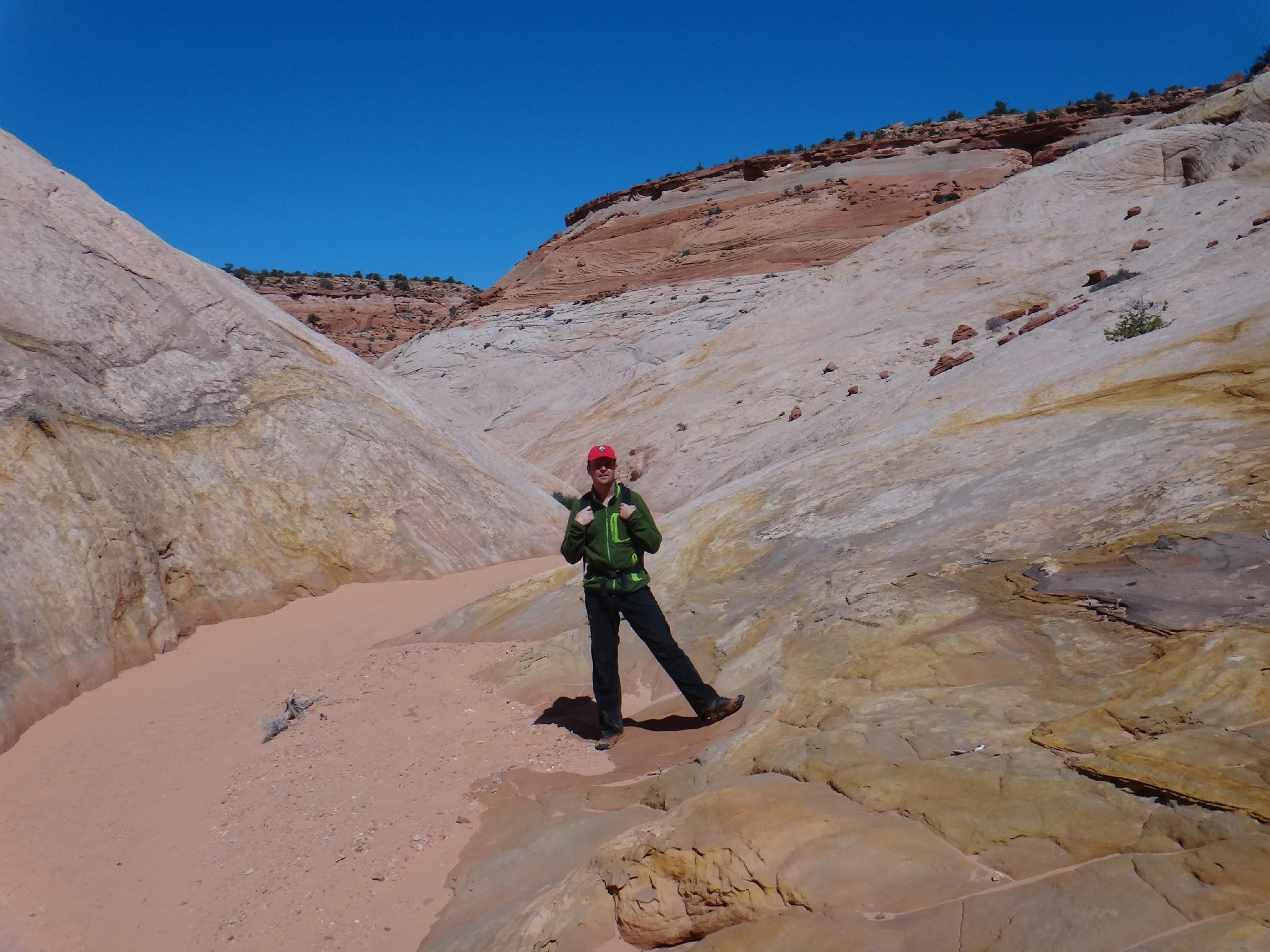
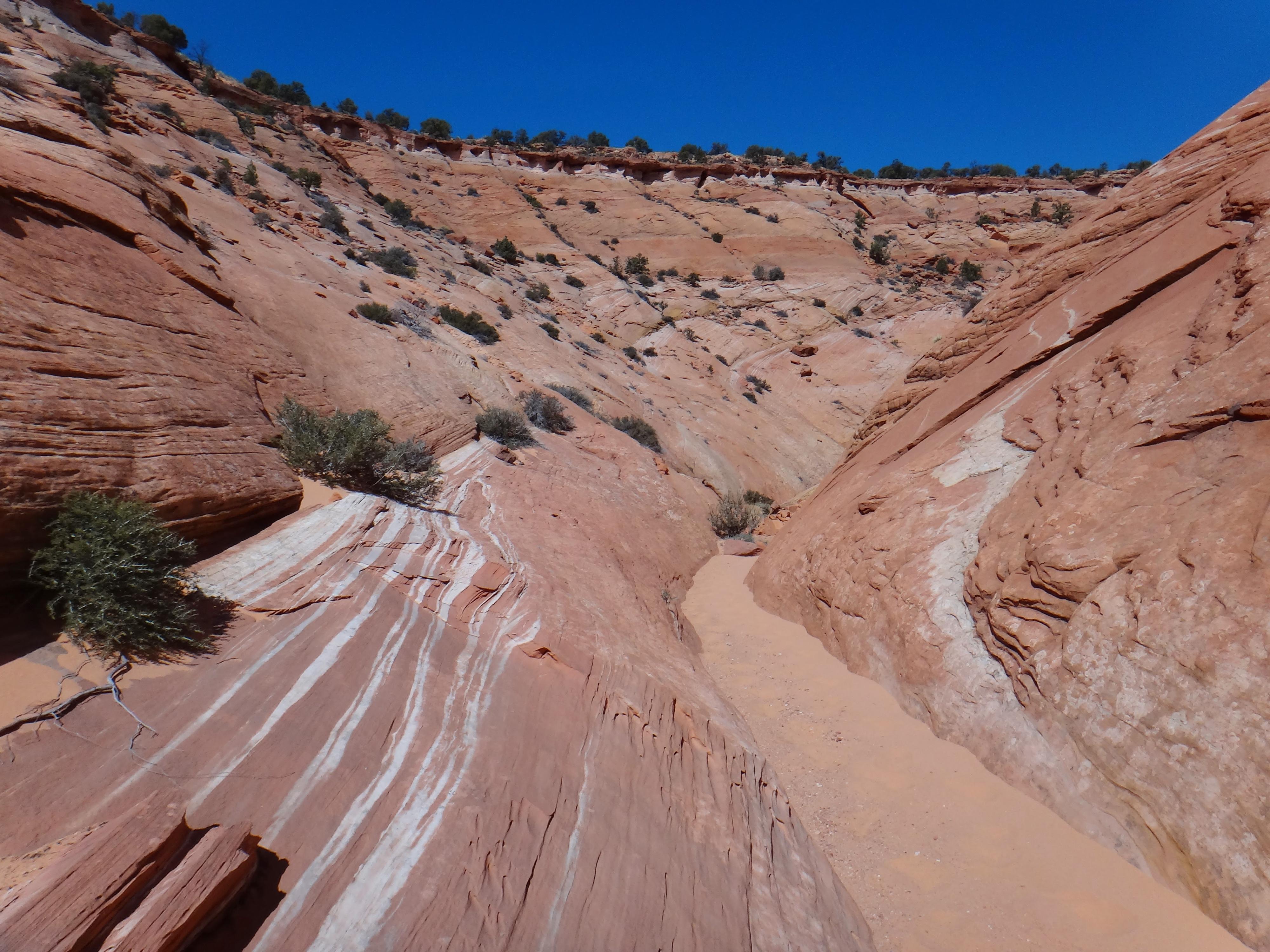
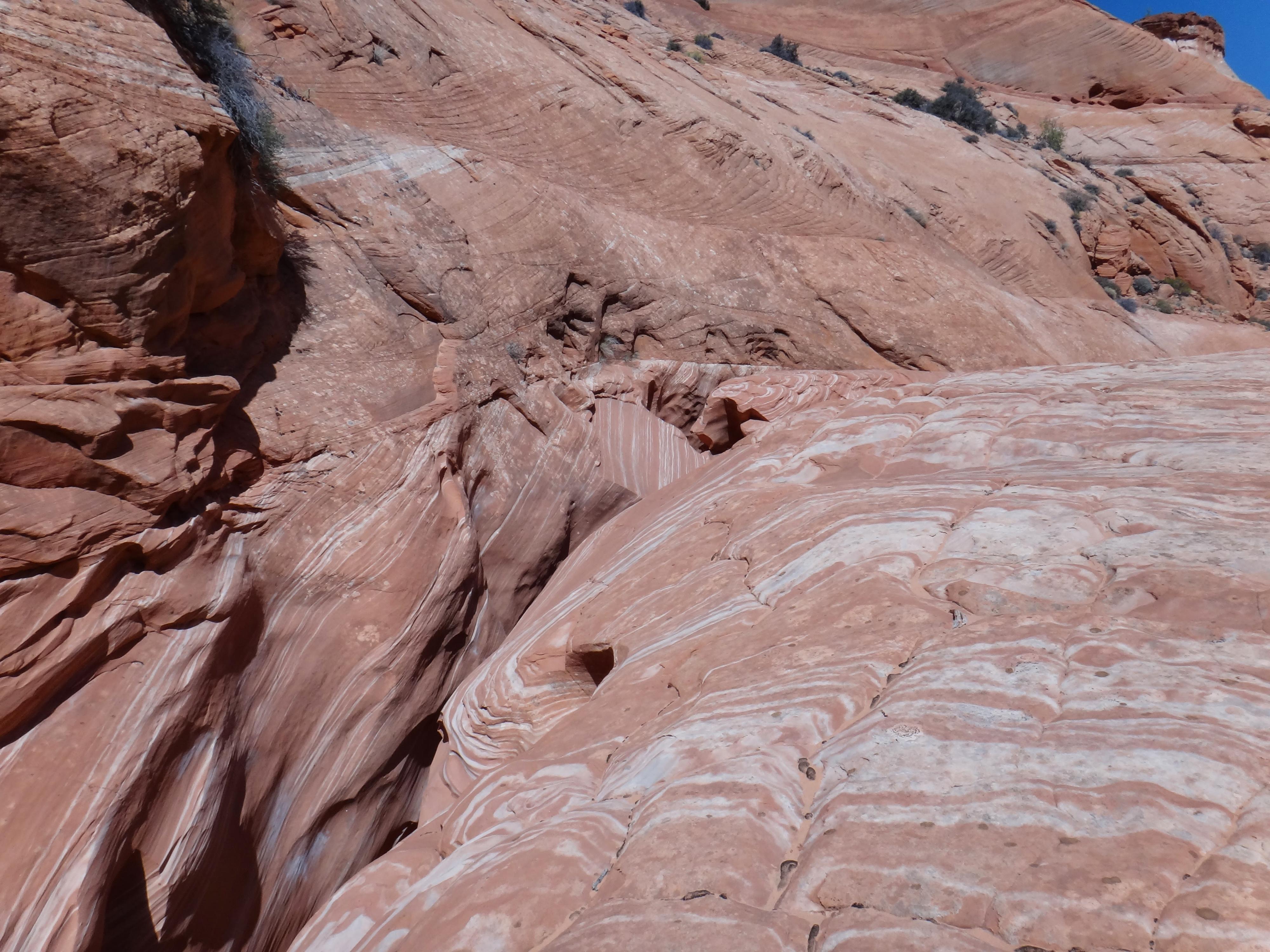
The canyon becomes deep, dark, and sinous. Stunning! Work down canyon through amazing narrows until it quickly opens before the confluence with the main fork and has an 8 m ( 27 ft. ) drop into a likely pool. This is the single rappel in the canyon. Below the rappel, the main canyon becomes wide and colorful. Follow it down with easy walking for 20-30 minutes (1 mile) until the west fork comes in on the right. It is guarded by an impassable dryfall.
Just down canyon from the dryfall and around the corner is a 4th class scramble on the right to get on the bench and above the dryfall, or continue down canyon a bit further to a well used social trail that gets you to the same place. Drop back to the canyon floor.
Heading up the west fork, it is wide and easy going before reaching the first of many boulder challenges blocking the canyon. All of these yield easily to a little climbing ability or team work. The higher you go, the deeper and narrower the canyon gets. Stunning!
Exit (1 hour)
When the canyon finally opens a bit and becomes easier, a dryfall may require backtracking and scrambling around it on the right (looking up canyon). This is just below the crossing marked on the map. Re-trace your approach route back to the trailhead.
Photos
Videos

Red Breaks
Maps

12S 467031E 4170382N
37°40'48"N 111°22'26"W
12S 467941E 4170329N
37°40'47"N 111°21'49"W
12S 469107E 4170688N
37°40'58"N 111°21'01"W
12S 469425E 4170952N
37°41'07"N 111°20'48"W
12S 469544E 4170370N
37°40'48"N 111°20'43"W
12S 469878E 4168855N
37°39'59"N 111°20'30"W