 Hiking
Mount Superior and Monte Cristo
Hiking
Mount Superior and Monte Cristo
Little Cottonwood
Overview
Mount Superior, near Alta, offers a good intermediate or advanced hike to a lofty summit. If you’re a climber, I would strongly recommend taking the south ridge up, which follows this route down. For non-climbers, this is the easiest way to the summit.
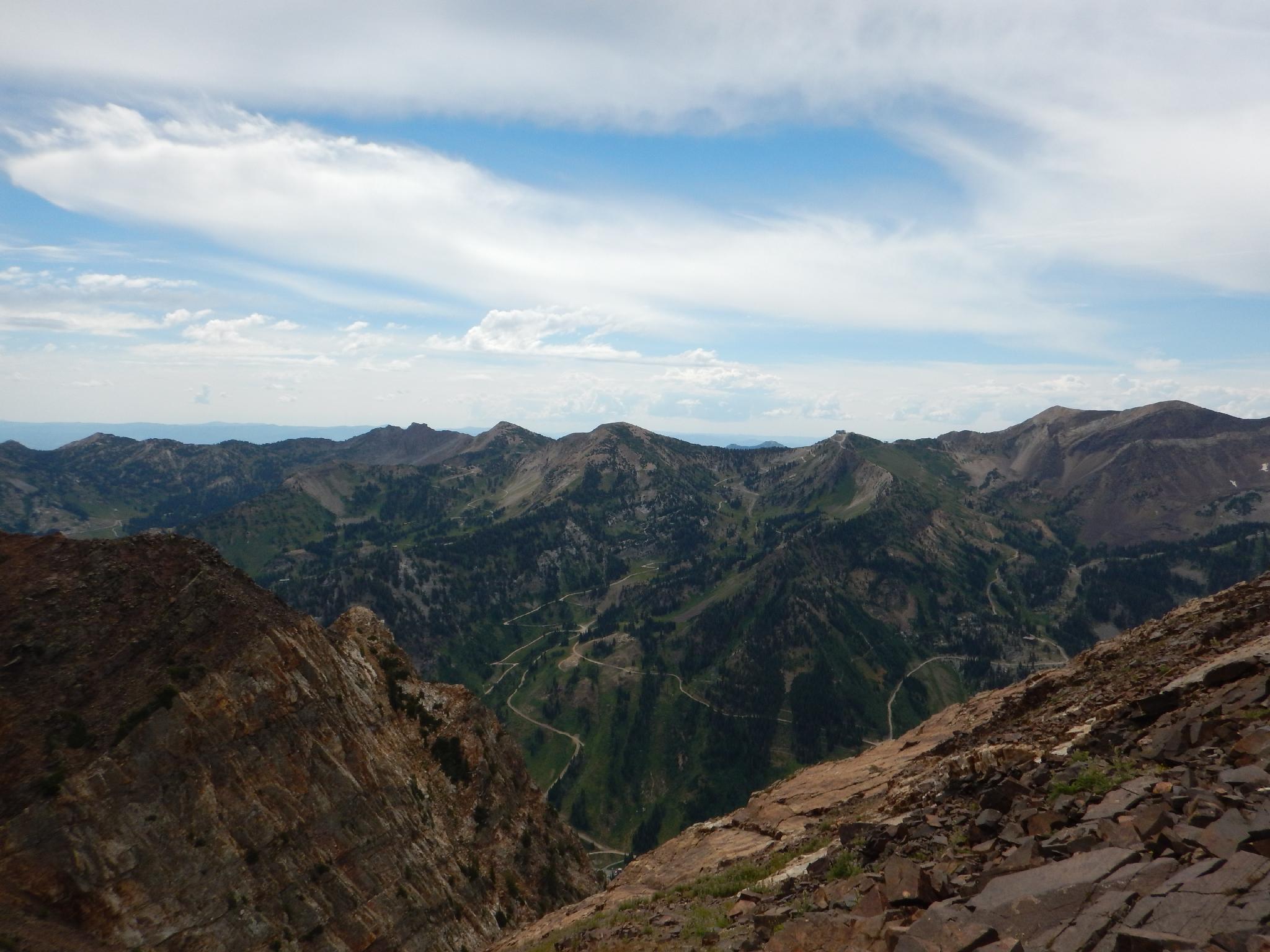
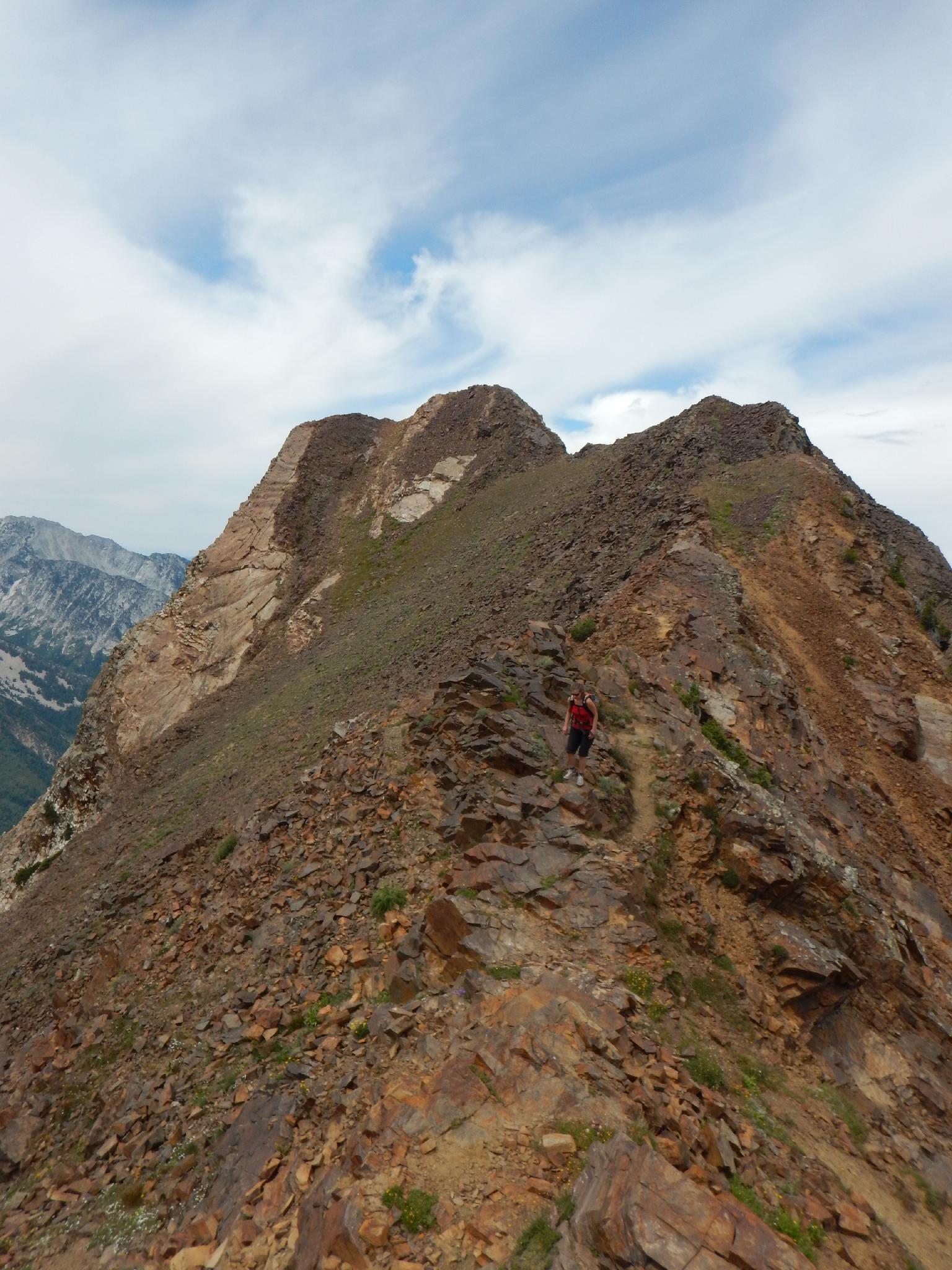
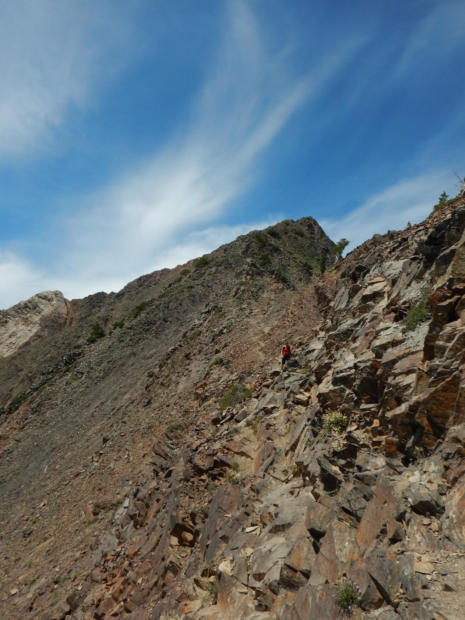
The trail starts off easy enough on an old mining road, but once it leaves Cardiff Pass, it has many steep, loose, and exposed sections. Nothing hard or too dangerous, but best done by those with a bit of experience under their belts. What is the reward for your effort? From Superior, you have excellent views of the ridge dividing Big Cottonwood and Mill Creek canyons, the ski resorts in Little Cottonwood Canyon, and the south ridge of Little Cottonwood Canyon. The difficulty makes this peak less frequently done than many others peaks around the Wasatch.
For bonus points, it adds less than 1/2 mile to the hike to traverse from Mount Superior over the Monte Cristo Peak and is highly recommended.
Getting There
Little Cottonwood Canyon is on the east side of the Salt Lake City Valley. Get there by following I-215 to the east, taking exit 6 off the interstate and heading east toward the mountains.
Follow 6200 South which becomes Wasatch Blvd for 1.8 miles to the stop light and signs for Big Cottonwood Canyon. Continue south (straight) through the light an additional 2.3 miles to a junction and light. Stay left here, reaching the mouth of Little Cottonwood Canyon in an additional 1.6 miles.
From the mouth of Little Cottonwood, travel up the canyon 8.1 mile, where Our Lady of the Snows Center is on the left. (Across from the Alta Lodge, just before the Shallow Shaft Restaurant.) Park here, just after a dirt road leaves on the left.
Route Description
To Cardiff Pass (1 hour / 1.3 miles / 1300' of gain)
Follow the paved road up past the Police Station. It turns to dirt. Continue up until a signed trail junction. Go left (right goes to Grizzly Gulch.) The trail follows an old mining road much of the way, zig-zagging up the hillside. Stay on the most used path up, there are many side trails that braid away from the main trail and return. The telephone poles mark the path up to Cardiff Pass, so if in doubt, follow the poles! The pass offers a great place to take in the views and catch your breath.
To Mount Superior (1-2 hours / 1.1 miles / 1500' of gain)
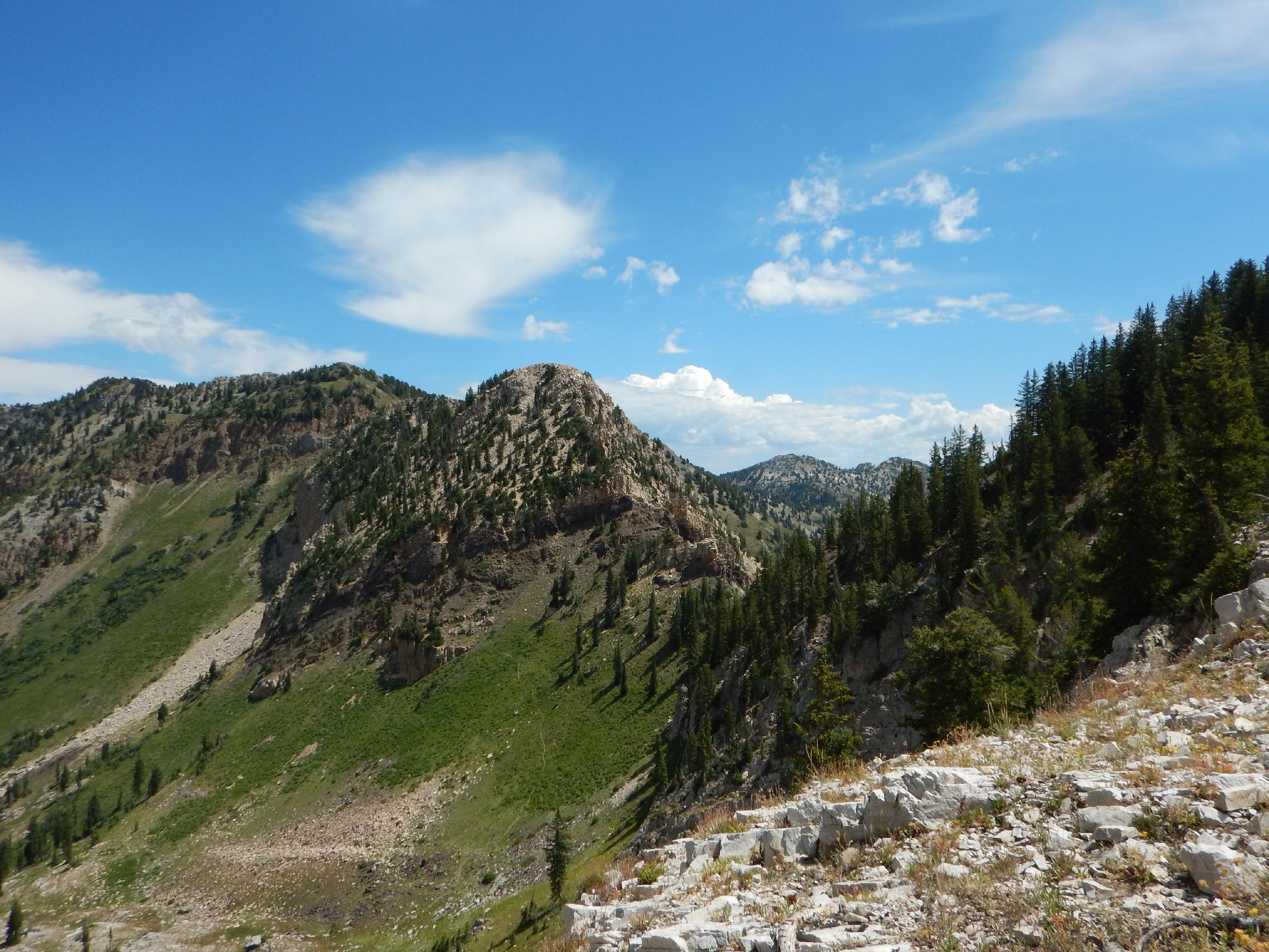
From the pass, a less used social trail traverses the west side hill and rounds the ridge. Follow this, going right once around the ridge. The trail climbs to the main ridge proper and begins following the ridge due west.
Monte Cristo Side Trip (0.5 miles round trip)
Continue west on the ridge 0.25 miles to the summit of Monte Cristo if time and energy allow. The views are great from Monte Cristo, and this is a recommended side trip.

Maps

12T 446044E 4493455N
40°35'25"N 111°38'15"W
12T 444881E 4494124N
40°35'46"N 111°39'05"W
12T 443543E 4493695N
40°35'32"N 111°40'02"W
12T 443198E 4493614N
40°35'29"N 111°40'17"W