
 Hiking
Hayden Peak
Hiking
Hayden Peak
Mirror Lake Highway
Overview


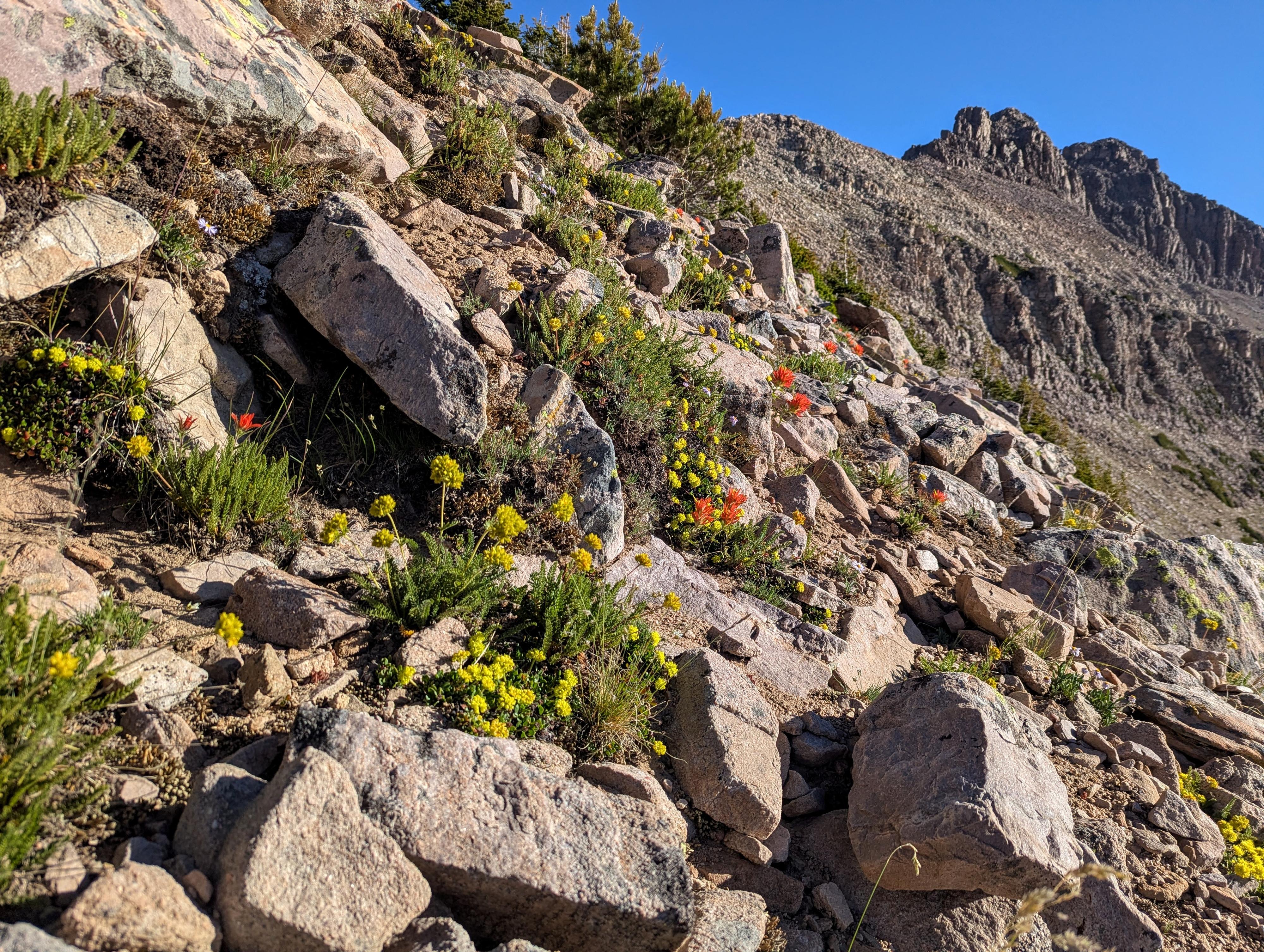
If you've driven the Mirror Lake Highway or hiked Ruth Lake, you have probably noticed the jagged ridgeline east of Ruth Lake and the Mirror Lake Highway near the Highline Trailhead. The highest peak on this jagged ridge is Hayden Peak. At 12,479, the peak is almost 500 feet higher than the popular nearby Bald Mountain. It is a very dramatic summit to reach.
The route to the summit is a bit over 4 miles round-trip and about 2,000' of elevation gain from the Highline Trailhead. Sound like a fairly accessible jaunt? Think again! The route is an advanced route requiring some scrambling, route finding, and much boulder hopping. For an experienced peak bagger, it is a lot of fun; for the beginner, it would be difficult at best and possibly very dangerous. Be sure you have the skills needed before heading up!
Some things to keep in mind:
- There is a social trail in parts of the hike, but many parts have sparse or no cairns, with much boulder hopping. A GPS is recommended, and pay attention to the route you take so you can find the same route on the way back. Good route-finding skills will be needed.
- Afternoon showers are very common; start early and keep an eye on the weather. You want to be back down to the trailhead before any storms move in.
- The route has a bit of scrambling. I would rate it 4th class with good route finding, though there are definitely more difficult spots if you get off the easiest route.
- The route sees a lot of traffic, with 6 groups on it the day I did it. Be careful to not knock loose rock off in case someone is below you.
- You'll be starting at over 10,000 feet and hiking very steep terrain. Be sure to bring plenty of water.
Getting There
The trailhead is the Highline Trailhead at the top of Hayden Pass.
If coming from Kamas, the south side of the Uintas, follow UT-150 for about 34 miles from Kamas to the top of Hayden Pass where the trailhead is signed on the right (east) side of the highway.
If coming from Evanston, the north side of the Uintas, follow WY-150 south out of town for about 22 miles to where you cross the state line and the road becomes UT-150. Continue on UT-150 an additional 20.5 miles to the top of Hayden Pass where the trailhead is signed on the left (east) side of the highway.
Route Description
From the restroom at the horse parking area, head south on the spur trail of the Highline trail for just a minute or two until a side trail leaves on the left. This is a good, well-used side trail.
Follow it as it heads east toward the base of the peak. Within just a few minutes of leaving the trailhead, you'll see a road and DWR cabin to the left a bit away from the trail, which is a good landmark that you are on the correct trail.
The trail is fairly well defined, but keep an eye on the map as you follow it. It heads mostly east and climbs, heading for the dirt alluvial fan that comes down from the peak. Follow the trail as it climbs this steep dirt slope. When it reaches the large boulder field at the top of the slope, and the trail becomes hard to find.
Keep an eye out for cairns, and aim north and uphill to the base of the cliff band. You are aiming to intersect the cliff band before it goes around a corner. There is a spot here where the trail goes through a small tunnel, then climbs up and back on top of the tunnel. The first crux is here, where a large triangular rock has been placed to aid in a step up to surmount the cliff band. Be sure you are comfortable both climbing and coming back down this spot! It isn't very difficult but may give some pause. If it is too difficult, I would recommend turning back!
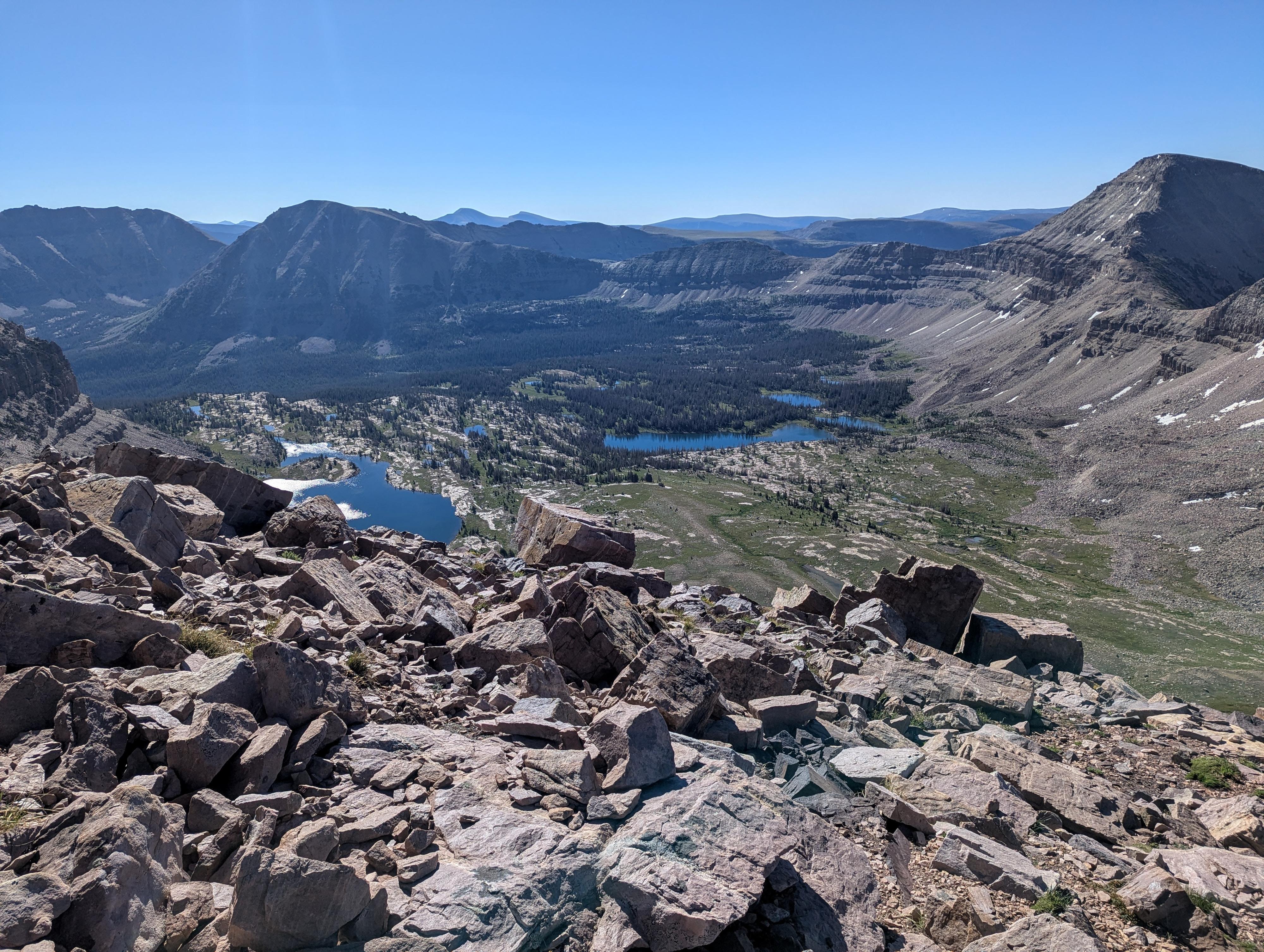
Once up, follow sparse cairns up and north to the ridge proper, then head north along the ridge. To the east below is the magnificent Middle Basin.
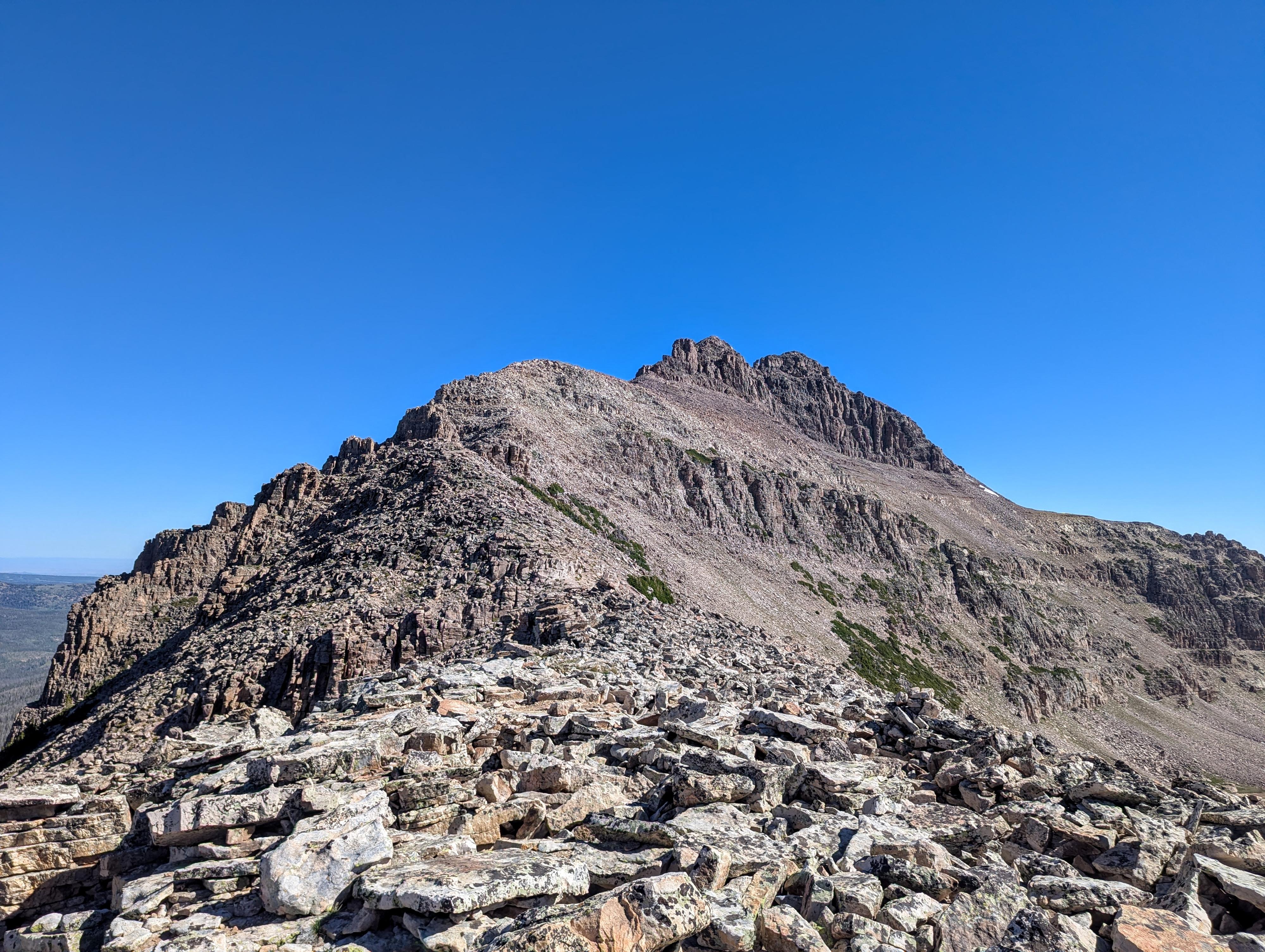
Follow the ridge north. Social trails are fairly evident in spots but can be easy to lose in the boulder sections. I stayed mostly on the ridge or just below the ridge on the west (left) side. In the distance, at least on my visit, there was a large cairn on the top of the ridge that looked like a person to me from a distance. When you get near the cliff band below it, go on the west side of the ridge until an area allows easy climbing, then up to the ridge just a bit north of the cairn.
When you reach the final cliff band that guards the summit, you have a couple of options. Both involve traversing east (right) along its base.
Option 1 is a short chimney that is near the start of the traverse east. The chimney is about 5 m high and, I thought, a good width for experienced climbers. It does, however, require real climbing moves. I ended up coming down this route. It is just a tiny bit shorter.
Option 2 is to keep traversing east and around the corner of the peak, then working up the ledgy slope to the summit. There are a few cairns here. I found it class 4, with some easy scrambling if you choose the simplest path. Work up to the summit and amazing views. There was, on my visit, a register just under the summit cairn. Be sure to pay attention to your route up, so you can find it again on the way down.
Photos
Maps
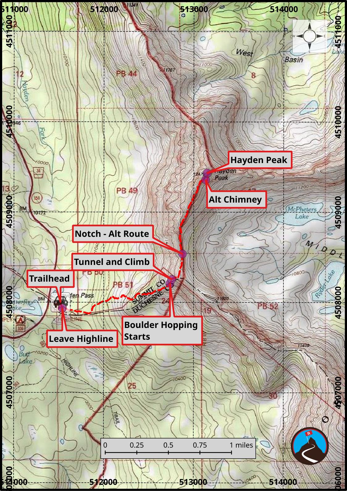
12T 511520E 4507997N
40°43'22"N 110°51'49"W
12T 511539E 4507933N
40°43'20"N 110°51'48"W
12T 512737E 4508209N
40°43'29"N 110°50'57"W
12T 512757E 4508253N
40°43'30"N 110°50'56"W
12T 512876E 4508536N
40°43'40"N 110°50'51"W
12T 513133E 4509358N
40°44'06"N 110°50'40"W
12T 513148E 4509433N
40°44'09"N 110°50'39"W